Restigouche County, New Brunswick

Last updated

Restigouche
Map of New Brunswick highlighting Restigouche County.png
Location within New Brunswick
Country Canada
Province New Brunswick
Established1837
Area
[1]
  Land8,580.00 km2 (3,312.76 sq mi)
Population
 (2016) [1]
  Total30,955
  Density3.6/km2 (9/sq mi)
  Change
2011-2016
Decrease2.svg 5.0%
  Dwellings
15,259
Time zone UTC-4 (AST)
  Summer (DST) UTC-3 (ADT)
Area code(s) 506

Restigouche County (2016 population 30,955) is located in north-central New Brunswick, Canada. [2] [1] The county is named for the Restigouche River which flows through the county and is famous for its salmon pools, which have attracted wealthy American and Canadian tourists to the region's summer colonies for decades. Forestry dominates the local economy.

Contents

Census subdivisions

Communities

There are nine municipalities within Restigouche County (listed by 2016 population): [2] [3]

Official NameDesignationArea km2Pop 2016Parish
Campbellton City18.586,883 Addington
Atholville Village119.603,570 Addington
Dalhousie Town15.223,126 Dalhousie
Saint-Quentin Town4.242,194 Saint-Quentin
Kedgwick Rural community658.081,979 Grimmer
Eel River Dundee Village65.481,953 Dalhousie
Balmoral Village43.391,674 Balmoral
Charlo Village31.301,310 Colborne
Tide Head Village19.43938 Addington

First Nations

There are two First Nations reservations in Restigouche County (listed by 2016 population): [2] [1]

Official NameDesignationArea km2PopulationParish
Eel River 3 Reservation1.46329 Dalhousie
Indian Ranch Reservation0.5889 Dalhousie

Parishes

The county is subdivided into eight parishes. (Listed by 2016 population, excluding municipalities): [2] [1]

Official NameArea km2PopulationMunicipalitiesUnincorporated communities
Saint-Quentin 2,478.571,532 Saint-Quentin (town) Five Fingers / Rang-Cinq-et-Six / Rang-Dix / Rang-Dix-Huit / Rang-Douze-Nord / Rang-Douze-Sud /
Rang-Quatorze / Rang-Seize / Rang-Sept-et-Huit / Saint-Martin-de-Restigouche
Durham 410.891,076 Black Point / Doyleville / Gravel Hill / Halfway / Hickey Settlement / Keepover / Lapointe Settlement /
Lorne / Nash Creek / Paradise Camp / Sea Side / Winton Crossing
Dalhousie 62.701,067 Dalhousie (town)
Eel River Dundee (village)
Eel River 3 (reserve)
Indian Ranch (reserve)
Dalhousie Junction / Lac-des-Lys / Maple Green / McLeods / McNeish / Point La Nim /
Upper Dundee
Durham 410.891,076 Black Point / Doyleville / Gravel Hill / Halfway / Hickey Settlement / Keepover / Lapointe Settlement /
Lorne / Nash Creek / Paradise Camp / Sea Side / Winton Crossing
Eldon 1,681.46657 Adams Gulch / Dawsonville / Glenwood / Menneval / Mann Mountain Settlement / Mann Siding /
Robinsonville / Saint-Jean-Baptiste-de-Restigouche / Squaw Cap / Upsalquitch / Wyers Brook
Addington 935.17656 Campbellton (city)
Atholville (village)
Tide Head (village)
Colebrooke Settlement / Dubé Settlement / Flatlands / Glen Levit / Glencoe / Malauze /
McKendrick / Popelogan Depot / Saint-Arthur / Val-d'Amour / Val-Melanson
Balmoral 1,089.41278 Balmoral (village) Maltais / Ramsay Sheds / Simpsons Field
Colborne 754.96227 Charlo (village) Benjamin River / Blackland / Caribou Depot / New Mills / Upper Crossing
Grimmer see *note Kedgwick (rural community)

Demographics

Historical Census Data - Restigouche County, New Brunswick
YearPop.±%
1991 39,248    
1996 38,701−1.4%
2001 36,134−6.6%
2006 33,834−6.4%
2011 32,594−3.7%
2016 30,955−5.0%
[5] [6] [1]

As a census division in the 2021 Census of Population conducted by Statistics Canada, Restigouche County had a population of 30,700 living in 14,165 of its 15,288 total private dwellings, a change of -0.8% from its 2016 population of 30,955. With a land area of 8,566.82 km2 (3,307.67 sq mi), it had a population density of 3.6/km2 (9.3/sq mi) in 2021. [7]

Canada census – Restigouche community profile
2021 2016 2011
Population30,700 (-0.8% from 2016)30,955 (-5.0% from 2011)32,594 (-3.7% from 2006)
Land area8,566.82 km2 (3,307.67 sq mi)8,580.00 km2 (3,312.76 sq mi)8,579.66 km2 (3,312.63 sq mi)
Population density3.6/km2 (9.3/sq mi)3.6/km2 (9.3/sq mi)3.8/km2 (9.8/sq mi)
Median age53.6 (M: 52.8, F: 54.4)51.7 (M: 51.2, F: 52.1)48.7 (M: 48.2, F: 49.2)
Total private dwellings14,16515,25915,468
Median household income$49,553$43,065
References: 2021 [8] 2016 [3] 2011 [9] earlier [10] [11]

Language

Canada Census Mother Tongue - Restigouche County, New Brunswick [5]
CensusTotal
French
English
French & English
Other
YearResponsesCountTrendPop %CountTrendPop %CountTrendPop %CountTrendPop %
2016
30,155
19,415Decrease2.svg 3.6%64.38%9,930Decrease2.svg 7.11%32.93%555Decrease2.svg 0.89%1.84%255Increase2.svg 6.25%0.85%
2011
31,640
20,150Decrease2.svg 4.2%63.68%10,690Decrease2.svg 4.3%33.79%560Increase2.svg 31.8%1.77%240Decrease2.svg 42.2%0.76%
2006
33,045
21,030Decrease2.svg 5.7%63.64%11,175Decrease2.svg 9.2%33.82%425Decrease2.svg 21.3%1.29%415Increase2.svg 62.7%1.25%
2001
35,405
22,300Decrease2.svg 5.2%62.98%12,310Decrease2.svg 10.3%34.77%540Decrease2.svg 21.2%1.53%255Increase2.svg 21.4%0.72%
1996
38,145
23,530n/a61.68%13,720n/a35.97%685n/a1.80%210n/a0.55%

Access routes

Highways and numbered routes that run through the county, including external routes that start or finish at the county limits: [12]

Protected areas and attractions

Notable people

See also

Related Research Articles

Gloucester County, New Brunswick County in New Brunswick, Canada

Gloucester County is located in the northeastern corner of New Brunswick, Canada. Fishing, mining and forestry are the major industries in the county. The eastern section of the county is known for its Acadian culture.

Kings County, New Brunswick County in New Brunswick, Canada

Kings County is located in southern New Brunswick, Canada. Its historical shire town is Hampton.

Madawaska County, New Brunswick County in New Brunswick, Canada

Madawaska County, also known as the "New Brunswick Panhandle", is located in northwestern New Brunswick, Canada. Over 90% of the county's population speaks French. Its Francophone population are known as "Brayons." Forestry is the major industry in the county.

Northumberland County, New Brunswick County in New Brunswick, Canada

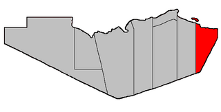
Northumberland County is located in northeastern New Brunswick, Canada.

Saint John County, New Brunswick County in New Brunswick, Canada

Saint John County is located in southern New Brunswick, Canada. The city of Saint John dominates the county. Elsewhere in the county, tourism is focused around the Bay of Fundy.

Victoria County, New Brunswick County in New Brunswick, Canada

Victoria County is located in northwestern New Brunswick, Canada. Farming, especially of potatoes, is the major industry in the county.

York County, New Brunswick County in New Brunswick, Canada

York County is located in west-central New Brunswick, Canada. The county contains the provincial capital, Fredericton. Outside the city, farming and forestry are two major industries in the county, which is bisected by the Saint John River. The Southwest Miramichi River flows through the northern section of the county.

Beresford is a town in Gloucester County, New Brunswick, Canada.

Saint-Quentin, New Brunswick Town in New Brunswick, Canada

Saint-Quentin is a Canadian town in Restigouche County, New Brunswick.

Belledune is a Canadian village that straddles both Restigouche County and Gloucester County, New Brunswick.

Eel River Crossing is a Canadian village in Restigouche County, New Brunswick.

Kedgwick is a Canadian rural community in Restigouche County, New Brunswick. Originally a local improvement district, then an incorporated village, Kedgwick became a rural community in 2012 when it amalgamated with the surrounding local service district of the parish of Grimmer.

Sainte-Marie-Saint-Raphaël is a Canadian village in Gloucester County, New Brunswick; its name is sometimes abbreviated Ste-Marie-St-Raphaël.

Tide Head, New Brunswick Village in New Brunswick, Canada

Tide Head is a Canadian village in Restigouche County, New Brunswick.

Rivière-Verte, New Brunswick Village in New Brunswick, Canada

Rivière-Verte is a Canadian village in Madawaska County, New Brunswick.

Balmoral Parish, New Brunswick Parish in New Brunswick, Canada

Balmoral is a civil parish in Restigouche County, New Brunswick, Canada.

Eldon Parish, New Brunswick Parish in New Brunswick, Canada

Eldon is a civil parish in Restigouche County, New Brunswick, Canada.

Grimmer Parish, New Brunswick Former Parish in New Brunswick, Canada

Grimmer is a civil parish in Restigouche County, New Brunswick, Canada.

Durham Parish, New Brunswick Parish in New Brunswick, Canada

Durham is a civil parish in Restigouche County, New Brunswick, Canada.

Saint-Quentin Parish, New Brunswick Parish in New Brunswick, Canada

Saint-Quentin is a civil parish in Restigouche County, New Brunswick, Canada.

References

  1. 1 2 3 4 5 6 "Census Profile, 2016 Census - Restigouche County [Census Division], New Brunswick and New Brunswick [Province]".
  2. 1 2 3 4 "Restigouche County". New Brunswick Provincial Archives.
  3. 1 2 "2016 Community Profiles". 2016 Canadian Census . Statistics Canada. August 12, 2021. Retrieved September 28, 2019.
  4. "Rural Community of Kedgwick Regulation - Municipalities Act". Attorney General. Province of New Brunswick. December 15, 2015. Retrieved January 5, 2016.
  5. 1 2 Statistics Canada: 1996, 2001, 2006, 2011 census
  6. 2011 Statistics Canada Census Profile: Restigouche County, New Brunswick
  7. "Population and dwelling counts: Canada and census divisions". Statistics Canada. February 9, 2022. Retrieved April 3, 2022.
  8. "2021 Community Profiles". 2021 Canadian Census . Statistics Canada. February 4, 2022. Retrieved April 27, 2022.
  9. "2011 Community Profiles". 2011 Canadian Census . Statistics Canada. March 21, 2019. Retrieved March 21, 2014.
  10. "2006 Community Profiles". 2006 Canadian Census . Statistics Canada. August 20, 2019.
  11. "2001 Community Profiles". 2001 Canadian Census . Statistics Canada. July 18, 2021.
  12. Atlantic Canada Back Road Atlas ISBN   978-1-55368-618-7


Coordinates: 47°43′33.9″N67°5′18.6″W / 47.726083°N 67.088500°W / 47.726083; -67.088500