Eldon Parish, New Brunswick

Last updated

Eldon
Restigouche County NB - Eldon Parish.PNG
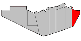
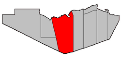
Location within Restigouche County.
Coordinates: 47°45′00″N67°04′30″W / 47.75°N 67.075°W / 47.75; -67.075
Country Flag of Canada (Pantone).svg  Canada
Province Flag of New Brunswick.svg  New Brunswick
County Restigouche
Erected1827
Dissolved1879
Reërected1896
Area
[1]
  Land1,688.58 km2 (651.96 sq mi)
Population
 (2021) [1]
  Total674
  Density0.4/km2 (1/sq mi)
  Change 2016-2021
Increase2.svg 0.3%
  Dwellings
369
Time zone UTC-4 (AST)
  Summer (DST) UTC-3 (ADT)
Population change reflects revised total for 2016. [1]

Eldon is a geographic parish in Restigouche County, New Brunswick, Canada. [4]

Contents

For governance purposes it is divided between the incorporated rural community of Kedgwick [5] and the Restigouche rural district, [6] both of which are members of the Restigouche Regional Service Commission. [7]

Before the 2023 governance reform, the parish was divided into four local service districts and part of another. Mann Mountain was opposite the mouth of the Matapedia River, with Flatlands straddling the eastern border; St. Jean Baptiste – Menneval, White's Brook were both along Route 17, nearer Kedgwick than Campbellton; the LSD of the parish of Eldon comprised the remainder of the parish. [8] In the reform, Kedgwick annexed the community of Wyers Brook, properties on either side of Route 17 south from Glenwood, and all of the parish to the west; [5] the remainder became part of the rural district. [6]

Origin of name

The parish was named in honour of the Earl of Eldon, [9] Lord High Chancellor of Great Britain at the time of its erection.

History

Eldon was erected in 1827 from Beresford Parish. [10] Eldon comprised Restigouche County west of the Upsalquitch River, with the county line being a prolongation of the western boundary of Northumberland County.

In 1840 the eastern boundary was altered to run due south from the mouth of the Upsalquitch. [11]

In 1852 the western county line was changed to its current location; Eldon's western line moved with it. [12]

In 1879 Eldon was dissolved and its territory added to Addington Parish. [13]

In 1896 Eldon was reërected from Addington, with the eastern line now further east in its modern configuration. [14]

In 1916 the western part of Eldon was erected as Grimmer Parish. [15] Grimmer included what is now Saint-Quentin Parish.

Boundaries

Eldon Parish is bounded: [2] [16] [17]

Communities

Communities at least partly within the parish. [16] [17] [18]

Bodies of water

Bodies of water [lower-alpha 1] at least partly within the parish. [16] [17] [18]

Islands

Islands at least partly within the parish. [16] [17] [18]

Other notable places

Parks, historic sites, and other noteworthy places at least partly within the parish. [16] [17] [18] [19]

Demographics

Population

Canada census – Eldon community profile
2021 2016 2011
Population674 (+0.3% from 2016)657 (-5.9%% from 2011)698 (-10.4% from 2006)
Land area1,688.58 km2 (651.96 sq mi)1,681.46 km2 (649.22 sq mi)1,681.54 km2 (649.25 sq mi)
Population density0.4/km2 (1.0/sq mi)0.4/km2 (1.0/sq mi)0.4/km2 (1.0/sq mi)
Median age55.6 (M: 55.6, F: 55.6)54.2 (M: 54.7, F: 53.6)52.0 (M: 51.8, F: 52.1)
Private dwellings369 (total)  335 (occupied)360 (total) 375 (total) 
Median household income$50,000$42,112$.N/A
Notes: 2011 income data for this area has been suppressed for data quality or confidentiality reasons.
References: 2021 [21] 2016 [22] 2011 [23] earlier [24] [25]
Historical Census Data - Eldon Parish, New Brunswick
YearPop.±%
1991 1,136    
1996 1,005−11.5%
YearPop.±%
2001 902−10.2%
2006 779−13.6%
YearPop.±%
2011 698−10.4%
2016 657−5.9%
[26] [27]

Language

Canada Census Mother Tongue - Eldon Parish, New Brunswick [26]
CensusTotal
English
French
English & French
Other
YearResponsesCountTrendPop %CountTrendPop %CountTrendPop %CountTrendPop %
2016
655
330Decrease2.svg 8.3%50.38%320Decrease2.svg 3.0%48.85%5Steady2.svg 0.0%0.76%0Steady2.svg 0.0%0.0%
2011
695
360Increase2.svg 1.4%51.80%330Decrease2.svg 19.5%47.48%5Decrease2.svg 66.7%0.72%0Steady2.svg 0.0%0.00%
2006
780
355Decrease2.svg 22.8%45.51%410Decrease2.svg 2.4%52.56%15Decrease2.svg 25.0%1.92%0Steady2.svg 0.0%0.00%
2001
900
460Decrease2.svg 19.3%51.11%420Decrease2.svg 11.6%46.67%20Increase2.svg n/a%2.22%0Steady2.svg 0.0%0.00%
1996
1,045
570n/a54.55%475n/a45.45%0n/a0.00%0n/a0.00%

Access Routes

Highways and numbered routes that run through the parish, including external routes that start or finish at the parish limits: [28]

See also

Notes

  1. Not including brooks, ponds or coves.

Related Research Articles

<span class="mw-page-title-main">Beresford Parish, New Brunswick</span> Parish in New Brunswick, Canada

Beresford is a geographic parish in Gloucester County, New Brunswick, Canada.

<span class="mw-page-title-main">Addington Parish, New Brunswick</span> Parish in New Brunswick, Canada

Addington is a geographic parish in Restigouche County, New Brunswick, Canada.

<span class="mw-page-title-main">Queensbury Parish, New Brunswick</span> Parish in New Brunswick, Canada

Queensbury is a geographic parish in York County, New Brunswick, Canada.

<span class="mw-page-title-main">Blissville Parish, New Brunswick</span> Parish in New Brunswick, Canada

Blissville is a geographic parish in Sunbury County, New Brunswick, Canada.

<span class="mw-page-title-main">Dalhousie Parish, New Brunswick</span> Parish in New Brunswick, Canada

Dalhousie is a geographic parish in Restigouche County, New Brunswick, Canada.

<span class="mw-page-title-main">Balmoral Parish, New Brunswick</span> Parish in New Brunswick, Canada

Balmoral is a geographic parish in Restigouche County, New Brunswick, Canada.

<span class="mw-page-title-main">Colborne Parish, New Brunswick</span> Parish in New Brunswick, Canada

Colborne is a geographic parish in Restigouche County, New Brunswick, Canada.

<span class="mw-page-title-main">Grimmer Parish, New Brunswick</span> Former Parish in New Brunswick, Canada

Grimmer is a geographic parish in Restigouche County, New Brunswick, Canada.

<span class="mw-page-title-main">Durham Parish, New Brunswick</span> Parish in New Brunswick, Canada

Durham is a geographic parish in Restigouche County, New Brunswick, Canada.

<span class="mw-page-title-main">Saint-Quentin Parish, New Brunswick</span> Parish in New Brunswick, Canada

Saint-Quentin is a geographic parish in Restigouche County, New Brunswick, Canada.

<span class="mw-page-title-main">Saint-François Parish, New Brunswick</span> Parish in New Brunswick, Canada

Saint-François is a geographic parish in Madawaska County, New Brunswick, Canada.

<span class="mw-page-title-main">Madawaska Parish, New Brunswick</span> Parish in New Brunswick, Canada

Madawaska is a geographic parish in Madawaska County, New Brunswick, Canada.

<span class="mw-page-title-main">Saint-Basile Parish, New Brunswick</span> Parish in New Brunswick, Canada

Saint-Basile is a geographic parish in Madawaska County, New Brunswick, Canada.

<span class="mw-page-title-main">Blackville Parish, New Brunswick</span> Parish in New Brunswick, Canada

Blackville is a geographic parish in Northumberland County, New Brunswick, Canada.

<span class="mw-page-title-main">Drummond Parish, New Brunswick</span> Parish in New Brunswick, Canada

Drummond is a geographic parish in Victoria County, New Brunswick, Canada.

<span class="mw-page-title-main">Lorne Parish, New Brunswick</span> Parish in New Brunswick, Canada

Lorne is a geographic parish in Victoria County, New Brunswick, Canada.

<span class="mw-page-title-main">Gordon Parish, New Brunswick</span> Parish in New Brunswick, Canada

Gordon is a geographic parish in Victoria County, New Brunswick, Canada.

<span class="mw-page-title-main">Brighton Parish, New Brunswick</span> Parish in New Brunswick, Canada

Brighton is a geographic parish in Carleton County, New Brunswick, Canada, northeast of Woodstock, extending from the eastern bank of the Saint John River to the York County line.

<span class="mw-page-title-main">Pennfield Parish, New Brunswick</span> Parish in Canada

Pennfield is a geographic parish in Charlotte County, New Brunswick, Canada, located west of Saint John located east of St. George and west of Saint John.

<span class="mw-page-title-main">Saint Stephen Parish, New Brunswick</span> Parish in Canada

Saint Stephen is a geographic parish in Charlotte County, New Brunswick, Canada, located in the southwestern corner of the province.

References

  1. 1 2 3 "Census Profile". Statistics Canada. 26 October 2022. Retrieved 29 October 2022.
  2. 1 2 "Chapter T-3 Territorial Division Act". Government of New Brunswick. Retrieved 24 January 2023.
  3. "Chapter I-13 Interpretation Act". Government of New Brunswick. Retrieved 24 January 2023.
  4. The Territorial Division Act [2] divides the province into 152 parishes, the cities of Saint John and Fredericton, and one town of Grand Falls. The Interpretation Act [3] clarifies that parishes include any local government within their borders.
  5. 1 2 "Restigouche Regional Service Commission: RSC 2". Government of New Brunswick. Retrieved 24 January 2023.
  6. 1 2 "Restigouche Regional Service Commission: RD 2". Government of New Brunswick. Retrieved 24 January 2023.
  7. "Regions Regulation – Regional Service Delivery Act". Government of New Brunswick. 21 July 2022. Retrieved 24 January 2023.
  8. "Local Service Districts Regulation - Municipalities Act". Government of New Brunswick. 25 June 2021. Retrieved 24 January 2023.
  9. Ganong, William F. (1896). A Monograph of the Place-Nomenclature of the Province of New Brunswick. Royal Society of Canada. p. 232. Retrieved 17 March 2021.
  10. "7 Geo. IV c. 31 An Act for the division of the County of Northumberland into three Counties, and to provide for the Government and Representation of the two new Counties.". Acts of the General Assembly of His Majesty's Province of New-Brunswick, Passed in the Year 1827. Fredericton: Government of New Brunswick. 1827. pp. 97–103. Retrieved 27 March 2021.
  11. "2 Vic. c. 19 An Act to divide the County of Restigouche into five Towns or Parishes and to define the boundaries thereof.". Acts of the General Assembly of Her Majesty's Province of New Brunswick, Passed in the Year 1839. Fredericton: Government of New Brunswick. 1839. pp. 63–64. Retrieved 27 March 2021.
  12. "15 Vic. c. 6 An Act to annex the Territory awarded to this Province by the New Brunswick and Canadian Arbitrators in the recent settlement of the Boundary question between the Provinces of New Brunswick and Canada, to the Counties of Victoria and Restigouche, and to alter the present Boundary Line between these counties.". Acts of the General Assembly of Her Majesty's Province of New Brunswick, Passed in the Year 1852. Fredericton: Government of New Brunswick. 1852. pp. 4–5. Retrieved 27 March 2021.
  13. "42 Vic. c. 57 An Act to extend the Parish of Addington, in the County of Restigouche.". Acts of the General Assembly of Her Majesty's Province of New Brunswick. Passed in the Month of April 1879. Fredericton: Government of New Brunswick. 1879. pp. 114–115. Available as a free ebook from Google Books.
  14. "59 Vic. c. 8 An Act to Revise and Codify an Act to Provide for the Division of the Province into Counties, Towns and Parishes.". Acts of the General Assembly of Her Majesty's Province of New Brunswick. Passed in the Month of March, 1896. Fredericton: Government of New Brunswick. 1896. pp. 86–123. Available as a free ebook from Google Books.
  15. "5 Geo. V c. 47 An Act to amend Chapter 2, Consolidated Statutes, 1903, so far as it relates to the Parish of Eldon, in the County of Restigouche.". Acts of the Legislative Assembly of New Brunswick Passed in the Months of April and May 1915. Fredericton: Government of New Brunswick. 1915. pp. 432–434.
  16. 1 2 3 4 5 "No. 3". Provincial Archives of New Brunswick. Department of Natural Resources and Energy Development. Retrieved 20 June 2021. Remainder of parish on maps 4, 5, 12, 13, 23, 24, 36, and 37 at same site.
  17. 1 2 3 4 5 "011" (PDF). Transportation and Infrastructure. Government of New Brunswick. Retrieved 20 June 2021. Remainder of parish on mapbooks 012, 024–026, 043–045, 063–065, 083–085, 103–105, 126, and 127 at same site.
  18. 1 2 3 4 "Search the Canadian Geographical Names Database (CGNDB)". Government of Canada. Retrieved 2 July 2021.
  19. "Explore New Brunswick's Protected Natural Areas". GeoNB. Retrieved 2 July 2021.
  20. "New Brunswick Regulation 2017-46 under the Parks Act (O.C. 2017-293)" (PDF). The Royal Gazette. 175. Fredericton: Queen's Printer: 1496–1497. 13 December 2017. ISSN   1714-9428 . Retrieved 5 July 2021.
  21. "2021 Community Profiles". 2021 Canadian Census . Statistics Canada. 4 February 2022. Retrieved 19 October 2023.
  22. "2016 Community Profiles". 2016 Canadian Census . Statistics Canada. 12 August 2021. Retrieved 28 September 2019.
  23. "2011 Community Profiles". 2011 Canadian Census . Statistics Canada. 21 March 2019. Retrieved 21 March 2014.
  24. "2006 Community Profiles". 2006 Canadian Census . Statistics Canada. 20 August 2019.
  25. "2001 Community Profiles". 2001 Canadian Census . Statistics Canada. 18 July 2021.
  26. 1 2 Statistics Canada: 1996, 2001, 2006, 2011 census
  27. "Census Profile, 2016 Census: Eldon, Parish [Census subdivision], New Brunswick". Statistics Canada. Retrieved 28 September 2019.
  28. Atlantic Canada Back Road Atlas ISBN   978-1-55368-618-7 Pages 4-5, 12-13


47°45′00″N67°04′30″W / 47.75000°N 67.07500°W / 47.75000; -67.07500 (Eldon Parish, New Brunswick)