Victoria County, New Brunswick

Last updated

Victoria
Map of New Brunswick highlighting Victoria County.png
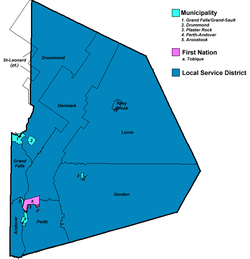
Location within New Brunswick.
Country Canada
Province New Brunswick
Established1844
Shire town Perth-Andover
Area
[1]
  Land5,492.85 km2 (2,120.80 sq mi)
Population
 (2021) [2]
  Total
18,312
  Density3.3/km2 (9/sq mi)
  Change
2016-2021
Decrease2.svg 1.6%
  Dwellings
9,054
Time zone UTC-4 (AST)
  Summer (DST) UTC-3 (ADT)
Area code 506
Map of municipal government units in Victoria County. CoVictoria.png
Map of municipal government units in Victoria County.

Victoria County (2021 population 18,312 [2] ) is located in northwestern New Brunswick, Canada. Farming, especially of potatoes, is the major industry in the county. The area was named for Queen Victoria. [3]

Contents

Census subdivisions

Communities

There are five municipalities within Victoria County (listed by 2016 population): [4]

Official NameDesignationArea km2PopulationParish
Grand Falls/Grand-Sault Town18.095,326 Grand Falls
Perth-Andover Village8.971,590 Perth
Plaster Rock Village3.041,023 Gordon
Drummond Village8.90737 Drummond
Aroostook Village2.23306 Andover

First Nations

There is one First Nations reserve in Victoria County (listed by 2016 population): [5]

Official NameDesignationArea km2PopulationParish
Tobique 20 Reserve24.98968 Perth

Parishes

The county is subdivided into seven parishes (listed by 2016 population): [4]

Official NameArea km2PopulationMunicipalitiesUnincorporated communities
Drummond 1,014.892,157 Drummond (village) Black Brook / Burgess Settlement / Caldwell / Canton / Davis Mill / Desjardins Road /
Ennishone / Hazen / Hennigar Corner / Jardine Brook / McManus Siding / Price Road /
Quatre-Coins / Violette Brook / Violette Station
Gordon 1,431.581,493 Plaster Rock (village) Anderson Road / Anfield / Arthurette / Birch Ridge / Bluebell Station / Crombie Settlement /
Hazeldean / Maple View / North View / O'Dell / Picadilly / Red Rapids / Rowena /
Sisson Ridge / St. Almo / Three Brooks / Wapske / Weaver
Denmark 751.271,471 Foley Brook / Lake Edward / Lerwick / New Denmark / North Tilley / Salmonhurst Corner /
South Tilley
Grand Falls 158.041,109 Grand Falls/Grand-Sault (town) Argosy / California Settlement / Costigan / Four Falls / Gillespie Settlement / Grand Falls Portage /
Kelly Road / Limestone / Lower California / Lower Portage / McCluskey / Morrell Siding / Undine /
Upper California
Perth 318.251,082 Perth-Andover (village)
Tobique 20 (reserve)
Beech Glen / Beech Glen Road / Bon Accord / Caldwell Brook / Currie / Gladwyn / Hillside /
Inman / Kilburn / Kincardine / Lower Kintore / Lower Perth / Maliseet / Muniac / Quaker Brook /
Red Rapids / Rowena / Tobique Narrows / Upper Kintore
Andover 123.45891 Aroostook (village) Bairdsville / Beaconsfield / Carlingford / Dover Hill / Hillandale / Maliseet / River De Chute /
Tinker / Turner Settlement
Lorne 1,641.87464 Blue Mountain Bend / Burntland Brook / Enterprise / Everett / Haley Brook / Lorne / Mapleview /
Nictau / North View / Oxbow / Riley Brook / Sisson Brook / Two Brooks / Victoria

Demographics

Historical Census Data - Victoria County, New Brunswick
YearPop.±%
1991 20,786    
1996 21,929+5.5%
2001 21,172−3.5%
2006 20,319−4.0%
2011 19,921−2.0%
2016 18,617−6.5%
2021 18,312−1.6%
[6] [7] [2]

As a census division in the 2021 Census of Population conducted by Statistics Canada, Victoria County had a population of 18,312 living in 8,249 of its 9,054 total private dwellings, a change of -1.6% from its 2016 population of 18,617. With a land area of 5,492.85 km2 (2,120.80 sq mi), it had a population density of 3.3/km2 (8.6/sq mi) in 2021. [2]

Canada census – Victoria County, New Brunswick community profile
2016 2011
Population18,617 (-6.5% from 2011)19,921 (-2.0% from 2006)
Land area5,505.56 km2 (2,125.71 sq mi)5,503.93 km2 (2,125.08 sq mi)
Population density3.4/km2 (8.8/sq mi)3.6/km2 (9.3/sq mi)
Median age48.7 (M: 47.9, F: 49.3)45.2 (M: 44.4, F: 45.9)
Private dwellings9,178 (total) 9,342 (total) 
Median household income$49,146$41,435
References: 2016 [4] 2011 [8]

Language

Canada Census Mother Tongue - Victoria County, New Brunswick [6] [7]
CensusTotal
English
French
English & French
Non-official languages
YearResponsesCountTrendPop %CountTrendPop %CountTrendPop %CountTrendPop %
2016
18,365
9,930Decrease2.svg 7.5%54.07%7,875Decrease2.svg 6.7%42.88%190Steady2.svg1.00%370Increase2.svg 25.2%2.01%
2011
19,630
10,740Decrease2.svg 0.2%54.71%8,405Decrease2.svg 2.2%42.82%190Increase2.svg 90.0%0.97%295Decrease2.svg 52.4%1.50%
2006
20,070
10,760Decrease2.svg 4.7%53.61%8,590Decrease2.svg 3.5%42.80%100Decrease2.svg 48.7%0.50%620Increase2.svg 18.1%3.09%
2001
20,915
11,290Decrease2.svg 6.2%53.98%8,905Decrease2.svg 0.8%42.58%195Decrease2.svg 13.3%0.93%525Increase2.svg 22.1%2.51%
1996
21,675
12,040n/a55.55%8,980n/a41.43%225n/a1.04%430n/a1.98%

Transportation

Major highways

Railways

The county is crossed by the Canadian National Railway’s mainline Napadogan Subdivision carrying freight and includes the Little Salmon River Trestle, the second largest railway bridge in Canada.

Protected areas and attractions

Notable people

Although not everyone in this list was born in Victoria County, they all live or have lived in Victoria County and have had significant connections to the communities.

Full NameCommunityFamous forBirthDeathOther
Ron Turcotte Drummond Sports 1941
Wayne Maunder Four Falls Actor 19372018

See also

References

  1. 1 2 3 4 "Population and dwelling counts: Canada and census divisions". Statistics Canada. February 9, 2022. Retrieved April 3, 2022.
  2. "Victoria County", Place Names of New Brunswick: Where is Home? New Brunswick Communities Past and Present, Provincial Archives of New Brunswick, retrieved August 13, 2023
  3. 1 2 3 "2016 Community Profiles". 2016 Canadian census . Statistics Canada. August 12, 2021. Retrieved October 1, 2019.
  4. "Census Profile, 2016 Census Tobique 20, Indian reserve [Census subdivision], New Brunswick". Statistics Canada. Retrieved October 1, 2019.
  5. 1 2 Statistics Canada: 1996, 2001, 2006, 2011 census
  6. 1 2 3 "Census Profile, 2016 Census Victoria, County [Census division], New Brunswick". Statistics Canada. Retrieved October 1, 2019.
  7. "2011 Community Profiles". 2011 Canadian census . Statistics Canada. March 21, 2019. Retrieved March 26, 2014.
  8. Religious make-up, for Victoria County, 2001 census - 100% data


47°4′30.7″N67°19′45.8″W / 47.075194°N 67.329389°W / 47.075194; -67.329389