Hanwell, New Brunswick

Last updated

Hanwell
Rural community
Canada location map 2.svg
Red pog.svg
Hanwell
Location of Hanwell in Canada
Canada New Brunswick location map 2.svg
Red pog.svg
Hanwell
Hanwell (New Brunswick)
Coordinates: 45°52′05″N66°47′42″W / 45.868°N 66.795°W / 45.868; -66.795 Coordinates: 45°52′05″N66°47′42″W / 45.868°N 66.795°W / 45.868; -66.795
CountryCanada
Province New Brunswick
County York County
Area
[1]
  Land152.06 km2 (58.71 sq mi)
Population
 (2021) [1]
  Total4,743
  Density31.2/km2 (81/sq mi)
  Change (2016–21)
Increase2.svg 0.9%
Time zone UTC-4 (AST)
  Summer (DST) UTC-3 (ADT)

Hanwell is an incorporated rural community and former local service district within Kingsclear Parish in York County, New Brunswick, Canada. It is located on Route 640 immediately southwest of Fredericton.

Contents

On 1 January 2023, Hanwell annexed the northern part the local service district of the parish of Kingsclear, including the communities of French Village, Island View, and Mazerolle Settlement; [2] [3] the annexed communities' names remain in official use. [4] Revised census figures have not been released.

History

Hanwell was named by Thomas Baillie, who was born at Hanwell, West London, England. Baillie brought Irish immigrants over to settle in the area in 1825. [5]

Originally a local service district (LSD) and a farming community, two residential subdivisions were constructed in Hanwell in the 1970s.[ citation needed ] The LSD was officially incorporated as the Rural Community of Hanwell on May 23, 2014. [6] Prior to official incorporation, the rural community's first election was held May 12, 2014. [6] The first council's oath of office and meeting following shortly after incorporation on May 27, 2014. [6]

Geography

Communities within Hanwell include Birchwood Estates, Brookdale Gardens, Brookdale Subdivision, Cobblestone Estates, Deerwood Acres, Eagle Ridge, Eaglewood Subdivision, Greer Subdivision, Somerset Park and Starlite Village. Hanwell also encompasses Yoho Lake, which has homes on the lakefront and a Scouts Canada lodge. [7]

Demographics

In the 2021 Census of Population conducted by Statistics Canada, Hanwell had a population of 4,743 living in 1,799 of its 1,887 total private dwellings, a change of

Attractions

Hanwell is the location of Kingswood Park, a large entertainment centre and golf course, and the Hanwell Recreation Park. [8]

Government

In 2016, a regular municipal election was held and the following individuals were elected: [9]

Chris Melvin - Mayor (resigned October 20, 2018); [10] Dave Morrison - Deputy Mayor and Ward 3 Councillor; Councillors at Large - Darren MacKenzie and Nicolle Carlin; Ward 1 Councillor - Susan Jonah; Ward 2 Councillor - Holly Hyslop; Ward 4 Councillor - Melissa Smith

As of August 2019, the Council consists of: Mayor Susan Cassidy; Councillors at Large Darren MacKenzie and Dan Fortier; and Ward Councillors Susan Jonah (Ward 1), Holly Hyslop (Ward 2), Dave Morrison (Ward 3, also Deputy Mayor), and Melissa Smith (Ward 4). [11]

Related Research Articles

<span class="mw-page-title-main">Fredericton</span> Capital city of New Brunswick, Canada

Fredericton is the capital city of the Canadian province of New Brunswick. The city is situated in the west-central portion of the province along the Saint John River, also known by its Indigenous name of Wolastoq, which flows west to east as it bisects the city. The river is the dominant natural feature of the area. One of the main urban centres in New Brunswick, the city had a population of 63,116 and a metropolitan population of 108,610 in the 2021 Canadian Census. It is the third-largest city in the province after Moncton and Saint John.

<span class="mw-page-title-main">Kawartha Lakes</span> City in Ontario, Canada

The City of Kawartha Lakes is a unitary municipality in Central Ontario, Canada. It is a municipality legally structured as a single-tier city; however, Kawartha Lakes is the size of a typical Ontario county and is mostly rural. It is the second largest single-tier municipality in Ontario by land area.

<span class="mw-page-title-main">Muskoka Lakes</span> Township in Ontario, Canada

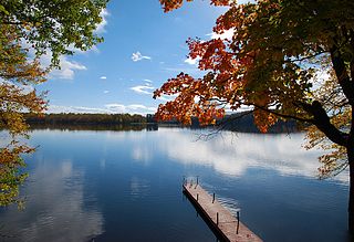
The Township of Muskoka Lakes is a municipality of the District Municipality of Muskoka, Ontario, Canada. It has a year-round population of 6,588.

<span class="mw-page-title-main">Riverview, New Brunswick</span> Town in New Brunswick, Canada

Riverview is a town in Albert County, New Brunswick, Canada. Riverview is located on the south side of the Petitcodiac River, across from the larger cities of Moncton and Dieppe. Riverview has an area of 34 square kilometres (13 sq mi), and a population density of 564.6 inhabitants per square kilometre (1,462/sq mi). Riverview's slogan is "A Great Place To Grow". With a population of 19,667 in 2016, Riverview is the fifth largest municipality in New Brunswick, having a larger population than the cities of Edmundston, Bathurst, Campbellton, and Miramichi, despite its designation of "town".

<span class="mw-page-title-main">Kingsclear Parish, New Brunswick</span> Parish in New Brunswick, Canada

Kingsclear is a civil parish in York County, New Brunswick, Canada.

<span class="mw-page-title-main">Beaubassin East, New Brunswick</span> Unincorporated area in New Brunswick, Canada

Beaubassin East was an incorporated rural community in Westmorland County, New Brunswick, Canada. It held rural community status prior to 2023.

<span class="mw-page-title-main">Blackville, New Brunswick</span> Community in New Brunswick, Canada

Blackville is a community, formerly an incorporated village, in Northumberland County, New Brunswick, Canada.

<span class="mw-page-title-main">Doaktown, New Brunswick</span> Village in New Brunswick, Canada

Doaktown is a Canadian village in Northumberland County, New Brunswick.

<span class="mw-page-title-main">Grand Bay-Westfield</span> Town in New Brunswick, Canada

Grand Bay-Westfield is a town on the west bank of the Saint John River immediately north of the boundary between Kings County and Saint John County.

A local service district (LSD) was a provincial administrative unit for the provision of local services in the Canadian province of New Brunswick. LSDs originally covered areas of the province that maintained some services but were not made municipalities when the province's former county municipalities were dissolved at the start of 1967; eventually all of rural New Brunswick was covered by the LSD system. They were defined in law by the Local Service Districts Regulation of the Municipalities Act. In 2017, the Municipalities Act was replaced by the Local Governance Act, which continued the Local Service Districts Regulation.

<span class="mw-page-title-main">Cocagne, New Brunswick</span> Place in New Brunswick, Canada

Cocagne is a Canadian community, formerly part of an eponymous local service district (LSD) and later incorporated rural community, in Kent County, New Brunswick.

<span class="mw-page-title-main">Balmoral Parish, New Brunswick</span> Parish in New Brunswick, Canada

Balmoral is a civil parish in Restigouche County, New Brunswick, Canada.

<span class="mw-page-title-main">Grimmer Parish, New Brunswick</span> Former Parish in New Brunswick, Canada

Grimmer is a civil parish in Restigouche County, New Brunswick, Canada.

<span class="mw-page-title-main">Fredericton West-Hanwell</span> Provincial electoral district in New Brunswick, Canada

Fredericton West-Hanwell is a provincial electoral district for the Legislative Assembly of New Brunswick, Canada. It was first contested in the 2014 general election, having been created in the 2013 redistribution of electoral boundaries by combining portions of the Fredericton-Silverwood and York electoral districts.

<span class="mw-page-title-main">Regional Municipality of Tracadie</span> Regional municipality in New Brunswick, Canada

The Regional Municipality of Tracadie is the first and only regional municipality in the province of New Brunswick, Canada.

<span class="mw-page-title-main">Administrative divisions of New Brunswick</span> Local governance in New Brunswick

The Canadian province of New Brunswick is divided into 89 local entities, consisting of 77 local governments and 12 rural districts.

References

  1. 1 2 3 "Census Profile of Hanwell". Statistics Canada. 6 December 2022. Retrieved 17 January 2023.
  2. "Local Governments Establishment Regulation – Local Governance Act". Government of New Brunswick. 12 October 2022. Retrieved 20 January 2023.
  3. "RSC 11 Regional Service Commission 11". Government of New Brunswick. Retrieved 17 January 2023.
  4. "Proposed entity names reflect strong ties to nature and history" (Press release). Irishtown, New Brunswick: Government of New Brunswick. 25 May 2022. Retrieved 20 January 2023.
  5. "Where is Home? New Brunswick Communities Past and Present". Provincial Archives of New Brunswick. Retrieved May 30, 2015.
  6. 1 2 3 "New Brunswick Regulation 2014-30 under the Municipalities Act (O.C. 2014-81)" (PDF) (PDF). Queen's Printer for New Brunswick. March 28, 2014. p. 2. Retrieved May 30, 2015.
  7. "Neighbourhoods". Hanwell Rural Community. Retrieved August 10, 2019.
  8. "Hanwell Recreation Park". Hanwell Rural Community. Retrieved August 10, 2019.
  9. "Quadrennial Municipal Elections and Other Local Electoral Events - Hanwell" (PDF). Elections New Brunswick. p. D-34. Retrieved August 10, 2019.
  10. Ross, Shane (20 October 2018). "Hanwell mayor resigns amid dispute over salary clawback". CBC News. Retrieved 20 October 2018.
  11. "Mayor and Council". Hanwell Rural Community. Retrieved August 10, 2019.