Kingsclear | |
---|---|
Coordinates: 45°53′06″N66°54′27″W / 45.885°N 66.9075°W | |
Country | Canada |
Province | New Brunswick |
County | York |
Erected | 1786 |
Area | |
• Land | 150.11 km2 (57.96 sq mi) |
Population (2021) [1] | |
• Total | 2,839 |
• Density | 18.9/km2 (49/sq mi) |
• Change 2016-2021 | 0.6% |
• Dwellings | 1,104 |
Time zone | UTC-4 (AST) |
• Summer (DST) | UTC-3 (ADT) |
Figures do not include portions within the city of Fredericton, the Kingsclear 6 Indian reserve, and the rural community of Hanwell |
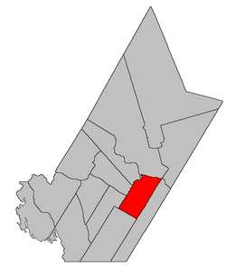
Kingsclear is a geographic parish in York County, New Brunswick, Canada. [2]
Prior to the 2023 governance reform, for governance purposes it was divided between the city of Fredericton, the Indian reserve of Kingsclear 6, the incorporated rural community of Hanwell, [3] and the local service district of the parish of Kingsclear, [4] all of which except the Indian reserve were members of Capital Region Service Commission (RSC11). [5] The LSD includes the special service area of Oswald Gray.
The parish's name may be a shortening of King's Clearing, a reference to early clearing of forests in the area. [6] [7]
Kingsclear was erected in 1786 as one of the county's original parishes. [8] The parish ran twelve miles back into the country and included the islands in front of it in the Saint John River.
In 1845 Madam Keswick Island (Keswick Island and Mitchells Island) was transferred to Douglas Parish. [9]
In 1850 the area behind Fredericton was included in the newly erected New Maryland Parish; Merrithews Island (Upper and Lower Shores Islands) was transferred to Douglas; and Kingsclear was extended back to the Charlotte County line. [10]
In 1855 the rear of Kingsclear was included in the newly erected Manners Sutton Parish. [11]
In 1867 Nevers Island and part of Sugar Island were transferred to Douglas. [12]
In 1869 the 1867 changes were repealed. [13]
In 1903 the 1867 changes were reinstituted. [14]
In 1973 Nevers Island was returned to Kingsclear. [15]
Kingsclear Parish is bounded: [2] [16] [17]
Communities at least partly within the parish. [16] [17] [21] bold indicates an incorporated municipality, incorporated rural community or Indian reserve
Bodies of water [lower-alpha 4] at least partly within the parish. [16] [17] [21]
Islands at least partly within the parish. [16] [17] [21] italics indicate a name no longer in official use
Parks, historic sites, and other noteworthy places at least partly within the parish. [16] [17] [21]
Parish population total does not include Hanwell, Kingsclear 6 Indian reserve, and portion within Fredericton
PopulationPopulation trend [24] [25] [26]
| LanguageMother tongue language (2006) [28]
|
Addington is a geographic parish in Restigouche County, New Brunswick, Canada.
Queensbury is a geographic parish in York County, New Brunswick, Canada.
Northampton is a geographic parish in Carleton County, New Brunswick, Canada, sitting across the Saint John River from Woodstock.
Simonds is a geographic parish in Carleton County, New Brunswick, Canada, located north of Woodstock on the western bank of the Saint John River.
Wakefield is a geographic parish in Carleton County, New Brunswick, Canada, located north on the west bank of the Saint John River north of Woodstock.
Brighton is a geographic parish in Carleton County, New Brunswick, Canada, northeast of Woodstock, extending from the eastern bank of the Saint John River to the York County line.
Woodstock is a geographic parish in Carleton County, New Brunswick, Canada, surrounding the town of the same name on its landward side.
Prince William is a geographic parish in York County, New Brunswick, Canada.
Manners Sutton is a geographic parish in York County, New Brunswick, Canada.
Douglas is a geographic parish in York County, New Brunswick, Canada.
Saint Marys is a geographic parish in York County, New Brunswick, Canada.
Lincoln is a geographic parish in Sunbury County, New Brunswick, Canada.
Hopewell is a geographic parish in eastern Albert County, New Brunswick, Canada.
Harvey is a geographic parish in southern Albert County, New Brunswick, Canada.
Shediac is a geographic parish in Westmorland County, New Brunswick, Canada.
Simonds is a geographic parish in Saint John County, New Brunswick, Canada.
Lepreau is a geographic parish in Charlotte County, New Brunswick, Canada, west of Saint John.
Burton is a geographic parish in Sunbury County, New Brunswick, Canada.
Pennfield is a geographic parish in Charlotte County, New Brunswick, Canada, located west of Saint John located east of St. George and west of Saint John.
Saint George is a geographic parish in Charlotte County, New Brunswick, Canada, located between St. Stephen and Saint John.