Douglas Parish, New Brunswick

Last updated

Douglas
York County NB - Douglas Parish.PNG
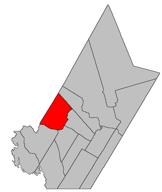
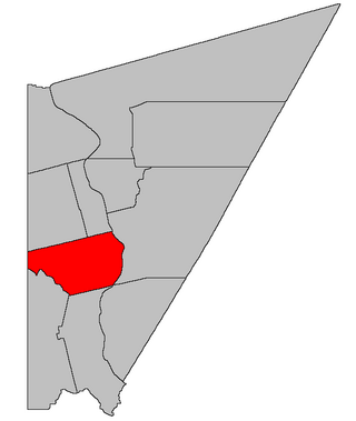
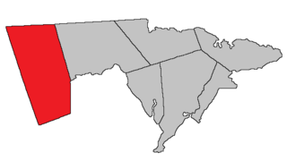
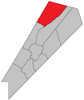
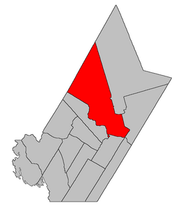
Location within York County, New Brunswick.
Coordinates: 45°58′48″N66°43′57″W / 45.98°N 66.7325°W / 45.98; -66.7325
Country Flag of Canada (Pantone).svg  Canada
Province Flag of New Brunswick.svg  New Brunswick
County York
Erected1824
Area
[1]
  Land1,443.31 km2 (557.27 sq mi)
Population
 (2021) [1]
  Total5,935
  Density4.1/km2 (11/sq mi)
  Change 2016-2021
Increase2.svg 4.1%
  Dwellings
2,357
Time zone UTC-4 (AST)
  Summer (DST) UTC-3 (ADT)
Population change reflects change in boundaries after 2016. [1]
Figures do not include portion within the city of Fredericton

Douglas is a geographic parish in York County, New Brunswick, Canada. [2]

Contents

Prior to the 2023 governance reform, for governance purposes it was divided between the city of Fredericton and the local service districts of Estey's Bridge and the parish of Douglas, [3] all of which were members of Capital Region Service Commission (RSC11). [4] Douglas Parish includes the special service areas of Carlisle Road and Lower Douglas.

Origin of name

The parish was named in honour of Sir Howard Douglas, Lieutenant Governor of New Brunswick at the time. [5]

History

Douglas was erected in 1824 from Queensbury and Saint Marys Parish; [6] the new parish included parts of modern Bright and Stanley Parishes and extended north only as far as the Nashwaak River. The boundary with Queensbury was adjusted in 1835, moving up the Saint John and running along a different angle in the interior. [7] William Francis Ganong's map of 1836 parish boundaries shows a much smaller parish than today. [8]

In 1837–38 the interior north of the Keswick River and South Branch Dunbar Stream was included in the original Stanley Parish, dissolved a year after it was erected. [9] [10] This put settlements along the modern Route 620 in Stanley.

In 1842 the parish was extended west to Southampton Parish, adding part of Queensbury to Douglas but also affecting unassigned lands. [11] The northern boundary was unmentioned, implicitly extended upstream along the Nashwaak River.

In 1845 the first of a half-dozen boundary changes among the islands in the Saint John River took place. [12] While most of these changes took place in the nineteenth century, it was 1973 before the modern boundary was finalised. [13]

In 1847 the holdings of the New Brunswick and Nova Scotia Land Company and unassigned lands to the north were erected as a new Stanley Parish, [14] establishing the southern part of the modern boundary with Douglas. In 1850 the unassigned area to the north of the Nashwaak River and west of Stanley was added to Douglas, [15] [lower-alpha 1] an area sparsely inhabited even today.

In 1869 part of Douglas along the length of its southwestern boundary was erected as Bright Parish. [16]

In 1952 a narrow strip of land along the eastern border was removed when the Revised Statutes updated the Territorial Division Act's boundary for Fredericton; [17] the earlier annexation of Devon by Fredericton did not affect the parish lines in the TDA. The 1973 enlargement of Fredericton created the same situation, with the city's municipal boundaries extending into Douglas Parish but not the boundaries listed in the TDA. [13]

Boundaries

Douglas Parish is bounded: [2] [18] [19]

Communities

Communities at least partly within the parish. [18] [19] [24] bold indicates an incorporated municipality; italics indicate a name no longer in official use

Bodies of water

Bodies of water [lower-alpha 6] at least partly within the parish. [18] [19] [24]

Islands

Islands at least partly within the parish. [18] [19] [24]

Other notable places

Parks, historic sites, and other noteworthy places at least partly within the parish. [18] [19] [24] [25]

Demographics

Parish population total does not include portion within Fredericton

See also

Notes

  1. The same consolidation added the remaining unassigned parts of the province to existing parishes, mainly in York County.
  2. By the magnet of 1846, [20] when declination in the area was slightly more than 18º west of north. [21] The Territorial Division Act clause referring to magnetic direction bearings was omitted in the 1952 [22] and 1973 Revised Statutes. [2]
  3. 1 2 By the magnet of 1850, [23] when declination in the area was between 18º and 19º west of north. [21]
  4. The Territorial Division Act uses the pre-1973 boundaries of Fredericton; the modern municipal boundaries extended further west.
  5. By the magnet of 1869, when declination in the area was between 19º and 20º west of north. [21]
  6. Not including brooks, ponds or coves.

Related Research Articles

<span class="mw-page-title-main">Saumarez Parish, New Brunswick</span> Parish in New Brunswick, Canada

Saumarez is a geographic parish in Gloucester County, New Brunswick, Canada.

<span class="mw-page-title-main">Kingsclear Parish, New Brunswick</span> Parish in New Brunswick, Canada

Kingsclear is a geographic parish in York County, New Brunswick, Canada.

<span class="mw-page-title-main">Beresford Parish, New Brunswick</span> Parish in New Brunswick, Canada

Beresford is a geographic parish in Gloucester County, New Brunswick, Canada.

<span class="mw-page-title-main">Queensbury Parish, New Brunswick</span> Parish in New Brunswick, Canada

Queensbury is a geographic parish in York County, New Brunswick, Canada.

<span class="mw-page-title-main">Southampton Parish, New Brunswick</span> Parish in New Brunswick, Canada

Southampton is a geographic parish in York County, New Brunswick, Canada.

<span class="mw-page-title-main">Saint-Basile Parish, New Brunswick</span> Parish in New Brunswick, Canada

Saint-Basile is a geographic parish in Madawaska County, New Brunswick, Canada.

<span class="mw-page-title-main">Saint-Léonard Parish, New Brunswick</span> Parish in New Brunswick, Canada

Saint-Léonard is a geographic parish in Madawaska County, New Brunswick, Canada.

<span class="mw-page-title-main">Blackville Parish, New Brunswick</span> Parish in New Brunswick, Canada

Blackville is a geographic parish in Northumberland County, New Brunswick, Canada.

<span class="mw-page-title-main">Gordon Parish, New Brunswick</span> Parish in New Brunswick, Canada

Gordon is a geographic parish in Victoria County, New Brunswick, Canada.

<span class="mw-page-title-main">Carleton Parish, New Brunswick</span> Parish in New Brunswick, Canada

Carleton is a geographic parish in Kent County, New Brunswick, Canada.

<span class="mw-page-title-main">Harcourt Parish, New Brunswick</span> Parish in New Brunswick, Canada

Harcourt is a geographic parish in Kent County, New Brunswick, Canada.

<span class="mw-page-title-main">Kent Parish, New Brunswick</span> Parish in New Brunswick, Canada

Kent is a geographic parish in the northeastern corner of Carleton County, New Brunswick, Canada.

<span class="mw-page-title-main">Wakefield Parish, New Brunswick</span> Parish in New Brunswick, Canada

Wakefield is a geographic parish in Carleton County, New Brunswick, Canada, located north on the west bank of the Saint John River north of Woodstock.

<span class="mw-page-title-main">Brighton Parish, New Brunswick</span> Parish in New Brunswick, Canada

Brighton is a geographic parish in Carleton County, New Brunswick, Canada, northeast of Woodstock, extending from the eastern bank of the Saint John River to the York County line.

<span class="mw-page-title-main">Prince William Parish, New Brunswick</span> Parish in New Brunswick, Canada

Prince William is a geographic parish in York County, New Brunswick, Canada.

<span class="mw-page-title-main">Saint Marys Parish, New Brunswick</span> Parish in New Brunswick, Canada

Saint Marys is a geographic parish in York County, New Brunswick, Canada.

<span class="mw-page-title-main">Stanley Parish, New Brunswick</span> Parish in New Brunswick, Canada

Stanley is a geographic parish in York County, New Brunswick, Canada.

<span class="mw-page-title-main">Salisbury Parish, New Brunswick</span> Parish in New Brunswick, Canada

Salisbury is a geographic parish in Westmorland County, New Brunswick, Canada.

<span class="mw-page-title-main">Gagetown Parish, New Brunswick</span> Parish in New Brunswick, Canada

Gagetown is a geographic parish in Queens County, New Brunswick, Canada.

<span class="mw-page-title-main">Chipman Parish, New Brunswick</span> Parish in New Brunswick, Canada

Chipman is a geographic parish in Queens County, New Brunswick, Canada.

References

  1. 1 2 3 "Census Profile". Statistics Canada. 26 October 2022. Retrieved 29 October 2022.
  2. 1 2 3 "Chapter T-3 Territorial Division Act". Government of New Brunswick. Retrieved 13 November 2020.
  3. "New Brunswick Regulation 84-168 under the Municipalities Act (O.C. 84-582)". Government of New Brunswick. Retrieved 25 July 2020.
  4. "Communities in each of the 12 Regional Service Commissions (RSC) / Les communautés dans chacune des 12 Commissions de services régionaux (CSR)" (PDF), Government of New Brunswick, July 2017, retrieved 2 February 2021
  5. Ganong, William F. (1896). A Monograph of the Place-Nomenclature of the Province of New Brunswick. Royal Society of Canada. p. 231. Retrieved 17 March 2021.
  6. "5 Geo. IV c. 27 An Act for erecting a part of the Parishes of Saint Mary and Queensbury, in the County of York, into a separate and distinct Town or Parish.". Acts of the General Assembly of His Majesty's Province of New-Brunswick, Passed in the Year 1824. Fredericton: Government of New Brunswick. 1824. pp. 63–65. Retrieved 27 March 2021.
  7. "5 Wm. IV c. 32 An Act to alter the division line between the Parishes of Douglas and Queensbury in the County of York.". Acts of the General Assembly of His Majesty's Province of New-Brunswick, Passed in the Year 1835. Fredericton: Government of New Brunswick. 1835. pp. 40–41. Retrieved 27 March 2021.
  8. Ganong, William F. (1901). A Monograph of the Evolution of the Boundaries of the Province of New Brunswick. Royal Society of Canada. p. Map No. 39. Retrieved 9 November 2021.
  9. "7 Wm. IV c. 25 An Act for erecting a part of the Parishes of Saint Mary's and Douglas in the County of York, into a separate and distinct Town or Parish.". Acts of the General Assembly of His Majesty's Province of New Brunswick, Passed in the Year 1837. Fredericton: Government of New Brunswick. 1837. pp. 82–83. Retrieved 27 March 2021.
  10. "1 Vic. c. 34 An Act to repeal an Act, intituled 'An Act for erecting a part of the Parishes of Saint Mary's and Douglas in the County of York, into a separate and distinct Town or Parish.'". Acts of the General Assembly of Her Majesty's Province of New Brunswick, Passed in the Year 1838. Fredericton: Government of New Brunswick. 1838. pp. 77–78. Retrieved 27 March 2021.
  11. "5 Vic. c. 11 An Act to alter the Division Line of the Parishes of Douglas and Queensbury, in the County of York.". Acts of the General Assembly of Her Majesty's Province of New Brunswick, Passed in the Year 1842. Fredericton: Government of New Brunswick. 1842. p. 10. Retrieved 27 March 2021.
  12. "8 Vic. c. 66 An Act to annex the Madam Kiswick Island to the Parish of Douglas, in the County of York.". Acts of the General Assembly of Her Majesty's Province of New Brunswick, Passed in the Year 1845. Fredericton: Government of New Brunswick. 1845. p. 46. Retrieved 27 March 2021.
  13. 1 2 "Chapter T-3 Territorial Division Act". Revised Statutes of New Brunswick 1973 Volume IV. Fredericton: Government of New Brunswick. 1973. pp. 1–70. The original printed version is cited separately to distinguish it from the edited version available online.
  14. "9 Vic. c. 38 An Act for erecting a part of the Parishes of Saint Mary's and Douglas, in the County of York, into a separate and distinct Town or Parish.". Acts of the General Assembly of Her Majesty's Province of New Brunswick, Passed in the Year 1846. Fredericton: Government of New Brunswick. 1846. pp. 41–42. Retrieved 27 March 2021.
  15. "13 Vic. c. 51 An Act to consolidate all the Laws now in force for the division of the Province into Counties, Towns and Parishes.". Acts of the General Assembly of Her Mjaesty's Province of New Brunswick, Passed in the Year 1850. Fredericton: Government of New Brunswick. 1850. pp. 142–152, 145–149. Retrieved 27 March 2021. Book was poorly proofread, resulting in title typo and reuse of page numbers 145–152.
  16. "32 Vic. c. 49 An Act to erect part of the Parish of Douglas, in the County of York, into a separate Town or Parish.". Acts of the General Assembly of Her Majesty's Province of New Brunswick. Passed in the Month of April 1869. Fredericton: Government of New Brunswick. 1869. pp. 94–95. Available as a free ebook from Google Books.
  17. "Chapter 227 Territorial Division Act". The Revised Statutes of New Brunswick 1952 Volume III. Fredericton: Government of New Brunswick. 1952. pp. 3725–3771.
  18. 1 2 3 4 5 "No. 83". Provincial Archives of New Brunswick. Department of Natural Resources and Energy Development. Retrieved 25 June 2021. Remainder of parish on maps 92–94, 102–104, 113, 114, 125, and 126 at same site.
  19. 1 2 3 4 5 "242" (PDF). Transportation and Infrastructure. Government of New Brunswick. Retrieved 25 June 2021. Remainder of parish on mapbooks 243, 258, 259, 274, 275, 289–291, 306–309, 326–328, 347–350, 369, and 370 at same site.
  20. "9 Vic. c. 38 An Act for erecting a part of the Parishes of Saint Mary's and Douglas, in the County of York, into a separate and distinct Town or Parish.". Acts of the General Assembly of Her Majesty's Province of New Brunswick, Passed in the Year 1846. Fredericton: Government of New Brunswick. 1846. pp. 41–42. Retrieved 27 March 2021.
  21. 1 2 3 "Historical Magnetic Declination". National Oceanic and Atmospheric Administration. Retrieved 9 May 2021.
  22. "Chapter 227 Territorial Division Act". The Revised Statutes of New Brunswick 1952 Volume III. Fredericton: Government of New Brunswick. 1952. pp. 3725–3771.
  23. "13 Vic. c. 51 An Act to consolidate all the Laws now in force for the division of the Province into Counties, Towns and Parishes.". Acts of the General Assembly of Her Mjaesty's Province of New Brunswick, Passed in the Year 1850. Fredericton: Government of New Brunswick. 1850. pp. 142–152, 145–149. Book was poorly proofread, resulting in title typo and reuse of page numbers 145–152.
  24. 1 2 3 4 "Search the Canadian Geographical Names Database (CGNDB)". Government of Canada. Retrieved 3 July 2021.
  25. "Explore New Brunswick's Protected Natural Areas". GeoNB. Retrieved 3 July 2021.
  26. Statistics Canada: 1996, 2001, 2006 census
  27. 2006 Statistics Canada Community Profile: Douglas Parish, New Brunswick
  28. 2011 Statistics Canada Census Profile: Douglas Parish, New Brunswick
  29. 1 2 "Census Profile, 2016 Census Douglas, Parish [Census subdivision], New Brunswick". Statistics Canada. Retrieved 8 October 2019.


45°58′48″N66°43′57″W / 45.98000°N 66.73250°W / 45.98000; -66.73250 (Douglas Parish, New Brunswick)