Addington Parish, New Brunswick

Last updated

Addington
Restigouche County NB - Addington Parish.PNG
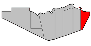
Location within Restigouche County.
Coordinates: 47°42′28″N66°45′40″W / 47.707777°N 66.76111°W / 47.707777; -66.76111
Country Flag of Canada (Pantone).svg  Canada
Province Flag of New Brunswick.svg  New Brunswick
County Restigouche
Erected1827
Area
[1]
  Land933.00 km2 (360.23 sq mi)
Population
 (2021) [1]
  Total698
  Density0.7/km2 (2/sq mi)
  Change 2016-2021
Increase2.svg 6.4%
  Dwellings
354
Time zone UTC-4 (AST)
  Summer (DST) UTC-3 (ADT)
Figures do not include portions within the city of Campbellton and the villages of Atholville and Tide Head

Addington is a geographic parish in Restigouche County, New Brunswick, Canada. [4]

Contents

For governance purposes it is divided between the city of Campbellton [5] and the Restigouche rural district, [6] both of which are members of the Restigouche Regional Service Commission. [7]

Before the 2023 governance reform, the northern part of the parish was heavily divided, with (moving upriver from the eastern parish line) the city of Campbellton, the village of Atholville, the village of Tide Head and the local service district of Flatlands, which straddled the western parish line; the (LSD) of Glencoe was inland of Tide Head and Flatlands, along Route 17 and Route 275, with Atholville extending inland around the loop of Route 275; the remainder of the parish's mainland formed the LSD of the parish of Addington. The islands in the Restigouche River were divided between Flatlands and Tide Head, though the boundary the village claimed differed from those recognised by the Regional Service Commission's map of Flatlands. [8] The 2023 reform amalgamated Addington and Tide Head with Campbellton, annexing Glencoe with two parts of the LSD of the parish of Addington on either side of Walker Road, allowing a smoother boundary, while the boundary between the river islands was settled; [5] Flatlands and the remainder of the parish LSD became part of the rural district. [6]

Origin of name

The parish was named in honour of Henry Unwin Addington, a diplomat who was appointed in 1826 as a plenipotentiary in the boundary negotiations with the United States. [9] [10] He was the nephew of Henry Addington, Prime Minister of the United Kingdom 1801–1804.

The other plenipotentiary in 1826 was William Huskisson, for whom Huskisson Parish in Kent County was named at the same time.

History

Addington was erected in 1827 in Gloucester County from Beresford Parish. [11] The parish comprised the area north of the prolongation of the southern line of modern Beresford and between the Benjamin and Upsalquitch Rivers.

In 1840 Restigouche County was reorganised following its erection. Addington was reduced to its modern eastern boundary while having its western boundary changed to a line due south from the mouth of the Upsalquitch River. [12]

In 1879 Eldon Parish was dissolved and the area added to Addington. [13]

In 1896 Eldon was reërected with altered boundaries, giving Addington its modern boundaries. [14]

Boundaries

Addington Parish is bounded: [2] [15] [16]

Communities

Communities at least partly within the parish. [15] [16] [17] bold indicates an incorporated municipality

Bodies of water

Bodies of water [lower-alpha 1] at least partly within the parish. [15] [16] [17]

Islands

Islands at least partly within the parish. [15] [16] [17]

Other notable places

Parks, historic sites, and other noteworthy places at least partly within the parish. [15] [16] [17] [18] [19]

Demographics

Parish population total does not include Tide Head or portions in Atholville and Campbellton. Revised census figures based on the 2023 local governance reforms have not been released.

Population

Canada census – Addington community profile
2021 2016 2011
Population698 (+6.4% from 2016)656 (-8.5% from 2011)2,615 (-4.1% from 2006)
Land area933.00 km2 (360.23 sq mi)935.17 km2 (361.07 sq mi)1,024.99 km2 (395.75 sq mi)
Population density0.7/km2 (1.8/sq mi)0.7/km2 (1.8/sq mi)2.6/km2 (6.7/sq mi)
Median age53.2 (M: 54.0, F: 53.2)53.3 (M: 53.6, F: 53.1)46.6 (M: 46.6, F: 46.6)
Private dwellings354 (total)  326 (occupied)333 (total) 1,086 (total) 
Median household income$57,600$48,640$47,794
References: 2021 [21] 2016 [22] 2011 [23] earlier [24] [25]
Historical Census Data - Addington Parish, New Brunswick
YearPop.±%
1991 3,179    
1996 3,014−5.2%
2001 2,982−1.1%
YearPop.±%
2006 2,727−8.6%
2011 2,615−4.1%
2011 Rev. 717−72.6%
YearPop.±%
2016 656−8.5%
[26] [27]

Language

Canada Census Mother Tongue - Addington Parish, New Brunswick [26]
CensusTotal
French
English
French & English
Other
YearResponsesCountTrendPop %CountTrendPop %CountTrendPop %CountTrendPop %
2016
660
18027.2%47071.2%50.8%50.8%
2011
2,610
1,950Decrease2.svg 2.5%74.71%630Decrease2.svg 8.0%24.14%30Increase2.svg 20.0%1.15%0Decrease2.svg 100.0%0.00%
2006
2,720
2,000Decrease2.svg 13.6%73.53%685Increase2.svg 6.2%25.18%25Increase2.svg 25.0%0.92%10Steady2.svg 0.0%0.37%
2001
2,990
2,315Increase2.svg 7.7%77.42%645Decrease2.svg 17.8%21.57%20Decrease2.svg 50.0%0.67%10Decrease2.svg 50.0%0.33%
1996
2,995
2,150n/a71.79%785n/a26.21%40n/a1.33%20n/a0.67%

Access Routes

Highways and numbered routes that run through the parish, including external routes that start or finish at the parish limits: [28]

See also

Notes

  1. Not including brooks, ponds or coves.

Related Research Articles

<span class="mw-page-title-main">Aberdeen Parish, New Brunswick</span> Parish in New Brunswick, Canada

Aberdeen is a geographic parish in Carleton County, New Brunswick, Canada, located in the interior east of the Saint John River.

<span class="mw-page-title-main">Beresford Parish, New Brunswick</span> Parish in New Brunswick, Canada

Beresford is a geographic parish in Gloucester County, New Brunswick, Canada.

<span class="mw-page-title-main">Atholville, New Brunswick</span> Community within the City of Campbellton

Atholville is a community in Restigouche County, New Brunswick, Canada. It held village status prior to 2023 but is now part of the city of Campbellton.

<span class="mw-page-title-main">Northampton Parish, New Brunswick</span> Parish in New Brunswick, Canada

Northampton is a geographic parish in Carleton County, New Brunswick, Canada, sitting across the Saint John River from Woodstock.

<span class="mw-page-title-main">Wicklow Parish, New Brunswick</span> Parish in New Brunswick, Canada

Wicklow is a geographic parish in Carleton County, New Brunswick, Canada, forming the northwestern corner of Carleton County.

<span class="mw-page-title-main">Dalhousie Parish, New Brunswick</span> Parish in New Brunswick, Canada

Dalhousie is a geographic parish in Restigouche County, New Brunswick, Canada.

<span class="mw-page-title-main">Balmoral Parish, New Brunswick</span> Parish in New Brunswick, Canada

Balmoral is a geographic parish in Restigouche County, New Brunswick, Canada.

<span class="mw-page-title-main">Colborne Parish, New Brunswick</span> Parish in New Brunswick, Canada

Colborne is a geographic parish in Restigouche County, New Brunswick, Canada.

<span class="mw-page-title-main">Eldon Parish, New Brunswick</span> Parish in New Brunswick, Canada

Eldon is a geographic parish in Restigouche County, New Brunswick, Canada.

<span class="mw-page-title-main">Grimmer Parish, New Brunswick</span> Former Parish in New Brunswick, Canada

Grimmer is a geographic parish in Restigouche County, New Brunswick, Canada.

<span class="mw-page-title-main">Durham Parish, New Brunswick</span> Parish in New Brunswick, Canada

Durham is a geographic parish in Restigouche County, New Brunswick, Canada.

<span class="mw-page-title-main">Saint-Quentin Parish, New Brunswick</span> Parish in New Brunswick, Canada

Saint-Quentin is a geographic parish in Restigouche County, New Brunswick, Canada.

<span class="mw-page-title-main">Bathurst Parish, New Brunswick</span> Parish in New Brunswick, Canada

Bathurst is a geographic parish in Gloucester County, New Brunswick, Canada.

<span class="mw-page-title-main">Brighton Parish, New Brunswick</span> Parish in New Brunswick, Canada

Brighton is a geographic parish in Carleton County, New Brunswick, Canada, northeast of Woodstock, extending from the eastern bank of the Saint John River to the York County line.

<span class="mw-page-title-main">Woodstock Parish, New Brunswick</span> Parish in New Brunswick, Canada

Woodstock is a geographic parish in Carleton County, New Brunswick, Canada, surrounding the town of the same name on its landward side.

<span class="mw-page-title-main">Pennfield Parish, New Brunswick</span> Parish in Canada

Pennfield is a geographic parish in Charlotte County, New Brunswick, Canada, located west of Saint John located east of St. George and west of Saint John.

<span class="mw-page-title-main">Saint George Parish, New Brunswick</span> Parish in Canada

Saint George is a geographic parish in Charlotte County, New Brunswick, Canada, located between St. Stephen and Saint John.

The Upsalquitch River is a tributary of the South bank of the Restigouche River, flowing in Restigouche County, in the northwest of New Brunswick, in Canada.

The Popelogan River is a tributary of the Eastern shore Upsalquitch River, flowing particularly through the Addington Parish, in Restigouche County, in the Northwest the New Brunswick, in Canada.

The Northwest Upsalquitch River is a tributary of the South bank of the Upsalquitch River, crossing the parishes of Saint-Quentin, Eldon and Addington, in Restigouche County, in the northwest of New Brunswick, in Canada.

References

  1. 1 2 "Census Profile". Statistics Canada. 26 October 2022. Retrieved 29 October 2022.
  2. 1 2 "Chapter T-3 Territorial Division Act". Government of New Brunswick. Retrieved 24 January 2023.
  3. "Chapter I-13 Interpretation Act". Government of New Brunswick. Retrieved 24 January 2023.
  4. The Territorial Division Act [2] divides the province into 152 parishes, the cities of Saint John and Fredericton, and one town of Grand Falls. The Interpretation Act [3] clarifies that parishes include any local government within their borders.
  5. 1 2 "Restigouche Regional Service Commission: RSC 2". Government of New Brunswick. Retrieved 24 January 2023.
  6. 1 2 "Restigouche Regional Service Commission: RD 2". Government of New Brunswick. Retrieved 24 January 2023.
  7. "Regions Regulation – Regional Service Delivery Act". Government of New Brunswick. 21 July 2022. Retrieved 24 January 2023.
  8. The Flatlands Rural Plan can accessed at "Maps & By-Laws". Restigouche Regional Service Commission. Retrieved 25 January 2023. The RSC uses Google Drive to store its documents, so a direct link isn't possible. Tide Head claimed a river boundary that continued the mainland boundary in a straight line.
  9. Ganong, William F. (1906). Additions and Corrections to Monographs on the Place-Nomenclature, Cartography, Historic Sites, Boundaries and Settlement-origins of the Province of New Brunswick. Royal Society of Canada. p. 13. Retrieved 12 April 2021.
  10. "Addington Parish". Provincial Archives of New Brunswick. Retrieved 13 April 2021.
  11. "7 Geo. IV c. 31 An Act for the division of the County of Northumberland into three Counties, and to provide for the Government and Representation of the two new Counties.". Acts of the General Assembly of His Majesty's Province of New-Brunswick, Passed in the Year 1827. Fredericton: Government of New Brunswick. 1827. pp. 97–103. Retrieved 27 March 2021.
  12. "2 Vic. c. 19 An Act to divide the County of Restigouche into five Towns or Parishes and to define the boundaries thereof.". Acts of the General Assembly of Her Majesty's Province of New Brunswick, Passed in the Year 1839. Fredericton: Government of New Brunswick. 1839. pp. 63–64. Retrieved 27 March 2021.
  13. "42 Vic. c. 57 An Act to extend the Parish of Addington, in the County of Restigouche.". Acts of the General Assembly of Her Majesty's Province of New Brunswick. Passed in the Month of April 1879. Fredericton: Government of New Brunswick. 1879. pp. 114–115. Available as a free ebook from Google Books.
  14. "59 Vic. c. 8 An Act to Revise and Codify an Act to Provide for the Division of the Province into Counties, Towns and Parishes.". Acts of the General Assembly of Her Majesty's Province of New Brunswick. Passed in the Month of March, 1896. Fredericton: Government of New Brunswick. 1896. pp. 86–123. Available as a free ebook from Google Books.
  15. 1 2 3 4 5 "No. 5". Provincial Archives of New Brunswick. Department of Natural Resources and Energy Development. Retrieved 20 June 2021. Remainder of parish on maps 13, 24, 25, 37, and 38 at same site.
  16. 1 2 3 4 5 "001" (PDF). Transportation and Infrastructure. Government of New Brunswick. Retrieved 20 June 2021. Remainder of parish on mapbooks 012, 013, 026, 027, 045, 046, 065, 066, 085, 086, 105, 106, and 127 at same site.
  17. 1 2 3 4 "Search the Canadian Geographical Names Database (CGNDB)". Government of Canada. Retrieved 7 July 2021.
  18. "Explore New Brunswick's Protected Natural Areas". GeoNB. Retrieved 2 July 2021.
  19. "New Brunswick Regulation 2017-46 under the Parks Act (O.C. 2017-293)" (PDF). The Royal Gazette. 175. Fredericton: Queen's Printer: 1496–1497. 13 December 2017. ISSN   1714-9428 . Retrieved 5 July 2021.
  20. "New Brunswick Regulation 94-43 under the Fish and Wildlife Act (O.C. 94-231)". Government of New Brunswick. 5 June 2006. Retrieved 8 July 2021.
  21. "2021 Community Profiles". 2021 Canadian Census . Statistics Canada. 4 February 2022. Retrieved 19 October 2023.
  22. "2016 Community Profiles". 2016 Canadian Census . Statistics Canada. 12 August 2021. Retrieved 28 September 2019.
  23. "2011 Community Profiles". 2011 Canadian Census . Statistics Canada. 21 March 2019. Retrieved 16 March 2014.
  24. "2006 Community Profiles". 2006 Canadian Census . Statistics Canada. 20 August 2019.
  25. "2001 Community Profiles". 2001 Canadian Census . Statistics Canada. 18 July 2021.
  26. 1 2 Statistics Canada: 1996, 2001, 2006, 2011 census
  27. "Census Profile, 2016 Census: Addington, Parish [Census subdivision], New Brunswick". Statistics Canada. Retrieved 28 December 2018.
  28. Atlantic Canada Back Road Atlas ISBN   978-1-55368-618-7 Pages 5, 14