
Campbellton is a city in Restigouche County, New Brunswick, Canada.
Eel River Crossing is a former village in Restigouche County, New Brunswick, Canada. It held village status prior to 2023 and is now part of the village of Bois-Joli.
Kedgwick is a Canadian incorporated rural community in northern New Brunswick, Canada. On 1 January 2023, Kedgwick annexed a large area including the local service districts of St. Jean Baptiste – Menneval and White's Brook, with parts of two others; revised census figures have not been released.
Renous-Quarryville was a Canadian local service district in Northumberland County, New Brunswick, located 25 mi upstream of Miramichi, situated where the Renous River, and the Indiantown brook. discharges into the Southwest Miramichi River. It was named for the Renous river, and settlement, as well as Quarryville's quarry, hence the name "Renous-Quarryville local service district." It is now part of the incorporated rural community of Miramichi River Valley.
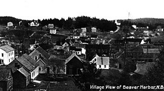
Beaver Harbour is a community on the Fundy shore of New Brunswick, Canada.
Big River is a Canadian rural community in Gloucester County, New Brunswick. It is the northernmost community in the local service district of Big River, which had a population of 721 inhabitants in 2016.

Comfort Cove-Newstead is a small fishing community located outside Campbellton, on the east coast of Newfoundland and Labrador, Canada,.
Flatlands was a local service district in Addington Parish, Restigouche County, New Brunswick, Canada. The Duncan family of Aberdeen, Scotland were the original settlers of Flatlands and Campbellton. In 1866 Flatlands was a farming and lumbering settlement with approximately 27 resident families. In 1871, it had a population of 150. In 1898 Flatlands was a station on the Intercolonial Railway and had one post office, three stores, a shingle mill, a church and a population of about 400.
Madran was a local service district in the Canadian province of New Brunswick. It is now part of the town of Belle-Baie. As of 2016, Madran had a population of 260.
Menneval is an unincorporated community in Restigouche County, New Brunswick, Canada, located about midway between Campbellton and Saint-Quentin on Route 17.
Dalhousie Junction is a rural community and former local service district in Restigouche County, New Brunswick, Canada. As of 2016, its population is 396 people.
McLeods was a local service district in Restigouche County, New Brunswick, Canada. In 2016, it had a population of 372 people.
Notre-Dame-des-Érables is an unincorporated community in Gloucester County, New Brunswick, on Route 340. The community is within the former local service district of the Paroisse Notre-Dame-des-Érables, which was often shortened to the same name.

Pointe-Sapin is a settlement on the northern coast of New Brunswick, Canada, on the Northumberland Strait in the Gulf of the St. Lawrence. As a designated place in the 2011 Census, it had a population of 350 living in 165 of its 192 total private dwellings. Pointe-Sapin lies in the Atlantic Time Zone (AST/ADT) and observes daylight saving time.
New Bandon-Salmon Beach was a local service district in New Brunswick, Canada. It was merged into the rural district of Chaleur on 1 January 2023, with a small area now part of the city of Bathurst.

Scoudouc is a community in New Brunswick, Canada.
Barryville-New Jersey is an unincorporated community within the former Canadian local service district of the parish of Alnwick in Northumberland County, New Brunswick.
Black River-Hardwicke was a local service district in Northumberland County, New Brunswick. It is now part of the Greater Miramichi rural district.
Grand Saint-Antoine was a local service district within Kent County that surrounded the village of Saint-Antoine in the Canadian province New Brunswick. Straddling the boundaries of three parishes – Dundas, Saint Mary, and Wellington – the local service district was divided into three designated places by Statistics Canada.
Benton was a local service district that was partially within Carleton County and partially within York County in the Canadian province New Brunswick. Straddling the boundaries of two parishes – Woodstock and Canterbury – the local service district was divided into two designated places by Statistics Canada.
