
The Battle of Krefeld was a battle fought on 23 June 1758 between a Prussian-Hanoverian army and a French army during the Seven Years' War.

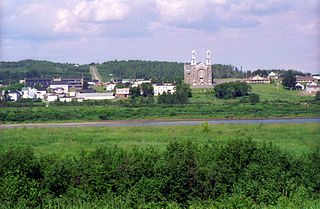
Shippagan is a Canadian town within Shippegan Parish, Gloucester County, New Brunswick.

Dix-Huit Montagnes Region is a defunct region of Ivory Coast. From 1997 to 2011, it was a first-level subdivision region. The region's capital was Man and its area was 16,782 km². Since 2011, the territory formerly encompassed by the region is part of Montagnes District.

Moyen-Cavally Region is a defunct region of Ivory Coast. From 2000 to 2011, it was a first-level subdivision region. The region's capital was Guiglo and its area was 14,268 km². Since 2011, the area formerly encompassed by the region is part of Montagnes District.
Garifuna (Karif) is a minority language widely spoken in villages of Garifuna people in the western part of the northern coast of Central America.
Sainte-Anne-de-Madawaska is a Canadian village in Madawaska County, New Brunswick.

Toulépleu Department is a department of Cavally Region in Montagnes District, Ivory Coast. In 2014, its population was 56,992 and its seat is the settlement of Toulépleu. The sub-prefectures of the department are Bakoubli, Méo, Nézobly, Péhé, Tiobly, and Toulépleu. It is the westernmost department of Ivory Coast.
The communes of Ivory Coast are a fifth-level administrative unit of administration in Ivory Coast. The sub-prefectures of Ivory Coast contain villages, and in select instances more than one village is combined into a commune. There are currently 197 communes in the 510 sub-prefectures.
Route 180 is a 140 km (87 mi) collector highway in northern New Brunswick, Canada. The western terminus is Route 17 at Saint-Quentin and the eastern terminus is Route 134 in Bathurst. In Saint-Quentin, the road is called rue Mgr-Martin Est, and in Bathurst, it is named Vanier Boulevard.

Rang-Sept is an unincorporated community in Restigouche County, New Brunswick, Canada.
Rang-Double-Sud is an unincorporated community in Restigouche County, New Brunswick, Canada.

Baker Brook is a civil parish in Madawaska County, New Brunswick, Canada.

Bangolo Department is a department of Guémon Region in Montagnes District, Ivory Coast. In 2014, its population was 318,129 and its seat is the settlement of Bangolo. The sub-prefectures of the department are Bangolo, Béoué-Zibiao, Bléniméouin, Diéouzon, Gohouo-Zagna, Guinglo-Tahouaké, Kahin-Zarabaon, Zéo, and Zou.

Duékoué Department is a department of Guémon Region in Montagnes District, Ivory Coast. In 2014, its population was 408,148 and its seat is the settlement of Duékoué. The sub-prefectures of the department are Bagohouo, Duékoué, Gbapleu, Guéhiébly, and Guézon.

Zouan-Hounien Department is a department of Tonkpi Region in Montagnes District, Ivory Coast. In 2014, its population was 195,082 and its seat is the settlement of Zouan-Hounien. The sub-prefectures of the department are Banneu, Bin-Houyé, Goulaleu, Téapleu, Yelleu, and Zouan-Hounien.
Route 350 is a 12-kilometre (7.5 mi) long east–west secondary highway in the northeast portion of New Brunswick, Canada.

Brindletown is an unincorporated community located within Plumsted Township, in Ocean County, New Jersey, United States. Brindletown was once a village home to a hotel, a mill, and large estates overlooking Brindle Lake. Brindletown was purchased by the federal government to expand Camp Dix in the 1920s. The site of the original Brindletown is within a weapons training site though the site of the current Brindletown is accessible to the public. The current settlement is centered about the intersection of Long Swamp Road and Carter Lane to the north of the original site. Houses line Long Swamp Road and other surrounding roads in the area while some farms are found to the north of Long Swamp Road. The portion of the community within the confines of Fort Dix is mostly forest.
Jerônimo Dix-Huit Rosado Maia was a Brazilian politician born in the city of Mossoró, in the state of Rio Grande do Norte.

The Petite rivière Bellevue is a tributary of the Lemoine River. It flows entirely in the municipality of Sainte-Victoire in the Pierre-De Saurel Regional County Municipality (MRC), in the administrative region of Montérégie, on the South Shore of St. Lawrence River, in Quebec, Canada.
