The Chandler River is a 24.5-mile-long (39.4 km) river in Washington County, Maine. It flows from its source on Cottontail Hill in Centerville to Jonesboro, where it empties into Englishman Bay.
The Crooked River is an 11.7-mile-long (18.8 km) river in Maine Township 30 MD, BPP, Maine. From its source, the river runs about 5 miles (8 km) southeast, then winds generally northward to its confluence with the Machias River.
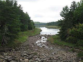
The East Branch Chandler River is a 5.2-mile-long (8.4 km) tributary of the Chandler River in Washington County, Maine. It flows west from its source in Jonesboro, to its mouth in Centerville.
The East Branch Mattawamkeag River is a tributary of the Mattawamkeag River in Aroostook County, Maine. From its source in Dudley, the river runs 36 miles (58 km) south and southeast to its confluence with the West Branch Mattawamkeag River in Haynesville, about 10 miles (16 km) west of the Canada–United States border.
The Englishman River is a short river in Washington County, Maine. From its source, in Whitneyville, Maine, the river runs about 8.1 miles (13.0 km) south to Roque Bluffs, where it empties into Englishman Bay.
Hardscrabble River is the estuary of Wilson Stream, a small river in Washington County, Maine. From its source in Charlotte, Wilson Stream runs about 10 miles (16 km) southeast to Dennys Bay. It changes name to Hardscrabble River at about the point where it is crossed by U.S. Route 1. This section of the stream separates Pembroke on its left bank from Dennysville and Edmunds on its right.
The Indian River is a river in Washington County, Maine. From its source in Columbia Falls, the river runs about 12.7 miles (20.4 km) south to its estuary at the village of Indian River in the town of Addison. The tidal portion of the Indian River extends another 3.6 miles (5.8 km) south through the township of Jonesport, and then west to Wohoa Bay, an arm of Western Bay on the Atlantic Ocean. The term "Indian River" is also used to loosely refer to the entire combined townships of Addison and Jonesport through which the river passes.

The Little River is a short, mostly-tidal river in Perry, Maine. From Boyden Stream Reservoir it runs about 2 miles (3 km) east to Passamaquoddy Bay.
The Little River is a short river in Waldo County, Maine. From its source in Belmont, the river runs 8.0 miles (12.9 km) east to Belfast Bay, on the border between Belfast and Northport.
The Little River is a tributary of the Pleasant River in Columbia Falls, Maine. From its source, the river runs 7.1 miles (11.4 km) south to its confluence with the Pleasant River.
The Middle Branch Pleasant River is a tributary of the Piscataquis River in Piscataquis County, Maine. From the outflow of Middle Branch Pond in Maine Township 5, Range 9, WELS, the river runs 11.4 miles (18.3 km) southeast to its confluence with the East Branch in Brownville. The East Branch runs about 1.5 miles (2.4 km) further south, joining with the West Branch to form the main stem of the Pleasant River.
The Mill River is a short river in Washington County, Maine. From its source in Cherryfield, the river runs 7.8 miles (12.6 km) southeast to Flat Bay and its confluence with the Harrington River. Its lower length forms the border between the towns of Milbridge and Harrington.
The Orange River is a short river in Whiting, Maine.
The Sanborn River is a 5.8-mile-long (9.3 km) river in Maine. It flows from its source on Round Mountain in the unorganized territory of South Oxford to Hicks Pond in the town of Greenwood. Hicks Pond drains via Niles Brook into the Little Androscoggin River, the Androscoggin River, and thence into Merrymeeting Bay in the Kennebec River estuary.
The Southwest Branch Indian River is a short stream in Addison, Maine. From its source, the river runs about 3 miles (5 km) east to its confluence with the Indian River.
The West Branch Pleasant River is a tributary of the Pleasant River in Washington County, Maine. From the confluence of Branch Brook and Bells Brook in southeast Columbia, the river meanders 2.3 miles (3.7 km) south to the estuary of the Pleasant River at Addison.
The West Branch Pleasant River is a 7.5-mile-long (12.1 km) tributary of the Pleasant River in the U.S. state of Maine. It is part of the Androscoggin River watershed, which flows to the tidal Kennebec River near its mouth at the Atlantic Ocean.
The West Branch Pleasant River is a 36.1-mile-long (58.1 km) tributary of the Piscataquis River in Piscataquis County, Maine. From a location north of Fourth West Branch Pond in Shawtown, the river runs about 18 miles (29 km) counterclockwise around the White Cap Mountain massif, then about 18 miles (29 km) southeast to its confluence with the East Branch of the Pleasant River in Brownville.
The West River is a short river in Addison, Maine. From its source, the river runs about 5 miles (8 km) to its confluence with the Indian River at the head of Wohoa Bay.


