There are 5 National Natural Landmarks in Arkansas. Four are forests and one is a spring.
Arkansas National Natural Landmarks (clickable map)
| Name | Image | Date | Location | County | Ownership | Description |
|---|---|---|---|---|---|---|
| Big Lake Natural Area |  | 1974 | 35°54′48.61″N90°7′3.4″W / 35.9135028°N 90.117611°W | Mississippi | Federal | Forest area within Big Lake National Wildlife Refuge. |
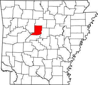
| Lake Winona Research Natural Area | 1976 | 34°42′36.66″N94°25′27.81″W / 34.7101833°N 94.4243917°W | Saline | Federal | Pine forest near Lake Winona (Arkansas); part of Ouachita National Forest. | |
| Mammoth Spring | 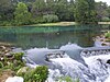 | 1972 | 36°29′52″N91°32′09″W / 36.4978°N 91.5359°W | Fulton | State | The largest first magnitude spring in Arkansas, it is connected underground to the Grand Gulf State Park in Missouri. |
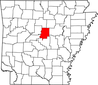
| Roaring Branch Research Natural Area | 1976 | 34°22′22.8″N93°58′40.8″W / 34.373000°N 93.978000°W | Polk | Federal | Steep ravine with a virgin forest in Ouachita National Forest. | |
| White River Sugarberry Natural Area |  | 1974 | 34°21′0″N91°6′0″W / 34.35000°N 91.10000°W | Desha | Federal | Virgin hardwood bottomland forest in White River National Wildlife Refuge. |