
Sully County is a county in the U.S. state of South Dakota. As of the 2020 census, the population was 1,446, making it the fifth-least populous county in South Dakota. Its county seat is Onida. The county was created in 1873 and organized in 1883. It is named after General Alfred Sully, who built Fort Sully.
Roberts County is a county in the U.S. state of South Dakota. As of the 2020 census, the population was 10,280. Its county seat is Sisseton. The county was named either for S. G. Roberts of Fargo, North Dakota, or for Solomon Robar, an early local French fur trader. It was created on March 8, 1883, and fully organized by August 6 of that year. Its boundary was altered once, in 1885.

Marshall County is a county in the U.S. state of South Dakota. As of the 2020 census, the population was 4,306. Its county seat is Britton. The county was created on May 2, 1885, and was named for Marshall Vincent, who homesteaded near Andover, South Dakota.

Clark County is a county in the U.S. state of South Dakota. As of the 2020 census, the population was 3,837. Its county seat is Clark. The county was created in 1873 and organized in 1881. It was named for Newton Clark, a Dakota Territory legislator in 1873.

Southwick Beach State Park is a New York State park that lies along an unusual stretch of sandy beach on the eastern shore of Lake Ontario. The park is 464 acres (188 ha) in size with a 3,500 foot (1,100 m) length of beach, and is visited annually by about 100,000 people. Immediately to the south is the Lakeview Wildlife Management Area, which extends the publicly accessible beach by several miles. They are in the Town of Ellisburg in Jefferson County, New York south of the lakeside community of Jefferson Park.

Allan H. Treman State Marine Park is a 91-acre (0.37 km2) state park and marina located in the City of Ithaca in Tompkins County, New York, United States. The park is located at the south end of Cayuga Lake, one of the 11 Finger Lakes of New York. The park's namesake, Allan Hosie Treman (1899-1975) was a Cornell University law professor, Ithaca city counsel, and member of the Finger Lakes Park Commission. He is the son of Robert H. Treman, who also has a state park named in his honor.
The Bad River is a river flowing to Lake Superior in northern Wisconsin in the United States. It flows for 119.6 kilometres (74.3 mi) in Ashland County, draining an area of 1,061 square miles (2,750 km2) in portions of Ashland, Bayfield and Iron counties. The Bad River sloughs were designated a Ramsar Wetland of International Importance on February 2, 2012.
Chester is an unincorporated community and census-designated place (CDP) in Lake County, South Dakota, United States. The population was 257 as of the 2020 census. Chester has been assigned the ZIP code of 57016.
The Missouri National Recreational River is a National Recreational River located on the border between Nebraska and South Dakota. The designation was first applied in 1978 to a 59-mile section of the Missouri River between Gavins Point Dam and Ponca State Park. In 1991, an additional 39-mile section between Fort Randall Dam and Niobrara, Nebraska, was added to the designation. These two stretches of the Missouri River are the only parts of the river between Montana and the mouth of the Missouri that remain undammed or unchannelized. The last 20 miles of the Niobrara River and 6 miles of Verdigre Creek were also added in 1991.
The Arrowwood National Wildlife Refuge Complex consists of numerous National Wildlife Refuges and Wetland Management Districts in the U.S. state of North Dakota. Altogether, twelve separate areas are in the complex, with the Chase Lake Prairie Project being the largest at 5.5 million acres (22,000 km2).
Stoney Slough National Wildlife Refuge is a 2,000-acre (810 ha) easement refuge with 1,120 acres (450 ha) owned in fee title and the remaining area of 880 acres (360 ha) covered by easement. The United States Fish and Wildlife Service fee title of 1,120 acres allows some wetland and upland management. The wetland areas on the Refuge cover approximately 600 acres (240 ha) in four permanent pools and two temporary pools. Water management using a series of canals and a water control structure is possible when there is sufficient spring runoff. The Refuge is a popular stopover for snow geese and white-fronted geese during fall migration.

The Columbia Slough is a narrow waterway, about 19 miles (31 km) long, in the floodplain of the Columbia River in the U.S. state of Oregon. From its source in the Portland suburb of Fairview, the Columbia Slough meanders west through Gresham and Portland to the Willamette River, about 1 mile (1.6 km) from the Willamette's confluence with the Columbia. It is a remnant of the historic wetlands between the mouths of the Sandy River to the east and the Willamette River to the west. Levees surround much of the main slough as well as many side sloughs, detached sloughs, and nearby lakes. Drainage district employees control water flows with pumps and floodgates. Tidal fluctuations cause reverse flow on the lower slough.

The Willamette Valley ecoregion is a Level III ecoregion designated by the United States Environmental Protection Agency in the U.S. states of Oregon and Washington. Slightly larger than the Willamette Valley for which it is named, the ecoregion contains fluvial terraces and floodplains of the Willamette River system, scattered hills, buttes, and adjacent foothills. It is distinguished from the neighboring Coast Range, Cascades, and Klamath Mountains ecoregions by lower precipitation, lower elevation, less relief, and a different mosaic of vegetation. Mean annual rainfall is 37 to 60 inches, and summers are generally dry. Historically, the region was covered by rolling prairies, oak savanna, coniferous forests, extensive wetlands, and deciduous riparian forests. Today, it contains the bulk of Oregon's population, industry, commerce, and agriculture. Productive soils and a temperate climate make it one of the most important agricultural areas in Oregon.

Smith and Bybee Wetlands Natural Area is a public park and nature reserve between the Columbia Slough and the Columbia River in Portland, Oregon. At about 2,000 acres (810 ha), it is one of the largest urban freshwater wetlands in the United States. Metro, the regional government for the Oregon part of the Portland metropolitan area, manages the park. A covered shelter, restrooms, a paved walkway, and a canoe launch lie on the north side of the natural area.

Blue Lake Regional Park is a public park in Fairview, in the U.S. state of Oregon. The 101-acre (41 ha) park, near the south shore of the Columbia River in Multnomah County, includes many covered and uncovered picnic areas, playing fields for sports such as softball, a cross country course and infrastructure related to lake recreation including swimming, boating, and fishing. Encompassing wooded areas, three ponds, and a wetland in addition to the lake, the park is frequented by migrating birds and other wildlife. Paved paths run through the park, which is near the 40-Mile Loop hiking and biking trail. Park vegetation includes cottonwoods, willows, and other trees and shrubs as well as wetland plants such as cattails.

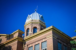
This is a list of the National Register of Historic Places listings in Lake County, South Dakota.
Lake Thompson is a lake in Kingsbury County, South Dakota, United States. With an area of 16,236 acres (65.70 km2), it is one of the largest natural lakes in South Dakota. The maximum depth of the lake is 26 ft (7.9 m), and the shoreline has a length of 44.6 miles (71.8 km). The lake is located in east-central South Dakota, on the Coteau des Prairies and is within the watershed of the Vermillion River.
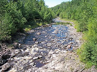
Buffalo Slough is a glacial prairie pothole wetland, and adjacent patch of bluestem tallgrass prairie, in Lake County, South Dakota, United States. The complex is located near Chester in far eastern South Dakota. Owned by the State of South Dakota, the formation was listed as a National Natural Landmark in 1980.

