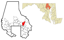
Perry Hall, Maryland

Last updated

Perry Hall, Maryland
Perry Hall High School.(wide view).png
Perry Hall High School in Perry Hall, Maryland
Baltimore County Maryland Incorporated and Unincorporated areas Perry Hall Highlighted.svg
Location of Perry Hall, Maryland
Coordinates: 39°24′5″N76°28′44″W / 39.40139°N 76.47889°W / 39.40139; -76.47889
CountryFlag of the United States.svg United States
State Flag of Maryland.svg  Maryland
County Flag of Baltimore County, Maryland.svg Baltimore
Named for Perry Hall Mansion
Area
[1]
  Total6.94 sq mi (17.97 km2)
  Land6.94 sq mi (17.97 km2)
  Water0.00 sq mi (0.01 km2)
Elevation
253 ft (77 m)
Population
 (2020)
  Total29,409
  Density4,239.44/sq mi (1,636.79/km2)
Time zone UTC−5 (Eastern (EST))
  Summer (DST) UTC−4 (EDT)
ZIP code
21128, 21236
Area code 410
FIPS code 24-60975
GNIS feature ID0590995

Perry Hall is an unincorporated community and census-designated place in Baltimore County, Maryland, United States. The population was 28,474 at the 2010 census. [2] It is a suburb of Baltimore.

Contents

Geography

Perry Hall is located at 39°24′5″N76°28′44″W / 39.40139°N 76.47889°W / 39.40139; -76.47889 . [3]

According to the United States Census Bureau, the CDP has a total area of 7.0 square miles (18 km2), all land.

Education

Elementary schools

Middle schools

Perry Hall Middle School is the largest middle school in Baltimore County. Current enrollment is 1851 students. The state rated school capacity is 1643. Enrollment projections released by Baltimore County Public Schools on Feb 20, 2017, indicate Perry Hall Middle School will have 2075 students in the 2018–19 school year. As of Feb 25, 2017, The Baltimore County Board of Education has not released any information on a plan to alleviate the overcapacity situation. http://www.bcps.org/schools/profile.aspx?OrgID=103, https://www.boarddocs.com/mabe/bcps/Board.nsf/files/AJDM3R56FD9D/$file/SC2016%20FINAL%20020217.pdf

High schools

Demographics

Historical population
CensusPop.Note
1970 5,446
1980 13,455147.1%
1990 22,72368.9%
2000 28,70526.3%
2010 28,474−0.8%
2020 29,4093.3%
U.S. Decennial Census [4]

As of the census [5] of 2000, there were 28,705 people, 11,578 households, and 7,884 families residing in the CDP. The population density was 4,104.8 inhabitants per square mile (1,584.9/km2). There were 11,578 housing units at an average density of 1,655.7 per square mile (639.3/km2). The racial makeup of the CDP was 88.79% White, 4.53% African American, 0.11% Native American, 5.08% Asian, 0.03% Pacific Islander, 0.37% from other races, and 1.10% from two or more races. Hispanic or Latino of any race were 1.50% of the population.

There were 11,328 households, out of which 33.5% had children under the age of 18 living with them, 56.3% were married couples living together, 9.9% had a female householder with no husband present, and 30.4% were non-families. 23.8% of all households were made up of individuals, and 7.2% had someone living alone who was 65 years of age or older. The average household size was 2.53, and the average family size was 3.03.

In the CDP, the population was spread out, with 24.2% under the age of 18, 7.4% from 18 to 24, 32.7% from 25 to 44, 24.0% from 45 to 64, and 11.6% who were 65 years of age or older. The median age was 37 years. For every 100 females, there were 92.8 males. For every 100 females age 18 and over, there were 88.6 males.

The median income for a household in the CDP was $57,033, and the median income for a family was $65,632 (these figures had risen to $74,450 and $84,093 respectively as of a 2007 estimate [6] ). Males had a median income of $42,371 versus $33,834 for females. The per capita income for the CDP was $26,361. About 2.3% of families and 2.9% of the population were below the poverty line, including 3.5% of those under age 18 and 3.2% of those age 65 or over.

Perry Hall Improvement Association

The Perry Hall Improvement Association (PHIA) is the oldest and largest civic organization in northeastern Baltimore County, Maryland. Since Perry Hall is not incorporated, the PHIA is the dominant communitywide coalition in the area.

An early version of the PHIA operated during the Second World War when Perry Hall residents organized a Health Committee to help veterans purchase wheelchairs, crutches, and other equipment. After the war ended, many of these leaders decided to create a permanent organization. The first meeting of the Perry Hall Improvement Association was held on July 31, 1945.

After World War II, there was a wave of growth in northeastern Baltimore County. The PHIA defeated plans for a cemetery on the South Farm, a racetrack on Forge Road, and a drive-in movie theater near St. Joseph's Roman Catholic Church. The PHIA also lobbied for lights along Joppa, Forge, and Cross Roads and Schroeder and Bauer Avenues. The PHIA pressured Baltimore County officials to fund road improvements and build new schools. Its most significant accomplishment came on September 8, 1963, when Baltimore County Executive Spiro Agnew and other officials dedicated the new Perry Hall library on Belair Road.

The PHIA worked on civic activities as well, starting a Community Christmas Party in 1946 and a Halloween Parade in 1949. In 1976, the PHIA helped form a Bicentennial Committee that hosted events at the old Perry Hall School. By the 1970s and 1980s, however, leaders spent much of their time dealing with development. The most symbolic loss for the community was the development of Lassahn Field, long used for soccer games, carnivals, and Easter egg hunts.

By the early 1990s, the community celebrated the opening of the Seven Oaks Senior Center and two new elementary schools, Seven Oaks and Joppa View. In 1994, the PHIA provided critical local support for the Honeygo Plan, a blueprint for developing Perry Hall's rural northeast.

The Perry Hall community logo, adopted in 1997 Perryhalllogo.JPG
The Perry Hall community logo, adopted in 1997

With the Honeygo Plan adopted and much of the community now built-out, the PHIA focused in the late 1990s on some of the civic activities that had been abandoned years earlier. In 2000, Perry Hall celebrated its 225th birthday. The PHIA worked with other groups to restart the Halloween Parade and begin a summer concert series, the centerpiece of which was a performance by the Baltimore Symphony Orchestra. Also, that year, the PHIA worked with other groups and elected officials to preserve the Perry Hall Mansion. The mansion was listed on the National Register of Historic Places in 1980. [7] In November 2001, Baltimore County leaders announced plans to purchase the property.

Between 1996 and 2009, the PHIA membership grew from 200 members to more than 2,000. Recently, the PHIA has focused on construction of a new Perry Hall Schools, completion of several new parks, stopping overdevelopment, and strategies to reduce school overcrowding.

The PHIA is governed by an executive board that includes Jack Amrhein, president; Kevin Leary, vice-president; Tom Benisch, treasurer; Renee Papavasiliou, secretary; and several members-at-large members. [8]

Related Research Articles

<span class="mw-page-title-main">Evans, Georgia</span> Census-designated place in Georgia, United States

Evans is a census-designated place (CDP) in Columbia County, Georgia, United States. It is a suburb of Augusta and is part of the Augusta metropolitan area. The population was 29,011 at the 2010 census, up from 17,727 at the 2000 census.

<span class="mw-page-title-main">Linthicum, Maryland</span> Census-designated place in Maryland, United States

Linthicum is a census-designated place (CDP) and unincorporated community in Anne Arundel County, Maryland, United States. The population was 10,324 at the 2010 census. It is located directly north of Baltimore–Washington International Thurgood Marshall Airport (BWI).

<span class="mw-page-title-main">Pasadena, Maryland</span> Census-designated place in Maryland, United States

Pasadena is a census-designated place (CDP) in Anne Arundel County, Maryland, United States. The population was 24,287 at the 2010 census.

<span class="mw-page-title-main">Carney, Maryland</span> Census-designated place in Maryland, United States

Carney is an unincorporated community and census-designated place in Baltimore County, Maryland, United States. The population was 29,941 at the 2010 census.

<span class="mw-page-title-main">Cockeysville, Maryland</span> Census-designated place in Maryland, United States

Cockeysville is a census-designated place (CDP) in Baltimore County, Maryland, United States. The population was 20,776 at the 2010 census.

<span class="mw-page-title-main">Essex, Maryland</span> Census-designated place in Maryland, United States

Essex is an unincorporated community and census-designated place in Baltimore County, Maryland, United States. Essex has a long history dating back to 1909. The population was 40,505 in the 2020 census, up from 39,262 in the 2010 census.

<span class="mw-page-title-main">Hampton, Maryland</span> Census-designated place in Maryland, United States

Hampton is an unincorporated community and census-designated place (CDP) in Baltimore County, Maryland, United States. The population was 5,052 at the 2010 census. Hampton is often considered a subdivision of the nearby community of Towson and is located just north of Baltimore, about twenty minutes from downtown. Hampton contains residences situated on lots up to several acres in a park-like setting. The community is anchored by its principal landmark, the Hampton National Historic Site. The Towson United Methodist Church is located in Hampton, flanked on the south by I-695 and Goucher College.

<span class="mw-page-title-main">Kingsville, Maryland</span> Census-designated place in Maryland, United States

Kingsville is a semi-rural, unincorporated community and census-designated place in Baltimore County, Maryland, United States. It is a close-knit and rustic community bounded by the Little Gunpowder Falls river and the Big Gunpowder Falls river which join to form the Gunpowder River. The population of Kingsville was 4,318 at the 2010 census.

<span class="mw-page-title-main">Milford Mill, Maryland</span> Census-designated place in Maryland, United States

Milford Mill is an unincorporated community and census-designated place in Baltimore County, Maryland, United States. Per the 2020 census, the population was 30,622.

<span class="mw-page-title-main">Overlea, Maryland</span> Census-designated place in Maryland, United States

Overlea is an unincorporated community and census-designated place in Baltimore County, Maryland, United States. The population was 12,275 at the 2010 census. Students attend Overlea High School. Area roads include Belair Road and Kenwood Avenue.

<span class="mw-page-title-main">Parkville, Maryland</span> Census-designated place in Maryland, United States

Parkville is an unincorporated community and census-designated place in Baltimore County, Maryland, United States. As of the 2010 census, the population was 30,734.

<span class="mw-page-title-main">Pikesville, Maryland</span> Census-designated place in Maryland, United States

Pikesville is a census-designated place (CDP) in Baltimore County, Maryland, United States. Pikesville is just northwest of the Baltimore city limits. It is the northwestern suburb closest to Baltimore.

<span class="mw-page-title-main">Rosedale, Maryland</span> Census-designated place in Maryland, United States

Rosedale is an unincorporated community and census-designated place in Baltimore County, Maryland, United States. The population was 19,257 at the 2010 United States Census.

<span class="mw-page-title-main">Towson, Maryland</span> Census-designated place in Maryland, United States

Towson is an unincorporated community and a census-designated place in Baltimore County, Maryland, United States. The population was 55,197 as of the 2010 census. It is the county seat of Baltimore County and the second-most populous unincorporated county seat in the United States.

<span class="mw-page-title-main">White Marsh, Maryland</span> Census-designated place in Maryland, United States

White Marsh is an unincorporated community and census-designated place in Baltimore County, Maryland, United States. The population was 9,513 at the 2010 census. White Marsh is a northeast suburb of Baltimore.

<span class="mw-page-title-main">Edgewood, Maryland</span> Census-designated place in Maryland, United States

Edgewood is an unincorporated community and census-designated place (CDP) in Harford County, Maryland, United States. The population was 25,562 at the 2010 census, up from 23,378 in 2000.

<span class="mw-page-title-main">Joppatowne, Maryland</span> Census-designated place in Maryland, United States

Joppatowne is a census-designated place in southwestern Harford County, Maryland, United States. Serving as a bedroom community for nearby Baltimore, it was established in 1961 as a planned unit development (PUD). The population was 12,616 at the 2010 census, up from 11,391 in 2000.

<span class="mw-page-title-main">Potomac, Maryland</span> Census-designated place in Maryland, United States

Potomac is an unincorporated community and census-designated place (CDP) in Montgomery County, Maryland. As of the 2020 census, it had a population of 47,018. It is named after the nearby Potomac River.

<span class="mw-page-title-main">Bowie, Maryland</span> City in Maryland, United States

Bowie is a city in Prince George's County, Maryland, United States. Per the 2020 census, the population was 58,329. Bowie has grown from a small railroad stop to the largest municipality in Prince George's County, and the fifth most populous city and third largest city by area in the U.S. state of Maryland. In 2014, CNN Money ranked Bowie 28th in its Best Places to Live list.

<span class="mw-page-title-main">Coral Hills, Maryland</span> Census-designated place in Maryland

Coral Hills is an unincorporated area and census-designated place (CDP) in Prince George's County, Maryland, United States. As of the 2020 census, the population was 9,997.

References

  1. "2020 U.S. Gazetteer Files". United States Census Bureau. Retrieved April 26, 2022.
  2. "Profile of General Population and Housing Characteristics: 2010 Demographic Profile Data (DP-1): Perry Hall CDP, Maryland". United States Census Bureau . Retrieved February 29, 2012.
  3. "US Gazetteer files: 2010, 2000, and 1990". United States Census Bureau. February 12, 2011. Retrieved April 23, 2011.
  4. "Census of Population and Housing". Census.gov. Retrieved June 4, 2016.
  5. "U.S. Census website". United States Census Bureau . Retrieved January 31, 2008.
  6. "American FactFinder - Results". Archived from the original on February 10, 2020. Retrieved April 5, 2009.
  7. "National Register Information System". National Register of Historic Places . National Park Service. April 15, 2008.
  8. perryhallmaryland.org

Sources