Edgemere, Maryland

Last updated
Edgemere, Maryland
Edgemere, MD 21219, USA - panoramio (13).jpg
Waterfront scene in Edgemere
Baltimore County Maryland Incorporated and Unincorporated areas Edgemere Highlighted.svg
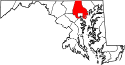
Location of Edgemere, Maryland
Coordinates: 39°13′45″N76°26′56″W / 39.22917°N 76.44889°W / 39.22917; -76.44889 Coordinates: 39°13′45″N76°26′56″W / 39.22917°N 76.44889°W / 39.22917; -76.44889
CountryFlag of the United States.svg United States
State Flag of Maryland.svg  Maryland
County Flag of Baltimore County, Maryland.svg Baltimore
Area
[1]
  Total20.57 sq mi (53.28 km2)
  Land10.87 sq mi (28.14 km2)
  Water9.71 sq mi (25.14 km2)
Elevation
20 ft (6 m)
Population
 (2020)
  Total9,069
  Density834.70/sq mi (322.27/km2)
Time zone UTC−5 (Eastern (EST))
  Summer (DST) UTC−4 (EDT)
FIPS code 24-24950
GNIS feature ID0590133

Edgemere is an unincorporated community and census-designated place in Baltimore County, Maryland, United States. The population was 8,669 at the 2010 census. [2] Founded in 1899 as Edgemere being renamed from previous name "Fitzell". Meeting held at the Fitzell Farm which was situated where the old Rheem plant was located (later it became the record storage facility for Bethlehem Steel plant at Sparrows Point).

Contents

Geography

Edgemere is located at 39°13′45″N76°26′56″W / 39.22917°N 76.44889°W / 39.22917; -76.44889 (39.229258, 76.448981). [3]

According to the United States Census Bureau, the CDP has a total area of 20.6 square miles (53 km2), of which 10.8 square miles (28 km2) is land and 9.8 square miles (25 km2), or 47.47%, is water.

Demographics

Historical population
CensusPop.Note
1960 11,775
1970 10,352−12.1%
1980 9,078−12.3%
1990 9,2261.6%
2000 9,2480.2%
2010 8,669−6.3%
2020 9,0694.6%
U.S. Decennial Census [4]

At the 2000 census there were 9,248 people, 3,530 households, and 2,513 families living in the CDP. The population density was 855.6 inhabitants per square mile (330.3/km2). There were 3,764 housing units at an average density of 348.2 per square mile (134.4/km2). The racial makeup of the CDP was 93.43% White, 5.19% African American, 0.18% Native American, 0.31% Asian, 0.18% Pacific Islander, 0.09% from other races, and 0.62% from two or more races. Hispanic or Latino of any race were 0.66%. [5]

Of the 3,530 households 28.2% had children under the age of 18 living with them, 55.9% were married couples living together, 10.1% had a female householder with no husband present, and 28.8% were non-families. 24.0% of households were one person and 12.3% were one person aged 65 or older. The average household size was 2.58 and the average family size was 3.04.

The age distribution was 22.1% under the age of 18, 7.2% from 18 to 24, 26.9% from 25 to 44, 27.1% from 45 to 64, and 16.7% 65 or older. The median age was 41 years. For every 100 females, there were 98.1 males. For every 100 females age 18 and over, there were 98.3 males.

The median household income was $46,928 and the median family income was $55,662. Males had a median income of $40,577 versus $28,398 for females. The per capita income for the CDP was $20,802. About 5.4% of families and 7.0% of the population were below the poverty line, including 9.0% of those under age 18 and 8.6% of those age 65 or over.

Related Research Articles

<span class="mw-page-title-main">Ferndale, Maryland</span> Census-designated place in Maryland, United States

Ferndale is a census-designated place (CDP) in Anne Arundel County, Maryland, United States. At the 2010 census, the population was 16,746.

<span class="mw-page-title-main">Herald Harbor, Maryland</span> Census-designated place in Maryland, United States

Herald Harbor is a census-designated place and an unincorporated community in Anne Arundel County, Maryland, United States. As of the 2010 census, the population was 2,603. It is a quiet residential area with a scenic view of the Severn River and is near the community of Crownsville and Interstate 97. Herald Harbor is known for its area immediately along the Severn River known as Long Point on the Severn, a fairly affluent neighborhood composed mainly of retired and wealthy land owners.

<span class="mw-page-title-main">Lake Shore, Maryland</span> Census-designated place in Maryland, United States

Lake Shore is a census-designated place and unincorporated community in Anne Arundel County, Maryland, United States, located east of Pasadena. The population of Lake Shore was 19,477 at the 2010 census.

<span class="mw-page-title-main">Riviera Beach, Maryland</span> Census-designated place in Maryland, United States

Riviera Beach is a census-designated place in Anne Arundel County, Maryland, United States. The population was 12,677 at the 2010 U.S. census.

<span class="mw-page-title-main">South Gate, Maryland</span> Former census-designated place in Maryland, United States

South Gate was a census-designated place (CDP) in Anne Arundel County, Maryland, United States, for the 2000 census, at which time its population was 28,672. It was added primarily to the Glen Burnie CDP for the 2010 census.

<span class="mw-page-title-main">Bowleys Quarters, Maryland</span> Census-designated place in Maryland, United States

Bowleys Quarters is an unincorporated community and census-designated place in Baltimore County, Maryland, United States, with a population of 6,755 at the 2010 census.

<span class="mw-page-title-main">Lochearn, Maryland</span> Census-designated place in Maryland, United States

Lochearn is an unincorporated community and census-designated place in Baltimore County, Maryland, United States, located immediately to the west of the City of Baltimore. Per the 2020 census, the population was 25,511.

<span class="mw-page-title-main">Milford Mill, Maryland</span> Census-designated place in Maryland, United States

Milford Mill is an unincorporated community and census-designated place in Baltimore County, Maryland, United States. Per the 2020 census, the population was 30,622.

<span class="mw-page-title-main">Rosedale, Maryland</span> Census-designated place in Maryland, United States

Rosedale is an unincorporated community and census-designated place in Baltimore County, Maryland, United States. The population was 19,257 at the 2010 United States Census.

<span class="mw-page-title-main">Rossville, Maryland</span> Census-designated place in Maryland, United States

Rossville is an unincorporated community and census-designated place in Baltimore County, Maryland, United States. The population was 15,147 at the 2010 census.

<span class="mw-page-title-main">Dunkirk, Maryland</span> Census-designated place in Maryland, United States

Dunkirk is a census-designated place (CDP) in Calvert County, Maryland, United States. The population was 2,521 at the 2010 census.

<span class="mw-page-title-main">Bel Air North, Maryland</span> Census-designated place in Maryland, United States

Bel Air North is a census-designated place (CDP) in Harford County, Maryland, United States. It is situated immediately north of the incorporated town of Bel Air. As of the 2010 census, the CDP population was 30,568, up from 25,798 in 2000.

<span class="mw-page-title-main">Fallston, Maryland</span> Census-designated place in Maryland, United States

Fallston is a census-designated place (CDP) in Harford County, Maryland, United States. The population was 8,958 at the 2010 census, up from 8,427 in 2000. Fallston is a semi-rural community consisting mostly of farms and suburban-like developments.

<span class="mw-page-title-main">Perryman, Maryland</span> Census-designated place in Maryland, United States

Perryman is an unincorporated community and census-designated place (CDP) in Harford County, Maryland, United States. The population was 2,342 at the 2010 census.

<span class="mw-page-title-main">Pleasant Hills, Maryland</span> Census-designated place in Maryland, United States

Pleasant Hills is a census-designated place (CDP) in Harford County, Maryland, United States. The population was 3,379 at the 2010 census, up from 2,851 in 2000. There is no post office with the designation "Pleasant Hills"; most of the residents have either Fallston or Kingsville addresses and consider themselves as belonging to those communities.

<span class="mw-page-title-main">Ashton-Sandy Spring, Maryland</span> Census-designated place in Maryland, United States

Ashton-Sandy Spring is a census-designated place (CDP) in Montgomery County, Maryland, United States. The CDP is designated to include the two unincorporated communities of Ashton and Sandy Spring. It had a population of 5,746 as of the 2020 census.

<span class="mw-page-title-main">Cloverly, Maryland</span> Census-designated place in Maryland, United States

Cloverly is an unincorporated town and census-designated place in Montgomery County, Maryland, United States. Its population was 15,285 as of the 2020 census.

<span class="mw-page-title-main">Fairland, Maryland</span> Census-designated place in Maryland, United States

Fairland is a census-designated place and an unincorporated area in Montgomery County, Maryland, United States. It had a population of 25,396 per the 2020 census.

<span class="mw-page-title-main">West Laurel, Maryland</span> Census-designated place in Maryland

West Laurel is an unincorporated area and census-designated place (CDP) in Prince George's County, Maryland, United States. Per the 2020 census, the population was 4,428.

<span class="mw-page-title-main">Dover-Foxcroft (CDP), Maine</span> CDP in Maine, United States

Dover-Foxcroft is a census-designated place (CDP) in the town of Dover-Foxcroft in Piscataquis County, Maine, United States. The population was 2,592 at the 2000 census.

References

  1. "2020 U.S. Gazetteer Files". United States Census Bureau. Retrieved April 26, 2022.
  2. "Profile of General Population and Housing Characteristics: 2010 Demographic Profile Data (DP-1): Edgemere CDP, Maryland". United States Census Bureau . Retrieved February 22, 2012.
  3. "US Gazetteer files: 2010, 2000, and 1990". United States Census Bureau. 2011-02-12. Retrieved 2011-04-23.
  4. "Census of Population and Housing". Census.gov. Retrieved June 4, 2016.
  5. "U.S. Census website". United States Census Bureau . Retrieved 2008-01-31.