Bowleys Quarters, Maryland

Last updated

Bowleys Quarters, Maryland
Hurricane Isabel flood damage Maryland.jpg
Bowleys Quarters in September 2003, with damage from Hurricane Isabel visible.
Baltimore County Maryland Incorporated and Unincorporated areas Bowleys Quarters Highlighted.svg
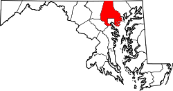
Location of Bowleys Quarters, Maryland
Coordinates: 39°19′17″N76°23′18″W / 39.32139°N 76.38833°W / 39.32139; -76.38833
CountryFlag of the United States.svg United States
State Flag of Maryland.svg  Maryland
County Flag of Baltimore County, Maryland.svg Baltimore
Area
[1]
  Total6.13 sq mi (15.88 km2)
  Land3.15 sq mi (8.15 km2)
  Water2.98 sq mi (7.73 km2)
Elevation
46 ft (14 m)
Population
 (2020)
  Total6,853
  Density2,179.01/sq mi (841.22/km2)
Time zone UTC−5 (Eastern (EST))
  Summer (DST) UTC−4 (EDT)
FIPS code 24-08800
GNIS feature ID0589790

Bowleys Quarters is an unincorporated community and census-designated place in Baltimore County, Maryland, United States, with a population of 6,755 at the 2010 census. [2]

Contents

History

Bowleys Quarters was named for Daniel Bowley, a merchant and sea captain who owned some 2,000 acres (8.1 km2) around Baltimore in the mid-18th century. Bowleys Quarters was used to house his slaves. The area later became a game preserve for waterfowl and a place where presidents and others, including Babe Ruth, came to hunt ducks. The area eventually became known as a vacation spot, and many summer homes were built along the water. Many blue-collar workers were attracted during the industrial boom of the 1920s through the 1950s. Many worked at the nearby Glenn L. Martin company (now Lockheed Martin) and Bethlehem Steel. The community experienced an economic downturn with downsizing of the Martin facility and other area businesses, and Bowleys Quarters became a mix of middle-class homes juxtaposed with modern waterfront homes. Increased interest in waterfront property in the 1990s, combined with the devastation of Hurricane Isabel, has led to revitalization, with some new homes selling for more than $1 million. Once predominantly populated by low-income to middle-class families, the community is now highly desirable for waterfront living.

In September 2003, Bowleys Quarters was substantially damaged by Hurricane Isabel and the resulting flood. According to The Baltimore Sun , Isabel destroyed 210 houses in Bowleys Quarters and caused major damage to 632 others. [3]

Geography

Bowleys Quarters is located at 39°19′17″N76°23′18″W / 39.321440°N 76.388212°W / 39.321440; -76.388212 . [4]

According to the United States Census Bureau, the CDP has a total area of 6.1 square miles (16 km2), of which 3.2 square miles (8.3 km2) is land and 2.9 square miles (7.5 km2), or 47.39%, is water.

Demographics

Historical population
CensusPop.Note
1990 5,595
2000 6,31412.9%
2010 6,7557.0%
2020 6,8531.5%
source: [2] [5]

As of the census [6] of 2000, there were 6,314 people, 2,483 households, and 1,748 families residing in the CDP. The population density was 1,954.8 inhabitants per square mile (754.8/km2). There were 2,721 housing units at an average density of 842.4 per square mile (325.3/km2). The racial makeup of the CDP was 91.65% White, 6.13% African American, 0.21% Native American, 0.65% Asian, 0.05% Pacific Islander, 0.29% from other races, and 1.03% from two or more races. Hispanic or Latino of any race were 0.57% of the population.

There were 2,483 households, of which 33.3% had children under the age of 18 living with them, 54.0% were married couples living together, 11.3% had a female householder with no husband present, and 29.6% were non-families. 22.3% of all households were made up of individuals, and 6.6% had someone living alone who was 65 years of age or older. The average household size was 2.54 and the average family size was 2.98.

In the CDP, the population was spread out, with 24.6% under the age of 18, 8.0% from 18 to 24, 34.0% from 25 to 44, 23.1% from 45 to 64, and 10.3% who were 65 years of age or older. The median age was 36 years. For every 100 females, there were 98.3 males. For every 100 females age 18 and over, there were 96.8 males.

The median income for a household in the CDP was $52,250, and the median income for a family was $61,024. Males had a median income of $41,881 versus $27,265 for females. The per capita income for the CDP was $23,295. About 5.5% of families and 6.6% of the population were below the poverty line, including 7.8% of those under age 18 and 10.7% of those ages 65 or over.

Related Research Articles

<span class="mw-page-title-main">Oroville East, California</span> Census-designated place in California, United States

Oroville East or Kelly Ridge is a census-designated place (CDP) in Butte County, California, United States. The population was 8,280 at the 2010 census, down from 8,680 at the 2000 census. Most citizens are dependent on the commerce of Oroville, and the vast majority of high school students in Kelly Ridge attend Las Plumas High School. The community of Kelly Ridge sits at Lake Oroville and offers direct access to boating, camping, fishing and a variety of water sports. Some of Oroville's most beautiful and modern properties can be found here and this neighborhood is also a popular place to retire and enjoy the outdoors.

<span class="mw-page-title-main">Meadow Vista, California</span> Census-designated place in California, United States

Meadow Vista is a census-designated place (CDP) in Placer County, California, United States. It is part of the Sacramento–Arden-Arcade–Roseville Metropolitan Statistical Area. The population was 3,217 at the 2010 census, up from 3,096 at the 2000 census.

<span class="mw-page-title-main">North Auburn, California</span> Census-designated place in California, United States

North Auburn is a census-designated place (CDP) in Placer County, California, United States. It is part of the Sacramento–Arden-Arcade–Roseville Metropolitan Statistical Area. The population was 13,452 at the 2020 census.

<span class="mw-page-title-main">Tobin, California</span> Census-designated place in California, United States

Tobin is a census-designated place (CDP) in Plumas County, California, United States. The population was 12 at the 2010 census, up from 11 at the 2000 census.

<span class="mw-page-title-main">Brooklyn Park, Maryland</span> Census-designated place in Maryland, United States

Brooklyn Park is a census-designated place (CDP) in Anne Arundel County, Maryland, United States. The population was 14,373 at the 2010 census.

<span class="mw-page-title-main">Ferndale, Maryland</span> Census-designated place in Maryland, United States

Ferndale is a census-designated place (CDP) in Anne Arundel County, Maryland, United States. At the 2010 census, the population was 16,746.

<span class="mw-page-title-main">Green Haven, Maryland</span> Former census-designated place in Maryland, United States

Green Haven is a neighborhood located within Pasadena in Anne Arundel County, Maryland, United States. It was delineated as a census-designated place at the 2000 census, at which time its population was 17,415.

<span class="mw-page-title-main">Pumphrey, Maryland</span> Unincorporated community in Maryland, United States

Pumphrey is an unincorporated community and former census-designated place (CDP) in Anne Arundel County, Maryland, United States. At the 2000 census, the population was 5,317. It was split between the Linthicum and Brooklyn Park CDPs for the 2010 census.

<span class="mw-page-title-main">Hampton, Maryland</span> Census-designated place in Maryland, United States

Hampton is an unincorporated community and census-designated place (CDP) in Baltimore County, Maryland, United States. The population was 5,052 at the 2010 census. Hampton is often considered a subdivision of the nearby community of Towson and is located just north of Baltimore, about twenty minutes from downtown. Hampton contains residences situated on lots up to several acres in a park-like setting. The community is anchored by its principal landmark, the Hampton National Historic Site. The Towson United Methodist Church is located in Hampton, flanked on the south by I-695 and Goucher College.

<span class="mw-page-title-main">Lansdowne-Baltimore Highlands, Maryland</span> Former census-designated place in Maryland, United States

Lansdowne-Baltimore Highlands was a census-designated place (CDP) in Baltimore County, Maryland, United States. The population was 15,724 at the 2000 census. At the 2010 census the area was split into two separate CDPs, the unincorporated communities of Lansdowne and Baltimore Highlands.

<span class="mw-page-title-main">Lochearn, Maryland</span> Census-designated place in Maryland, United States

Lochearn is an unincorporated community and census-designated place in Baltimore County, Maryland, United States, located immediately to the west of the City of Baltimore. Per the 2020 census, the population was 25,511.

<span class="mw-page-title-main">Lutherville-Timonium, Maryland</span> Former census-designated place in Maryland, United States

Lutherville-Timonium was a census-designated place (CDP) in Baltimore County, Maryland, United States, for the 2000 census. At that time the population was 15,814. For the 2010 census the area was split into two CDPs, the unincorporated communities of Lutherville and Timonium. Within its borders lies the Lutherville Historic District. The Maryland State Fair is held in Timonium each year near Labor Day.

<span class="mw-page-title-main">Milford Mill, Maryland</span> Census-designated place in Maryland, United States

Milford Mill is an unincorporated community and census-designated place in Baltimore County, Maryland, United States. Per the 2020 census, the population was 30,622.

<span class="mw-page-title-main">Randallstown, Maryland</span> Census-designated place in Maryland, United States

Randallstown is an unincorporated community and census-designated place in Baltimore County, Maryland, United States. It is named after Christopher and Thomas Randall, two 18th-century tavern-keepers. At that time, Randallstown was a tollgate crossroads on the Liberty Turnpike, a major east–west thoroughfare. It is a suburb of Baltimore, with a population of 33,655 as of the 2020 census. As of 2020 it was 72 percent African American. In the 1990s, Randallstown transitioned to a majority African American community.

<span class="mw-page-title-main">Rosedale, Maryland</span> Census-designated place in Maryland, United States

Rosedale is an unincorporated community and census-designated place in Baltimore County, Maryland, United States. The population was 19,257 at the 2010 United States Census.

<span class="mw-page-title-main">Rossville, Maryland</span> Census-designated place in Maryland, United States

Rossville is an unincorporated community and census-designated place in Baltimore County, Maryland, United States. The population was 15,147 at the 2010 census.

<span class="mw-page-title-main">Bel Air North, Maryland</span> Census-designated place in Maryland, United States

Bel Air North is a census-designated place (CDP) in Harford County, Maryland, United States. It is situated immediately north of the incorporated town of Bel Air. As of the 2010 census, the CDP population was 30,568, up from 25,798 in 2000.

<span class="mw-page-title-main">Bel Air South, Maryland</span> Census-designated place in Maryland, United States

Bel Air South is a census-designated place (CDP) in Harford County, Maryland, United States. The population was 47,709 at the 2010 census, up from 39,711 in 2000.

<span class="mw-page-title-main">Fallston, Maryland</span> Census-designated place in Maryland, United States

Fallston is a census-designated place (CDP) in Harford County, Maryland, United States. The population was 8,958 at the 2010 census, up from 8,427 in 2000. Fallston is a semi-rural community consisting mostly of farms and suburban-like developments.

<span class="mw-page-title-main">Pleasant Hills, Maryland</span> Census-designated place in Maryland, United States

Pleasant Hills is a census-designated place (CDP) in Harford County, Maryland, United States. The population was 3,379 at the 2010 census, up from 2,851 in 2000. There is no post office with the designation "Pleasant Hills"; most of the residents have either Fallston or Kingsville addresses and consider themselves as belonging to those communities.

References

  1. "2020 U.S. Gazetteer Files". United States Census Bureau. Retrieved April 26, 2022.
  2. 1 2 "Profile of General Population and Housing Characteristics: 2010 Demographic Profile Data (DP-1): Bowleys Quarters CDP, Maryland". United States Census Bureau . Retrieved February 22, 2012.
  3. "Embracing Isabel's 'silver lining'" by Joe Nawrozki, Baltimore Sun, October 24, 2005, retrieved April 18, 2006
  4. "US Gazetteer files: 2010, 2000, and 1990". United States Census Bureau. February 12, 2011. Retrieved April 23, 2011.
  5. "CENSUS OF POPULATION AND HOUSING (1790-2000)". U.S. Census Bureau . Retrieved July 17, 2010.
  6. "U.S. Census website". United States Census Bureau . Retrieved January 31, 2008.