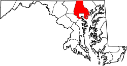
Trump, Maryland

Last updated

Trump, Maryland
USA Maryland location map.svg
Red pog.svg
Trump, Maryland
Usa edcp location map.svg
Red pog.svg
Trump, Maryland
Coordinates: 39°40′56″N76°36′08″W / 39.68222°N 76.60222°W / 39.68222; -76.60222
Country Flag of the United States.svg United States
State Flag of Maryland.svg  Maryland
County Flag of Baltimore County, Maryland.svg Baltimore
Elevation
215 m (705 ft)
Time zone UTC-5 (Eastern (EST))
  Summer (DST) UTC-4 (EDT)
Area code(s) 410, 443, & 667
GNIS feature ID593847 [1]

Trump is an unincorporated community in northern Baltimore County, Maryland, United States. [1] [2] . It was named after a nineteenth century settler named Simeon O. Van Trump, who ran a grocery store at Old York Road near West Liberty Road. [3]

Notes

  1. 1 2 "Trump, Maryland". Geographic Names Information System . United States Geological Survey, United States Department of the Interior.
  2. Baltimore County, Maryland map
  3. Clinton and Trump, Maryland’s campaign crossroads


Related Research Articles

<span class="mw-page-title-main">Maryland</span> U.S. state

Maryland is a state in the Mid-Atlantic region of the United States. It borders Virginia, West Virginia, and Washington, D.C., to its south and west; Pennsylvania to its north; and Delaware and the Atlantic Ocean to its east. With a total land area of 12,407 square miles (32,130 km2), Maryland is the eighth-smallest state by land area, and its population of 6,177,224 ranks it the 18th-most populous state and the fifth-most densely populated. Baltimore is the largest city in the state, and the capital is Annapolis. The western portion of the state contains numerous stretches of the Appalachian Mountains, while the central portion is primarily composed of the Piedmont. The eastern side of the state makes up the Chesapeake Bay, sharing the border with Delaware, and the southeastern side borders the Atlantic Ocean. Among its occasional nicknames are Old Line State, the Free State, and the Chesapeake Bay State. It is named after Henrietta Maria, the French-born queen of England, Scotland, and Ireland, who was known then in England as Mary.

<span class="mw-page-title-main">Baltimore County, Maryland</span> County in Maryland, United States

Baltimore County is the third-most populous county in the U.S. state of Maryland and is part of the Baltimore metropolitan area. Baltimore County is part of the Northeast megalopolis, which stretches from Northern Virginia northward to Boston. Baltimore County hosts a diversified economy, with particular emphasis on education, government, and health care. As of the 2020 census, the population was 854,535.

<span class="mw-page-title-main">Carroll County, Maryland</span> County in Maryland, United States

Carroll County is located in the U.S. state of Maryland. As of the 2020 census, the population was 172,891. Its county seat is Westminster.

<span class="mw-page-title-main">Somerset County, Maryland</span> County in Maryland, United States

Somerset County is the southernmost county in the U.S. state of Maryland. As of the 2020 census, the population was 24,620, making it the second-least populous county in Maryland. The county seat is Princess Anne.

<span class="mw-page-title-main">Catonsville, Maryland</span> Census-designated place in Maryland, United States

Catonsville is a census-designated place (CDP) in Baltimore County, Maryland. The population was 41,567 at the 2010 census. The community lies to the west of Baltimore along the city's border. Catonsville contains the majority of the University of Maryland, Baltimore County (UMBC), a major public research university with close to 14,000 students.

<span class="mw-page-title-main">Cockeysville, Maryland</span> Census-designated place in Maryland, United States

Cockeysville is a census-designated place (CDP) in Baltimore County, Maryland, United States. The population was 20,776 at the 2010 census.

<span class="mw-page-title-main">Lochearn, Maryland</span> Census-designated place in Maryland, United States

Lochearn is an unincorporated community and census-designated place in Baltimore County, Maryland, United States, located immediately to the west of the City of Baltimore. Per the 2020 census, the population was 25,511.

<span class="mw-page-title-main">Milford Mill, Maryland</span> Census-designated place in Maryland, United States

Milford Mill is an unincorporated community and census-designated place in Baltimore County, Maryland, United States. Per the 2020 census, the population was 30,622.

<span class="mw-page-title-main">Pikesville, Maryland</span> Census-designated place in Maryland, United States

Pikesville is a census-designated place (CDP) in Baltimore County, Maryland, United States. Pikesville is just northwest of the Baltimore city limits. It is the northwestern suburb closest to Baltimore.

<span class="mw-page-title-main">Randallstown, Maryland</span> Census-designated place in Maryland, United States

Randallstown is an unincorporated community and census-designated place in Baltimore County, Maryland, United States. It is named after Christopher and Thomas Randall, two 18th-century tavern-keepers. At that time, Randallstown was a tollgate crossroads on the Liberty Turnpike, a major east–west thoroughfare. It is a suburb of Baltimore, with a population of 33,655 as of the 2020 census. As of 2020 it was 72 percent African American. In the 1990s, Randallstown transitioned to a majority African American community.

<span class="mw-page-title-main">Towson, Maryland</span> Census-designated place in Maryland, United States

Towson is an unincorporated community and a census-designated place in Baltimore County, Maryland, United States. The population was 55,197 as of the 2010 census. It is the county seat of Baltimore County and the second-most populous unincorporated county seat in the United States.

<span class="mw-page-title-main">Woodlawn, Baltimore County, Maryland</span> Place in Maryland, United States

Woodlawn is an unincorporated community and census-designated place in Baltimore County, Maryland. Per the 2020 census, the population was 39,986. It is home to the headquarters of the Social Security Administration (SSA) and the Centers for Medicare and Medicaid Services (CMS). It is bordered by Catonsville on the south, by the Patapsco River and Howard County on the west, by Randallstown and Lochearn to the north, and by the City of Baltimore to the east. Parts of Woodlawn are sometimes informally referred to as Security, Maryland, due to the importance of the SSA's headquarters as well as nearby Security Boulevard and Security Square Mall.

<span class="mw-page-title-main">Timonium, Maryland</span> Census-designated place in Maryland, United States

Timonium is a census-designated place (CDP) in Baltimore County, Maryland, United States. As of the 2010 census it had a population of 9,926. Prior to 2010 the area was part of the Lutherville-Timonium CDP.

<span class="mw-page-title-main">Lansdowne, Maryland</span> Census-designated place in Maryland, United States

Lansdowne is a census-designated place in southern Baltimore County, Maryland, United States, located just south of Baltimore. As of the 2010 census, it had a population of 8,409. At the 2000 census and earlier, the area was delineated as part of the Lansdowne-Baltimore Highlands CDP.

<span class="mw-page-title-main">Jamie Raskin</span> American politician (born 1962)

Jamin Ben Raskin is an American attorney, law professor, and politician serving as the U.S. representative for Maryland's 8th congressional district since 2017. A member of the Democratic Party, he served in the Maryland State Senate from 2007 to 2016. The district previously included portions of Montgomery County, a suburban county northwest of Washington, D.C., and extended through rural Frederick County to the Pennsylvania border. Since redistricting in 2022, Raskin's district now encompasses only part of Montgomery County.

<span class="mw-page-title-main">Andy Harris (politician)</span> American politician (born 1957)

Andrew Peter Harris is an American politician and physician serving as the U.S. representative for Maryland's 1st congressional district since 2011. The district includes the entire Eastern Shore, as well as several eastern exurbs of Baltimore. He is the only Republican member of Maryland's congressional delegation. Harris previously served in the Maryland Senate.

<span class="mw-page-title-main">Larry Hogan</span> Governor of Maryland from 2015 to 2023

Lawrence Joseph Hogan Jr. is an American politician and businessman who served as the 62nd governor of Maryland from 2015 to 2023. A member of the Republican Party and son of three-term congressman Lawrence Hogan, he also served as chair of the National Governors Association from 2019 to 2020.

<span class="mw-page-title-main">2016 United States presidential election in Maryland</span> U.S. presidential election in Maryland

The 2016 United States presidential election in Maryland was held on Tuesday, November 8, 2016, as part of the 2016 United States presidential election in which all 50 states plus the District of Columbia participated. Maryland voters chose electors to represent them in the Electoral College via a popular vote, pitting the Republican Party's nominee, businessman Donald Trump, and running mate Indiana Governor Mike Pence against Democratic Party nominee, former Secretary of State Hillary Clinton, and her running mate Virginia Senator Tim Kaine. Maryland has 10 electoral votes in the Electoral College.

<span class="mw-page-title-main">2020 United States presidential election in Maryland</span> U.S. presidential election in Maryland

The 2020 United States presidential election in Maryland was held on Tuesday, November 3, 2020, as part of the 2020 United States presidential election in which all 50 states plus the District of Columbia participated. Maryland voters chose electors to represent them in the Electoral College via a popular vote, pitting the Republican Party's nominee, incumbent President Donald Trump, and running mate Vice President Mike Pence against Democratic Party nominee, former Vice President Joe Biden, and his running mate California Senator Kamala Harris. Maryland has 10 electoral votes in the Electoral College.

White Marylanders are White Americans living in Maryland. As of 2019, they comprise 57.3% of the state's population. 49.8% of the population is non-Hispanic white, making Maryland a majority minority state. The regions of Western Maryland, Southern Maryland and the Eastern Shore all have majority white populations. Many white Marylanders also live in Central Maryland, including Baltimore, as well as in the suburbs of Washington, D.C. Garrett County (97.5%) and Carroll County (91.9%) are the counties with the highest percentage of white Americans. Garrett and Carroll counties also have the highest percentage of non-Hispanic whites at 96.3% and 88.7%, respectively. Prince George's County (27%), Baltimore (30.4%), and Charles County (42.8%) have the lowest percentages of white people. Prince George's County has the lowest percentage of non-Hispanic whites, at 12.5% of the population. White Marylanders are a minority in Baltimore, Cambridge, Charles County, Jessup, Owings Mills, Prince George's County, Randallstown, and White Oak. Non-Hispanic whites are the plurality in Montgomery County, Columbia, Elkridge, Reisterstown, Salisbury, and Severn.