Cloud Peak Wilderness

Last updated
Cloud Peak Wilderness
The Big Horns.jpg
Cloud Peak Wilderness, as viewed from Freezout, off Cold Springs Road.
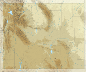
USA Wyoming relief location map.svg
Red pog.svg
Location in Wyoming
Usa edcp relief location map.png
Red pog.svg
Location in United States
Location Johnson / Big Horn / Sheridan counties, Wyoming, USA
Nearest city Sheridan, WY
Coordinates 44°23′55″N107°12′07″W / 44.39861°N 107.20194°W / 44.39861; -107.20194
Area189,039 acres (765.01 km2)
Established1984
Governing body U.S. Forest Service

The Cloud Peak Wilderness is located in north central Wyoming in the United States. Entirely within Bighorn National Forest, [2] the wilderness was established in 1984 in an effort to preserve the wildest section of the Bighorn Mountains. The wilderness has the highest peaks in the Bighorn Mountains including Cloud Peak and Black Tooth Mountain, as well as Cloud Peak Glacier, the only remaining active glacier in the Bighorn Mountains. The Cloud Peak Wilderness is 189,039 acres (765.01 km2).

Contents

U.S. Wilderness Areas do not allow motorized or mechanized vehicles, including bicycles. Although camping and fishing are allowed with proper permit, no roads or buildings are constructed and there is also no logging or mining, in compliance with the 1964 Wilderness Act. Wilderness areas within National Forests and Bureau of Land Management areas also allow hunting in season.
Climate

Climate data for Shell Creek, Wyoming, 1991–2020 normals: 9580ft (2920m)
MonthJanFebMarAprMayJunJulAugSepOctNovDecYear
Average high °F (°C)22.0
(−5.6)
22.9
(−5.1)
30.8
(−0.7)
37.9
(3.3)
47.1
(8.4)
56.4
(13.6)
65.9
(18.8)
63.9
(17.7)
52.8
(11.6)
38.6
(3.7)
27.9
(−2.3)
21.2
(−6.0)
40.6
(4.8)
Daily mean °F (°C)14.8
(−9.6)
14.8
(−9.6)
21.6
(−5.8)
27.9
(−2.3)
37.2
(2.9)
45.7
(7.6)
54.1
(12.3)
52.6
(11.4)
43.4
(6.3)
30.9
(−0.6)
20.5
(−6.4)
14.2
(−9.9)
31.5
(−0.3)
Average low °F (°C)7.5
(−13.6)
6.7
(−14.1)
12.4
(−10.9)
17.9
(−7.8)
27.4
(−2.6)
35.0
(1.7)
42.3
(5.7)
41.3
(5.2)
33.9
(1.1)
23.2
(−4.9)
13.1
(−10.5)
7.1
(−13.8)
22.3
(−5.4)
Average precipitation inches (mm)2.21
(56)
2.01
(51)
2.39
(61)
3.21
(82)
3.55
(90)
3.26
(83)
1.52
(39)
1.16
(29)
2.31
(59)
2.57
(65)
2.15
(55)
1.77
(45)
28.11
(715)
Source 1: XMACIS2 [3]
Source 2: NOAA (Precipitation) [4]
Climate data for Cloud Peak Wilderness
MonthJanFebMarAprMayJunJulAugSepOctNovDecYear
Average high °F (°C)35.6
(2.0)
40.4
(4.7)
49.7
(9.8)
59.2
(15.1)
69.2
(20.7)
79.0
(26.1)
86.7
(30.4)
85.6
(29.8)
75.1
(23.9)
62.3
(16.8)
45.2
(7.3)
37.4
(3.0)
60.5
(15.8)
Daily mean °F (°C)24.7
(−4.1)
29.4
(−1.4)
38.1
(3.4)
46.7
(8.2)
56.1
(13.4)
65.5
(18.6)
72.6
(22.6)
71.7
(22.1)
61.6
(16.4)
50.0
(10.0)
35.4
(1.9)
26.9
(−2.8)
48.2
(9.0)
Average low °F (°C)13.7
(−10.2)
18.4
(−7.6)
26.5
(−3.1)
34.2
(1.2)
43.0
(6.1)
51.9
(11.1)
58.4
(14.7)
57.9
(14.4)
48.0
(8.9)
37.6
(3.1)
25.5
(−3.6)
16.4
(−8.7)
36.0
(2.2)
Average precipitation inches (mm)0.5
(13)
0.3
(7.6)
0.9
(23)
1.3
(33)
2.3
(58)
1.8
(46)
0.9
(23)
0.6
(15)
1.4
(36)
1.2
(30)
0.7
(18)
0.6
(15)
12.5
(317.6)
Source: climbingweather.com [5]

See also

Related Research Articles

<span class="mw-page-title-main">Absaroka–Beartooth Wilderness</span> Protected wilderness area in Montana and Wyoming, United States

Absaroka–Beartooth Wilderness was created from existing National Forest lands in 1978 and is located in Montana and Wyoming, United States. The wilderness encompasses two distinct mountain ranges: the Beartooth and Absaroka ranges. These ranges are completely distinct geologically speaking, with the Absaroka composed primarily of volcanic and metamorphic rock, while the Beartooth is made up almost entirely of granitic rocks. The Absaroka are noted for their dark and craggy appearance, lush and heavily forested valleys, and abundant wildlife. The highest peak in the range, in Wyoming, is Francs Peak at 13,153 feet (4,009 m). The Beartooth is more alpine, with huge treeless plateaus and the highest peak of Montana. The wilderness has more than 120 peaks over 10,000 feet (3,000 m) and 28 peaks over 12,000 feet (3,700 m), including Montana's highest, Granite Peak at 12,799 feet (3,901 m). The wilderness is integral to the 20-million-acre (81,000 km2) Greater Yellowstone Ecosystem and borders Yellowstone National Park.

<span class="mw-page-title-main">Popo Agie Wilderness</span>

Popo Agie Wilderness is located within Shoshone National Forest, Wyoming, United States. The wilderness consists of 101,870 acres on the east side of the continental divide in the Wind River Range. Originally set aside as a primitive area in 1932, in 1984 the Wyoming Wilderness Act was passed securing a more permanent protection status for the wilderness. The wilderness is a part of the 20,000,000 acres Greater Yellowstone Ecosystem.

<span class="mw-page-title-main">Bridger Wilderness</span>

The Bridger Wilderness is located in Bridger-Teton National Forest in Wyoming, United States. Originally established in 1931 as a primitive area, 428,169-acre (1,732.74 km2) region was redesignated as a wilderness in 1964 and expanded to the current size in 1984. The wilderness lies on the west side of the Continental Divide in the Wind River Range and contains Gannett Peak; at 13,809 feet (4,209 m) it is the tallest mountain in Wyoming. The wilderness is a part of the Greater Yellowstone Ecosystem.

<span class="mw-page-title-main">Great Bear Wilderness</span>

The Great Bear Wilderness is located in northern Montana, United States, within Flathead National Forest Created by an act of Congress in 1978, the wilderness comprises 286,700 acres (1,160 km2) and borders the Bob Marshall Wilderness on the north. The Great Bear and Bob Marshall Wildernesses, along with the Scapegoat Wilderness which borders the Bob Marshall to the south, collectively form the Bob Marshall Wilderness Complex, which is over 1.5 million acres (6,100 km2) of almost untouched landscape. Glacier National Park is separated from the Great Bear Wilderness by U.S. Highway 2.

<span class="mw-page-title-main">Gros Ventre Wilderness</span> Wilderness area within Bridger-Teton National Forest

The Gros Ventre Wilderness is located in Bridger-Teton National Forest in the U.S. state of Wyoming. Most of the Gros Ventre Range is located within the wilderness.

The Washakie Wilderness is located in Shoshone National Forest in the U.S. state of Wyoming.

<span class="mw-page-title-main">North Absaroka Wilderness</span>

The North Absaroka Wilderness is located in Shoshone National Forest in the U.S. state of Wyoming. It lies adjacent to the eastern border of Yellowstone National Park.

<span class="mw-page-title-main">Fitzpatrick Wilderness</span>

The Fitzpatrick Wilderness is located in Shoshone National Forest in the U.S. state of Wyoming. The wilderness was originally known as the Glacier Primitive Area, but was redesignated a wilderness in 1976.

The Huston Park Wilderness is located in south central Wyoming in the United States. Entirely within Medicine Bow National Forest, the wilderness was designated in 1984 to preserve the northernmost section of the central Rocky Mountains, an area of high mountain peaks and coniferous forest.

The Cabinet Mountains Wilderness, created by an act of Congress in 1964, is located in the U.S. state of Montana. Protecting the wildest portions of the Cabinet Mountains and an integral part of Kootenai National Forest and Kaniksu National Forest, the wilderness had enjoyed more limited protection since 1935 as a Primitive Area.

<span class="mw-page-title-main">Fort Niobrara Wilderness</span> Protected area in Nebraska, US

The Fort Niobrara Wilderness is located in the U.S. state of Nebraska, near Valentine. Created by an act of Congress in 1976, the wilderness is managed by the U.S. Fish and Wildlife Service and covers an area of 4,635 acres (18.75 km2) within Fort Niobrara National Wildlife Refuge. The wilderness lies along the northern banks of the Niobrara River, providing sanctuary to bison, prairie dogs, mule deer, river otter and the bald eagle. A mixture of flat prairie and wooded ravines, there are no maintained trails in the wilderness. Access is only allowed during daylight hours and there is no camping or fires allowed.

<span class="mw-page-title-main">Black Elk Wilderness</span>

The Black Elk Wilderness is located in the U.S. state of South Dakota. The wilderness was designated by an act of Congress in 1980. Managed by the U.S. Forest Service, Black Elk Wilderness is part of Black Hills National Forest. This 13,426 acre (54 km2) region is considered sacred to Native Americans, especially the Sioux and is named after Black Elk, an Oglala Sioux holy man. Mount Rushmore National Memorial is immediately to the north and much of the rest of the wilderness is bordered by other protected land under the jurisdiction of state and federal agencies.

<span class="mw-page-title-main">Cloud Peak Glacier</span> Glacier in Wyoming, USA

Cloud Peak Glacier is in the Bighorn Mountains in the northcentral section of the U.S. state of Wyoming. Centered within the Cloud Peak Wilderness of Bighorn National Forest, Cloud Peak Glacier is the only active glacier in the Bighorn Mountains. The glacier is in a deep cirque immediately northeast of Cloud Peak, the highest peak in the Bighorn Mountains. Cloud Peak Glacier lies at approximately 11,800 feet (3,600 m) above sea level.

<span class="mw-page-title-main">Black Tooth Mountain</span> Mountain in Wyoming, United States

Black Tooth Mountain is located in the Bighorn Mountains in the U.S. state of Wyoming. The peak is the second highest in the range after Cloud Peak, which is only 1.5 miles (2.4 km) to the south, and the summit is located in the Cloud Peak Wilderness of Bighorn National Forest. The sharp dark profile of the mountain resembles a dark tooth or fang, hence the name. Because of the steep terrain, Black Tooth Mountain is one of the hardest mountains to climb in the Bighorns. Many of the trails up the mountain are unmarked which adds to the difficulty of reaching the summit. Mount Woolsey is an adjacent summit only .20 mi (0.32 km) to the southeast. Another high peak of the Bighorns known as Hallelujah Peak is situated along a knife-like ridge known as an arête .64 mi (1.03 km) to the northeast. Several tiny remnant glaciers can be found on the north slopes of Black Tooth Mountain.

<span class="mw-page-title-main">Mount Woolsey</span> Mountain in Wyoming, United States

Mount Woolsey is located in the Bighorn Mountains in the U.S. state of Wyoming. The peak is the third highest in the range after Cloud Peak, which is only 1.3 miles (2.1 km) to the south, and the summit is located in the Cloud Peak Wilderness of Bighorn National Forest. Black Tooth Mountain, the second highest mountain in the Bighorns, is an adjacent summit only .20 mi (0.32 km) to the northwest. Mount Woolsey is on a knife-like ridge known as an arête and is connected to both Black Tooth Mountain and Cloud Peak by this ridge. Along the arête is another mountain peak known as The Innominate. A small glacier lies below the arête to the southeast of Mount Woolsey.

<span class="mw-page-title-main">Hallelujah Peak</span> Mountain in the American state of Wyoming

Hallelujah Peak, also known as Peak 12590, is located in the Bighorn Mountains in the U.S. state of Wyoming. The peak is the fifth-highest in the range and it is in the Cloud Peak Wilderness of Bighorn National Forest. Hallelujah Peak is 0.64 miles (1.03 km) northeast of Black Tooth Mountain and connected to that peak by a knife-like ridge known as an arête.

<span class="mw-page-title-main">The Innominate</span> Mountain in Wyoming, United States

The Innominate is a mountain peak located in the Bighorn Mountains in the U.S. state of Wyoming. Situated along a knife-like ridge known as an arête, the summit is located in the Cloud Peak Wilderness of Bighorn National Forest. The slightly taller Mount Woolsey is .30 miles (0.48 km) to the northwest. A small glacier lies below the arête to the east.

<span class="mw-page-title-main">Bighorn Peak</span> Mountain in the American state of Wyoming

Bighorn Peak is located in the Bighorn Mountains in the U.S. state of Wyoming. The peak is the seventh highest in the range and it is in the Cloud Peak Wilderness of Bighorn National Forest. Bighorn Peak is 1.5 miles (2.4 km) south of Darton Peak.

<span class="mw-page-title-main">Darton Peak</span> Mountain in the country of Canada

Darton Peak is located in the Bighorn Mountains in the U.S. state of Wyoming. The peak is the eighth-highest in the range and it is in the Cloud Peak Wilderness of Bighorn National Forest. Darton Peak is 1.5 miles (2.4 km) north of Bighorn Peak and 4.5 mi (7.2 km) southeast of Mather Peaks.

Mather Peaks is located in the Bighorn Mountains in the U.S. state of Wyoming. The peak is the sixth highest in the range and it is in the Cloud Peak Wilderness of Bighorn National Forest. Mather Peaks is 4.5 miles (7.2 km) northwest of Darton Peak and 3.2 mi (5.1 km) south of Bomber Mountain.

References

  1. Protected Planet Website- Retrieved March 30, 2023
  2. "Cloud Peak Wilderness" . Retrieved 2019-10-06.
  3. "xmACIS2". National Oceanic and Atmospheric Administration. Retrieved October 12, 2023.
  4. "Shell Creek, Wyoming 1991-2020 Monthly Normals" . Retrieved October 12, 2023.
  5. "climbingweather.com" . Retrieved October 6, 2019.