Clear Creek County is a county located in the U.S. state of Colorado. As of the 2020 census, the population was 9,397. The county seat is Georgetown.

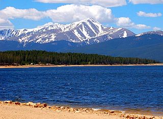
Mount Elbert is the highest summit of the Rocky Mountains of North America. With an elevation of 14,438 feet (4400.58 m), it is also the highest point in the U.S. state of Colorado and the second-highest summit in the contiguous United States after Mount Whitney, which is slightly taller. The ultra-prominent fourteener is the highest peak in the Sawatch Range, as well as the highest point in the entire Mississippi River drainage basin. Mount Elbert is located in San Isabel National Forest, 12.1 miles (19.4 km) southwest of the city of Leadville in Lake County, Colorado.

Horsetooth Mountain is a mountain summit in the foothills of the Front Range of the Rocky Mountains of North America. The 7,259-foot (2,213 m) peak is located in the Horsetooth Mountain Open Space, 7.0 miles (11.2 km) west of downtown Fort Collins in Larimer County, Colorado, United States.

Grays Peak is the tenth-highest summit of the Rocky Mountains of North America and the U.S. state of Colorado. The prominent 14,276-foot (4351.18 m) fourteener is the highest summit of the Front Range and the highest point on the Continental Divide and the Continental Divide Trail in North America. Grays Peak is located in Arapahoe National Forest, 3.9 miles (6.2 km) southeast by east of Loveland Pass on the Continental Divide between Clear Creek and Summit counties. The peak is the highest point in both counties.

Torreys Peak is a mountain in the Front Range region of the Rocky Mountains in Colorado. It is one of 53 fourteeners in Colorado. Its nearest major city is Denver. Torreys Peak is located along the Continental Divide, as well as the division between Clear Creek County and Summit County. In the Arapaho language Torrey's Peak and the adjacent Gray's Peak are named, Heeniiyoowuu or "Ant Hills".

Blanca Peak is the fourth highest summit of the Rocky Mountains of North America and the U.S. state of Colorado. The ultra-prominent 14,351-foot (4,374 m) peak is the highest summit of the Sierra Blanca Massif, the Sangre de Cristo Range, and the Sangre de Cristo Mountains. The fourteener is located 9.6 miles (15.5 km) north by east of the Town of Blanca, on the drainage divide separating Rio Grande National Forest and Alamosa County from the Sangre de Cristo Land Grant and Costilla County. The summit is the highest point of both counties and the entire drainage basin of the Rio Grande. Below the steep North Face of Blanca Peak two live Glaciers once developed, until extinction sometime after 1903. North & South Blanca Glaciers were located at 37° 35N.,longitude 105° 28W. Blanca Peak is higher than any point in the United States east of its longitude.

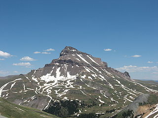
Uncompahgre Peak is the sixth highest summit of the Rocky Mountains of North America and the U.S. state of Colorado. The prominent 14,316-foot (4363.46 m) fourteener is the highest summit of the San Juan Mountains and the highest point in the drainage basin of the Colorado River and the Gulf of California. It is located in the Uncompahgre Wilderness in the northern San Juans, in northern Hinsdale County approximately 7 miles (11 km) west of the town of Lake City.

Crestone Peak is the seventh-highest summit of the Rocky Mountains of North America and the U.S. state of Colorado. The prominent 14,296.8-foot (4,358 m) fourteener is the highest summit of the Crestones and the second-highest summit in the Sangre de Cristo Range after Blanca Peak. The summit is located in the Sangre de Cristo Wilderness of Rio Grande National Forest, 5.0 miles (8.1 km) east by south of the Town of Crestone in Saguache County, Colorado, United States.

Mount Lincoln is the eighth-highest summit of the Rocky Mountains of North America and the U.S. state of Colorado. The prominent 14,291-foot (4355.79 m) fourteener is the highest summit of the Mosquito Range and the eleventh-highest summit in the contiguous United States. Mount Lincoln is located in Pike National Forest, 5.2 miles (8.3 km) north-northwest of the Town of Alma in Park County, Colorado, United States. The summit of Mount Lincoln is the highest point in Park County and the entire drainage basin of the Missouri River. The mountain was named in honor of Abraham Lincoln, 16th President of the United States.

Argentine Peak is a high mountain summit in the Front Range of the Rocky Mountains of North America. The 13,743-foot (4,189 m) thirteener is located in Arapaho National Forest, 8.5 miles (13.6 km) southwest by south of Georgetown, Colorado, United States. The summit lies on the Continental Divide between Clear Creek and Summit counties.

Mount Antero, historically called Antero Peak, is the highest summit of the southern Sawatch Range of the Rocky Mountains of North America. The prominent 14,269-foot (4349.21 m) fourteener is located in San Isabel National Forest, 12.2 miles (19.6 km) southwest by south of the Town of Buena Vista in Chaffee County, Colorado, United States. The mountain is named in honor of Chief Antero of the Uintah band of the Ute people.

Wetterhorn Peak is a fourteen thousand-foot mountain peak in the U.S. state of Colorado. It is located in the Uncompahgre Wilderness of the northern San Juan Mountains, in northwestern Hinsdale County and southeastern Ouray County, approximately 9 miles (14 km) east of the town of Ouray and 2.75 mi (4.4 km) west of Uncompahgre Peak.

Quandary Peak is the highest summit of the Tenmile Range in the Rocky Mountains of North America and is the most commonly climbed fourteener in Colorado. It has nearly the same elevation as Castle Peak and Mount Blue Sky. It lies in Summit County and within the White River National Forest about 6 miles (10 km) south-southwest of the town of Breckenridge.

San Luis Peak is a high summit in the San Juan Mountains, a range in the Rocky Mountains of North America. The prominent 14,022-foot (4273.8 m) fourteener is located in the Gunnison National Forest portion of the La Garita Wilderness in Saguache County approximately 10 miles (16 km) north of Creede. It is situated rather far to the east of the other fourteeners in the San Juans, and has more of a wilderness setting than many of the others.

Mount Yale is a high and prominent mountain summit of the Collegiate Peaks in the Sawatch Range of the Rocky Mountains of North America. The 14,197-foot (4327.24 m) fourteener is located in the Collegiate Peaks Wilderness of San Isabel National Forest, 9.4 miles (15.2 km) west by north of Buena Vista, Colorado. The mountain was named in honor of Elihu Yale, the primary benefactor of what is now Yale University.

Mount Adams is a high mountain summit of the Crestones in the Sangre de Cristo Range of the Rocky Mountains of North America. The 13,937-foot (4,248 m) thirteener is located in the Sangre de Cristo Wilderness, 5.1 miles (8.2 km) east by north of the Town of Crestone, Colorado, United States, on the drainage divide separating San Isabel National Forest and Custer County from Rio Grande National Forest and Saguache County.

Pikes Peak is the highest summit of the southern Front Range of the Rocky Mountains in North America. The ultra-prominent 14,107-foot (4,299.83 m) fourteener is located in Pike National Forest, 12 miles (19 km) west of downtown Colorado Springs, Colorado. The town of Manitou Springs lies at its base.

Mount Sniktau is a high mountain summit in the Front Range of the Rocky Mountains of North America. The 13,240-foot (4,036 m) thirteener is located in Arapaho National Forest, 1.6 miles (2.5 km) northeast of Loveland Pass in Clear Creek County, Colorado, United States.

Grizzly Peak is a high mountain summit in the Front Range of the Rocky Mountains of North America. Also known as Grizzly Peak D, the 13,433-foot (4,094 m) thirteener is located in Arapaho National Forest, 2.1 miles (3.4 km) southeast by east of Loveland Pass, Colorado, United States, on the Continental Divide between Clear Creek and Summit counties. Its proximate parent peak is Torreys Peak.

Mount Parnassus is a high mountain summit in the Front Range of the Rocky Mountains of North America. The 13,580-foot (4,139 m) thirteener is located in Arapaho National Forest, 5.4 miles (8.7 km) west-northwest of the Town of Silver Plume in Clear Creek County, Colorado, United States.


