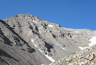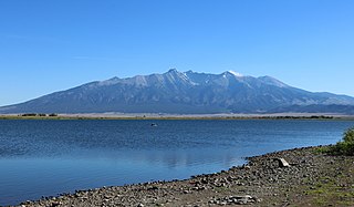
Las Animas County is a county located in the U.S. state of Colorado. As of the 2020 census, the population was 14,555. The county seat is Trinidad. The county takes its name from the Mexican Spanish name of the Purgatoire River, originally called El Río de las Ánimas Perdidas en el Purgatorio, which means "River of the Lost Souls in Purgatory."

Mount Whitney is the highest mountain in the contiguous United States, with an elevation of 14,505 feet (4,421 m). It is in East–Central California, in the Sierra Nevada, on the boundary between California's Inyo and Tulare counties, and 84.6 miles (136.2 km) west-northwest of North America's lowest topographic point, Badwater Basin in Death Valley National Park, at 282 ft (86 m) below sea level. The mountain's west slope is in Sequoia National Park and the summit is the southern terminus of the John Muir Trail, which runs 211.9 mi (341.0 km) from Happy Isles in Yosemite Valley. The eastern slopes are in Inyo National Forest in Inyo County. Mount Whitney is ranked 18th by topographic isolation.

Two Buttes is a dual-peaked mountain in Prowers County, Colorado. The two peaks, which are the highest point in Prowers County, rise about 300 feet (91 m) above the mostly flat Great Plains that surround them, making them visible for miles. The south peak is about 30 feet (9.1 m) higher than the north one, and both are connected by a saddle.

Castle Peak is the ninth highest summit of the Rocky Mountains of North America and the U.S. state of Colorado. The prominent 14,272-foot (4350.20 m) fourteener is the highest summit of the Elk Mountains and the Maroon Bells-Snowmass Wilderness. The peak is located 11.6 miles (18.7 km) northeast by north of the Town of Crested Butte, Colorado, United States, on the drainage divide separating Gunnison National Forest and Gunnison County from White River National Forest and Pitkin County. The summit of Castle Peak is the highest point of both counties.

Tumamoc Hill is a butte located immediately west of "A" Mountain and downtown Tucson, Arizona. It is home to many radio, television, and public safety transmitters. The 860-acre ecological reserve and U.S. National Historic Landmark was established by the Carnegie Institution in 1903. The University of Arizona (UA) owns a 340-acre (1.4 km2) preserve and leases another 509 acres (2.06 km2) as a research and education facility. The Steward Observatory maintains a small astronomical observatory with a 20-inch (510 mm) telescope on the hill. Besides being a prominent landmark, Tumamoc Hill has a long and varied history, and is currently an important site for ecological and anthropological research as well as a refuge and a recreational option for the people of Tucson. Part of the University of Arizona, the Desert Laboratory is located on Tumamoc.

Mount Langley is a mountain located on the crest of the Sierra Nevada, on the boundary between Inyo and Tulare counties in eastern California, in the United States. To the east is the Owens Valley, and to the west is the Kern River Valley. It is the ninth-highest peak in the state and the seventh-highest in the Sierra. Mount Whitney, the highest peak in the contiguous United States, lies 4.8 miles (7.7 km) to the northwest. Mount Langley also has the distinction of being the southernmost fourteener in the United States.

Trinchera is an unincorporated community and a U.S. Post Office located in Las Animas County, Colorado, United States. The Trinchera Post Office has the ZIP Code 81081.

The Indian Peaks Wilderness is a 73,931 acre wilderness area in north central Colorado managed jointly by the United States Forest Service and the National Park Service within the Arapaho and Roosevelt National Forests and small parts of the southern section of Rocky Mountain National Park. It includes over 50 lakes, 28 trails, and numerous glaciers. It was founded as a protected area by an act of Congress in 1978. It borders the James Peak Wilderness to the south, and straddles the Continental Divide. The area receives high visitation due to its proximity to the Denver metropolitan area.

Grizzly Peak is a high and prominent mountain summit of the Collegiate Peaks in the Sawatch Range of the Rocky Mountains of North America. The 13,995-foot (4265.6 m) thirteener is located 2.6 miles (4.2 km) south-southwest of Independence Pass, Colorado, United States, on the Continental Divide separating San Isabel National Forest and Chaffee County from White River National Forest and Pitkin County.

Dominick "Big Trin" Trinchera was an American caporegime in the Bonanno crime family who was murdered with Alphonse Indelicato and Philip Giaccone for planning to overthrow Bonanno boss Philip Rastelli.

Philip Giaccone, also known as "Philly Lucky", was an American mobster and caporegime in the Bonanno crime family who was murdered with Dominick Trinchera and Al Indelicato for planning to overthrow Bonanno boss Philip Rastelli.

Trincheras is a town in Trincheras Municipality, in the north-west of the Mexican state of Sonora. It was founded in 1775 by Bernardo de Urrea. The municipal area is 3,764.26 km2, and the population in 2000 was 1,788.

Bright Star Wilderness is a 8,190-acre (3,314 ha) wilderness area in Kern County in the U.S. state of California.

Altar is a municipality in the Mexican state of Sonora in north-western Mexico. The municipality had a 2010 census population of 9,049 inhabitants, the vast majority of whom lived in the municipal seat of Altar, which had a population of 7,927 inhabitants. There are no other localities with over 1,000 inhabitants.
The Trinchera Cave Archeological District (5LA9555) is an archaeological site in Las Animas County, Colorado with artifacts primarily dating from 1000 BC to AD 1749, although there were some Archaic period artifacts found. The site was added to the National Register of Historic Places in 2001 and is located on State Trust Lands.

Trinchera Creek is a tributary of the Rio Grande in Costilla County, Colorado in the United States. It flows west from a source in the Sangre de Cristo Mountains to a confluence with the Rio Grande.

Smith Reservoir is located in Costilla County, Colorado, south of Blanca in the San Luis Valley. The reservoir is owned by the Trinchera Irrigation Company.
The Mescal Wash Site is an archaeological site in Pima County, Southeastern Arizona in the United States. It is located near Cienega Creek, situated in where the Sonoran and Chihuahuan Desert meet. Its environment consists of upland hills and grassland in the desert.
The Sangre de Cristo Land Grant in the San Luis Valley of southern Colorado and northern New Mexico consists of 1,000,000 acres (4,000 km2) of mostly arid land. It was awarded by the government of New Mexico to the Beaubien family in 1843. The land grant was originally settled by Hispanics from New Mexico. Since the incorporation of the area of the grant into the United States in 1848, legal disputes between the descendants of the Hispanic settlers and Anglo ranchers about ownership of and access to some of the land in the grant area have been frequent and continued into the 21st century.


