Devils Postpile National Monument is a U.S. National Monument located near Mammoth Mountain in Eastern California. The monument protects Devils Postpile, an unusual rock formation of columnar basalt, “all closely and perfectly fitted together like a vast mosaic.” The monument encompasses 798 acres (323 ha) and includes two main attractions: the Devils Postpile formation and Rainbow Falls, a waterfall on the Middle Fork of the San Joaquin River. In addition, the John Muir Trail and Pacific Crest Trail merge into one trail as they pass through the monument. Excluding a small developed area containing the monument headquarters, visitor center and a campground, the National Monument lies within the borders of the Ansel Adams Wilderness.

Mount Thielsen, or Big Cowhorn, is an extinct shield volcano in the Oregon High Cascades, near Mount Bailey. Because eruptive activity ceased 250,000 years ago, glaciers have heavily eroded the volcano's structure, creating precipitous slopes and a horn-like peak. The spire-like shape of Thielsen attracts lightning strikes and creates fulgurite, an unusual mineral. The prominent horn forms a centerpiece for the Mount Thielsen Wilderness, a reserve for recreational activities such as skiing and hiking. Thielson is one of Oregon's Matterhorns.

The North Cascades are a section of the Cascade Range of western North America. They span the border between the Canadian province of British Columbia and the U.S. state of Washington and are officially named in the U.S. and Canada as the Cascade Mountains. The portion in Canada is known to Americans as the Canadian Cascades, a designation that also includes the mountains above the east bank of the Fraser Canyon as far north as the town of Lytton, at the confluence of the Thompson and Fraser Rivers.

The Colorado Plateau, also known as the Colorado Plateau Province, is a physiographic and desert region of the Intermontane Plateaus, roughly centered on the Four Corners region of the southwestern United States. This province covers an area of 336,700 km2 (130,000 mi2) within western Colorado, northwestern New Mexico, southern and eastern Utah, northern Arizona, and a tiny fraction in the extreme southeast of Nevada. About 90% of the area is drained by the Colorado River and its main tributaries: the Green, San Juan, and Little Colorado. Most of the remainder of the plateau is drained by the Rio Grande and its tributaries.

The Never Summer Mountains are a mountain range in the Rocky Mountains in north central Colorado in the United States consisting of seventeen named peaks. The range is located along the northwest border of Rocky Mountain National Park, forming the continental divide between the headwaters of the Colorado River in Rocky Mountain National Park to the local-east and the upper basin of the North Platte River to the local-west; the continental divide makes a loop in these mountains. The range is small and tall, covering only 25 sq mi (65 km2) with a north-south length of 10 mi (16 km) while rising to over 12,000 ft (3,700 m) at over ten distinct peaks. The range straddles the Jackson-Grand county line for most of its length, and stretches into Jackson and Larimer county at its northern end. A panoramic view of the range is available from sections of Trail Ridge Road in Rocky Mountain National Park. One of the northernmost peaks, Nokhu Crags, is prominently visible from the west side of Cameron Pass.
The Powderhorn Wilderness is a 62,050-acre (251.1 km2) wilderness area in Hinsdale and Gunnison counties, Colorado, United States, located 5 miles (8.0 km) northeast of Lake City.

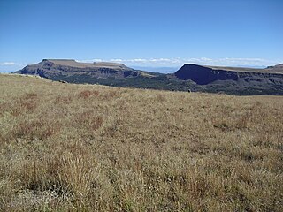
Flat Tops Wilderness Area is the second largest U.S. Wilderness Area in Colorado. It is 235,214 acres (951.88 km2), with 38,870 acres (157.3 km2) in Routt National Forest and 196,344 acres (794.58 km2) in White River National Forest. It was designated a wilderness area in 1975. Trappers Lake, located in the north of the area, was the lake that inspired Arthur Carhart, a United States Forest Service official, to plead for wilderness preservation.

The Sawtooth Range is a mountain range of the Rocky Mountains in central Idaho, United States, reaching a maximum elevation of 10,751 feet (3,277 m) at the summit of Thompson Peak. It encompasses an area of 678 square miles (1,756 km2) spanning parts of Custer, Boise, Blaine, and Elmore counties, and is bordered to the east by the Sawtooth Valley. Much of the mountain range is within the Sawtooth Wilderness, part of the Sawtooth National Recreation Area and Sawtooth National Forest.
The South Warner Wilderness is a federally designated wilderness area 12 miles (19 km) east of Alturas, California, United States. It encompasses more than 70,000 acres (283 km2) of the Warner Mountains. It is within the Modoc National Forest and managed by the US Forest Service. Elevations range from 5,000 feet (1,500 m) to 9,895 feet at Eagle Peak.

The Cascades ecoregion is a Level III ecoregion designated by the United States Environmental Protection Agency (EPA) in the U.S. states of Washington, Oregon, and California. Somewhat smaller than the Cascade mountain range for which it is named, the ecoregion extends north to Snoqualmie Pass, near Seattle, and south to Hayden Pass, near the Oregon-California border, including the peaks and western slopes of most of the High Cascades. A discontiguous section is located on Mount Shasta in California.

Dragontail Peak, also known as Dragon Tail, is a mountain in the Stuart Range, in Chelan County, Washington. While climbing an adjacent peak, Lex Maxwell, Bob McCall, and Bill Prater remarked that the needles on the crest, southwest of the summit, resembled a "dragon tail". The name was officially accepted in 1955. On the mountain's northeast flank lies Colchuck Lake which drains into Mountaineer Creek, and Colchuck Glacier lies below the western slopes of the peak. On its south side the mountain drops steeply to Ingalls Creek, which flows about 5,800 feet (1,800 m) below the summit.
Flat Top Mountain is the highest summit of the Flat Tops in the Rocky Mountains of North America. The prominent 12,361-foot (3,768 m) peak is located in the Flat Tops Wilderness, 19.1 miles (30.7 km) south-southwest of the Town of Oak Creek, Colorado, United States, on the drainage divide between Routt National Forest and White River National Forest. The summit of Flat Top Mountain is the highest point in Garfield County, Colorado.

Cannibal Plateau is a summit in Hinsdale County, Colorado in the United States. The broad 12,533-foot (3,820 m) mountain is located in the San Juan Mountains and within the Powderhorn Wilderness, a protected area managed by the Bureau of Land Management Gunnison Field Office and the Gunnison National Forest.

Chair Peak is a 6,238 ft (1,900 m) mountain summit located in east King County of Washington state. It's part of the Cascade Range and is set within the Alpine Lakes Wilderness. Chair Peak is situated three miles northwest of Snoqualmie Pass on land managed by Mount Baker-Snoqualmie National Forest. Precipitation runoff from this mountain drains into tributaries of the Snoqualmie River. Chair Peak is located immediately south of Snow Lake which is a popular hiking destination. The nearest higher neighbor is Kaleetan Peak, 0.57 miles (0.92 km) to the west-northwest.
The White River Plateau is a "broad structural dome" located north of Glenwood Springs, Colorado and north of the Colorado River. Also called the White River Uplift, the mountainous area is shown on maps as being roughly circular in area, occupying parts of the Colorado counties of Garfield and Rio Blanco, with small portions extending into Eagle and Routt counties. The Grand Hogback marks parts of the plateau's southern and western boundaries. The Flat Tops mountain range is part of the White River Plateau, and much of the plateau is located within the White River National Forest.

Cape Horn is a 7,316-foot (2,230-metre) mountain summit located in Chelan County of Washington state. Cape Horn is situated 12 mi (19 km) west-northwest of Leavenworth, within the Alpine Lakes Wilderness, on land managed by the Okanogan–Wenatchee National Forest. Cape Horn is part of the Chiwaukum Mountains, a subset of the Cascade Range. Its nearest higher neighbor is Ladies Peak, 0.9 mi (1.4 km) to the northwest, and Grindstone Mountain is set 1.4 mi (2.3 km) to the south. Precipitation runoff from Cape Horn drains west to Icicle Creek, whereas the east slopes drain into Chiwaukum Creek, and both are tributaries of the Wenatchee River. Although modest in elevation, relief is significant since this peak rises over 4,300 feet above Icicle Creek Valley in approximately two miles. This mountain was named by Albert Hale Sylvester in 1909 for its sharp profile.

Iron Cap Mountain is a 6,347-foot (1,935-metre) mountain summit located two miles west-northwest of Dutch Miller Gap, in east King County of Washington state. It is situated in the heart of the Alpine Lakes Wilderness, on land managed by Mount Baker-Snoqualmie National Forest. Iron Cap Mountain is set two miles west of the crest of the Cascade Range. Precipitation runoff from the south side of the mountain drains into tributaries of the Snoqualmie River, whereas the north side drains into tributaries of the Foss River. Although modest in elevation, relief is significant since Iron Cap rises 2,500 feet above the Middle Fork Snoqalmie River Valley in less than one mile. Its neighbors include La Bohn Peak, 1.77 miles (2.85 km) to the east, and Little Big Chief Mountain, 2.14 miles (3.44 km) to the southeast.
Calf Creek Plateau is a mountain in the northern San Juan Mountains of the Rocky Mountains of North America. The mountain is located in Hinsdale County, and at an elevation of 12,661 feet (3,859 m), it is the high point of the Powderhorn Wilderness.
Mount Margaret is a 5,850-ft mountain summit located in the Wenatchee National Forest, in the Alpine Lakes Wilderness, in Kittitas County of Washington state. It is situated in the Cascade Range, 4.5 mi (7.2 km) east of Interstate 90, and on the south aspect of Rampart Ridge. Its nearest higher neighbor is Alta Mountain, 4.93 mi (7.93 km) to the north. Keechelus Lake is a short distance west and Kachess Lake further east.
Trappers Peak is a 5,966-foot (1,818 m) elevation mountain summit located in the North Cascades of Washington state. It is situated within North Cascades National Park, Stephen Mather Wilderness, and Whatcom County. It rises steeply above Lower Thornton Lake which is set at the southwestern face of the mountain. Like many North Cascades peaks, Trappers Peak is more notable for its large, steep rise above local terrain than for its absolute elevation. Topographic relief is significant as the southeast aspect rises 5,500 feet (1,700 m) above the North Cascades Highway in approximately two miles. The nearest higher neighbor is Thornton Peak, 1.5 miles (2.4 km) to the northwest, Mount Triumph is two miles to the northwest, and Newhalem is three miles to the east-southeast. Precipitation runoff from the mountain drains into tributaries of the Skagit River. The summit of Trappers Peak is known for its grand view of the jagged peaks of the Picket Range.