

The U.S. State of Colorado currently has 271 active incorporated municipalities, comprising 196 towns, 73 cities, and two consolidated city and county governments. [1]
The U.S. State of Colorado currently has 271 active incorporated municipalities, comprising 196 towns, 73 cities, and two consolidated city and county governments. [1]
Colorado municipalities operate under one of five types of municipal governing authority. [2] [3]
In the State of Colorado, only Denver and Broomfield have consolidated city and county governments:
Colorado has 61 cities and 35 towns that are home rule municipalities:

Colorado has 12 statutory cities:

Colorado has 160 statutory towns:

The Town of Georgetown is the only municipality that still operates under a charter granted by the Territory of Colorado:
Colorado law makes relatively few distinctions between a city and a town. [2] [3] A Home Rule Municipality may declare itself either a city or a town. In general, cities are more populous than towns, although the towns of Castle Rock and Parker have more than 50,000 residents each, while the City of Black Hawk has fewer than 150 residents.
The City of Central is the only Colorado municipality that does not place its full place name at the end of its municipal name. The towns of Garden City, Lake City, Orchard City, and Sugar City are statutory towns despite the word "city" at the end of their name. The municipality of Creede uses the official title "City of Creede" despite its status as a Colorado statutory town.
Neither village nor civil township is a type of civil division in the State of Colorado, although the cities of Cherry Hills Village and Greenwood Village and the towns of Log Lane Village, Mountain Village, and Snowmass Village have the word "village" at the end of their names. Several resort communities use the word "village" to describe their central business district.
In Colorado, a municipality may extend into multiple counties.
The sortable table below lists each of the 271 active incorporated municipalities of the State of Colorado with the following information:
| Place Name | Municipality | Incorporation Date | Government | County | Map | Pop Rank | 2014 Estimate | 2010 Census | Change | Pop Density | Land Area | Water Area | Total Area | INCITS | WGS84 |
|---|---|---|---|---|---|---|---|---|---|---|---|---|---|---|---|
| Aguilar | Town of Aguilar | January 10, 1894 | statutory town | Las Animas County | map | 197 | 495 | 538 | −7.99% | 1262 mi−2 487 km−2 | 0.3923 mi−2 1.0161 km−2 | none | 0.3923 mi−2 1.0161 km−2 | 0800760 | 37°24′13″N104°39′18″W / 37.403626°N 104.655036°W |
| Akron | Town of Akron | September 22, 1887 | statutory town | Washington County [6] | map | 121 | 1,694 | 1,702 | −0.47% | 649 mi−2 251 km−2 | 2.6244 mi−2 6.7973 km−2 | none | 2.6244 mi−2 6.7973 km−2 | 0800925 | 40°09′52″N103°13′14″W / 40.164382°N 103.220685°W |
| Alamosa | City of Alamosa | August 12, 1878 | home rule municipality | Alamosa County [6] | map | 48 | 9,531 | 8,780 | +8.55% | 1298 mi−2 501 km−2 | 7.3663 mi−2 19.0788 km−2 | 0.1244 mi−2 0.3222 km−2 | 7.4908 mi−2 19.4010 km−2 | 0801090 | 37°28′30″N105°52′31″W / 37.475041°N 105.875314°W |
| Alma | Town of Alma | December 2, 1873 | statutory town | Park County | map | 221 | 275 | 270 | +1.85% | 742 mi−2 286 km−2 | 0.3600 mi−2 0.9325 km−2 | 0.0019 mi−2 0.0049 km−2 | 0.3619 mi−2 0.9374 km−2 | 0801530 | 39°17′09″N106°03′59″W / 39.285942°N 106.066319°W |
| Antonito | Town of Antonito | December 29, 1889 | statutory town | Conejos County | map | 163 | 775 | 781 | −0.77% | 1927 mi−2 744 km−2 | 0.4033 mi−2 1.0446 km−2 | none | 0.4033 mi−2 1.0446 km−2 | 0802355 | 37°04′36″N106°00′37″W / 37.076605°N 106.010222°W |
| Arriba | Town of Arriba | August 29, 1918 | statutory town | Lincoln County | map | 237 | 194 | 193 | +0.52% | 427 mi−2 165 km−2 | 0.4401 mi−2 1.1398 km−2 | none | 0.4401 mi−2 1.1398 km−2 | 0803235 | 39°17′03″N103°16′26″W / 39.284058°N 103.273902°W |
| Arvada | City of Arvada | August 24, 1904 | home rule municipality | Jefferson County Adams County | map | 7 | 113,574 | 106,433 | +6.71% | 2914 mi−2 1125 km−2 | 38.3316 mi−2 99.2785 km−2 | 0.6235 mi−2 1.6149 km−2 | 38.9551 mi−2 100.8933 km−2 | 0803455 | 39°50′01″N105°09′01″W / 39.833728°N 105.150306°W |
| Aspen | City of Aspen | April 1, 1881 | home rule municipality | Pitkin County [6] | map | 59 | 6,805 | 6,658 | +2.21% | 1734 mi−2 670 km−2 | 3.8796 mi−2 10.0481 km−2 | none | 3.8796 mi−2 10.0481 km−2 | 0803620 | 39°11′42″N106°50′13″W / 39.194951°N 106.837002°W |
| Ault | Town of Ault | April 11, 1904 [7] | statutory town | Weld County | map | 123 | 1,603 | 1,519 | +5.53% | 1996 mi−2 771 km−2 | 0.7886 mi−2 2.0426 km−2 | none | 0.7886 mi−2 2.0426 km−2 | 0803950 | 40°35′00″N104°44′02″W / 40.583454°N 104.733962°W |
| Aurora | City of Aurora | May 5, 1903 [8] | home rule municipality | Arapahoe County Adams County Douglas County | map | 3 | 353,108 | 325,078 | +8.62% | 2248 mi−2 868 km−2 | 153.8290 mi−2 398.4152 km−2 | 0.6784 mi−2 1.7570 km−2 | 154.5074 mi−2 400.1722 km−2 | 0804000 | 39°41′17″N104°41′23″W / 39.688002°N 104.689740°W |
| Avon | Town of Avon | February 24, 1978 | home rule municipality | Eagle County | map | 63 | 6,447 | 6,447 | 0.00% | 798 mi−2 308 km−2 | 8.0338 mi−2 20.8075 km−2 | 0.0720 mi−2 0.1866 km−2 | 8.1059 mi−2 20.9941 km−2 | 0804110 | 39°38′30″N106°30′57″W / 39.641797°N 106.515877°W |
| Basalt | Town of Basalt | August 26, 1901 | home rule municipality | Eagle County Pitkin County | map | 86 | 3,919 | 3,857 | +1.61% | 1929 mi−2 745 km−2 | 1.9990 mi−2 5.1774 km−2 | 0.0078 mi−2 0.0203 km−2 | 2.0068 mi−2 5.1977 km−2 | 0804935 | 39°21′29″N107°01′07″W / 39.358174°N 107.018557°W |
| Bayfield | Town of Bayfield | August 18, 1906 | statutory town | La Plata County | map | 102 | 2,533 | 2,333 | +8.57% | 1729 mi−2 668 km−2 | 1.4415 mi−2 3.7335 km−2 | none | 1.4415 mi−2 3.7335 km−2 | 0805265 | 37°14′07″N107°35′41″W / 37.235248°N 107.594814°W |
| Bennett | Town of Bennett | January 22, 1930 | statutory town | Adams County Arapahoe County | map | 103 | 2,443 | 2,308 | +5.85% | 416 mi−2 161 km−2 | 5.7934 mi−2 15.0049 km−2 | 0.0060 mi−2 0.0156 km−2 | 5.7994 mi−2 15.0205 km−2 | 0806090 | 39°44′46″N104°26′34″W / 39.745990°N 104.442841°W |
| Berthoud | Town of Berthoud | August 28, 1888 | statutory town | Larimer County Weld County | map | 70 | 5,807 | 5,105 | +13.75% | 448 mi−2 173 km−2 | 12.0289 mi−2 31.1547 km−2 | 0.1264 mi−2 0.3275 km−2 | 12.1553 mi−2 31.4822 km−2 | 0806255 | 40°17′05″N104°57′56″W / 40.284667°N 104.965504°W |
| Bethune | Town of Bethune | June 10, 1926 | statutory town | Kit Carson County | map | 232 | 240 | 237 | +1.27% | 1438 mi−2 555 km−2 | 0.1620 mi−2 0.4196 km−2 | none | 0.1620 mi−2 0.4196 km−2 | 0806530 | 39°18′14″N102°25′24″W / 39.303822°N 102.423414°W |
| Black Hawk | City of Black Hawk | June 12, 1886 | home rule municipality | Gilpin County | map | 250 | 126 | 118 | +6.78% | 62 mi−2 24 km−2 | 1.9449 mi−2 5.0372 km−2 | none | 1.9449 mi−2 5.0372 km−2 | 0807025 | 39°48′04″N105°29′21″W / 39.801069°N 105.489224°W |
| Blanca | Town of Blanca | May 18, 1910 | statutory town | Costilla County | map | 211 | 372 | 385 | −3.38% | 208 mi−2 80 km−2 | 1.7857 mi−2 4.6250 km−2 | none | 1.7857 mi−2 4.6250 km−2 | 0807190 | 37°26′21″N105°30′49″W / 37.439281°N 105.513526°W |
| Blue River [9] | Town of Blue River | 1964 | statutory town | Summit County | map | 155 | 882 | 849 | +3.89% | 345 mi−2 133 km−2 | 2.5149 mi−2 6.5136 km−2 | 0.0996 mi−2 0.2579 km−2 | 2.6145 mi−2 6.7715 km−2 | 0807410 | 39°26′55″N106°02′12″W / 39.448494°N 106.036774°W |
| Bonanza [10] | Town of Bonanza | January 13, 1881 [11] | statutory town | Saguache County | map | 270 | 16 | 16 | 0.00% | 37 mi−2 14 km−2 | 0.4365 mi−2 1.1306 km−2 | none | 0.4365 mi−2 1.1306 km−2 | 0807571 | 38°17′48″N106°08′31″W / 38.296607°N 106.141873°W |
| Boone | Town of Boone | September 22, 1956 | statutory town | Pueblo County | map | 213 | 342 | 339 | +0.88% | 932 mi−2 360 km−2 | 0.3616 mi−2 0.9365 km−2 | 0.0098 mi−2 0.0253 km−2 | 0.3713 mi−2 0.9618 km−2 | 0807795 | 38°15′02″N104°15′39″W / 38.250445°N 104.260792°W |
| Boulder | City of Boulder | November 4, 1871 [12] | home rule municipality | Boulder County [6] | map | 11 | 105,112 | 97,385 | +7.93% | 4152 mi−2 1603 km−2 | 24.8478 mi−2 64.3556 km−2 | 1.0187 mi−2 2.6384 km−2 | 25.8665 mi−2 66.9940 km−2 | 0807850 | 40°01′39″N105°15′07″W / 40.027435°N 105.251945°W |
| Bow Mar | Town of Bow Mar | August 1958 | statutory town | Arapahoe County Jefferson County | map | 151 | 921 | 866 | +6.35% | 1322 mi−2 510 km−2 | 0.6846 mi−2 1.7732 km−2 | 0.1511 mi−2 0.3913 km−2 | 0.8357 mi−2 2.1645 km−2 | 0808070 | 39°37′36″N105°03′03″W / 39.626594°N 105.050914°W |
| Branson | Town of Branson | March 26, 1921 | statutory town | Las Animas County | map | 262 | 67 | 74 | −9.46% | 282 mi−2 109 km−2 | 0.2448 mi−2 0.6340 km−2 | none | 0.2448 mi−2 0.6340 km−2 | 0808345 | 37°00′56″N103°53′02″W / 37.015493°N 103.883777°W |
| Breckenridge | Town of Breckenridge | March 3, 1880 | home rule municipality | Summit County [6] | map | 79 | 4,749 | 4,540 | +4.60% | 775 mi−2 299 km−2 | 5.9946 mi−2 15.5259 km−2 | none | 5.9946 mi−2 15.5259 km−2 | 0808400 | 39°29′59″N106°02′36″W / 39.499619°N 106.043292°W |
| Brighton | City of Brighton | September 1, 1887 | home rule municipality | Adams County [6] Weld County | map | 22 | 36,765 | 33,352 | +10.23% | 1720 mi−2 664 km−2 | 20.7614 mi−2 53.7719 km−2 | 0.3013 mi−2 0.7803 km−2 | 21.0627 mi−2 54.5522 km−2 | 0808675 | 39°57′53″N104°47′48″W / 39.964790°N 104.796581°W |
| Brookside [13] | Town of Brookside | 1913 | statutory town | Fremont County | map | 231 | 243 | 233 | +4.29% | 512 mi−2 198 km−2 | 0.4649 mi−2 1.2041 km−2 | none | 0.4649 mi−2 1.2041 km−2 | 0809115 | 38°24′49″N105°11′28″W / 38.413543°N 105.191060°W |
| Broomfield | City and County of Broomfield | June 6, 1961 [14] | consolidated city and county | City and County of Broomfield [15] | map | 15 | 62,138 | 55,889 | +11.18% | 1802 mi−2 696 km−2 | 33.0031 mi−2 85.4775 km−2 | 0.5455 mi−2 1.4127 km−2 | 33.5485 mi−2 86.8903 km−2 | 0809280 | 39°57′12″N105°03′07″W / 39.953302°N 105.052038°W |
| Brush | City of Brush | November 24, 1884 | statutory city | Morgan County | map | 71 | 5,466 | 5,463 | +0.05% | 2159 mi−2 834 km−2 | 2.5474 mi−2 6.5978 km−2 | none | 2.5474 mi−2 6.5978 km−2 | 0809555 | 40°15′29″N103°37′56″W / 40.258136°N 103.632160°W |
| Buena Vista | Town of Buena Vista | November 8, 1879 | statutory town | Chaffee County | map | 96 | 2,734 | 2,617 | +4.47% | 792 mi−2 306 km−2 | 3.4544 mi−2 8.9469 km−2 | 0.0008 mi−2 0.0022 km−2 | 3.4553 mi−2 8.9491 km−2 | 0810105 | 38°49′46″N106°08′22″W / 38.829332°N 106.139515°W |
| Burlington | City of Burlington | January 12, 1888 | home rule municipality | Kit Carson County [6] | map | 85 | 4,014 | 4,254 | −5.64% | 1917 mi−2 740 km−2 | 2.0878 mi−2 5.4073 km−2 | none | 2.0878 mi−2 5.4073 km−2 | 0810600 | 39°18′16″N102°16′17″W / 39.304491°N 102.271463°W |
| Calhan | Town of Calhan | May 10, 1919 | statutory town | El Paso County | map | 162 | 797 | 780 | +2.18% | 912 mi−2 352 km−2 | 0.8710 mi−2 2.2559 km−2 | none | 0.8710 mi−2 2.2559 km−2 | 0811260 | 39°02′04″N104°17′57″W / 39.034438°N 104.299139°W |
| Campo | Town of Campo | March 6, 1950 | statutory town | Baca County | map | 256 | 105 | 109 | −3.67% | 742 mi−2 286 km−2 | 0.1443 mi−2 0.3737 km−2 | none | 0.1443 mi−2 0.3737 km−2 | 0811645 | 37°06′17″N102°34′44″W / 37.104711°N 102.578798°W |
| Cañon City | City of Cañon City | April 3, 1872 | home rule municipality | Fremont County [6] | map | 34 | 16,337 | 16,400 | −0.38% | 1304 mi−2 504 km−2 | 12.5117 mi−2 32.4051 km−2 | 0.0122 mi−2 0.0315 km−2 | 12.5238 mi−2 32.4366 km−2 | 0811810 | 38°26′31″N105°13′15″W / 38.441889°N 105.220891°W |
| Carbondale | Town of Carbondale | April 26, 1888 | home rule municipality | Garfield County | map | 61 | 6,574 | 6,427 | +2.29% | 3205 mi−2 1238 km−2 | 2.0443 mi−2 5.2947 km−2 | none | 2.0443 mi−2 5.2947 km−2 | 0812045 | 39°23′41″N107°12′52″W / 39.394616°N 107.214475°W |
| Castle Pines | City of Castle Pines | November 6, 2007 [16] | home rule municipality | Douglas County | map | 46 | 10,796 | 10,796 | 0.00% | 1121 mi−2 433 km−2 | 9.5674 mi−2 24.7793 km−2 | none | 9.5674 mi−2 24.7793 km−2 | 0812387 | 39°27′45″N104°52′14″W / 39.462512°N 104.870620°W |
| Castle Rock | Town of Castle Rock | May 17, 1881 | home rule municipality | Douglas County [6] | map | 17 | 55,747 | 48,231 | +15.58% | 1567 mi−2 605 km−2 | 33.8639 mi−2 87.7070 km−2 | none | 33.8639 mi−2 87.7070 km−2 | 0812415 | 39°22′34″N104°51′13″W / 39.376089°N 104.853487°W |
| Cedaredge | Town of Cedaredge | May 2, 1907 | home rule municipality | Delta County | map | 111 | 2,187 | 2,253 | −2.93% | 1136 mi−2 438 km−2 | 1.9556 mi−2 5.0650 km−2 | none | 1.9556 mi−2 5.0650 km−2 | 0812635 | 38°53′39″N107°55′32″W / 38.894137°N 107.925498°W |
| Centennial | City of Centennial | February 7, 2001 | home rule municipality | Arapahoe County | map | 10 | 107,201 | 100,377 | +6.80% | 3672 mi−2 1418 km−2 | 28.9014 mi−2 74.8543 km−2 | 0.1472 mi−2 0.3813 km−2 | 29.0486 mi−2 75.2356 km−2 | 0812815 | 39°35′26″N104°52′09″W / 39.590568°N 104.869118°W |
| Center | Town of Center | January 18, 1907 | statutory town | Rio Grande County Saguache County | map | 109 | 2,199 | 2,230 | −1.39% | 2694 mi−2 1040 km−2 | 0.8260 mi−2 2.1392 km−2 | none | 0.8260 mi−2 2.1392 km−2 | 0812855 | 37°45′05″N106°06′37″W / 37.751351°N 106.110195°W |
| Central City | City of Central | June 12, 1886 | home rule municipality | Gilpin County [6] Clear Creek County | map | 170 | 724 | 663 | +9.20% | 280 mi−2 108 km−2 | 2.4493 mi−2 6.3438 km−2 | 0.0000 mi−2 0.0000 km−2 | 2.4494 mi−2 6.3438 km−2 | 0812910 | 39°47′45″N105°30′53″W / 39.795790°N 105.514835°W |
| Cheraw | Town of Cheraw | April 17, 1917 | statutory town | Otero County | map | 230 | 249 | 252 | −1.19% | 1567 mi−2 605 km−2 | 0.1583 mi−2 0.4100 km−2 | none | 0.1583 mi−2 0.4100 km−2 | 0813460 | 38°06′29″N103°30′39″W / 38.108104°N 103.510926°W |
| Cherry Hills Village | City of Cherry Hills Village | July 19, 1945 | home rule municipality | Arapahoe County | map | 64 | 6,423 | 5,987 | +7.28% | 1018 mi−2 393 km−2 | 6.2038 mi−2 16.0678 km−2 | 0.0715 mi−2 0.1853 km−2 | 6.2753 mi−2 16.2531 km−2 | 0813845 | 39°38′15″N104°56′51″W / 39.637418°N 104.947470°W |
| Cheyenne Wells | Town of Cheyenne Wells | May 14, 1890 | statutory town | Cheyenne County [6] | map | 159 | 860 | 846 | +1.65% | 814 mi−2 314 km−2 | 1.0696 mi−2 2.7702 km−2 | none | 1.0696 mi−2 2.7702 km−2 | 0814175 | 38°49′09″N102°21′07″W / 38.819202°N 102.352030°W |
| Coal Creek | Town of Coal Creek | February 11, 1882 | statutory town | Fremont County | map | 214 | 339 | 343 | −1.17% | 266 mi−2 103 km−2 | 1.2719 mi−2 3.2942 km−2 | none | 1.2719 mi−2 3.2942 km−2 | 0815330 | 38°21′43″N105°08′30″W / 38.362038°N 105.141782°W |
| Cokedale | Town of Cokedale | March 15, 1948 | statutory town | Las Animas County | map | 251 | 119 | 129 | −7.75% | 581 mi−2 224 km−2 | 0.2049 mi−2 0.5308 km−2 | none | 0.2049 mi−2 0.5308 km−2 | 0815550 | 37°08′39″N104°37′18″W / 37.144223°N 104.621590°W |
| Collbran | Town of Collbran | July 22, 1908 | statutory town | Mesa County | map | 172 | 706 | 708 | −0.28% | 1184 mi−2 457 km−2 | 0.5912 mi−2 1.5312 km−2 | none | 0.5912 mi−2 1.5312 km−2 | 0815605 | 39°14′24″N107°57′50″W / 39.240016°N 107.963956°W |
| Colorado Springs | City of Colorado Springs | June 19, 1886 | home rule municipality | El Paso County [6] | map | 2 | 445,830 | 416,427 | +7.06% | 2257 mi−2 872 km−2 | 194.8701 mi−2 504.7114 km−2 | 0.3657 mi−2 0.9472 km−2 | 195.2359 mi−2 505.6585 km−2 | 0816000 | 38°52′02″N104°45′39″W / 38.867255°N 104.760749°W |
| Columbine Valley [17] | Town of Columbine Valley | July 2, 1959 | statutory town | Arapahoe County | map | 133 | 1,328 | 1,256 | +5.73% | 1287 mi−2 497 km−2 | 1.0245 mi−2 2.6534 km−2 | 0.0144 mi−2 0.0372 km−2 | 1.0388 mi−2 2.6906 km−2 | 0816385 | 39°35′58″N105°01′51″W / 39.599580°N 105.030771°W |
| Commerce City | City of Commerce City | December 18, 1952 [18] | home rule municipality | Adams County | map | 18 | 51,762 | 45,913 | +12.74% | 1426 mi−2 551 km−2 | 34.9113 mi−2 90.4199 km−2 | 0.4119 mi−2 1.0669 km−2 | 35.3233 mi−2 91.4868 km−2 | 0816495 | 39°52′59″N104°47′44″W / 39.882968°N 104.795452°W |
| Cortez | City of Cortez | November 10, 1902 | home rule municipality | Montezuma County [6] | map | 52 | 8,602 | 8,482 | +1.41% | 1379 mi−2 532 km−2 | 6.2130 mi−2 16.0916 km−2 | 0.0272 mi−2 0.0704 km−2 | 6.2402 mi−2 16.1620 km−2 | 0817375 | 37°20′59″N108°34′36″W / 37.349783°N 108.576687°W |
| Craig | City of Craig | July 15, 1908 | home rule municipality | Moffat County [6] | map | 50 | 8,846 | 9,464 | −6.53% | 1749 mi−2 675 km−2 | 5.1354 mi−2 13.3007 km−2 | none | 5.1354 mi−2 13.3007 km−2 | 0817760 | 40°31′01″N107°33′20″W / 40.517034°N 107.555674°W |
| Crawford | Town of Crawford | December 19, 1910 | statutory town | Delta County | map | 205 | 411 | 431 | −4.64% | 1736 mi−2 670 km−2 | 0.2431 mi−2 0.6296 km−2 | none | 0.2431 mi−2 0.6296 km−2 | 0817925 | 38°42′19″N107°36′36″W / 38.705183°N 107.610061°W |
| Creede | City of Creede [19] | May 19, 1892 | statutory town | Mineral County [6] | map | 219 | 282 | 290 | −2.76% | 319 mi−2 123 km−2 | 0.9161 mi−2 2.3727 km−2 | none | 0.9161 mi−2 2.3727 km−2 | 0814765 | 37°50′57″N106°55′31″W / 37.849102°N 106.925415°W |
| Crested Butte | Town of Crested Butte | July 15, 1880 | home rule municipality | Gunnison County | map | 125 | 1,541 | 1,487 | +3.63% | 1805 mi−2 697 km−2 | 0.8417 mi−2 2.1800 km−2 | none | 0.8417 mi−2 2.1800 km−2 | 0818310 | 38°52′04″N106°58′38″W / 38.867736°N 106.977266°W |
| Crestone | Town of Crestone | January 24, 1902 | statutory town | Saguache County | map | 246 | 137 | 127 | +7.87% | 350 mi−2 135 km−2 | 0.3772 mi−2 0.9771 km−2 | none | 0.3772 mi−2 0.9771 km−2 | 0818420 | 37°59′40″N105°41′47″W / 37.994497°N 105.696273°W |
| Cripple Creek | City of Cripple Creek | June 9, 1892 | statutory city | Teller County [6] | map | 136 | 1,172 | 1,189 | −1.43% | 763 mi−2 294 km−2 | 1.5328 mi−2 3.9699 km−2 | none | 1.5328 mi−2 3.9699 km−2 | 0818530 | 38°44′46″N105°11′03″W / 38.746149°N 105.184042°W |
| Crook | Town of Crook | September 23, 1918 | statutory town | Logan County | map | 254 | 109 | 110 | −0.91% | 815 mi−2 315 km−2 | 0.1338 mi−2 0.3464 km−2 | none | 0.1338 mi−2 0.3464 km−2 | 0818640 | 40°51′32″N102°48′05″W / 40.858752°N 102.801392°W |
| Crowley | Town of Crowley | October 10, 1921 | statutory town | Crowley County | map | 238 | 175 | 176 | −0.57% | 754 mi−2 291 km−2 | 0.2255 mi−2 0.5840 km−2 | none | 0.2255 mi−2 0.5840 km−2 | 0818750 | 38°11′37″N103°51′35″W / 38.193506°N 103.859744°W |
| Dacono | City of Dacono | September 23, 1908 | home rule municipality | Weld County | map | 81 | 4,544 | 4,152 | +9.44% | 539 mi−2 208 km−2 | 8.1208 mi−2 21.0328 km−2 | 0.0091 mi−2 0.0235 km−2 | 8.1299 mi−2 21.0563 km−2 | 0819080 | 40°03′49″N104°56′48″W / 40.063521°N 104.946804°W |
| De Beque | Town of De Beque | January 18, 1890 | statutory town | Mesa County | map | 195 | 496 | 504 | −1.59% | 115 mi−2 45 km−2 | 4.3012 mi−2 11.1401 km−2 | 0.0256 mi−2 0.0664 km−2 | 4.3269 mi−2 11.2065 km−2 | 0819355 | 39°16′33″N108°11′36″W / 39.275733°N 108.193405°W |
| Deer Trail | Town of Deer Trail | February 3, 1920 | statutory town | Arapahoe County | map | 187 | 576 | 546 | +5.49% | 525 mi−2 203 km−2 | 1.0714 mi−2 2.7748 km−2 | 0.0043 mi−2 0.0111 km−2 | 1.0757 mi−2 2.7859 km−2 | 0819630 | 39°36′57″N104°02′35″W / 39.615892°N 104.043007°W |
| Del Norte | Town of Del Norte | November 15, 1895 | statutory town | Rio Grande County [6] | map | 122 | 1,629 | 1,686 | −3.38% | 1643 mi−2 634 km−2 | 1.0075 mi−2 2.6093 km−2 | none | 1.0075 mi−2 2.6093 km−2 | 0819795 | 37°40′42″N106°21′14″W / 37.678447°N 106.353931°W |
| Delta | City of Delta | October 24, 1882 | home rule municipality | Delta County [6] | map | 51 | 8,720 | 8,915 | −2.19% | 664 mi−2 256 km−2 | 13.3451 mi−2 34.5635 km−2 | 0.2813 mi−2 0.7286 km−2 | 13.6264 mi−2 35.2922 km−2 | 0819850 | 38°45′27″N108°05′17″W / 38.757372°N 108.087959°W |
| Denver | City and County of Denver | December 3, 1859 [20] [21] | consolidated city and county | City and County of Denver [22] [23] | map | 1 | 663,862 | 600,158 | +10.61% | 4244 mi−2 1639 km−2 | 153.0374 mi−2 396.3650 km−2 | 1.6249 mi−2 4.2086 km−2 | 154.6623 mi−2 400.5735 km−2 | 0820000 | 39°45′43″N104°52′52″W / 39.761850°N 104.881105°W |
| Dillon | Town of Dillon | January 26, 1883 | home rule municipality | Summit County | map | 149 | 937 | 904 | +3.65% | 586 mi−2 226 km−2 | 1.5694 mi−2 4.0648 km−2 | 0.8587 mi−2 2.2241 km−2 | 2.4281 mi−2 6.2889 km−2 | 0820440 | 39°37′33″N106°02′37″W / 39.625881°N 106.043728°W |
| Dinosaur | Town of Dinosaur | December 18, 1947 [24] | statutory town | Moffat County | map | 216 | 312 | 339 | −7.96% | 407 mi−2 157 km−2 | 0.7847 mi−2 2.0324 km−2 | none | 0.7847 mi−2 2.0324 km−2 | 0820495 | 40°14′26″N109°00′31″W / 40.240551°N 109.008590°W |
| Dolores | Town of Dolores | July 19, 1900 | statutory town | Montezuma County | map | 148 | 948 | 936 | +1.28% | 1296 mi−2 500 km−2 | 0.7279 mi−2 1.8852 km−2 | none | 0.7279 mi−2 1.8852 km−2 | 0820770 | 37°28′26″N108°29′59″W / 37.473990°N 108.499824°W |
| Dove Creek | Town of Dove Creek | June 15, 1939 | statutory town | Dolores County [6] | map | 174 | 703 | 735 | −4.35% | 1342 mi−2 518 km−2 | 0.5373 mi−2 1.3916 km−2 | none | 0.5373 mi−2 1.3916 km−2 | 0821265 | 37°46′00″N108°54′23″W / 37.766665°N 108.906297°W |
| Durango | City of Durango | April 27, 1881 | home rule municipality | La Plata County [6] | map | 33 | 17,834 | 16,887 | +5.61% | 1586 mi−2 612 km−2 | 11.0712 mi−2 28.6743 km−2 | 0.0330 mi−2 0.0854 km−2 | 11.1042 mi−2 28.7597 km−2 | 0822035 | 37°16′24″N107°52′18″W / 37.273267°N 107.871692°W |
| Eads | Town of Eads | January 29, 1916 | statutory town | Kiowa County [6] | map | 185 | 599 | 609 | −1.64% | 1296 mi−2 501 km−2 | 0.4698 mi−2 1.2167 km−2 | none | 0.4698 mi−2 1.2167 km−2 | 0822145 | 38°28′53″N102°46′47″W / 38.481346°N 102.779776°W |
| Eagle | Town of Eagle | April 5, 1905 | statutory town | Eagle County [6] | map | 62 | 6,572 | 6,508 | +0.98% | 1420 mi−2 548 km−2 | 4.5927 mi−2 11.8949 km−2 | 0.0201 mi−2 0.0520 km−2 | 4.6127 mi−2 11.9469 km−2 | 0822200 | 39°38′04″N106°48′59″W / 39.634496°N 106.816402°W |
| Eaton | Town of Eaton | December 5, 1892 | statutory town | Weld County | map | 78 | 4,815 | 4,365 | +10.31% | 1967 mi−2 760 km−2 | 2.3620 mi−2 6.1177 km−2 | none | 2.3620 mi−2 6.1177 km−2 | 0822860 | 40°31′31″N104°42′48″W / 40.525181°N 104.713308°W |
| Eckley | Town of Eckley | June 16, 1920 | statutory town | Yuma County | map | 227 | 255 | 257 | −0.78% | 539 mi−2 208 km−2 | 0.4767 mi−2 1.2346 km−2 | none | 0.4767 mi−2 1.2346 km−2 | 0823025 | 40°06′45″N102°29′19″W / 40.112467°N 102.488545°W |
| Edgewater | City of Edgewater | November 5, 1904 | home rule municipality | Jefferson County | map | 76 | 5,289 | 5,170 | +2.30% | 7531 mi−2 2908 km−2 | 0.6978 mi−2 1.8072 km−2 | none | 0.6978 mi−2 1.8072 km−2 | 0823135 | 39°45′03″N105°03′45″W / 39.750820°N 105.062615°W |
| Elizabeth | Town of Elizabeth | October 9, 1890 | statutory town | Elbert County | map | 130 | 1,395 | 1,358 | +2.72% | 1099 mi−2 424 km−2 | 1.2489 mi−2 3.2348 km−2 | none | 1.2489 mi−2 3.2348 km−2 | 0823740 | 39°21′40″N104°36′22″W / 39.361015°N 104.606172°W |
| Empire | Town of Empire | April 12, 1882 | statutory town | Clear Creek County | map | 218 | 283 | 282 | +0.35% | 1128 mi−2 436 km−2 | 0.2446 mi−2 0.6335 km−2 | 0.0022 mi−2 0.0058 km−2 | 0.2468 mi−2 0.6393 km−2 | 0824620 | 39°45′35″N105°40′58″W / 39.759710°N 105.682813°W |
| Englewood | City of Englewood | May 9, 1903 | home rule municipality | Arapahoe County | map | 23 | 32,480 | 30,255 | +7.35% | 4810 mi−2 1857 km−2 | 6.5515 mi−2 16.9684 km−2 | 0.0878 mi−2 0.2274 km−2 | 6.6393 mi−2 17.1958 km−2 | 0824785 | 39°38′47″N104°59′38″W / 39.646505°N 104.994001°W |
| Erie | Town of Erie | November 15, 1885 | statutory town | Boulder County Weld County | map | 28 | 20,493 | 18,135 | +13.00% | 1142 mi−2 441 km−2 | 17.2659 mi−2 44.7185 km−2 | 0.1263 mi−2 0.3271 km−2 | 17.3922 mi−2 45.0457 km−2 | 0824950 | 40°02′25″N105°02′22″W / 40.040351°N 105.039365°W |
| Estes Park | Town of Estes Park | April 17, 1917 | statutory town | Larimer County | map | 66 | 6,165 | 5,858 | +5.24% | 908 mi−2 351 km−2 | 6.6998 mi−2 17.3525 km−2 | 0.0864 mi−2 0.2238 km−2 | 6.7863 mi−2 17.5764 km−2 | 0825115 | 40°22′38″N105°31′32″W / 40.377117°N 105.525514°W |
| Evans | City of Evans | November 15, 1885 | home rule municipality | Weld County | map | 29 | 20,473 | 18,537 | +10.44% | 1964 mi−2 758 km−2 | 10.1524 mi−2 26.2946 km−2 | 0.3438 mi−2 0.8906 km−2 | 10.4962 mi−2 27.1851 km−2 | 0825280 | 40°21′01″N104°44′54″W / 40.350168°N 104.748388°W |
| Fairplay | Town of Fairplay | November 15, 1872 | statutory town | Park County [6] | map | 175 | 679 | 679 | 0.00% | 587 mi−2 227 km−2 | 1.1445 mi−2 2.9642 km−2 | 0.0095 mi−2 0.0247 km−2 | 1.1540 mi−2 2.9889 km−2 | 0825610 | 39°13′26″N105°59′38″W / 39.223780°N 105.994005°W |
| Federal Heights | City of Federal Heights | May 19, 1940 | home rule municipality | Adams County | map | 42 | 12,178 | 11,467 | +6.20% | 6742 mi−2 2603 km−2 | 1.7759 mi−2 4.5995 km−2 | 0.0021 mi−2 0.0055 km−2 | 1.7780 mi−2 4.6049 km−2 | 0826270 | 39°51′53″N105°00′59″W / 39.864590°N 105.016341°W |
| Firestone | Town of Firestone | October 8, 1908 | statutory town | Weld County | map | 43 | 11,537 | 10,147 | +13.70% | 979 mi−2 378 km−2 | 11.4095 mi−2 29.5504 km−2 | 0.1784 mi−2 0.4622 km−2 | 11.5879 mi−2 30.0126 km−2 | 0826600 | 40°08′57″N104°57′43″W / 40.149261°N 104.961932°W |
| Flagler | Town of Flagler | November 2, 1916 | statutory town | Kit Carson County | map | 189 | 561 | 561 | 0.00% | 444 mi−2 171 km−2 | 1.2768 mi−2 3.3070 km−2 | none | 1.2768 mi−2 3.3070 km−2 | 0826765 | 39°17′44″N103°04′36″W / 39.295491°N 103.076707°W |
| Fleming | Town of Fleming | May 5, 1917 | statutory town | Logan County | map | 207 | 399 | 408 | −2.21% | 768 mi−2 297 km−2 | 0.5205 mi−2 1.3482 km−2 | none | 0.5205 mi−2 1.3482 km−2 | 0826875 | 40°40′54″N102°50′22″W / 40.681771°N 102.839443°W |
| Florence | City of Florence | September 13, 1887 | statutory city | Fremont County | map | 88 | 3,852 | 3,881 | −0.75% | 923 mi−2 356 km−2 | 4.1695 mi−2 10.7990 km−2 | 0.0037 mi−2 0.0097 km−2 | 4.1732 mi−2 10.8087 km−2 | 0827040 | 38°22′47″N105°05′53″W / 38.379826°N 105.098107°W |
| Fort Collins | City of Fort Collins | February 12, 1883 | home rule municipality | Larimer County [6] | map | 4 | 156,480 | 143,986 | +8.68% | 2784 mi−2 1075 km−2 | 54.6183 mi−2 141.4607 km−2 | 1.2242 mi−2 3.1707 km−2 | 55.8425 mi−2 144.6314 km−2 | 0827425 | 40°32′54″N105°03′53″W / 40.548216°N 105.064833°W |
| Fort Lupton | City of Fort Lupton | January 15, 1890 | statutory city | Weld County | map | 54 | 7,783 | 7,377 | +5.50% | 997 mi−2 385 km−2 | 7.7156 mi−2 19.9833 km−2 | 0.0373 mi−2 0.0965 km−2 | 7.7529 mi−2 20.0799 km−2 | 0827700 | 40°04′53″N104°47′55″W / 40.081503°N 104.798544°W |
| Fort Morgan | City of Fort Morgan | June 15, 1887 | home rule municipality | Morgan County [6] | map | 44 | 11,329 | 11,315 | +0.12% | 2591 mi−2 1000 km−2 | 4.4027 mi−2 11.4030 km−2 | 0.0689 mi−2 0.1785 km−2 | 4.4716 mi−2 11.5815 km−2 | 0827810 | 40°15′22″N103°47′29″W / 40.256029°N 103.791319°W |
| Fountain | City of Fountain | April 23, 1903 | home rule municipality | El Paso County | map | 25 | 27,631 | 25,846 | +6.91% | 1113 mi−2 430 km−2 | 24.5017 mi−2 63.4592 km−2 | 0.0361 mi−2 0.0935 km−2 | 24.5378 mi−2 63.5527 km−2 | 0827865 | 38°41′58″N104°41′59″W / 38.699580°N 104.699758°W |
| Fowler | Town of Fowler | August 25, 1900 | statutory town | Otero County | map | 138 | 1,155 | 1,182 | −2.28% | 2233 mi−2 862 km−2 | 0.5236 mi−2 1.3560 km−2 | none | 0.5236 mi−2 1.3560 km−2 | 0827975 | 38°07′47″N104°01′32″W / 38.129631°N 104.025673°W |
| Foxfield | Town of Foxfield | December 15, 1994 | statutory town | Arapahoe County | map | 168 | 741 | 685 | +8.18% | 573 mi−2 221 km−2 | 1.2775 mi−2 3.3087 km−2 | none | 1.2775 mi−2 3.3087 km−2 | 0828105 | 39°35′18″N104°47′09″W / 39.588405°N 104.785823°W |
| Fraser | Town of Fraser | June 15, 1953 | statutory town | Grand County | map | 137 | 1,165 | 1,224 | −4.82% | 329 mi−2 127 km−2 | 3.5064 mi−2 9.0815 km−2 | 0.0050 mi−2 0.0129 km−2 | 3.5114 mi−2 9.0944 km−2 | 0828305 | 39°55′24″N105°48′19″W / 39.923324°N 105.805286°W |
| Frederick | Town of Frederick | September 9, 1908 | statutory town | Weld County | map | 45 | 10,927 | 8,679 | +25.90% | 733 mi−2 283 km−2 | 13.9101 mi−2 36.0270 km−2 | 0.1333 mi−2 0.3453 km−2 | 14.0434 mi−2 36.3723 km−2 | 0828360 | 40°06′34″N104°57′55″W / 40.109362°N 104.965251°W |
| Frisco | Town of Frisco | December 3, 1880 | home rule municipality | Summit County | map | 93 | 2,914 | 2,683 | +8.61% | 1674 mi−2 646 km−2 | 1.6851 mi−2 4.3645 km−2 | 0.1022 mi−2 0.2648 km−2 | 1.7874 mi−2 4.6293 km−2 | 0828690 | 39°34′43″N106°05′28″W / 39.578482°N 106.090973°W |
| Fruita | City of Fruita | April 18, 1894 | home rule municipality | Mesa County | map | 40 | 12,761 | 12,646 | +0.91% | 1669 mi−2 644 km−2 | 7.6236 mi−2 19.7450 km−2 | 0.1859 mi−2 0.4814 km−2 | 7.8094 mi−2 20.2264 km−2 | 0828745 | 39°09′14″N108°43′42″W / 39.153960°N 108.728196°W |
| Garden City | Town of Garden City | September 14, 1936 | statutory town | Weld County | map | 223 | 264 | 234 | +12.82% | 2321 mi−2 896 km−2 | 0.1129 mi−2 0.2924 km−2 | none | 0.1129 mi−2 0.2924 km−2 | 0829185 | 40°23′41″N104°41′22″W / 40.394591°N 104.689494°W |
| Genoa | Town of Genoa | July 27, 1905 | statutory town | Lincoln County | map | 245 | 140 | 139 | +0.72% | 386 mi−2 149 km−2 | 0.3576 mi−2 0.9262 km−2 | none | 0.3576 mi−2 0.9262 km−2 | 0829680 | 39°16′42″N103°29′56″W / 39.278330°N 103.498786°W |
| Georgetown | Town of Georgetown | January 10, 1868 | territorial charter municipality | Clear Creek County [6] | map | 142 | 1,038 | 1,034 | +0.39% | 1061 mi−2 410 km−2 | 0.9689 mi−2 2.5094 km−2 | 0.1013 mi−2 0.2624 km−2 | 1.0702 mi−2 2.7718 km−2 | 0829735 | 39°43′17″N105°41′39″W / 39.721298°N 105.694029°W |
| Gilcrest | Town of Gilcrest | March 18, 1912 | statutory town | Weld County | map | 140 | 1,080 | 1,034 | +4.45% | 1323 mi−2 511 km−2 | 0.8110 mi−2 2.1004 km−2 | none | 0.8110 mi−2 2.1004 km−2 | 0829955 | 40°17′03″N104°46′55″W / 40.284156°N 104.782024°W |
| Glendale | City of Glendale | May 19, 1952 | home rule municipality | Arapahoe County | map | 77 | 5,115 | 4,184 | +22.25% | 7821 mi−2 3020 km−2 | 0.5769 mi−2 1.4943 km−2 | 0.0022 mi−2 0.0057 km−2 | 0.5792 mi−2 1.5000 km−2 | 0830340 | 39°42′11″N104°56′10″W / 39.702917°N 104.936069°W |
| Glenwood Springs | City of Glenwood Springs | September 4, 1885 | home rule municipality | Garfield County [6] | map | 47 | 9,840 | 9,614 | +2.35% | 1731 mi−2 668 km−2 | 5.6828 mi−2 14.7184 km−2 | 0.0089 mi−2 0.0231 km−2 | 5.6917 mi−2 14.7415 km−2 | 0830780 | 39°33′02″N107°19′28″W / 39.550626°N 107.324308°W |
| Golden | City of Golden | January 2, 1871 [25] | home rule municipality | Jefferson County [6] | map | 30 | 20,201 | 18,867 | +7.07% | 1948 mi−2 752 km−2 | 9.9557 mi−2 25.7852 km−2 | 0.0968 mi−2 0.2507 km−2 | 10.0525 mi−2 26.0359 km−2 | 0830835 | 39°44′33″N105°12′38″W / 39.742483°N 105.210561°W |
| Granada | Town of Granada | July 25, 1887 | statutory town | Prowers County | map | 196 | 490 | 517 | −5.22% | 710 mi−2 274 km−2 | 0.7053 mi−2 1.8268 km−2 | none | 0.7053 mi−2 1.8268 km−2 | 0831550 | 38°03′47″N102°18′42″W / 38.062975°N 102.311707°W |
| Granby | Town of Granby | December 11, 1905 | statutory town | Grand County | map | 117 | 1,808 | 1,864 | −3.00% | 138 mi−2 53 km−2 | 12.9832 mi−2 33.6263 km−2 | none | 12.9832 mi−2 33.6263 km−2 | 0831605 | 40°02′13″N105°54′01″W / 40.036989°N 105.900174°W |
| Grand Junction | City of Grand Junction | July 22, 1882 | home rule municipality | Mesa County [6] | map | 16 | 60,210 | 58,566 | +2.81% | 1535 mi−2 593 km−2 | 38.9379 mi−2 100.8486 km−2 | 0.3545 mi−2 0.9181 km−2 | 39.2924 mi−2 101.7667 km−2 | 0831660 | 39°05′21″N108°34′03″W / 39.089062°N 108.567452°W |
| Grand Lake | Town of Grand Lake | June 23, 1944 | statutory town | Grand County | map | 200 | 466 | 471 | −1.06% | 435 mi−2 168 km−2 | 1.0490 mi−2 2.7170 km−2 | 0.0005 mi−2 0.0013 km−2 | 1.0495 mi−2 2.7183 km−2 | 0831715 | 40°14′48″N105°49′32″W / 40.246652°N 105.825629°W |
| Greeley | City of Greeley | November 15, 1885 | home rule municipality | Weld County [6] | map | 12 | 98,596 | 92,889 | +6.14% | 2049 mi−2 791 km−2 | 47.1215 mi−2 122.0442 km−2 | 0.1225 mi−2 0.3172 km−2 | 47.2440 mi−2 122.3614 km−2 | 0832155 | 40°24′51″N104°46′16″W / 40.414034°N 104.771043°W |
| Green Mountain Falls | Town of Green Mountain Falls | August 19, 1880 | statutory town | El Paso County Teller County | map | 176 | 676 | 640 | +5.62% | 627 mi−2 242 km−2 | 1.0673 mi−2 2.7642 km−2 | 0.0016 mi−2 0.0041 km−2 | 1.0688 mi−2 2.7683 km−2 | 0832650 | 38°56′06″N105°01′11″W / 38.934954°N 105.019713°W |
| Greenwood Village | City of Greenwood Village | September 19, 1950 | home rule municipality | Arapahoe County | map | 35 | 15,385 | 13,925 | +10.48% | 1775 mi−2 685 km−2 | 8.2539 mi−2 21.3776 km−2 | 0.0124 mi−2 0.0321 km−2 | 8.2663 mi−2 21.4097 km−2 | 0833035 | 39°36′57″N104°54′42″W / 39.615934°N 104.911688°W |
| Grover | Town of Grover | October 6, 1916 | statutory town | Weld County | map | 243 | 145 | 137 | +5.84% | 233 mi−2 90 km−2 | 0.5954 mi−2 1.5422 km−2 | none | 0.5954 mi−2 1.5422 km−2 | 0833310 | 40°52′09″N104°13′33″W / 40.869111°N 104.225932°W |
| Gunnison | City of Gunnison | March 1, 1880 | home rule municipality | Gunnison County [6] | map | 68 | 5,973 | 5,854 | +2.03% | 1413 mi−2 545 km−2 | 4.1570 mi−2 10.7667 km−2 | none | 4.1570 mi−2 10.7667 km−2 | 0833640 | 38°32′44″N106°55′21″W / 38.545479°N 106.922551°W |
| Gypsum | Town of Gypsum | November 25, 1911 | home rule municipality | Eagle County | map | 60 | 6,797 | 6,477 | +4.94% | 771 mi−2 298 km−2 | 8.6514 mi−2 22.4069 km−2 | 0.0850 mi−2 0.2200 km−2 | 8.7363 mi−2 22.6270 km−2 | 0833695 | 39°38′24″N106°54′41″W / 39.639971°N 106.911471°W |
| Hartman | Town of Hartman | May 14, 1910 | statutory town | Prowers County | map | 260 | 73 | 81 | −9.88% | 275 mi−2 106 km−2 | 0.2725 mi−2 0.7059 km−2 | none | 0.2725 mi−2 0.7059 km−2 | 0834520 | 38°07′16″N102°13′18″W / 38.121118°N 102.221652°W |
| Haswell | Town of Haswell | September 2, 1920 | statutory town | Kiowa County | map | 261 | 68 | 68 | 0.00% | 81 mi−2 31 km−2 | 0.8520 mi−2 2.2067 km−2 | none | 0.8520 mi−2 2.2067 km−2 | 0834740 | 38°27′09″N103°09′54″W / 38.452451°N 103.164896°W |
| Haxtun | Town of Haxtun | July 30, 1909 | statutory town | Phillips County | map | 150 | 933 | 946 | −1.37% | 1728 mi−2 667 km−2 | 0.5375 mi−2 1.3920 km−2 | none | 0.5375 mi−2 1.3920 km−2 | 0834960 | 40°38′29″N102°37′46″W / 40.641520°N 102.629539°W |
| Hayden | Town of Hayden | May 5, 1906 | home rule municipality | Routt County | map | 116 | 1,837 | 1,810 | +1.49% | 599 mi−2 231 km−2 | 3.0047 mi−2 7.7821 km−2 | none | 3.0047 mi−2 7.7821 km−2 | 0835070 | 40°29′07″N107°14′32″W / 40.485241°N 107.242311°W |
| Hillrose | Town of Hillrose | May 20, 1919 | statutory town | Morgan County | map | 229 | 250 | 264 | −5.30% | 1290 mi−2 498 km−2 | 0.1939 mi−2 0.5021 km−2 | none | 0.1939 mi−2 0.5021 km−2 | 0836610 | 40°19′29″N103°31′20″W / 40.324654°N 103.522175°W |
| Holly | Town of Holly | September 4, 1903 | statutory town | Prowers County | map | 164 | 766 | 802 | −4.49% | 1075 mi−2 415 km−2 | 0.7252 mi−2 1.8784 km−2 | 0.0010 mi−2 0.0026 km−2 | 0.7263 mi−2 1.8810 km−2 | 0837215 | 38°03′20″N102°07′29″W / 38.055639°N 102.124589°W |
| Holyoke | City of Holyoke | May 31, 1888 | home rule municipality | Phillips County [6] | map | 108 | 2,263 | 2,313 | −2.16% | 957 mi−2 369 km−2 | 2.3657 mi−2 6.1272 km−2 | 0.0070 mi−2 0.0180 km−2 | 2.3727 mi−2 6.1452 km−2 | 0837270 | 40°34′56″N102°17′54″W / 40.582094°N 102.298414°W |
| Hooper | Town of Hooper | May 20, 1898 | statutory town | Alamosa County | map | 257 | 103 | 103 | 0.00% | 401 mi−2 155 km−2 | 0.2520 mi−2 0.6527 km−2 | none | 0.2520 mi−2 0.6527 km−2 | 0837380 | 37°44′46″N105°52′40″W / 37.745976°N 105.877735°W |
| Hot Sulphur Springs | Town of Hot Sulphur Springs | April 1, 1903 | statutory town | Grand County [6] | map | 178 | 656 | 663 | −1.06% | 842 mi−2 325 km−2 | 0.7592 mi−2 1.9664 km−2 | none | 0.7592 mi−2 1.9664 km−2 | 0837600 | 40°04′29″N106°06′09″W / 40.074834°N 106.102486°W |
| Hotchkiss | Town of Hotchkiss | March 14, 1901 | statutory town | Delta County | map | 152 | 907 | 944 | −3.92% | 1007 mi−2 389 km−2 | 0.9125 mi−2 2.3635 km−2 | none | 0.9125 mi−2 2.3635 km−2 | 0837545 | 38°47′57″N107°42′49″W / 38.799065°N 107.713633°W |
| Hudson | Town of Hudson | April 2, 1914 | home rule municipality | Weld County | map | 101 | 2,569 | 2,356 | +9.04% | 502 mi−2 194 km−2 | 4.7874 mi−2 12.3994 km−2 | 0.0200 mi−2 0.0519 km−2 | 4.8075 mi−2 12.4513 km−2 | 0837820 | 40°04′42″N104°38′28″W / 40.078388°N 104.641005°W |
| Hugo | Town of Hugo | June 21, 1909 | statutory town | Lincoln County [6] | map | 169 | 731 | 730 | +0.14% | 769 mi−2 297 km−2 | 0.9390 mi−2 2.4319 km−2 | none | 0.9390 mi−2 2.4319 km−2 | 0837875 | 39°08′09″N103°28′24″W / 39.135962°N 103.473373°W |
| Idaho Springs | City of Idaho Springs | November 15, 1885 | statutory city | Clear Creek County | map | 120 | 1,710 | 1,717 | −0.41% | 795 mi−2 307 km−2 | 2.1198 mi−2 5.4902 km−2 | 0.0334 mi−2 0.0864 km−2 | 2.1532 mi−2 5.5767 km−2 | 0838370 | 39°44′56″N105°30′17″W / 39.748923°N 105.504759°W |
| Ignacio | Town of Ignacio | July 7, 1913 | statutory town | La Plata County | map | 171 | 721 | 697 | +3.44% | 1709 mi−2 660 km−2 | 0.4155 mi−2 1.0762 km−2 | none | 0.4155 mi−2 1.0762 km−2 | 0838535 | 37°07′04″N107°38′15″W / 37.117729°N 107.637460°W |
| Iliff | Town of Iliff | February 20, 1906 | statutory town | Logan County | map | 225 | 258 | 266 | −3.01% | 1018 mi−2 393 km−2 | 0.2524 mi−2 0.6537 km−2 | none | 0.2524 mi−2 0.6537 km−2 | 0838590 | 40°45′30″N103°03′58″W / 40.758333°N 103.066128°W |
| Jamestown | Town of Jamestown | June 22, 1883 | statutory town | Boulder County | map | 224 | 262 | 274 | −4.38% | 454 mi−2 175 km−2 | 0.6236 mi−2 1.6151 km−2 | 0.0004 mi−2 0.0010 km−2 | 0.6240 mi−2 1.6161 km−2 | 0839195 | 40°07′01″N105°23′21″W / 40.117078°N 105.389048°W |
| Johnstown | Town of Johnstown | May 13, 1907 | home rule municipality | Weld County Larimer County | map | 38 | 13,306 | 9,887 | +34.58% | 876 mi−2 338 km−2 | 13.8030 mi−2 35.7496 km−2 | 0.0853 mi−2 0.2209 km−2 | 13.8883 mi−2 35.9705 km−2 | 0839855 | 40°23′23″N104°58′10″W / 40.389789°N 104.969443°W |
| Julesburg | Town of Julesburg | November 18, 1886 | statutory town | Sedgwick County [6] | map | 134 | 1,211 | 1,225 | −1.14% | 821 mi−2 317 km−2 | 1.4839 mi−2 3.8432 km−2 | none | 1.4839 mi−2 3.8432 km−2 | 0839965 | 40°59′06″N102°15′45″W / 40.984988°N 102.262580°W |
| Keenesburg | Town of Keenesburg | June 4, 1919 | statutory town | Weld County | map | 135 | 1,191 | 1,127 | +5.68% | 529 mi−2 204 km−2 | 2.2341 mi−2 5.7862 km−2 | 0.0279 mi−2 0.0724 km−2 | 2.2620 mi−2 5.8586 km−2 | 0840185 | 40°06′47″N104°29′21″W / 40.112932°N 104.489163°W |
| Kersey | Town of Kersey | December 3, 1908 | statutory town | Weld County | map | 124 | 1,560 | 1,454 | +7.29% | 1266 mi−2 489 km−2 | 1.2082 mi−2 3.1291 km−2 | none | 1.2082 mi−2 3.1291 km−2 | 0840515 | 40°23′15″N104°33′57″W / 40.387430°N 104.565866°W |
| Kim | Town of Kim | 1910 | statutory town | Las Animas County | map | 262 | 67 | 74 | −9.46% | 182 mi−2 70 km−2 | 0.3787 mi−2 0.9809 km−2 | none | 0.3787 mi−2 0.9809 km−2 | 0840570 | 37°14′49″N103°21′12″W / 37.247062°N 103.353411°W |
| Kiowa | Town of Kiowa | December 30, 1912 | home rule municipality | Elbert County [6] | map | 167 | 742 | 723 | +2.63% | 824 mi−2 318 km−2 | 0.8845 mi−2 2.2908 km−2 | 0.0021 mi−2 0.0054 km−2 | 0.8866 mi−2 2.2963 km−2 | 0840790 | 39°20′37″N104°27′26″W / 39.343530°N 104.457176°W |
| Kit Carson | Town of Kit Carson | July 13, 1931 | statutory town | Cheyenne County | map | 234 | 235 | 233 | +0.86% | 407 mi−2 157 km−2 | 0.5841 mi−2 1.5128 km−2 | none | 0.5841 mi−2 1.5128 km−2 | 0841010 | 38°45′46″N102°47′43″W / 38.762823°N 102.795366°W |
| Kremmling | Town of Kremmling | May 14, 1904 | statutory town | Grand County | map | 129 | 1,404 | 1,444 | −2.77% | 1051 mi−2 406 km−2 | 1.3231 mi−2 3.4269 km−2 | none | 1.3231 mi−2 3.4269 km−2 | 0841560 | 40°03′24″N106°22′41″W / 40.056543°N 106.378160°W |
| La Jara | Town of La Jara | November 11, 1910 | statutory town | Conejos County | map | 160 | 817 | 818 | −0.12% | 2071 mi−2 800 km−2 | 0.3955 mi−2 1.0244 km−2 | none | 0.3955 mi−2 1.0244 km−2 | 0842055 | 37°16′25″N105°57′35″W / 37.273562°N 105.959821°W |
| La Junta | City of La Junta | April 23, 1881 | home rule municipality | Otero County [6] | map | 58 | 6,964 | 7,077 | −1.60% | 2347 mi−2 906 km−2 | 3.0159 mi−2 7.8112 km−2 | 0.0059 mi−2 0.0152 km−2 | 3.0218 mi−2 7.8265 km−2 | 0842110 | 37°58′46″N103°32′50″W / 37.979414°N 103.547336°W |
| La Veta | Town of La Veta | June 16, 1886 | statutory town | Huerfano County | map | 166 | 758 | 800 | −5.25% | 560 mi−2 216 km−2 | 1.3665 mi−2 3.5392 km−2 | none | 1.3665 mi−2 3.5392 km−2 | 0844100 | 37°30′31″N105°00′31″W / 37.508562°N 105.008487°W |
| Lafayette | City of Lafayette | January 6, 1890 | home rule municipality | Boulder County | map | 26 | 27,081 | 24,453 | +10.75% | 2874 mi−2 1110 km−2 | 9.3201 mi−2 24.1389 km−2 | 0.2028 mi−2 0.5253 km−2 | 9.5229 mi−2 24.6642 km−2 | 0841835 | 39°59′43″N105°05′59″W / 39.995268°N 105.099620°W |
| Lake City | Town of Lake City | September 19, 1884 | statutory town | Hinsdale County [6] | map | 210 | 378 | 408 | −7.35% | 471 mi−2 182 km−2 | 0.8321 mi−2 2.1551 km−2 | 0.0097 mi−2 0.0250 km−2 | 0.8417 mi−2 2.1801 km−2 | 0842330 | 38°01′50″N107°18′37″W / 38.030504°N 107.310176°W |
| Lakeside [26] | Town of Lakeside | November 25, 1907 | statutory town | Jefferson County | map | 271 | 8 | 8 | 0.00% | 43 mi−2 16 km−2 | 0.1876 mi−2 0.4860 km−2 | 0.0607 mi−2 0.1573 km−2 | 0.2484 mi−2 0.6432 km−2 | 0842495 | 39°46′45″N105°03′28″W / 39.779075°N 105.057825°W |
| Lakewood | City of Lakewood | June 24, 1969 | home rule municipality | Jefferson County | map | 5 | 149,643 | 142,980 | +4.66% | 3434 mi−2 1326 km−2 | 42.8725 mi−2 111.0391 km−2 | 1.1800 mi−2 3.0563 km−2 | 44.0525 mi−2 114.0954 km−2 | 0843000 | 39°41′56″N105°07′03″W / 39.698942°N 105.117551°W |
| Lamar | City of Lamar | December 5, 1886 | home rule municipality | Prowers County [6] | map | 55 | 7,608 | 7,804 | −2.51% | 1546 mi−2 597 km−2 | 5.0305 mi−2 13.0288 km−2 | 0.0002 mi−2 0.0006 km−2 | 5.0307 mi−2 13.0294 km−2 | 0843110 | 38°04′29″N102°37′00″W / 38.074729°N 102.616682°W |
| Larkspur | Town of Larkspur | 1979 | home rule municipality | Douglas County | map | 236 | 198 | 183 | +8.20% | 124 mi−2 48 km−2 | 1.5609 mi−2 4.0426 km−2 | none | 1.5609 mi−2 4.0426 km−2 | 0843550 | 39°13′47″N104°53′09″W / 39.229776°N 104.885758°W |
| Las Animas | City of Las Animas | May 15, 1886 | statutory city | Bent County [6] | map | 110 | 2,198 | 2,410 | −8.80% | 1390 mi−2 537 km−2 | 1.6200 mi−2 4.1957 km−2 | 0.0459 mi−2 0.1188 km−2 | 1.6658 mi−2 4.3145 km−2 | 0843660 | 38°04′11″N103°13′24″W / 38.069668°N 103.223229°W |
| LaSalle | Town of LaSalle | 1910 | statutory town | Weld County | map | 113 | 2,047 | 1,955 | +4.71% | 2231 mi−2 861 km−2 | 0.9101 mi−2 2.3572 km−2 | none | 0.9101 mi−2 2.3572 km−2 | 0843605 | 40°20′55″N104°42′21″W / 40.348525°N 104.705927°W |
| Leadville | City of Leadville | February 18, 1878 | statutory city | Lake County [6] | map | 99 | 2,595 | 2,602 | −0.27% | 2339 mi−2 903 km−2 | 1.1029 mi−2 2.8565 km−2 | none | 1.1029 mi−2 2.8565 km−2 | 0844320 | 39°14′48″N106°17′37″W / 39.246693°N 106.293509°W |
| Limon | Town of Limon | November 18, 1909 | statutory town | Lincoln County | map | 115 | 1,887 | 1,880 | +0.37% | 609 mi−2 235 km−2 | 3.0516 mi−2 7.9037 km−2 | 0.0317 mi−2 0.0821 km−2 | 3.0833 mi−2 7.9858 km−2 | 0844980 | 39°15′53″N103°41′02″W / 39.264844°N 103.683757°W |
| Littleton | City of Littleton | March 13, 1890 | home rule municipality | Arapahoe County [6] Jefferson County Douglas County | map | 20 | 44,669 | 41,737 | +7.02% | 3476 mi−2 1342 km−2 | 12.7355 mi−2 32.9849 km−2 | 1.1279 mi−2 2.9212 km−2 | 13.8634 mi−2 35.9061 km−2 | 0845255 | 39°35′25″N105°01′12″W / 39.590375°N 105.020084°W |
| Lochbuie | Town of Lochbuie | May 1974 | statutory town | Weld County Adams County | map | 75 | 5,302 | 4,726 | +12.19% | 1396 mi−2 539 km−2 | 3.7191 mi−2 9.6325 km−2 | 0.0230 mi−2 0.0595 km−2 | 3.7421 mi−2 9.6920 km−2 | 0845530 | 40°00′38″N104°43′28″W / 40.010496°N 104.724484°W |
| Log Lane Village | Town of Log Lane Village | June 12, 1956 | statutory town | Morgan County | map | 156 | 872 | 873 | −0.11% | 3173 mi−2 1225 km−2 | 0.2739 mi−2 0.7093 km−2 | none | 0.2739 mi−2 0.7093 km−2 | 0845695 | 40°16′13″N103°49′46″W / 40.270230°N 103.829382°W |
| Lone Tree | City of Lone Tree | November 1995 | home rule municipality | Douglas County | map | 37 | 13,545 | 10,218 | +32.56% | 1371 mi−2 529 km−2 | 9.6759 mi−2 25.0604 km−2 | none | 9.6759 mi−2 25.0604 km−2 | 0845955 | 39°31′51″N104°52′16″W / 39.530744°N 104.871031°W |
| Longmont | City of Longmont | November 15, 1885 | home rule municipality | Boulder County Weld County | map | 13 | 90,237 | 86,270 | +4.60% | 3299 mi−2 1274 km−2 | 27.2550 mi−2 70.5901 km−2 | 1.4700 mi−2 3.8074 km−2 | 28.7250 mi−2 74.3974 km−2 | 0845970 | 40°10′11″N105°05′56″W / 40.169842°N 105.099006°W |
| Louisville | City of Louisville | June 3, 1882 | home rule municipality | Boulder County | map | 31 | 20,112 | 18,376 | +9.45% | 2461 mi−2 950 km−2 | 7.9598 mi−2 20.6158 km−2 | 0.1140 mi−2 0.2952 km−2 | 8.0738 mi−2 20.9110 km−2 | 0846355 | 39°58′10″N105°08′36″W / 39.969532°N 105.143215°W |
| Loveland | City of Loveland | April 30, 1881 | home rule municipality | Larimer County | map | 14 | 72,651 | 66,859 | +8.66% | 2102 mi−2 812 km−2 | 33.9341 mi−2 87.8889 km−2 | 1.4678 mi−2 3.8017 km−2 | 35.4019 mi−2 91.6906 km−2 | 0846465 | 40°25′01″N105°03′47″W / 40.416905°N 105.063111°W |
| Lyons | Town of Lyons | April 10, 1891 | statutory town | Boulder County | map | 112 | 2,108 | 2,033 | +3.69% | 1697 mi−2 655 km−2 | 1.2390 mi−2 3.2090 km−2 | 0.0163 mi−2 0.0423 km−2 | 1.2554 mi−2 3.2514 km−2 | 0847070 | 40°13′23″N105°16′07″W / 40.223050°N 105.268665°W |
| Manassa | Town of Manassa | June 6, 1889 | statutory town | Conejos County | map | 145 | 978 | 991 | −1.31% | 1052 mi−2 406 km−2 | 0.9312 mi−2 2.4118 km−2 | none | 0.9312 mi−2 2.4118 km−2 | 0848060 | 37°10′26″N105°56′14″W / 37.173841°N 105.937275°W |
| Mancos | Town of Mancos | November 30, 1894 | statutory town | Montezuma County | map | 132 | 1,377 | 1,336 | +3.07% | 2132 mi−2 823 km−2 | 0.6383 mi−2 1.6532 km−2 | none | 0.6383 mi−2 1.6532 km−2 | 0848115 | 37°20′48″N108°17′38″W / 37.346597°N 108.293856°W |
| Manitou Springs | City of Manitou Springs | January 25, 1888 | home rule municipality | El Paso County | map | 74 | 5,314 | 4,992 | +6.45% | 1662 mi−2 642 km−2 | 3.1565 mi−2 8.1753 km−2 | none | 3.1565 mi−2 8.1753 km−2 | 0848445 | 38°51′27″N104°54′45″W / 38.857602°N 104.912429°W |
| Manzanola | Town of Manzanola | July 9, 1900 | statutory town | Otero County | map | 204 | 425 | 434 | −2.07% | 1556 mi−2 601 km−2 | 0.2764 mi−2 0.7158 km−2 | none | 0.2764 mi−2 0.7158 km−2 | 0848500 | 38°06′32″N103°52′00″W / 38.108825°N 103.866778°W |
| Marble | Town of Marble | 1899 | statutory town | Gunnison County | map | 248 | 131 | 131 | 0.00% | 330 mi−2 127 km−2 | 0.3945 mi−2 1.0218 km−2 | none | 0.3945 mi−2 1.0218 km−2 | 0848555 | 39°04′19″N107°11′26″W / 39.071817°N 107.190467°W |
| Mead | Town of Mead | March 17, 1908 | statutory town | Weld County | map | 84 | 4,104 | 3,405 | +20.53% | 369 mi−2 142 km−2 | 10.8107 mi−2 27.9996 km−2 | 0.0847 mi−2 0.2194 km−2 | 10.8954 mi−2 28.2191 km−2 | 0849600 | 40°13′37″N104°59′18″W / 40.226983°N 104.988312°W |
| Meeker | Town of Meeker | November 10, 1885 | statutory town | Rio Blanco County [6] | map | 105 | 2,429 | 2,475 | −1.86% | 711 mi−2 275 km−2 | 3.5052 mi−2 9.0785 km−2 | none | 3.5052 mi−2 9.0785 km−2 | 0849875 | 40°02′59″N107°53′43″W / 40.049800°N 107.895355°W |
| Merino | Town of Merino | January 4, 1917 | statutory town | Logan County | map | 219 | 282 | 284 | −0.70% | 1650 mi−2 637 km−2 | 0.1673 mi−2 0.4332 km−2 | none | 0.1673 mi−2 0.4332 km−2 | 0850040 | 40°29′05″N103°21′13″W / 40.484825°N 103.353616°W |
| Milliken | Town of Milliken | October 1, 1910 | statutory town | Weld County | map | 67 | 6,091 | 5,610 | +8.57% | 471 mi−2 182 km−2 | 12.5898 mi−2 32.6074 km−2 | 0.0844 mi−2 0.2187 km−2 | 12.6742 mi−2 32.8261 km−2 | 0850480 | 40°18′38″N104°51′30″W / 40.310502°N 104.858384°W |
| Minturn | Town of Minturn | November 23, 1904 | home rule municipality | Eagle County | map | 143 | 1,035 | 1,027 | +0.78% | 134 mi−2 52 km−2 | 7.6599 mi−2 19.8389 km−2 | 0.1804 mi−2 0.4672 km−2 | 7.8402 mi−2 20.3061 km−2 | 0850920 | 39°32′08″N106°22′54″W / 39.535508°N 106.381727°W |
| Moffat | Town of Moffat | April 20, 1911 | statutory town | Saguache County | map | 252 | 116 | 116 | 0.00% | 83 mi−2 32 km−2 | 1.4014 mi−2 3.6296 km−2 | none | 1.4014 mi−2 3.6296 km−2 | 0851250 | 38°00′07″N105°54′20″W / 38.001997°N 105.905455°W |
| Monte Vista | City of Monte Vista | September 27, 1886 | home rule municipality | Rio Grande County | map | 82 | 4,311 | 4,444 | −2.99% | 1692 mi−2 653 km−2 | 2.5927 mi−2 6.7150 km−2 | 0.0179 mi−2 0.0465 km−2 | 2.6106 mi−2 6.7614 km−2 | 0851635 | 37°34′43″N106°09′02″W / 37.578541°N 106.150630°W |
| Montezuma | Town of Montezuma | 1882 | statutory town | Summit County | map | 262 | 67 | 65 | +3.08% | 833 mi−2 321 km−2 | 0.0793 mi−2 0.2053 km−2 | none | 0.0793 mi−2 0.2053 km−2 | 0851690 | 39°34′54″N105°52′05″W / 39.581706°N 105.868071°W |
| Montrose | City of Montrose | May 1, 1882 | home rule municipality | Montrose County [6] | map | 32 | 19,045 | 19,132 | −0.45% | 1080 mi−2 417 km−2 | 17.6085 mi−2 45.6058 km−2 | none | 17.6085 mi−2 45.6058 km−2 | 0851745 | 38°28′09″N107°51′38″W / 38.469173°N 107.860682°W |
| Monument | Town of Monument | May 14, 1881 | statutory town | El Paso County | map | 65 | 6,391 | 5,530 | +15.57% | 861 mi−2 333 km−2 | 6.7534 mi−2 17.4913 km−2 | 0.0497 mi−2 0.1288 km−2 | 6.8031 mi−2 17.6200 km−2 | 0851800 | 39°04′29″N104°50′38″W / 39.074698°N 104.843906°W |
| Morrison | Town of Morrison | January 29, 1906 | home rule municipality | Jefferson County | map | 203 | 431 | 428 | +0.70% | 197 mi−2 76 km−2 | 2.1886 mi−2 5.6683 km−2 | 0.0035 mi−2 0.0089 km−2 | 2.1920 mi−2 5.6773 km−2 | 0852075 | 39°37′32″N105°12′29″W / 39.625613°N 105.207919°W |
| Mount Crested Butte [27] | Town of Mount Crested Butte | 1973 | home rule municipality | Gunnison County | map | 193 | 522 | 507 | +2.96% | 233 mi−2 90 km−2 | 2.2187 mi−2 5.7463 km−2 | none | 2.2187 mi−2 5.7463 km−2 | 0852570 | 38°54′30″N106°57′31″W / 38.908453°N 106.958673°W |
| Mountain View [28] | Town of Mountain View | October 11, 1904 | home rule municipality | Jefferson County | map | 131 | 1,387 | 1,320 | +5.08% | 14702 mi−2 5677 km−2 | 0.0930 mi−2 0.2408 km−2 | none | 0.0930 mi−2 0.2408 km−2 | 0852350 | 39°46′29″N105°03′24″W / 39.774776°N 105.056711°W |
| Mountain Village | Town of Mountain Village | March 10, 1995 | home rule municipality | San Miguel County | map | 161 | 809 | 801 | +1.00% | 238 mi−2 92 km−2 | 3.3783 mi−2 8.7498 km−2 | none | 3.3783 mi−2 8.7498 km−2 | 0852550 | 37°55′57″N107°51′28″W / 37.932377°N 107.857854°W |
| Naturita | Town of Naturita | November 30, 1951 | statutory town | Montrose County | map | 191 | 530 | 546 | −2.93% | 764 mi−2 295 km−2 | 0.6872 mi−2 1.7798 km−2 | none | 0.6872 mi−2 1.7798 km−2 | 0853120 | 38°13′07″N108°34′06″W / 38.218554°N 108.568286°W |
| Nederland | Town of Nederland | November 15, 1885 | statutory town | Boulder County | map | 126 | 1,504 | 1,445 | +4.08% | 1009 mi−2 389 km−2 | 1.4781 mi−2 3.8283 km−2 | 0.0694 mi−2 0.1797 km−2 | 1.5475 mi−2 4.0080 km−2 | 0853175 | 39°57′50″N105°30′21″W / 39.963815°N 105.505864°W |
| New Castle | Town of New Castle | March 27, 1890 | home rule municipality | Garfield County | map | 80 | 4,608 | 4,518 | +1.99% | 1721 mi−2 665 km−2 | 2.6574 mi−2 6.8826 km−2 | 0.0325 mi−2 0.0842 km−2 | 2.6899 mi−2 6.9669 km−2 | 0853395 | 39°34′42″N107°31′34″W / 39.578289°N 107.526243°W |
| Northglenn | City of Northglenn | April 19, 1969 | home rule municipality | Adams County Weld County | map | 21 | 38,596 | 35,789 | +7.84% | 5098 mi−2 1968 km−2 | 7.3558 mi−2 19.0514 km−2 | 0.0923 mi−2 0.2391 km−2 | 7.4481 mi−2 19.2905 km−2 | 0854330 | 39°54′40″N104°58′44″W / 39.911166°N 104.978840°W |
| Norwood | Town of Norwood | August 20, 1903 | statutory town | San Miguel County | map | 190 | 554 | 518 | +6.95% | 1869 mi−2 722 km−2 | 0.2900 mi−2 0.7511 km−2 | none | 0.2900 mi−2 0.7511 km−2 | 0854880 | 38°07′44″N108°17′30″W / 38.128846°N 108.291711°W |
| Nucla | Town of Nucla | March 14, 1915 | statutory town | Montrose County | map | 173 | 704 | 711 | −0.98% | 963 mi−2 372 km−2 | 0.7195 mi−2 1.8634 km−2 | none | 0.7195 mi−2 1.8634 km−2 | 0854935 | 38°16′00″N108°32′55″W / 38.266534°N 108.548716°W |
| Nunn | Town of Nunn | March 28, 1908 | statutory town | Weld County | map | 201 | 440 | 416 | +5.77% | 140 mi−2 54 km−2 | 3.1165 mi−2 8.0717 km−2 | none | 3.1165 mi−2 8.0717 km−2 | 0855045 | 40°42′43″N104°47′23″W / 40.711917°N 104.789804°W |
| Oak Creek | Town of Oak Creek | December 26, 1907 | statutory town | Routt County | map | 154 | 892 | 884 | +0.90% | 2545 mi−2 983 km−2 | 0.3442 mi−2 0.8916 km−2 | none | 0.3442 mi−2 0.8916 km−2 | 0855155 | 40°16′26″N106°57′25″W / 40.273991°N 106.957083°W |
| Olathe | Town of Olathe | October 16, 1907 | statutory town | Montrose County | map | 118 | 1,804 | 1,849 | −2.43% | 1247 mi−2 482 km−2 | 1.4509 mi−2 3.7579 km−2 | none | 1.4509 mi−2 3.7579 km−2 | 0855540 | 38°36′30″N107°58′58″W / 38.608319°N 107.982841°W |
| Olney Springs | Town of Olney Springs | May 27, 1912 | statutory town | Crowley County | map | 215 | 334 | 345 | −3.19% | 1363 mi−2 526 km−2 | 0.2406 mi−2 0.6231 km−2 | none | 0.2406 mi−2 0.6231 km−2 | 0855705 | 38°09′59″N103°56′40″W / 38.166274°N 103.944491°W |
| Ophir | Town of Ophir | 1881 | home rule municipality | San Miguel County | map | 240 | 167 | 159 | +5.03% | 932 mi−2 360 km−2 | 0.1759 mi−2 0.4555 km−2 | none | 0.1759 mi−2 0.4555 km−2 | 0855870 | 37°51′25″N107°49′44″W / 37.856840°N 107.829023°W |
| Orchard City | Town of Orchard City | May 25, 1912 | statutory town | Delta County | map | 91 | 3,025 | 3,119 | −3.01% | 268 mi−2 104 km−2 | 11.4068 mi−2 29.5435 km−2 | 0.0072 mi−2 0.0186 km−2 | 11.4140 mi−2 29.5621 km−2 | 0855980 | 38°48′51″N107°58′03″W / 38.814059°N 107.967542°W |
| Ordway | Town of Ordway | September 4, 1900 | statutory town | Crowley County [6] | map | 141 | 1,059 | 1,080 | −1.94% | 1346 mi−2 520 km−2 | 0.7714 mi−2 1.9980 km−2 | none | 0.7714 mi−2 1.9980 km−2 | 0856145 | 38°13′15″N103°45′24″W / 38.220898°N 103.756679°W |
| Otis | Town of Otis | March 27, 1917 | statutory town | Washington County | map | 199 | 468 | 475 | −1.47% | 1145 mi−2 442 km−2 | 0.4130 mi−2 1.0697 km−2 | none | 0.4130 mi−2 1.0697 km−2 | 0856365 | 40°09′00″N102°57′44″W / 40.150129°N 102.962138°W |
| Ouray | City of Ouray | March 24, 1884 | home rule municipality | Ouray County [6] | map | 144 | 1,021 | 1,000 | +2.10% | 1150 mi−2 444 km−2 | 0.8809 mi−2 2.2816 km−2 | none | 0.8809 mi−2 2.2816 km−2 | 0856420 | 38°01′39″N107°40′25″W / 38.027430°N 107.673580°W |
| Ovid | Town of Ovid | December 21, 1925 | statutory town | Sedgwick County | map | 217 | 308 | 318 | −3.14% | 1938 mi−2 748 km−2 | 0.1620 mi−2 0.4197 km−2 | none | 0.1620 mi−2 0.4197 km−2 | 0856475 | 40°57′38″N102°23′18″W / 40.960564°N 102.388352°W |
| Pagosa Springs | Town of Pagosa Springs | March 18, 1891 | home rule municipality | Archuleta County [6] | map | 119 | 1,743 | 1,727 | +0.93% | 353 mi−2 136 km−2 | 4.8708 mi−2 12.6154 km−2 | 0.0261 mi−2 0.0675 km−2 | 4.8969 mi−2 12.6829 km−2 | 0856860 | 37°15′49″N107°00′13″W / 37.263604°N 107.003530°W |
| Palisade | Town of Palisade | April 4, 1904 | statutory town | Mesa County | map | 97 | 2,645 | 2,692 | −1.75% | 2436 mi−2 941 km−2 | 1.0807 mi−2 2.7991 km−2 | 0.0055 mi−2 0.0143 km−2 | 1.0863 mi−2 2.8134 km−2 | 0856970 | 39°06′27″N108°21′33″W / 39.107404°N 108.359087°W |
| Palmer Lake | Town of Palmer Lake | March 12, 1889 | statutory town | El Paso County | map | 100 | 2,579 | 2,420 | +6.57% | 821 mi−2 317 km−2 | 3.0922 mi−2 8.0088 km−2 | 0.0216 mi−2 0.0560 km−2 | 3.1138 mi−2 8.0647 km−2 | 0857025 | 39°06′48″N104°53′59″W / 39.113465°N 104.899806°W |
| Paoli | Town of Paoli | August 6, 1930 | statutory town | Phillips County | map | 269 | 33 | 34 | −2.94% | 111 mi−2 43 km−2 | 0.3052 mi−2 0.7905 km−2 | none | 0.3052 mi−2 0.7905 km−2 | 0857245 | 40°36′46″N102°28′19″W / 40.612871°N 102.472061°W |
| Paonia | Town of Paonia | September 3, 1902 | statutory town | Delta County | map | 127 | 1,413 | 1,451 | −2.62% | 1671 mi−2 645 km−2 | 0.8584 mi−2 2.2231 km−2 | none | 0.8584 mi−2 2.2231 km−2 | 0857300 | 38°52′11″N107°35′29″W / 38.869824°N 107.591433°W |
| Parachute | Town of Parachute | April 1, 1908 [29] | home rule municipality | Garfield County | map | 139 | 1,098 | 1,085 | +1.20% | 682 mi−2 263 km−2 | 1.6081 mi−2 4.1649 km−2 | 0.0618 mi−2 0.1601 km−2 | 1.6699 mi−2 4.3250 km−2 | 0857400 | 39°27′00″N108°03′20″W / 39.450047°N 108.055481°W |
| Parker | Town of Parker | May 1981 | home rule municipality | Douglas County | map | 19 | 49,857 | 45,297 | +10.07% | 2295 mi−2 886 km−2 | 21.1821 mi−2 54.8613 km−2 | 0.0080 mi−2 0.0208 km−2 | 21.1901 mi−2 54.8821 km−2 | 0857630 | 39°30′15″N104°46′23″W / 39.504167°N 104.773173°W |
| Peetz | Town of Peetz | May 17, 1917 | statutory town | Logan County | map | 233 | 237 | 238 | −0.42% | 1196 mi−2 462 km−2 | 0.1914 mi−2 0.4958 km−2 | none | 0.1914 mi−2 0.4958 km−2 | 0858235 | 40°57′43″N103°06′51″W / 40.962046°N 103.114231°W |
| Pierce | Town of Pierce | August 30, 1918 | statutory town | Weld County | map | 157 | 871 | 834 | +4.44% | 1031 mi−2 398 km−2 | 0.8390 mi−2 2.1730 km−2 | none | 0.8390 mi−2 2.1730 km−2 | 0859005 | 40°38′01″N104°45′19″W / 40.633499°N 104.755178°W |
| Pitkin | Town of Pitkin | April 5, 1880 | statutory town | Gunnison County | map | 262 | 67 | 66 | +1.52% | 248 mi−2 96 km−2 | 0.2700 mi−2 0.6992 km−2 | none | 0.2700 mi−2 0.6992 km−2 | 0859830 | 38°36′31″N106°30′59″W / 38.608612°N 106.516466°W |
| Platteville | Town of Platteville | January 1, 1887 | statutory town | Weld County | map | 98 | 2,608 | 2,485 | +4.95% | 894 mi−2 345 km−2 | 2.8731 mi−2 7.4413 km−2 | 0.0103 mi−2 0.0266 km−2 | 2.8834 mi−2 7.4680 km−2 | 0860160 | 40°13′00″N104°49′27″W / 40.216683°N 104.824077°W |
| Poncha Springs | Town of Poncha Springs | December 16, 1880 | statutory town | Chaffee County | map | 165 | 764 | 737 | +3.66% | 281 mi−2 109 km−2 | 2.7146 mi−2 7.0307 km−2 | none | 2.7146 mi−2 7.0307 km−2 | 0860600 | 38°31′08″N106°04′21″W / 38.518844°N 106.072576°W |
| Pritchett | Town of Pritchett | 1923 | statutory town | Baca County | map | 247 | 136 | 140 | −2.86% | 588 mi−2 227 km−2 | 0.2330 mi−2 0.6036 km−2 | none | 0.2330 mi−2 0.6036 km−2 | 0861315 | 37°22′12″N102°51′31″W / 37.370009°N 102.858749°W |
| Pueblo | City of Pueblo | November 15, 1885 | home rule municipality | Pueblo County [6] | map | 9 | 108,423 | 106,595 | +1.71% | 2020 mi−2 780 km−2 | 53.5917 mi−2 138.8020 km−2 | 0.7852 mi−2 2.0337 km−2 | 54.3770 mi−2 140.8357 km−2 | 0862000 | 38°16′12″N104°36′44″W / 38.269934°N 104.612294°W |
| Ramah | Town of Ramah | July 18, 1927 | statutory town | El Paso County | map | 249 | 127 | 123 | +3.25% | 517 mi−2 200 km−2 | 0.2454 mi−2 0.6356 km−2 | none | 0.2454 mi−2 0.6356 km−2 | 0862660 | 39°07′20″N104°10′02″W / 39.122238°N 104.167334°W |
| Rangely | Town of Rangely | August 27, 1946 | statutory town | Rio Blanco County | map | 104 | 2,430 | 2,365 | +2.75% | 586 mi−2 226 km−2 | 4.1505 mi−2 10.7496 km−2 | none | 4.1505 mi−2 10.7496 km−2 | 0862880 | 40°05′43″N108°45′24″W / 40.095177°N 108.756740°W |
| Raymer [30] | Town of Raymer | 1919 | statutory town | Weld County | map | 258 | 102 | 96 | +6.25% | 139 mi−2 54 km−2 | 0.7188 mi−2 1.8616 km−2 | none | 0.7188 mi−2 1.8616 km−2 | 0863045 | 40°36′28″N103°50′40″W / 40.607758°N 103.844329°W |
| Red Cliff | Town of Red Cliff | December 18, 1880 | statutory town | Eagle County | map | 222 | 270 | 267 | +1.12% | 1120 mi−2 433 km−2 | 0.2348 mi−2 0.6080 km−2 | none | 0.2348 mi−2 0.6080 km−2 | 0863265 | 39°30′33″N106°22′12″W / 39.509143°N 106.370030°W |
| Rico | Town of Rico | February 25, 1880 | home rule municipality | Dolores County | map | 226 | 256 | 265 | −3.40% | 346 mi−2 134 km−2 | 0.7567 mi−2 1.9599 km−2 | none | 0.7567 mi−2 1.9599 km−2 | 0864090 | 37°41′19″N108°01′53″W / 37.688569°N 108.031434°W |
| Ridgway | Town of Ridgway | April 2, 1891 | home rule municipality | Ouray County | map | 147 | 953 | 924 | +3.14% | 399 mi−2 154 km−2 | 2.3350 mi−2 6.0475 km−2 | none | 2.3350 mi−2 6.0475 km−2 | 0864200 | 38°09′33″N107°45′11″W / 38.159128°N 107.753111°W |
| Rifle | City of Rifle | August 18, 1905 | home rule municipality | Garfield County | map | 49 | 9,488 | 9,172 | +3.45% | 1367 mi−2 528 km−2 | 6.9404 mi−2 17.9755 km−2 | 0.0629 mi−2 0.1628 km−2 | 7.0033 mi−2 18.1384 km−2 | 0864255 | 39°32′15″N107°46′13″W / 39.537565°N 107.770345°W |
| Rockvale | Town of Rockvale | September 30, 1886 | statutory town | Fremont County | map | 194 | 498 | 487 | +2.26% | 260 mi−2 101 km−2 | 1.9169 mi−2 4.9648 km−2 | none | 1.9169 mi−2 4.9648 km−2 | 0864970 | 38°21′53″N105°09′53″W / 38.364713°N 105.164779°W |
| Rocky Ford | City of Rocky Ford | August 19, 1887 | statutory city | Otero County | map | 87 | 3,873 | 3,957 | −2.12% | 2355 mi−2 909 km−2 | 1.6608 mi−2 4.3014 km−2 | 0.0140 mi−2 0.0362 km−2 | 1.6748 mi−2 4.3376 km−2 | 0865190 | 38°03′01″N103°43′22″W / 38.050212°N 103.722672°W |
| Romeo | Town of Romeo | September 4, 1923 | statutory town | Conejos County | map | 208 | 394 | 404 | −2.48% | 1715 mi−2 662 km−2 | 0.2332 mi−2 0.6041 km−2 | none | 0.2332 mi−2 0.6041 km−2 | 0865740 | 37°10′19″N105°59′07″W / 37.171819°N 105.985414°W |
| Rye | Town of Rye | November 22, 1937 | statutory town | Pueblo County | map | 241 | 154 | 153 | +0.65% | 1588 mi−2 613 km−2 | 0.0951 mi−2 0.2462 km−2 | none | 0.0951 mi−2 0.2462 km−2 | 0866895 | 37°55′17″N104°55′56″W / 37.921281°N 104.932135°W |
| Saguache [31] | Town of Saguache [31] | August 13, 1891 | statutory town | Saguache County [6] [31] | map | 197 | 480 | 485 | −1.03% | 1215 mi−2 469 km−2 | 0.3985 mi−2 1.0321 km−2 | none | 0.3985 mi−2 1.0321 km−2 | 0867005 | 38°05′10″N106°08′27″W / 38.086247°N 106.140876°W |
| Salida | City of Salida | March 23, 1891 | statutory city | Chaffee County [6] | map | 72 | 5,406 | 5,236 | +3.25% | 2094 mi−2 809 km−2 | 2.5829 mi−2 6.6896 km−2 | none | 2.5829 mi−2 6.6896 km−2 | 0867280 | 38°31′49″N105°59′56″W / 38.530275°N 105.998784°W |
| San Luis | Town of San Luis | 1885 | statutory town | Costilla County [6] | map | 182 | 622 | 629 | −1.11% | 1108 mi−2 428 km−2 | 0.5595 mi−2 1.4490 km−2 | none | 0.5595 mi−2 1.4490 km−2 | 0868105 | 37°12′08″N105°25′21″W / 37.202341°N 105.422469°W |
| Sanford | Town of Sanford | April 9, 1907 | home rule municipality | Conejos County | map | 158 | 870 | 879 | −1.02% | 594 mi−2 229 km−2 | 1.4645 mi−2 3.7931 km−2 | none | 1.4645 mi−2 3.7931 km−2 | 0867830 | 37°15′27″N105°54′03″W / 37.257425°N 105.900741°W |
| Sawpit [32] | Town of Sawpit | 1896 | statutory town | San Miguel County | map | 267 | 42 | 40 | +5.00% | 1333 mi−2 515 km−2 | 0.0307 mi−2 0.0796 km−2 | none | 0.0307 mi−2 0.0796 km−2 | 0868655 | 37°59′41″N108°00′04″W / 37.994621°N 108.001189°W |
| Sedgwick | Town of Sedgwick | January 28, 1918 | statutory town | Sedgwick County | map | 243 | 145 | 146 | −0.68% | 425 mi−2 164 km−2 | 0.3338 mi−2 0.8647 km−2 | none | 0.3338 mi−2 0.8647 km−2 | 0868930 | 40°56′06″N102°31′32″W / 40.935068°N 102.525674°W |
| Seibert | Town of Seibert | June 21, 1917 | statutory town | Kit Carson County | map | 235 | 218 | 181 | +20.44% | 525 mi−2 203 km−2 | 0.3428 mi−2 0.8880 km−2 | none | 0.3428 mi−2 0.8880 km−2 | 0869040 | 39°17′53″N102°52′10″W / 39.297967°N 102.869524°W |
| Severance | Town of Severance | November 20, 1920 | statutory town | Weld County | map | 90 | 3,525 | 3,165 | +11.37% | 555 mi−2 214 km−2 | 6.1160 mi−2 15.8404 km−2 | 0.0963 mi−2 0.2495 km−2 | 6.2123 mi−2 16.0899 km−2 | 0869150 | 40°32′22″N104°52′12″W / 40.539441°N 104.870121°W |
| Sheridan | City of Sheridan | April 1, 1890 | home rule municipality | Arapahoe County | map | 69 | 5,949 | 5,664 | +5.03% | 2644 mi−2 1021 km−2 | 2.2220 mi−2 5.7549 km−2 | 0.0665 mi−2 0.1723 km−2 | 2.2885 mi−2 5.9273 km−2 | 0869700 | 39°38′52″N105°01′03″W / 39.647757°N 105.017457°W |
| Sheridan Lake | Town of Sheridan Lake | June 11, 1951 | statutory town | Kiowa County | map | 259 | 88 | 88 | 0.00% | 284 mi−2 110 km−2 | 0.3171 mi−2 0.8212 km−2 | none | 0.3171 mi−2 0.8212 km−2 | 0869645 | 38°28′00″N102°17′39″W / 38.466677°N 102.294142°W |
| Silt | Town of Silt | May 19, 1915 | home rule municipality | Garfield County | map | 92 | 3,007 | 2,930 | +2.63% | 1762 mi−2 680 km−2 | 1.6915 mi−2 4.3809 km−2 | 0.0456 mi−2 0.1181 km−2 | 1.7371 mi−2 4.4990 km−2 | 0870195 | 39°32′52″N107°39′15″W / 39.547648°N 107.654073°W |
| Silver Cliff | Town of Silver Cliff | February 10, 1879 | statutory town | Custer County | map | 186 | 584 | 587 | −0.51% | 37 mi−2 14 km−2 | 15.4639 mi−2 40.0514 km−2 | 0.0017 mi−2 0.0044 km−2 | 15.4656 mi−2 40.0558 km−2 | 0870250 | 38°07′45″N105°23′57″W / 38.129203°N 105.399189°W |
| Silver Plume | Town of Silver Plume | September 24, 1880 | statutory town | Clear Creek County | map | 239 | 172 | 170 | +1.18% | 642 mi−2 248 km−2 | 0.2586 mi−2 0.6697 km−2 | 0.0026 mi−2 0.0068 km−2 | 0.2612 mi−2 0.6765 km−2 | 0870360 | 39°41′44″N105°43′36″W / 39.695445°N 105.726666°W |
| Silverthorne | Town of Silverthorne | September 5, 1967 | home rule municipality | Summit County | map | 83 | 4,271 | 3,887 | +9.88% | 1012 mi−2 391 km−2 | 3.9738 mi−2 10.2920 km−2 | 0.0568 mi−2 0.1472 km−2 | 4.0306 mi−2 10.4392 km−2 | 0870525 | 39°39′14″N106°05′33″W / 39.654012°N 106.092443°W |
| Silverton | Town of Silverton | November 15, 1885 | statutory town | San Juan County [6] | map | 179 | 655 | 637 | +2.83% | 742 mi−2 287 km−2 | 0.8474 mi−2 2.1947 km−2 | none | 0.8474 mi−2 2.1947 km−2 | 0870580 | 37°48′40″N107°39′53″W / 37.811092°N 107.664643°W |
| Simla | Town of Simla | January 15, 1913 | statutory town | Elbert County | map | 181 | 627 | 618 | +1.46% | 1099 mi−2 424 km−2 | 0.5677 mi−2 1.4703 km−2 | none | 0.5677 mi−2 1.4703 km−2 | 0870635 | 39°08′28″N104°04′54″W / 39.141051°N 104.081754°W |
| Snowmass Village | Town of Snowmass Village | 1977 | home rule municipality | Pitkin County | map | 94 | 2,898 | 2,826 | +2.55% | 105 mi−2 40 km−2 | 27.3167 mi−2 70.7498 km−2 | 0.0820 mi−2 0.2123 km−2 | 27.3986 mi−2 70.9621 km−2 | 0871755 | 39°13′01″N106°56′38″W / 39.216872°N 106.943974°W |
| South Fork | Town of South Fork | May 19, 1992 | statutory town | Rio Grande County | map | 212 | 364 | 386 | −5.70% | 150 mi−2 58 km−2 | 2.4754 mi−2 6.4112 km−2 | 0.0009 mi−2 0.0023 km−2 | 2.4763 mi−2 6.4136 km−2 | 0872395 | 37°40′09″N106°38′34″W / 37.669186°N 106.642851°W |
| Springfield | Town of Springfield | January 16, 1889 | statutory town | Baca County [6] | map | 128 | 1,405 | 1,451 | −3.17% | 1260 mi−2 486 km−2 | 1.1263 mi−2 2.9172 km−2 | none | 1.1263 mi−2 2.9172 km−2 | 0873330 | 37°24′18″N102°37′08″W / 37.404915°N 102.618898°W |
| Starkville | Town of Starkville | March 2, 1954 | statutory town | Las Animas County | map | 266 | 53 | 59 | −10.17% | 755 mi−2 291 km−2 | 0.0729 mi−2 0.1888 km−2 | none | 0.0729 mi−2 0.1888 km−2 | 0873715 | 37°07′01″N104°31′24″W / 37.116820°N 104.523298°W |
| Steamboat Springs | City of Steamboat Springs | July 19, 1900 | home rule municipality | Routt County [6] | map | 41 | 12,260 | 12,088 | +1.42% | 1192 mi−2 460 km−2 | 10.1468 mi−2 26.2800 km−2 | 0.0129 mi−2 0.0334 km−2 | 10.1597 mi−2 26.3134 km−2 | 0873825 | 40°28′32″N106°49′23″W / 40.475587°N 106.822935°W |
| Sterling | City of Sterling | December 3, 1884 | home rule municipality | Logan County [6] | map | 36 | 14,629 | 14,777 | −1.00% | 1923 mi−2 743 km−2 | 7.6098 mi−2 19.7092 km−2 | none | 7.6098 mi−2 19.7092 km−2 | 0873935 | 40°37′15″N103°11′31″W / 40.620706°N 103.191867°W |
| Stratton | Town of Stratton | April 15, 1917 | statutory town | Kit Carson County | map | 177 | 663 | 658 | +0.76% | 1293 mi−2 499 km−2 | 0.5137 mi−2 1.3305 km−2 | none | 0.5137 mi−2 1.3305 km−2 | 0874485 | 39°18′10″N102°36′13″W / 39.302883°N 102.603473°W |
| Sugar City | Town of Sugar City | July 2, 1900 | statutory town | Crowley County | map | 228 | 253 | 258 | −1.94% | 637 mi−2 246 km−2 | 0.3849 mi−2 0.9968 km−2 | none | 0.3849 mi−2 0.9968 km−2 | 0874815 | 38°13′58″N103°39′48″W / 38.232773°N 103.663312°W |
| Superior | Town of Superior | June 10, 1904 | statutory town | Boulder County Jefferson County | map | 39 | 12,855 | 12,483 | +2.98% | 3240 mi−2 1251 km−2 | 3.9705 mi−2 10.2835 km−2 | 0.0406 mi−2 0.1052 km−2 | 4.0111 mi−2 10.3887 km−2 | 0875640 | 39°55′52″N105°09′33″W / 39.931190°N 105.159085°W |
| Swink | Town of Swink | June 6, 1906 | statutory town | Otero County | map | 183 | 602 | 617 | −2.43% | 2307 mi−2 891 km−2 | 0.2644 mi−2 0.6847 km−2 | none | 0.2644 mi−2 0.6847 km−2 | 0875970 | 38°00′51″N103°37′41″W / 38.014148°N 103.628163°W |
| Telluride | Town of Telluride | February 10, 1887 [33] | home rule municipality | San Miguel County [6] | map | 107 | 2,369 | 2,325 | +1.89% | 1062 mi−2 410 km−2 | 2.1832 mi−2 5.6545 km−2 | none | 2.1832 mi−2 5.6545 km−2 | 0876795 | 37°56′23″N107°49′04″W / 37.939664°N 107.817888°W |
| Thornton | City of Thornton | June 12, 1956 | home rule municipality | Adams County Weld County | map | 6 | 130,307 | 118,772 | +9.71% | 3628 mi−2 1401 km−2 | 35.1056 mi−2 90.9232 km−2 | 1.0541 mi−2 2.7300 km−2 | 36.1597 mi−2 93.6532 km−2 | 0877290 | 39°55′10″N104°56′34″W / 39.919420°N 104.942808°W |
| Timnath | Town of Timnath | July 6, 1920 | home rule municipality | Larimer County | map | 114 | 1,983 | 625 | +217.28% | 320 mi−2 124 km−2 | 4.8220 mi−2 12.4890 km−2 | 0.0168 mi−2 0.0435 km−2 | 4.8388 mi−2 12.5325 km−2 | 0877510 | 40°31′59″N104°57′40″W / 40.533090°N 104.961193°W |
| Trinidad | City of Trinidad | December 30, 1879 | home rule municipality | Las Animas County [6] | map | 53 | 8,193 | 9,096 | −9.93% | 913 mi−2 352 km−2 | 9.2756 mi−2 24.0238 km−2 | 0.0004 mi−2 0.0010 km−2 | 9.2760 mi−2 24.0248 km−2 | 0878610 | 37°10′23″N104°29′25″W / 37.173157°N 104.490326°W |
| Two Buttes | Town of Two Buttes | October 19, 1911 | statutory town | Baca County | map | 267 | 42 | 43 | −2.33% | 169 mi−2 65 km−2 | 0.2480 mi−2 0.6422 km−2 | none | 0.2480 mi−2 0.6422 km−2 | 0879270 | 37°33′38″N102°23′48″W / 37.560664°N 102.396556°W |
| Vail | Town of Vail | 1966 | home rule municipality | Eagle County | map | 73 | 5,328 | 5,305 | +0.43% | 1137 mi−2 439 km−2 | 4.6711 mi−2 12.0981 km−2 | 0.0154 mi−2 0.0400 km−2 | 4.6865 mi−2 12.1381 km−2 | 0880040 | 39°38′15″N106°21′52″W / 39.637527°N 106.364526°W |
| Victor | City of Victor | July 16, 1894 | statutory city | Teller County | map | 206 | 400 | 397 | +0.76% | 1458 mi−2 563 km−2 | 0.2701 mi−2 0.6997 km−2 | none | 0.2701 mi−2 0.6997 km−2 | 0880865 | 38°42′32″N105°08′31″W / 38.709004°N 105.141855°W |
| Vilas | Town of Vilas | June 25, 1888 | statutory town | Baca County | map | 253 | 110 | 114 | −3.51% | 876 mi−2 338 km−2 | 0.1278 mi−2 0.3311 km−2 | none | 0.1278 mi−2 0.3311 km−2 | 0881030 | 37°22′25″N102°26′51″W / 37.373664°N 102.447416°W |
| Vona | Town of Vona | August 9, 1919 | statutory town | Kit Carson County | map | 255 | 107 | 106 | +0.94% | 488 mi−2 188 km−2 | 0.2213 mi−2 0.5732 km−2 | none | 0.2213 mi−2 0.5732 km−2 | 0881690 | 39°18′08″N102°44′36″W / 39.302119°N 102.743352°W |
| Walden | Town of Walden | December 2, 1890 | statutory town | Jackson County [6] | map | 184 | 601 | 608 | −1.15% | 1760 mi−2 680 km−2 | 0.3352 mi−2 0.8683 km−2 | none | 0.3352 mi−2 0.8683 km−2 | 0882130 | 40°43′54″N106°16′53″W / 40.731584°N 106.281336°W |
| Walsenburg | City of Walsenburg | June 16, 1873 | statutory city | Huerfano County [6] | map | 95 | 2,896 | 3,068 | −5.61% | 979 mi−2 378 km−2 | 2.9898 mi−2 7.7435 km−2 | none | 2.9898 mi−2 7.7435 km−2 | 0882350 | 37°37′50″N104°46′54″W / 37.630598°N 104.781719°W |
| Walsh | Town of Walsh | July 19, 1928 | statutory town | Baca County | map | 192 | 524 | 546 | −4.03% | 1178 mi−2 455 km−2 | 0.4473 mi−2 1.1584 km−2 | none | 0.4473 mi−2 1.1584 km−2 | 0882460 | 37°23′10″N102°16′48″W / 37.386107°N 102.279933°W |
| Ward | Town of Ward | June 9, 1896 | home rule municipality | Boulder County | map | 241 | 154 | 150 | +2.67% | 270 mi−2 104 km−2 | 0.5731 mi−2 1.4844 km−2 | 0.0014 mi−2 0.0035 km−2 | 0.5745 mi−2 1.4879 km−2 | 0882735 | 40°04′24″N105°30′56″W / 40.073201°N 105.515621°W |
| Wellington | Town of Wellington | November 10, 1905 | statutory town | Larimer County | map | 57 | 7,185 | 6,289 | +14.25% | 1999 mi−2 772 km−2 | 3.3645 mi−2 8.7140 km−2 | 0.0047 mi−2 0.0123 km−2 | 3.3693 mi−2 8.7263 km−2 | 0883230 | 40°41′58″N105°00′21″W / 40.699366°N 105.005825°W |
| Westcliffe | Town of Westcliffe | November 21, 1887 | statutory town | Custer County [6] | map | 188 | 572 | 568 | +0.70% | 457 mi−2 177 km−2 | 1.2351 mi−2 3.1990 km−2 | 0.0016 mi−2 0.0042 km−2 | 1.2367 mi−2 3.2032 km−2 | 0883450 | 38°08′03″N105°27′55″W / 38.134203°N 105.465306°W |
| Westminster | City of Westminster | May 24, 1911 | home rule municipality | Adams County Jefferson County | map | 8 | 112,090 | 106,114 | +5.63% | 3502 mi−2 1352 km−2 | 31.6761 mi−2 82.0407 km−2 | 2.2765 mi−2 5.8961 km−2 | 33.9526 mi−2 87.9368 km−2 | 0883835 | 39°52′56″N105°03′52″W / 39.882190°N 105.064426°W |
| Wheat Ridge | City of Wheat Ridge | August 20, 1969 | home rule municipality | Jefferson County | map | 24 | 31,034 | 30,166 | +2.88% | 3301 mi−2 1274 km−2 | 9.3671 mi−2 24.2606 km−2 | 0.2458 mi−2 0.6367 km−2 | 9.6129 mi−2 24.8974 km−2 | 0884440 | 39°46′22″N105°06′17″W / 39.772675°N 105.104801°W |
| Wiggins | Town of Wiggins | October 11, 1974 | statutory town | Morgan County | map | 153 | 895 | 893 | +0.22% | 678 mi−2 262 km−2 | 1.3265 mi−2 3.4355 km−2 | 0.0044 mi−2 0.0113 km−2 | 1.3308 mi−2 3.4468 km−2 | 0884770 | 40°13′36″N104°04′25″W / 40.226588°N 104.073498°W |
| Wiley | Town of Wiley | January 28, 1909 | statutory town | Prowers County | map | 209 | 387 | 405 | −4.44% | 1298 mi−2 501 km−2 | 0.3051 mi−2 0.7902 km−2 | none | 0.3051 mi−2 0.7902 km−2 | 0885045 | 38°09′19″N102°43′09″W / 38.155356°N 102.719248°W |
| Williamsburg [34] | Town of Williamsburg | April 7, 1888 | statutory town | Fremont County | map | 180 | 653 | 662 | −1.36% | 181 mi−2 70 km−2 | 3.5678 mi−2 9.2405 km−2 | none | 3.5678 mi−2 9.2405 km−2 | 0885155 | 38°23′02″N105°10′16″W / 38.383984°N 105.171179°W |
| Windsor | Town of Windsor | April 15, 1890 | home rule municipality | Weld County Larimer County | map | 27 | 21,106 | 18,644 | +13.21% | 836 mi−2 323 km−2 | 24.4316 mi−2 63.2776 km−2 | 0.3185 mi−2 0.8248 km−2 | 24.7501 mi−2 64.1025 km−2 | 0885485 | 40°28′39″N104°55′00″W / 40.477555°N 104.916800°W |
| Winter Park | Town of Winter Park | September 1, 1979 | home rule municipality | Grand County | map | 146 | 955 | 999 | −4.40% | 57 mi−2 22 km−2 | 16.5337 mi−2 42.8221 km−2 | none | 16.5337 mi−2 42.8221 km−2 | 0885705 | 39°52′40″N105°46′58″W / 39.877821°N 105.782813°W |
| Woodland Park | City of Woodland Park | June 6, 1891 | home rule municipality | Teller County | map | 56 | 7,194 | 7,200 | −0.08% | 1083 mi−2 418 km−2 | 6.6065 mi−2 17.1108 km−2 | none | 6.6065 mi−2 17.1108 km−2 | 0886090 | 38°59′55″N105°03′34″W / 38.998706°N 105.059533°W |
| Wray | City of Wray | June 22, 1906 | home rule municipality | Yuma County [6] | map | 106 | 2,400 | 2,342 | +2.48% | 695 mi−2 268 km−2 | 3.4376 mi−2 8.9034 km−2 | 0.0029 mi−2 0.0075 km−2 | 3.4405 mi−2 8.9109 km−2 | 0886310 | 40°04′48″N102°13′43″W / 40.079953°N 102.228622°W |
| Yampa | Town of Yampa | February 25, 1907 | statutory town | Routt County | map | 202 | 436 | 429 | +1.63% | 1782 mi−2 688 km−2 | 0.2408 mi−2 0.6235 km−2 | none | 0.2408 mi−2 0.6235 km−2 | 0886475 | 40°09′11″N106°54′31″W / 40.152996°N 106.908496°W |
| Yuma | City of Yuma | March 24, 1887 | home rule municipality | Yuma County | map | 89 | 3,606 | 3,524 | +2.33% | 1147 mi−2 443 km−2 | 3.1181 mi−2 8.0760 km−2 | 0.0387 mi−2 0.1002 km−2 | 3.1568 mi−2 8.1761 km−2 | 0886750 | 40°07′28″N102°43′03″W / 40.124400°N 102.717612°W |

In the United States, a county is an administrative or political subdivision of a state that consists of a geographic region with specific boundaries and usually some level of governmental authority. The term "county" is used in 48 U.S. states, while Louisiana and Alaska have functionally equivalent subdivisions called parishes and boroughs, respectively.

Mineral County is one of the 64 counties in the U.S. state of Colorado. As of the 2010 census, the population was 712, making it the second-least populous county in Colorado, behind San Juan County. The county seat and only incorporated municipality in the county is Creede. The county was named for the many valuable minerals found in the mountains and streams of the area.

The City of Arvada is a Home Rule Municipality in Jefferson and Adams counties, Colorado, Unites States. Arvada is a part of the Denver-Aurora-Lakewood, CO Metropolitan Statistical Area. As of the 2010 census the population was 106,433, and in 2019 the estimated population was 121,272, ranking Arvada as the seventh most populous municipality in Colorado. The Olde Town Arvada historic district is 7 miles northwest of the Colorado State Capitol in Denver.

The City and County of Broomfield is a consolidated city and county located in the U.S. State of Colorado. Broomfield has a consolidated government which operates under Article XX, Sections 10-13 of the Constitution of the State of Colorado. The city is a part of the Denver-Aurora-Lakewood, CO Metropolitan Statistical Area. Its population was 55,889 at the 2010 United States Census., making it the 16th most populous municipality and the 13th most populous county in Colorado.

Thornton is a home rule municipality in Adams and Weld counties in the U.S. state of Colorado, located in the northeast quadrant of the Denver-Aurora-Broomfield, CO Metropolitan Statistical Area. Thornton is 10 miles (16 km) north/northeast of downtown Denver. The United States Census Bureau reported the city's growing population at 118,772 on April 1, 2010, a 44.2% increase from the 2000 Census population of 82,384. Thornton is the sixth-most populous city in the state of Colorado and the 213th-most populous city in the United States.
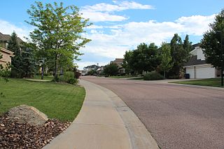
The City of Castle Pines is a Home Rule Municipality located in Douglas County, Colorado, United States. As of the 2010 census, the population of the city was 10,360. By 2019, the United States Census Bureau estimated the population to have increased to 10,763. The city is situated 19 miles (31 km) south-southeast of the Colorado State Capitol in Denver. The city is located north of the Town of Castle Rock and south of the City of Lone Tree, Colorado.

The Town of Lakeside is a Statutory Town in Jefferson County, Colorado, United States. The town population was 8 at the 2010 United States Census, making Lakeside the least populous municipality in the State of Colorado. Lakeside is immediately west of the City and County of Denver, the most populous municipality in the state. The Denver Post Office serves Lakeside.
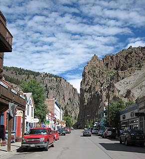
Creede is a statutory town that is the county seat of Mineral County, Colorado, United States. The town population was 290 at the 2010 United States Census.

South Fork is a statutory town in Rio Grande County, Colorado, United States. It lies at the confluence of the South Fork and Rio Grande rivers. The population was 386 at the 2010 census.
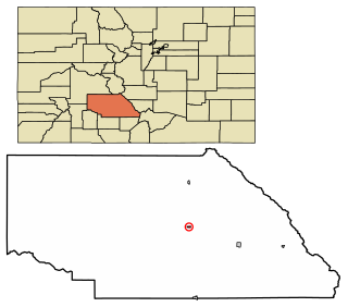
The historic town of Saguache is a statutory town that is the county seat of Saguache County, Colorado, United States. The population was 493 at the U.S. Census 2010.
In United States local government, a consolidated city-county is formed when one or more cities and their surrounding county merge into one unified jurisdiction. As such it has the governmental powers of both a municipal corporation and an administrative division of a state.
The Government of Colorado is the governmental structure as established by the Constitution of the State of Colorado. It is composed of three branches: the executive branch headed by the Governor, the legislative branch consisting of the General Assembly, and the judicial branch consisting of the Supreme Court and lower courts. The constitution also allows direct participation of the electorate by initiative, referendum, recall and ratification.
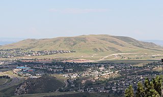
Lakewood is a home-rule municipality that is the most-populous municipality in Jefferson County, Colorado, United States. Lakewood is the fifth-most populous city in Colorado and the 172nd-most populous city in the United States. The city population was 142,980 at the 2010 United States Census. Lakewood is west of Denver and is part of the Denver-Aurora-Broomfield, Colorado, metropolitan statistical area.
This article includes information about the 100 most populous incorporated cities, the 100 most populous Core Based Statistical Areas (CBSAs), and the 100 most populous Primary Statistical Areas (PSAs) of the United States and Puerto Rico. This information is displayed in two tables. The first table ranks the cities, CBSAs, and PSAs separately by population. The second table displays the areas in hierarchical order by the most populous PSA, then most populous CBSA, and then most populous city.


