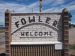
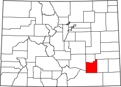
Fowler, Colorado

Last updated

Fowler, Colorado
Fowler, CO, welcome sign IMG 5635.JPG
Welcome Sign (2010)
Otero County Colorado Incorporated and Unincorporated areas Fowler Highlighted 0827975.svg
Location of the Town of Fowler in Otero County, Colorado
Usa edcp location map.svg
Red pog.svg
Fowler
Location of the Town of Fowler in the United States
Coordinates: 38°7′42″N104°1′30″W / 38.12833°N 104.02500°W / 38.12833; -104.02500
Country Flag of the United States.svg  United States
State Flag of Colorado.svg  Colorado
County Otero County [1]
Incorporated (town) August 25, 1925 [2]
Area
[3]
  Total0.563 sq mi (1.458 km2)
  Land0.000 sq mi (0.000 km2)
  Water0.559 sq mi (1.448 km2)
Elevation
[4]
4,340 ft (1,322 m)
Population
 (2020) [3]
  Total1,253
  Density2,241/sq mi (865/km2)
Time zone UTC−07:00 (MST)
  Summer (DST) UTC−06:00 (MDT)
ZIP code [5]
81039
Area code 719
FIPS code 08-27975
GNIS feature ID0204802
Website www.fowlercolorado.com

Fowler is a statutory town located in northwestern Otero County, Colorado, United States. [1] The town population was 1,253 at the 2020 United States Census. [3]

Contents

History

Fowler was named for Orson Squire Fowler, a phrenologist who founded the town. [6] The town was incorporated in 1925. [7]

The town was built as a small railroad station for the Atchison, Topeka and Santa Fe Railway. The town was originally named Oxford, for a large ox that was killed when crossing the railroad tracks. The name of the town was changed because there was another town named Oxford located on the rail line. [8]

Geography

Fowler is located at 38°7′42″N104°1′30″W / 38.12833°N 104.02500°W / 38.12833; -104.02500 (38.128343, -104.025007). [9]

At the 2020 United States Census, the town had a total area of 360 acres (1.458 km2), including 2.5 acres (0.010 km2) of water. [3]

It is on the Arkansas River and U.S. Route 50.

Demographics

Historical population
CensusPop.Note
1910 925
1920 1,06214.8%
1930 968−8.9%
1940 922−4.8%
1950 1,02511.2%
1960 1,24021.0%
1970 1,2410.1%
1980 1,227−1.1%
1990 1,154−5.9%
2000 1,2064.5%
2010 1,182−2.0%
2020 1,2536.0%
U.S. Decennial Census

As of the census [10] of 2000, there were 1206 people, 521 households, and 330 families residing in the town. The population density was 2,468.5 inhabitants per square mile (953.1/km2). There were 591 housing units at an average density of 1,209.7 per square mile (467.1/km2). The racial makeup of the town was 95.02% White, 0.08% Black, 1.08% Native American, 0.17% Asian, 2.99% from other races, and 0.66% from two or more races. Latino or Hispanic of any race were 12.35% of the population.

There were 521 households, out of which 25.9% had children under the age of 18 living with them, 52.8% were married couples living together, 7.7% had a female householder with no husband present, and 36.5% were non-families. 34.5% of all households were made up of individuals, and 16.3% had someone living alone who was 65 years of age or older. The average household size was 2.22 and the average family size was 2.87.

In the town, the population was spread out, with 22.3% under the age of 18, 7.5% from 18 to 24, 22.5% from 25 to 44, 23.1% from 45 to 64, and 24.6% who were 65 years of age or older. The median age was 43 years. For every 100 females, there were 84.4 males. For every 100 females age 18 and over, there were 79.2 males.

The median income for a household in the town was $25,761, and the median income for a family was $32,143. Males had a median income of $25,536 versus $20,750 for females. The per capita income for the town was $15,501. About 11.3% of families and 11.9% of the population were below the poverty line, including 13.0% of those under age 18 and 9.3% of those age 65 or over.

Government

The town has a small police department and fire department. [11] [12] In 1998, the magazine Westword included Fowler among examples of small police departments that struggled to hire or retain their police chiefs. Police chief Floyd Rogers was fired in 1997 after a string of controversies regarding the department's treatment of adolescents. After his firing a crowd of 60 adolescents rioted in Fowler, barricading U.S. Route 50, setting fires, and vandalizing the police station and two police cars. [13]

Education

The Fowler School District has one elementary school and one high school. The high school mascot is the Grizzlies.

Transportation

Fowler is part of Colorado's Bustang network. It is along the Lamar-Pueblo-Colorado Springs Outrider line. [14]

Notable people

See also

Related Research Articles

<span class="mw-page-title-main">Alamosa, Colorado</span> City in Colorado, United States

Alamosa is a home rule municipality and the county seat of Alamosa County, Colorado, United States. The city population was 9,806 in the 2020 United States Census. The city is the commercial center of the San Luis Valley in south-central Colorado, and is the home of Adams State University.

<span class="mw-page-title-main">Buena Vista, Colorado</span> Town in Colorado, United States

Buena Vista is a Statutory Town located in Chaffee County, Colorado, United States. The town population was 2,855 at the 2020 United States Census.

<span class="mw-page-title-main">Eagle, Colorado</span> Town in Colorado, United States

Eagle is the Statutory Town that is the county seat of Eagle County, Colorado, United States. The town population was 7,511 at the 2020 United States Census, a +15.41% increase since the 2010 United States Census. Eagle is the part of the Edwards, CO Micropolitan Statistical Area.

<span class="mw-page-title-main">Fountain, Colorado</span> City in Colorado, United States

The City of Fountain is a home rule municipality located in El Paso County, Colorado, United States. The city population was 29,802 at the 2020 United States Census, a +15.31% increase since the 2010 United States Census. Fountain is a part of the Colorado Springs, CO Metropolitan Statistical Area and the Front Range Urban Corridor.

<span class="mw-page-title-main">Elizabeth, Colorado</span> Town in Elbert County, Colorado, United States

Elizabeth is a Statutory Town that is the most populous municipality in Elbert County, Colorado, United States. The town population was 1,675 at the 2020 United States Census, a +23.34% increase since the 2010 United States Census. Elizabeth is a part of the Denver–Aurora–Lakewood, CO Metropolitan Statistical Area and the Front Range Urban Corridor.

<span class="mw-page-title-main">Penrose, Colorado</span> Unincorporated community in Fremont County, Colorado, United States

Penrose is a census-designated place (CDP) and post office located in and governed by Fremont County, Colorado, United States. The CDP is a part of the Cañon City, CO Micropolitan Statistical Area. The Penrose post office has the ZIP Code 81240. At the United States Census 2020, the population of the Penrose CDP was 3,685.

<span class="mw-page-title-main">Edgewater, Colorado</span> City in Colorado, United States

The City of Edgewater is a home rule municipality located in Jefferson County, Colorado, United States. The city population was 5,005 at the 2020 United States Census. Edgewater is surrounded by Denver to the east, Lakewood to the south and west, and Wheat Ridge to the north. The city is a part of the Denver–Aurora–Lakewood, CO Metropolitan Statistical Area and the Front Range Urban Corridor.

<span class="mw-page-title-main">Aguilar, Colorado</span> Town in Colorado, United States

Aguilar is a Statutory Town located in Las Animas County, Colorado, United States. The town population was 456 at the 2020 United States Census. Cattleman and prominent pioneer José Ramón Aguilar founded the town in 1894.

<span class="mw-page-title-main">Trinidad, Colorado</span> City in Colorado, United States

Trinidad is the home rule municipality that is the county seat and the most populous municipality of Las Animas County, Colorado, United States. The population was 8,329 as of the 2020 census. Trinidad lies 21 mi (34 km) north of Raton, New Mexico, and 195 mi (314 km) south of Denver. It is on the historic Santa Fe Trail.

<span class="mw-page-title-main">Dolores, Colorado</span> Town in Montezuma County, Colorado, United States

The Town of Dolores is a Statutory Town located in Montezuma County, Colorado, United States. The town population was 885 at the 2020 United States Census.

<span class="mw-page-title-main">La Junta, Colorado</span> City in Otero County, Colorado, United States

La Junta is a home rule municipality in, the county seat of, and the most populous municipality of Otero County, Colorado, United States. The city population was 7,322 at the 2020 United States Census. La Junta is located on the Arkansas River in southeastern Colorado 68 miles (109 km) east of Pueblo.

<span class="mw-page-title-main">Manzanola, Colorado</span> Town in Otero County, Colorado, United States

Manzanola is a Statutory Town in Otero County, Colorado, United States. The town population was 341 at the 2020 United States Census.

<span class="mw-page-title-main">Rocky Ford, Colorado</span> City in Otero County, Colorado, United States

Rocky Ford is a statutory city located in Otero County, Colorado, United States. The population was 3,876 at the 2020 census.

<span class="mw-page-title-main">Swink, Colorado</span> Town in Otero County, Colorado, United States

Swink is a Statutory Town in Otero County, Colorado, United States. The population was 604 at the 2020 census.

<span class="mw-page-title-main">Fairplay, Colorado</span> Town in Park County, Colorado, United States

Fairplay is the Statutory Town that is the county seat and the most populous municipality of Park County, Colorado, United States. The town population was 724 at the 2020 United States Census. Fairplay is located in South Park at an elevation of 9,953 feet (3,034 m). The town is the fifth-highest incorporated place in the State of Colorado. Fairplay is now a part of the Denver–Aurora–Lakewood, CO Metropolitan Statistical Area and the Front Range Urban Corridor.

<span class="mw-page-title-main">Lamar, Colorado</span> City in Colorado, United States

Lamar is the home rule municipality that is the county seat and the most populous municipality of Prowers County, Colorado. The city population was 7,687 at the 2020 United States Census. The city was named after L.Q.C. Lamar, a slaveholder, Confederate soldier and diplomat who wrote the Mississippi Secession Ordinance, and after the Civil War, went on to serve as Secretary of the Interior and as a Supreme Court Justice.

<span class="mw-page-title-main">Moffat, Colorado</span> Town in Saguache County, Colorado, United States

The Town of Moffat is a statutory town in Saguache County, Colorado, United States. The town population was 108 at the 2020 United States Census.

<span class="mw-page-title-main">Frisco, Colorado</span> Town in Colorado, United States

Frisco is a home rule municipality located in Summit County, Colorado, United States. The town population was 2,913 at the 2020 United States Census. Frisco is a part of the Breckenridge, CO Micropolitan Statistical Area. It is a popular town among skiers from around the world. Four major ski resorts are located in close proximity to Frisco: Copper Mountain, Breckenridge, Keystone, and Arapahoe Basin.

<span class="mw-page-title-main">Platteville, Colorado</span> Town in Colorado, United States

Platteville is a Statutory Town in Weld County, Colorado, United States. The population was 2,955 at the 2020 census. It is adjacent to Fort Vasquez on U.S. Highway 85.

<span class="mw-page-title-main">Lakewood, Colorado</span> City in Colorado, United States

The City of Lakewood is the home rule municipality that is the most populous municipality in Jefferson County, Colorado, United States. The city population was 155,984 at the 2020 U.S. Census, making Lakewood the fifth most populous city in Colorado and the 167th most populous city in the United States. Lakewood is a suburb of Denver and is a principal city of the Denver–Aurora–Lakewood, CO Metropolitan Statistical Area and a major city of the Front Range Urban Corridor.

References

  1. 1 2 3 "Active Colorado Municipalities". Colorado Department of Local Affairs . Retrieved October 18, 2021.
  2. "Colorado Municipal Incorporations". State of Colorado, Department of Personnel & Administration, Colorado State Archives. December 1, 2004. Retrieved September 2, 2007.
  3. 1 2 3 4 "Decennial Census P.L. 94-171 Redistricting Data". United States Census Bureau, United States Department of Commerce. August 12, 2021. Retrieved September 27, 2021.
  4. "US Board on Geographic Names". United States Geological Survey. October 25, 2007. Retrieved September 1, 2015.
  5. "ZIP Code Lookup". United States Postal Service. Archived from the original (JavaScript/HTML) on November 4, 2010. Retrieved October 19, 2015.
  6. Dawson, John Frank. Place names in Colorado: why 700 communities were so named, 150 of Spanish or Indian origin. Denver, CO: The J. Frank Dawson Publishing Co. p. 22.
  7. "Fowler, Colorado". City-Data.com. Retrieved July 12, 2012.
  8. "History". Fowler, Colorado. Retrieved July 12, 2012.
  9. "US Gazetteer files: 2010, 2000, and 1990". United States Census Bureau. February 12, 2011. Retrieved April 23, 2011.
  10. "U.S. Census website". United States Census Bureau . Retrieved January 31, 2008.
  11. Steven R. Wasserman; Jacqueline Wasserman Monroe; Bonnie Shaw Pfaff, eds. (1997). Law and legal information directory (9 ed.). Detroit, Mich.: Gale Research Co. ISBN   0-8103-4896-9. OCLC   35334976.
  12. "Contact Us". Fowler, Colorado. Retrieved March 4, 2023.
  13. Perez-Giese, Tony (February 26, 1998). "Hell to the Chiefs". Westword. Retrieved March 4, 2023.
  14. "Bustang Schedule". RideBustang. CDOT.
  15. Devlin, Neil H. (May 3, 2007). "The last Hochevar could be the best". The Denver Post. Retrieved July 4, 2022.