List of largest California cities by land area

Last updated

This is a list of the 25 largest incorporated cities in the State of California ranked by land area.

If ranked by total area, a number of coastal cities would appear disproportionately larger. For instance, San Francisco's 46.9 square miles (121 km2) of land area would make it 30th on this list. Sorted by total area, San Francisco would be third, as water makes up nearly 80% of its total area of 231.9 square miles (601 km2).

Note: These are the actual incorporated areas of the listed cities, as opposed to metropolitan areas, urban areas, or counties, and will therefore differ from other available listings.

RankCityLand areaWater areaTotal areaPopulation (2010) [1] Population Density
1 Los Angeles 468.7 sq mi (1,214 km2)34.0 sq mi (88 km2)502.7 sq mi (1,302 km2)3,792,6218,091.8/sq mi (3,124.3/km2)
2 San Diego 325.2 sq mi (842 km2)47.2 sq mi (122 km2)456.4 sq mi (1,182 km2)1,301,6174,002.5/sq mi (1,545.4/km2)
3 California City 203.531 sq mi (527.14 km2)0.1 sq mi (0.26 km2)203.631 sq mi (527.40 km2)14,120

69.3/sq mi (26.8/km2)

4 San Jose 176.5 sq mi (457 km2)3.4 sq mi (8.8 km2)179.9 sq mi (466 km2)958,7895,329.6/sq mi (2,057.8/km2)
5 Bakersfield 149.73 sq mi (387.8 km2)1.47 sq mi (3.8 km2)151.2 sq mi (392 km2)347,4832,543.8/sq mi (982.2/km2)
6 Fresno 111.9 sq mi (290 km2)0.4 sq mi (1.0 km2)112.3 sq mi (291 km2)510,3654,544.7/sq mi (1,754.7/km2)
7 Palmdale 106.0 sq mi (275 km2)0.2 sq mi (0.52 km2)106.2 sq mi (275 km2)152,7501,438.3/sq mi (555.3/km2)
8 Sacramento 97.9 sq mi (254 km2)2.2 sq mi (5.7 km2)100.1 sq mi (259 km2)466,4884,660.2/sq mi (1,799.3/km2)
9 Lancaster 94.3 sq mi (244 km2)0.2 sq mi (0.52 km2)94.5 sq mi (245 km2)156,6331,657.5/sq mi (640.0/km2)
10 Palm Springs 94.1 sq mi (244 km2)0.9 sq mi (2.3 km2)95.0 sq mi (246 km2)44,552468.9/sq mi (181.0/km2)
11 Riverside 81.1 sq mi (210 km2)0.3 sq mi (0.78 km2)81.4 sq mi (211 km2)303,8713,733.1/sq mi (1,441.4/km2)
12 Fremont 77.5 sq mi (201 km2)10.1 sq mi (26 km2)87.6 sq mi (227 km2)214,0892,443.9/sq mi (943.6/km2)
13 Apple Valley 73.2 sq mi (190 km2)0.3 sq mi (0.78 km2)73.5 sq mi (190 km2)69,135994.5/sq mi (384.0/km2)
14 Victorville 73.2 sq mi (190 km2)0.5 sq mi (1.3 km2)73.7 sq mi (191 km2)115,9031,583.4/sq mi (611.4/km2)
15 Hesperia 73.1 sq mi (189 km2)0.1 sq mi (0.26 km2)73.2 sq mi (190 km2)90,1731,233.6/sq mi (476.3/km2)
16 Irvine 66.1 sq mi (171 km2)0.3 sq mi (0.78 km2)66.4 sq mi (172 km2)212,3753,212.9/sq mi (1,240.5/km2)
17 Stockton 61.7 sq mi (160 km2)3.1 sq mi (8.0 km2)64.8 sq mi (168 km2)291,7074,727.8/sq mi (1,825.4/km2)
18 Redding 59.6 sq mi (154 km2)1.5 sq mi (3.9 km2)61.1 sq mi (158 km2)89,8611,507.7/sq mi (582.1/km2)
19 San Bernardino 59.2 sq mi (153 km2)0.4 sq mi (1.0 km2)59.6 sq mi (154 km2)209,9243,546.0/sq mi (1,369.1/km2)
20 Twentynine Palms 59.1 sq mi (153 km2)0.0 sq mi (0 km2)59.1 sq mi (153 km2)25,048423.8/sq mi (163.6/km2)
21 Adelanto 56.0 sq mi (145 km2)0.0 sq mi (0 km2)56.0 sq mi (145 km2)31,765567.2/sq mi (219.0/km2)
22 Oakland 55.8 sq mi (145 km2)22.2 sq mi (57 km2)78.0 sq mi (202 km2)390,7247,002.2/sq mi (2,703.6/km2)
23 Thousand Oaks 55.0 sq mi (142 km2)0.1 sq mi (0.26 km2)55.1 sq mi (143 km2)126,8332,306.1/sq mi (890.4/km2)
24 Santa Clarita 52.7 sq mi (136 km2)0.1 sq mi (0.26 km2)52.8 sq mi (137 km2)177,6413,370.8/sq mi (1,301.5/km2)
25 Moreno Valley 51.3 sq mi (133 km2)0.2 sq mi (0.52 km2)51.5 sq mi (133 km2)186,3653,632.8/sq mi (1,402.6/km2)

See also

Related Research Articles

San Bernardino County, California County in southern California, United States

San Bernardino County, officially the County of San Bernardino, is a county located in the southern portion of the U.S. state of California, and is located within the Inland Empire area. As of the 2010 U.S. Census, the population was 2,035,210, making it the fifth-most populous county in California and the 14th-most populous in the United States. The county seat is San Bernardino.

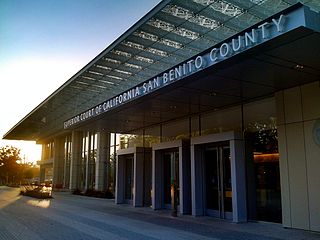
San Benito County, California County in California, United States

San Benito County, officially the County of San Benito, is a county located in the Coast Range Mountains of the U.S. state of California. As of the 2010 census, the population was 55,269. The county seat is Hollister.

Solano County, California County in California, United States

Solano County is a county located in the U.S. state of California. As of the 2010 census, the population was 413,344. The county seat is Fairfield.

Stanislaus County, California County in California, United States

Stanislaus County is a county in California's San Joaquin Valley. As of the 2010 census, the population was 514,453. The county seat is Modesto.

Menlo Park, California City in California, United States

Menlo Park is a city at the eastern edge of San Mateo County within the San Francisco Bay Area of California in the United States. It is bordered by San Francisco Bay on the north and east; East Palo Alto, Palo Alto, and Stanford to the south; and Atherton, North Fair Oaks, and Redwood City to the west. It is one of the most educated cities in California and the United States; nearly 70% of residents over 25 have earned a bachelor's degree or higher. It had 32,026 residents at the 2010 United States Census, and an estimated 34,698 by 2019. It is home to the corporate headquarters of Facebook, and is where Google and Round Table Pizza were founded.

Hercules, California City in California, United States

Hercules is a city in western Contra Costa County, California. Situated along the coast of San Pablo Bay, it is located in the eastern region of the San Francisco Bay Area, about 10 miles (16 km) north of Berkeley, California. As of 2010, its population was 24,060, according to the United States Census Bureau. The site of Hercules was first developed in 1881 as a manufacturing facility of the California Powder Works for the production of its patented dynamite formulation, Hercules powder. In 1882, the Hercules Powder Company was incorporated and assumed responsibility for the Hercules site. It was one of several explosive manufacturers that were active along the Pinole shoreline in the late 19th to the mid-20th century. The small company town that grew up near the facility subsequently became known as "Hercules", and was incorporated at the end of 1900. Starting in the 1970s, Hercules was heavily redeveloped as suburban bedroom community that lies along the I-80 corridor in Western Contra Costa County. It has a very ethnically diverse population.

Belvedere, California City in California in the United States

Belvedere is a residential incorporated city located on the San Francisco Bay in Marin County, California, United States. Consisting of two islands and a lagoon, it is connected to the Tiburon Peninsula by two causeways. At the 2010 census, the population was 2,068. The per-capita income of Belvedere residents in the year 2000 was $250,000, but currently the average income is $283,000, making it one of the highest-income cities in California and the eighth highest-income community in the United States. Belvedere and Tiburon share a post office and the 94920 ZIP code.

Belmont, California City in the US state of California

Belmont is a city in San Mateo County in the U.S. state of California. It is in the San Francisco Bay Area, on the San Francisco Peninsula about halfway between San Francisco and San Jose. It was originally part of Rancho de las Pulgas, for which one of its main roads, the Alameda de las Pulgas, is named. The city was incorporated in 1926. Its population was 25,835 at the 2010 census.

Daly City, California City in California, United States

Daly City is the most populous city in San Mateo County, California, United States, with an estimated 2019 population of 106,280. Located in the San Francisco Bay Area, and immediately south of San Francisco, it is named for businessman and landowner John Donald Daly.

Foster City, California City in California, United States

Foster City is a city located in San Mateo County, California. In 2019, the United States Census estimated the population to be 33,901, an increase of more than 10% over the 2010 census figure of 30,567. Foster City is sometimes considered to be part of Silicon Valley for its local industry and its proximity to Silicon Valley cities. Foster City is one of the United States’ safest cities, with an average of one murder per decade.

Rio Vista, California City in California, United States

Rio Vista is a city located in the eastern end of Solano County, California, in the Sacramento River Delta region of Northern California. The population was 7,360 at the 2010 census.

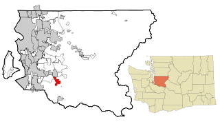
Black Diamond, Washington City in Washington, United States

Black Diamond is a city in King County, Washington, United States. The population was 4,151 at the 2010 census.

In 45 of the 50 states of the United States, the county is used for the level of local government immediately below the state itself. Louisiana uses parishes, and Alaska uses boroughs. In Connecticut, Massachusetts, and Rhode Island, some or all counties within states have no governments of their own; the counties continue to exist as legal entities, however, and are used by states for some administrative functions and by the United States Census bureau for statistical analysis. There are 3,242 counties and county equivalent administrative units in total, including the District of Columbia and 100 county-equivalents in the U.S. territories.

The 2020 United States Census reported that San Francisco had a population of 873,965—an increase from the 2010 Census count of 805,235. With a population density of 18,633 per square mile (7,194/km2), San Francisco is the second-most densely populated major American city, behind only New York.

References

  1. Bureau, U. S. Census. "U.S. Census website". United States Census Bureau . Retrieved 2019-03-31.