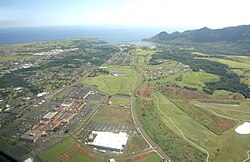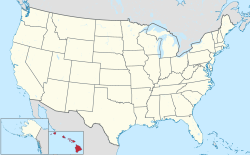
This is a list of census-designated places in Hawaii . There are no separately incorporated cities in the entire state; Honolulu County is both a city and county. There are 151 census-designated places. Population data from the 2020 Census. [1]
† County seat
†† State capital and county seat
Honolulu is the capital and most populous city of the U.S. state of Hawaii, which is in the Pacific Ocean. An unincorporated city, it is the county seat of the consolidated City and County of Honolulu, situated along the southeast coast of the island of Oʻahu, and is the westernmost and southernmost major U.S. city. Honolulu is Hawaii's main gateway to the world. It is also a major hub for business, finance, hospitality, and military defense in both the state and Oceania. The city is characterized by a mix of various Asian, Western, and Pacific cultures, reflected in its diverse demography, cuisine, and traditions.
Hilo is the largest settlement in Hawaii County, Hawaii, United States, which encompasses the Island of Hawaii, and is a census-designated place (CDP). The population was 44,186 according to the 2020 census. It is the fourth-largest settlement in the state of Hawaii, the largest settlement in the state outside of Oahu, and the largest settlement in the state outside of the Greater Honolulu Area.
A census-designated place (CDP) is a concentration of population defined by the United States Census Bureau for statistical purposes only.
The following is a set–index article, providing a list of lists, for the cities, towns and villages within the jurisdictional United States. It is divided, alphabetically, according to the state, territory, or district name in which they are located.
The United States Census Bureau defines a place as a concentration of population which has a name, is locally recognized, and is not part of any other place. A place typically has a residential nucleus and a closely spaced street pattern, and it frequently includes commercial property and other urban land uses. A place may be an incorporated place or it may be a census-designated place (CDP). Incorporated places are defined by the laws of the states in which they are contained. The Census Bureau delineates CDPs. A small settlement in the open countryside or the densely settled fringe of a large city may not be a place as defined by the Census Bureau. As of the 1990 census, 26% of the people in the United States lived outside of places.
Teasdale is a census-designated place in western Wayne County, Utah, United States, between the Dixie and Fishlake National Forests and near Capitol Reef National Park. The population was 191 at the 2010 census. Teasdale lies along local roads south of State Route 24, southeast of the town of Loa, the county seat of Wayne County. Teasdale has a post office with the ZIP code 84773.
Honolulu County, officially known as the City and County of Honolulu, is a consolidated city-county in the U.S. state of Hawaii. The city-county includes both Urban Honolulu and the rest of the neighborhoods on the island of Oʻahu, as well as several minor outlying islands, including all of the Northwestern Hawaiian Islands except Midway Atoll.