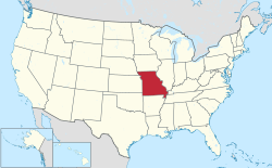
This article lists census-designated places (CDPs) in the U.S. state of Missouri . As of 2020, there were a total of 131 census-designated places in Missouri.
Defiance is an unincorporated community and census-designated place in Saint Charles County, Missouri, United States. As of the 2020 census, the population was 159.
The following is a set–index article, providing a list of lists, for the cities, towns and villages within the jurisdictional United States. It is divided, alphabetically, according to the state, territory, or district name in which they are located.
Sussex is a census-designated place (CDP) in and the county seat of Sussex County, Virginia, United States. The population as of the 2020 Census was 181.
Phelps City is a census-designated place and unincorporated community in Atchison County, Missouri, United States. As of the 2020 census, its population was zero. The community is 5 miles (8.0 km) west of Rock Port. It is the closest Missouri community to Brownville Bridge, a Missouri River crossing that is listed on the National Register of Historic Places.
White Branch is an unincorporated community and census-designated place (CDP) in Benton County, Missouri, United States. It is southwest of the center of the county, on the south side of the Osage River where it is joined from the south by White Branch, a tributary. To the north, across the Osage, is the city of Warsaw, the Benton county seat. U.S. Route 65 forms the western edge of the CDP, leading north through Warsaw 35 miles (56 km) to Sedalia and south 77 miles (124 km) to Springfield.
Bent Tree Harbor is an unincorporated community and census-designated place (CDP) in Benton County, Missouri, United States. It is in the western part of the county, on the north side of State Highway Z, 6 miles (10 km) west of Warsaw, the county seat. It is bordered to the northwest and northeast by arms of Harry S. Truman Reservoir on the South Grand River, a tributary of the Osage River.
Indian Lake is an unincorporated community and census-designated place (CDP) in Crawford County, Missouri, United States. It is in the northwestern part of the county, surrounding a lake of the same name, a reservoir on Brush Creek, a north-flowing tributary of the Bourbeuse River. The community is 5 miles (8 km) northwest of Cuba and Interstate 44.
Lake St. Clair is an unincorporated community and census-designated place (CDP) in Franklin County, Missouri, United States. It is in the southeast part of the county, surrounding a lake impounded on a tributary of Hoosier Creek, a south-flowing tributary of the Meramec River. The community is bordered to the north by the city of Saint Clair and is 54 miles (87 km) southwest of St. Louis.
Tarsney Lakes is an unincorporated community and census-designated place (CDP) in Jackson County, Missouri, United States. It is in the eastern part of the county, northeast of the unincorporated community of Tarsney, and consisting of residential neighborhoods surrounding Tarsney Lake and Wood Lake, just south of the West Fork of Sni-A-Bar Creek. It is 28 miles (45 km) southeast of downtown Kansas City.
Briarwood Estates is an unincorporated community and census-designated place (CDP) in Jefferson County, Missouri, United States. It is in the southern part of the county, northwest of De Soto. It is a residential community built around three lakes: Lake Briarwood, Fishermans Lake, and Spring Lake. Missouri Route 21 passes between Briarwood Estates and De Soto, leading northeast 44 miles (71 km) to St. Louis and southwest 24 miles (39 km) to Potosi.
Raintree Plantation is an unincorporated community and census-designated place (CDP) in Jefferson County, Missouri, United States. It is in the central part of the county, northwest of Hillsboro. It is built around the Raintree Country Club and several artificial lakes, the largest of which is Rain Tree Lake. It is 40 miles (64 km) southwest of St. Louis.
Summer Set is an unincorporated community and census-designated place (CDP) in Jefferson County, Missouri, United States. It is in the southern part of the county, 3 miles (5 km) south of De Soto. It is a residential community built around two artificial lakes: Summerset Lake and Fishermans Lake.
Shakertowne is an unincorporated community and census-designated place (CDP) in Perry County, Missouri, United States. It is in the central part of the county and is bordered to the north by Perryville, the county seat. Interstate 55 forms the western edge of the CDP; the closest access is from Exit 129 in Perryville. Via I-55 St. Louis is 84 miles (135 km) to the north and Cape Girardeau is 34 miles (55 km) to the south.
Goose Creek Lake is an unincorporated community and census-designated place (CDP) in St. Francois and Ste. Genevieve counties, Missouri, United States. The community is built around a lake of the same name, a reservoir impounding Goose Creek, an east-flowing tributary of Fourche Du Clos and part of the Establishment Creek watershed leading to the Mississippi River.
Lake Timberline is an unincorporated community and census-designated place (CDP) in St. Francois County, Missouri, United States. The community is built around several reservoirs built in the valleys of Bee Run and Primrose Creek, southwest-flowing tributaries of the Big River, which in turn flows northwest to the Meramec River.
Argenta is an unincorporated community and census-designated place (CDP) in Beaverhead County, Montana, United States. It is in southwestern Montana, 13 miles (21 km) northwest of Dillon, the Beaverhead county seat. Argenta is in the valley of Rattlesnake Creek, a southeast-flowing tributary of the Beaverhead River, part of the Jefferson River watershed leading to the Missouri and finally the Mississippi River.
Hardy is an unincorporated community and census-designated place (CDP) in Cascade County, Montana, United States. It is in the southwest part of the county, in the valley of the Missouri River where it emerges from its canyon through the Adel Mountains Volcanic Field. Interstate 15 passes the community, with access from Exit 247. I-15 leads northeast 34 miles (55 km) to Great Falls and southwest 56 miles (90 km) to Helena.
Tracy is an unincorporated community and census-designated place (CDP) in Cascade County, Montana, United States. It is in the east-central part of the county, in the valley of Sand Coulee Creek, a north-flowing tributary of the Missouri River. Tracy is bordered to the west by the community of Sand Coulee, and it is 12 miles (19 km) southeast of Great Falls.
York is an unincorporated community and census-designated place (CDP) in Lewis and Clark County, Montana, United States. It is in the southeastern part of the county, 20 miles (32 km) northeast of Helena, the state capital. It sits at the southwestern base of the Big Belt Mountains, in the valley of Trout Creek, which flows southwest to the Missouri River in Hauser Lake.