Adair County, Missouri

Last updated

Adair County
Adair County MO Courthouse 20141022 A.jpg
Adair County Courthouse in Kirksville
Map of Missouri highlighting Adair County.svg
Location within the U.S. state of Missouri
Missouri in United States.svg
Missouri's location within the U.S.
Coordinates: 40°11′N92°36′W / 40.19°N 92.6°W / 40.19; -92.6
CountryFlag of the United States.svg United States
StateFlag of Missouri.svg  Missouri
FoundedJanuary 29, 1841
Named for Adair County, Kentucky
Seat Kirksville
Largest cityKirksville
Area
  Total569 sq mi (1,470 km2)
  Land567 sq mi (1,470 km2)
  Water2.1 sq mi (5 km2)  0.4%
Population
 (2020)
  Total25,314
  Density44/sq mi (17/km2)
Time zone UTC−6 (Central)
  Summer (DST) UTC−5 (CDT)
Congressional district 6th
Website adaircountymissouri.com

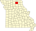
Adair County is a county located in the northeastern part of the U.S. state of Missouri. The population census for 2020 was 25,314. [1] As of July 1, 2021, the U.S. Census Bureau's Population Estimates for the county is 25,185, a -0.5% change. Adair county seat is Kirksville. [2] The county was first settled by immigrants from Kentucky and organized on January 29, 1841. Adair County comprises the Kirksville, MO Micropolitan Statistical Area.

Contents

History

The first permanent settlement in Adair County began in 1828. Many of the first settlers were from Adair County in Kentucky, for which the Missouri county was named. [3] The county in Kentucky was named for John Adair, a respected Governor of Kentucky. [4] [5] This was 25 years after the Louisiana Purchase, seven years after Missouri was granted statehood, and four years after the Sac and Fox Native American tribes surrendered their claims to the land. The original settlement was called "Cabins of White Folks," or simply, "The Cabins," and was located six miles (9.7 km) west of present-day Kirksville along the Chariton River.

The Big Neck War: In July 1829, a large party of Iowa (or Ioway) Native Americans, led by Chief Big Neck, returned to their former hunting grounds in violation of treaty. One of the Ioway's dogs killed a pig, and some tribe members threatened (or insulted, according to some sources) the white women. The settlers sent messengers south to Randolph and Macon counties asking for help. Captain William Trammell responded with a party of some two dozen men to help. By the time of their arrival, the Ioways had left the area and moved up the Chariton into what is now Schuyler County. Trammell's force, augmented by several of the men from The Cabins, pursued and engaged the Ioway at a place called Battle Creek, killing several Native Americans including Big Neck's brother, sister-in-law, and their child. [6] The Trammell party lost three men in the skirmish, including Captain Trammell himself, and one additional casualty died of his wounds shortly afterward. The surviving whites returned to the cabins, collected the women and children, and headed south for the Randolph County settlement of Huntsville. Later, a group of militia under General John B. Clark pursued and apprehended Big Neck and his braves, capturing them in March 1830. Several of them soon escaped from jail and fled to the current state of Iowa; however, Big Neck himself and the remainder were put on trial by a grand jury convened in Randolph County. The jury found on March 31, 1830, that: "After examining all the witnesses, and maturely considering the charges for which these Iowa Indians are now in confinement, we find them not guilty, and they are at once discharged." [7] The acquittal of Big Neck seemed to have brought the war to a peaceful, if uneasy, conclusion. A few months later, white settlers returned to The Cabins in greater numbers than before, and this time to stay permanently. The outbreak of the Blackhawk War in 1832 again caused consternation among the early settlers although all fighting was hundreds of miles away in present-day Illinois and Wisconsin. To ease fears in the area, militia units were dispatched and two small forts were constructed. One, Fort Clark, was located on high ground adjacent to The Cabins. Several miles to the northeast, another detachment of troops established Fort Matson. After months of no hostile Native American activity in the Adair County area, both forts were abandoned. The site of Fort Clark is now marked by a large boulder and plaque, while the Fort Matson site was later the location for a church and its name corrupted to Fort Madison (not to be confused with the Iowa city). The Fort Matson/Madison Cemetery still remains. [8]

Courthouse

The Adair County courthouse is a three-story Romanesque structure in the center of the Kirksville city square that was completed in 1899. The architect was Robert G. Kirsch who would later also design the courthouses for Carroll, Polk, Vernon, and Cooper counties. The county had no dedicated courthouse from 1865 until 1899, operating out of temporary rented quarters on or near the square. The county voters finally approved a $50,000 bond issue in 1897 to build the current courthouse after four failed attempts between 1872 and 1896. The courthouse was placed on the National Register of Historic Places in 1978. [9] [10]

Geography

According to the U.S. Census Bureau, the county has a total area of 569 square miles (1,470 km2), of which 567 square miles (1,470 km2) is land and 2.1 square miles (5.4 km2) (0.4%) is water. [11]

Rivers

Adjacent counties

Major highways

Transit

Railroads

Demographics

Historical population
CensusPop.Note
1850 2,283
1860 8,436269.5%
1870 11,44835.7%
1880 15,19032.7%
1890 17,41714.7%
1900 21,72824.8%
1910 22,7004.5%
1920 21,404−5.7%
1930 19,436−9.2%
1940 20,2464.2%
1950 19,689−2.8%
1960 20,1052.1%
1970 22,47211.8%
1980 24,87010.7%
1990 24,577−1.2%
2000 24,9771.6%
2010 25,6072.5%
2020 25,314−1.1%
U.S. Decennial Census [12]
1790-1960 [13] 1900-1990 [14]
1990-2000 [15] 2010-2015 [1]

As of the census [16] of 2000, there were 24,977 people, 9,669 households, and 5,346 families residing in the county. The population density was 44 inhabitants per square mile (17/km2). There were 10,826 housing units at an average density of 19 units per square mile (7.3 units/km2). The racial makeup of the county was 95.82% White, 1.20% Black or African American, 0.26% Native American, 1.39% Asian, 0.05% Pacific Islander, 0.41% from other races, and 0.88% from two or more races. Approximately 1.26% of the population were Hispanic or Latino of any race.

There were 9,669 households, out of which 25.20% had children under the age of 18 living with them, 45.50% were married couples living together, 7.20% had a female householder with no husband present, and 44.70% were non-families. 31.50% of all households were made up of individuals, and 10.50% had someone living alone who was 65 years of age or older. The average household size was 2.29 and the average family size was 2.90.

In the county, the population was spread out, with 19.20% under the age of 18, 27.40% from 18 to 24, 22.80% from 25 to 44, 18.40% from 45 to 64, and 12.30% who were 65 years of age or older. The median age was 28 years. For every 100 females, there were 88.20 males. For every 100 females age 18 and over, there were 84.50 males.

The median income for a household in the county was $26,677, and the median income for a family was $38,085. Males had a median income of $26,323 versus $21,837 for females. The per capita income for the county was $15,484. About 11.90% of families and 23.30% of the population were below the poverty line, including 16.80% of those under age 18 and 12.00% of those age 65 or over.

Religion

According to the Association of Religion Data Archives County Membership Report (2010), Adair County is sometimes regarded as being on the northern edge of the Bible Belt, with evangelical Protestantism being the most predominant religion. The most predominant denominations among residents in Adair County who adhere to a religion are Southern Baptists (19.73%), United Methodists (14.27%), and Roman Catholics (12.72%).

2020 census

Adair County Racial Composition [17]
RaceNum.Perc.
White (NH)21,59085.3%
Black or African American (NH)1,2655%
Native American (NH)410.16%
Asian (NH)6852.7%
Pacific Islander (NH)130.05%
Other/Mixed (NH)1,0594.2%
Hispanic or Latino 6612.61%

Education

Public schools

− ** La Plata R-2 Elementary School (K-06) − ** La Plata R-2 High School (07-12) − ** The La Plata R-2 facilities are located in La Plata, Missouri, in northern Macon County, Missouri, however the district boundaries encompass part of southern Adair County as well.

Private schools

Post-secondary education

Public libraries

Communities

Cities

Villages

Unincorporated communities

Townships

Adair County is divided into ten townships:

Politics

United States presidential election results for Adair County, Missouri [20]
Year Republican Democratic Third party
No.%No.%No.%
2020 6,41362.05%3,71035.89%2132.06%
2016 6,03058.97%3,50034.23%6966.81%
2012 5,65155.81%4,21941.67%2562.53%
2008 5,89149.63%5,73548.31%2452.06%
2004 6,36755.83%4,93843.30%990.87%
2000 6,05057.34%4,10138.86%4013.80%
1996 4,65644.78%4,44142.71%1,30012.50%
1992 4,14138.92%4,23239.77%2,26721.31%
1988 5,72161.29%3,57138.26%420.45%
1984 6,43067.34%3,11932.66%00.00%
1980 5,51357.90%3,50736.83%5025.27%
1976 5,24957.47%3,68440.34%2002.19%
1972 6,15772.92%2,28627.08%00.00%
1968 4,62458.82%2,64533.65%5927.53%
1964 3,57345.76%4,23554.24%00.00%
1960 5,46963.38%3,16036.62%00.00%
1956 5,32260.89%3,41839.11%00.00%
1952 5,74863.03%3,33936.61%330.36%
1948 4,02449.07%4,13650.43%410.50%
1944 4,90957.48%3,60642.22%260.30%
1940 5,68853.83%4,81345.55%650.62%
1936 4,68546.26%5,31552.48%1271.25%
1932 2,99138.54%4,62359.57%1461.88%
1928 5,53865.70%2,84133.71%500.59%
1924 4,38353.56%2,80034.22%1,00012.22%
1920 4,86161.70%2,53432.17%4836.13%
1916 2,68151.10%2,27543.36%2915.55%
1912 1,42729.16%1,78436.46%1,68234.38%
1908 2,51451.38%1,99240.71%3877.91%
1904 2,79157.76%1,68734.91%3547.33%
1900 2,67352.91%2,18043.15%1993.94%
1896 2,40250.63%2,31148.71%310.65%
1892 1,95350.05%1,03926.63%91023.32%
1888 2,22857.87%1,53139.77%912.36%

Local

Adair County is governed by a three-member commission. The presiding commissioner is elected by the county voters at large. The first district and second district commissioners are voted on by the residents living in the eastern half of the county, and western half of the county respectively. Each commissioner has an equal vote in all county business. Most offices are housed in the Adair County Courthouse, a structure dating from 1896 and listed on the National Register of Historic Places. The Adair County Sheriff's Office is located in the Adair County Detention Center one block north of the courthouse, while the Prosecuting Attorney's office resides in the County Annex building across from the detention center.

The Republican Party controls politics at the local level in Adair County. Republicans hold all but three of the elected positions in the county.

Adair County, Missouri[ citation needed ][ when? ]
Elected countywide officials
Assessor Kent Bryant Republican
Circuit Clerk Martha Cole Republican
County Clerk Sandra Collop Democratic
Collector Sonja Harden Democratic
Commissioner
(Presiding)
Mark Shahan Republican
Commissioner
(District 1)
William J. King Republican
Commissioner
(District 2)
Mark Thompson Republican
Coroner Brian C. Noe Republican
Prosecuting Attorney David Goring Republican
Public Administrator Rhonda Noe Republican
Recorder Tracy Hunter Democratic
Sheriff Eldon Grissom Republican
Treasurer Lori J. Smith Republican

State

Adair County is split between two legislative districts in the Missouri House of Representatives, both of which are held by Republicans.

All of Adair County is a part of Missouri's 18th District in the Missouri Senate and is currently represented by Cindy O'Laughlin (R-Shelbina).

See also

Related Research Articles

<span class="mw-page-title-main">Putnam County, Missouri</span> County in Missouri, United States

Putnam County is in north central Missouri. At the 2020 census, the population was 4,681. Its county seat is Unionville. The county was organized February 28, 1845, and named for Israel Putnam, a hero in the French and Indian War and a general in the American Revolutionary War.

<span class="mw-page-title-main">Sullivan County, Missouri</span> County in Missouri, United States

Sullivan County is a county located in the northern portion of the U.S. state of Missouri. As of the 2020 census, the population was 5,999. Its county seat is Milan. The county was organized February 14, 1845, and named for Major General John Sullivan of the American Revolutionary War.

<span class="mw-page-title-main">Schuyler County, Missouri</span> County in Missouri, United States

Schuyler County is a county located in the northeastern portion of the U.S. state of Missouri. As of the 2020 census, its population was 4,032, making it the fourth-least populous county in Missouri. Its county seat is Lancaster. The county was organized February 14, 1845, from Adair County, and named for General Philip Schuyler, delegate to the Continental Congress and U.S. Senator from New York.

<span class="mw-page-title-main">Randolph County, Missouri</span> County in Missouri, United States

Randolph County is a county in the northern portion of the U.S. state of Missouri. As of the 2020 census, the population was 24,716. Its county seat is Huntsville. The county was organized January 22, 1829, and named for U.S. Representative and U.S. Senator John Randolph of Roanoke, Virginia.

<span class="mw-page-title-main">Macon County, Missouri</span> County in Missouri, United States

Macon County is a county located in the northern portion of the U.S. state of Missouri. As of the 2020 census, the population was 15,209. Its county seat is Macon. The county was organized January 6, 1837, and named for Nathaniel Macon, a Revolutionary War hero and North Carolina politician.

<span class="mw-page-title-main">Knox County, Missouri</span> County in Missouri, United States

Knox County is a county located in the northeast portion of the U.S. state of Missouri. As of the 2020 census, its population was 3,744, making it the third-least populous county in Missouri. Its county seat is Edina. The county was organized February 14, 1845, and named for U.S. Secretary of War General Henry Knox.

<span class="mw-page-title-main">Hancock County, Illinois</span> County in Illinois, United States

Hancock County is a county in the U.S. state of Illinois. According to the 2020 census, it has a population of 17,620. Its county seat is Carthage, and its largest city is Hamilton. The county is composed of rural towns with many farmers.

<span class="mw-page-title-main">Brashear, Missouri</span> Town in Missouri, United States

Brashear is a city in Salt River Township, Adair County, Missouri, United States. The population was 273 at the 2010 census.

<span class="mw-page-title-main">Gibbs, Missouri</span> Village in Missouri, United States

Gibbs is a village in Wilson Township, Adair County, Missouri, United States. The population was 107 at the 2010 census.

<span class="mw-page-title-main">Kirksville, Missouri</span> City in Missouri, United States

Kirksville is the county seat and most populous city in Adair County, Missouri. Located in Benton Township, its population was 17,530 at the 2020 census. Kirksville is home to three colleges: Truman State University, Moberly Area Community College, and A.T. Still University.

<span class="mw-page-title-main">Novinger, Missouri</span> Town in Missouri, United States

Novinger is a town in Nineveh Township, Adair County, Missouri, United States. The population was 456 at the 2010 census.

<span class="mw-page-title-main">La Plata, Missouri</span> City in Missouri, United States

La Plata is a city in Macon County, Missouri, United States. The population was 1,257 at the 2020 census, down from 1,366 in 2010. La Plata is located next to the Adair County line and is on a mainline of the BNSF Railway. The town is best known for La Plata station, which provides passenger rail service to Chicago and Los Angeles.

<span class="mw-page-title-main">Macon, Missouri</span> City in Missouri, United States

Macon is a city in and the county seat of Macon County, Missouri, United States. The population was 5,457 at the 2020 census.

<span class="mw-page-title-main">Waynesville, Missouri</span> City in Missouri, United States

Waynesville is a city in and the county seat of Pulaski County, Missouri, United States. Its population was 5,406 at the 2020 census. Located in the Missouri Ozarks, it was once served by Route 66.

<span class="mw-page-title-main">Huntsville, Missouri</span> City in Missouri, United States

Huntsville is a city in Randolph County, Missouri, United States. The population was 1,376 at the 2020 census. It is the county seat of Randolph County.

<span class="mw-page-title-main">Moberly, Missouri</span> City in Missouri, United States

Moberly is a city in Randolph County, Missouri, United States. The population was 13,783 as of the 2020 census. It is part of the Columbia metropolitan area.

<span class="mw-page-title-main">Grand River (Missouri)</span> Stream in the American state of Missouri

The Grand River is a river that stretches from northernmost tributary origins between Creston and Winterset in Iowa approximately 226 miles (364 km) to its mouth on the Missouri River near Brunswick, Missouri.

<span class="mw-page-title-main">Benton Township, Adair County, Missouri</span> Township in Missouri, United States

Benton Township is one of ten townships in Adair County, Missouri, United States. As of the 2010 census, its population was 19,700. It is named for Thomas Hart Benton, one of the inaugural pair of U.S. senators from Missouri.

<span class="mw-page-title-main">Kirksville micropolitan area, Missouri</span> Micropolitan Statistical Area in Missouri, United States

The Kirksville Micropolitan Statistical Area, as defined by the United States Census Bureau, is an area consisting of two counties in Missouri, anchored by the city of Kirksville. As of the 2000 census, the μSA had a population of 29,147, and in the 2010 census the population was 30,008.

<span class="mw-page-title-main">Adair County R-1</span> School district in Missouri

Adair County R-1, also known as Novinger R-1 is a public school district located in Adair County, Missouri. It serves a largely rural population in western Adair County, along with the town of Novinger, Missouri, providing pre-Kindergarten through 12th grade education.

References

  1. 1 2 "2020 Population and Housing State Data". United States Census Bureau. Retrieved August 25, 2021.
  2. "Find a County". National Association of Counties. Archived from the original on May 31, 2011. Retrieved June 7, 2011.
  3. Ramsay, Robert L. (1928–1945). "Adair County". Survey of Missouri Place Names. University of Missouri. Archived from the original on June 26, 2017. Retrieved June 13, 2019.
  4. Violette, E. M. (1911). History of Adair County. The Denslow History Company. pp.  34.
  5. Eaton, David Wolfe (1916). How Missouri Counties, Towns and Streams Were Named. The State Historical Society of Missouri. pp.  200.
  6. A Book Of Adair County History, page 34-36. Published 1976 by The Kirksville-Adair County Bicentennial Committee
  7. "History of Randolph County". Archived from the original on October 15, 2008. Retrieved May 1, 2010. History of Randolph County
  8. A Book Of Adair County History, page 37-38. Published 1976 by The Kirksville-Adair County Bicentennial Committee
  9. "National Register - Adair County". Missouri Department of Natural Resources State Historic Preservation Office. Archived from the original on July 13, 2015. Retrieved January 17, 2015.
  10. March, David D. (1977). "Adair County Courthouse National Register of Historic Places Inventory Nomination Form" (PDF). Retrieved January 17, 2015.
  11. "2010 Census Gazetteer Files". United States Census Bureau. August 22, 2012. Archived from the original on October 21, 2013. Retrieved November 13, 2014.
  12. "U.S. Decennial Census". United States Census Bureau. Retrieved November 13, 2014.
  13. "Historical Census Browser". University of Virginia Library. Retrieved November 13, 2014.
  14. "Population of Counties by Decennial Census: 1900 to 1990". United States Census Bureau. Retrieved November 13, 2014.
  15. "Census 2000 PHC-T-4. Ranking Tables for Counties: 1990 and 2000" (PDF). United States Census Bureau. Archived (PDF) from the original on March 27, 2010. Retrieved November 13, 2014.
  16. "U.S. Census website". United States Census Bureau . Retrieved January 31, 2008.
  17. "P2 HISPANIC OR LATINO, AND NOT HISPANIC OR LATINO BY RACE – 2020: DEC Redistricting Data (PL 94-171) – Adair County, Missouri".
  18. Breeding, Marshall. "Adair County Public Library". Libraries.org. Retrieved May 8, 2017.
  19. "Adair County Public Library (Main Library)". Missouri State Library. Retrieved May 14, 2017.
  20. Leip, David. "Dave Leip's Atlas of U.S. Presidential Elections". uselectionatlas.org. Retrieved October 23, 2022.

40°11′N92°36′W / 40.19°N 92.60°W / 40.19; -92.60