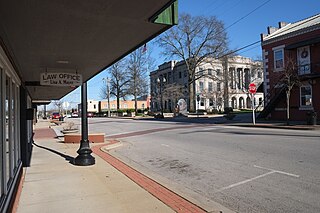
The facade of the historic 4th Street theater in downtown Moberly. Built in 1913; is the oldest vaudeville theatre in Mid-Missouri.
Moberly was founded in 1866, and named after Colonel William E. Moberly,[7] the first president of the Chariton and Randolph County railroads.
Moberly, which gained the nickname the "Magic City" because of its explosive growth in a railroad boom, grew from the town platted by the North Missouri Railroad (later part of the Wabash Railroad) in 1866 to a transportation center with a 6,070 population by 1880. The North Mo. acquired the site when it took over the Chariton and Randolph R.R. after the Civil War. In 1860, the C.& R. had planned a road west to Brunswick from this point on the North Mo. then reaching toward Iowa.
The Chariton and Randolph R. R. named its proposed junction for William Moberly, head of the railroad, and offered free land to residents of once nearby Allen to settle here. Patrick Lynch, who alone accepted, was given two lots by the North Missouri after the Civil War for holding the site without "the loss of a life or a house."
Moberly has been a division point since 1867 when the North Mo. (Wabash) reached Brunswick. Huge railroad repair shops, one of the earliest railroad plants west of the Mississippi, were opened, 1872. The M. K. & T. formed a junction here, 1873. Transportation facilities brought industrial growth and the development of the soil, fire clay, and coal resources of the area.
Moberly lies in a glacial plains area in a county organized, 1829, and names for John Randolph of Roanoke, Va. In Missouri's Little Dixie Region, it was first settled by William Holman, 1818. William Fort boiled salt at a spring near Huntsville in 1820s/ The Bee Trace, a pioneer trail, ran along the Grand Divide (the high point in The Grand Prairie) between the Missouri and Mississippi through the county. The Iowa, Sac, and Fox tribes gave up claims to the region, 1824.
At Huntsville, county seat, since 1831, a plank road was built to Glasgow, 1854, and the 1855-82 Mt. Pleasant (Baptist) College was founded. County legal business has been conducted at Huntsville and Moberly since 1885. Moberly Junior College opened, 1927.
World War II Gen. Omar N. Bradley, first Chairman Joint Chiefs of Staff and commander of the largest Army in United States history was born in nearby Clark, but grew up in Moberly and graduated from Moberly High School. Moberly's airport is named for him. Moberly is the home of novelist Elizabeth Seifert Gasparotti and birthplace of writer Jack Conroy. G.W. P. Hunt, first Governor of Arizona, was born in Huntsville. Hancock L. Jackson, interim Gov. of Mo., 1857; Lt. Gov., 1857–61, and the biochemist Victor C. Vaughn, were natives of Randolph County.
The Missouri state Moberly Correctional Center was constructed two miles south of Moberly in 1963 as a minimum-security prison. As of 2014, it houses about 1800 minimum and medium security inmates.[8]
On Independence Day, 1995, a tornado ripped through downtown Moberly. There were no reported deaths, but there was a large amount of structural damage. Another tornado hit nearby Renick on March 12, 2006. Four people were killed and thirteen were injured in the F3-level tornado. Dozens of homes were destroyed.
The World War II-era US Navy frigate USSMoberly(PF-63) was named for the town. The ship participated mostly in convoy escort, earning a battle star for her assistance in sinking a German submarine, U-853.
The city of Moberly was born of a railroad auction on September 27, 1866. The county incorporated the town in 1868 with a board of trustees. The same year that the Wabash Railroad, St. Louis & Pacific Railway shops were finished in Moberly,[11][12] the city entered a charter into state record and incorporated.[13] At the time, there was no such thing as a council-manager government, but the 1950s saw the government form come into vogue in Missouri.[2]Now, the city of Moberly has a council-manager government. The council consists of five members elected for three-year terms and one city counselor who drafts ordinances and acts as legal counsel. Each year, the council elects one of its members as mayor and one as mayor pro tempore to serve for one year. To manage the city and oversee day-to-day operations, the council selects a city manager.[3] In 2015, the government had these officers:
City Council
Brandon L. Lucas, Mayor
John W. Kimmons, Jr., Mayor Pro-Tempore
Austin Kyser, Councilman
Chuck McKeown, Councilman
Sarah Barfield Graff, Councilman
Randall Thompson, City Counselor
Michael R. Bugalski, City Manager
A panorama from the northeast corner of the Kwix-Kres-Kirk office building in downtown Moberly, Missouri.
According to the United States Census Bureau, the city has an area of 12.26 square miles (31.75km2), of which 12.22 square miles (31.65km2) is land and 0.04 square miles (0.10km2) is water.[15]
Climate
Climate data for Moberly, Missouri (1991–2020 normals, extremes 1936–present)
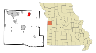
The Moberly Micropolitan Statistical Area consists of Randolph County.
2020 census
The 2020 United States census[21] counted 13,783 people, 4,708 households, and 2,968 families in Moberly. The population density was 1,045.8 per square mile (403.8/km2). There were 5,603 housing units at an average density of 425.1 per square mile (164.2/km2). The racial makeup was 82.39% (11,356) white, 9.13% (1,258) black or African-American, 0.52% (71) Native American, 0.49% (67) Asian, 0.04% (6) Pacific Islander, 0.76% (105) from other races, and 6.67% (920) from two or more races. Hispanic or Latino of any race was 2.1% (287) of the population.
Of the 4,708 households, 30.6% had children under the age of 18; 36.4% were married couples living together; 39.4% had a female householder with no husband present. Of all households, 32.8% consisted of individuals and 15.1% had someone living alone who was 65 years of age or older. The average household size was 2.5 and the average family size was 3.1.
23.0% of the population was under the age of 18, 8.9% from 18 to 24, 29.6% from 25 to 44, 23.4% from 45 to 64, and 14.6% who were 65 years of age or older. The median age was 36.4 years. For every 100 females, the population had 114.4 males. For every 100 females ages 18 and older, there were 115.9 males.
The 2016-2020 5-year American Community Survey[22] estimates show that the median household income was $39,327 (with a margin of error of +/- $3,442) and the median family income was $50,714 (+/- $7,271). Males had a median income of $31,651 (+/- $3,623) versus $25,865 (+/- $4,420) for females. The median income for those above 16 years old was $28,497 (+/- $4,084). Approximately, 18.3% of families and 21.2% of the population were below the poverty line, including 33.7% of those under the age of 18 and 8.1% of those ages 65 or over.
2010 census
As of the census[23] of 2010, there were 13,974 people, 4,960 households, and 3,019 families residing in the city. The population density was 1,143.5 inhabitants per square mile (441.5/km2). There were 5,687 housing units at an average density of 465.4 per square mile (179.7/km2). The racial makeup of the city was 86.4% White, 9.7% African American, 0.4% Native American, 0.6% Asian, 0.3% from other races, and 2.6% from two or more races. Hispanic or Latino of any race were 2.1% of the population.
There were 4,960 households, of which 32.5% had children under the age of 18 living with them, 40.1% were married couples living together, 15.9% had a female householder with no husband present, 4.8% had a male householder with no wife present, and 39.1% were non-families. 33.4% of all households were made up of individuals, and 14.1% had someone living alone who was 65 years of age or older. The average household size was 2.35 and the average family size was 2.97.
The median age in the city was 35.7 years. 22% of residents were under the age of 18; 10.9% were between the ages of 18 and 24; 29.7% were from 25 to 44; 23.5% were from 45 to 64; and 13.9% were 65 years of age or older. The gender makeup of the city was 53.8% male and 46.2% female.
2000 census
As of the census[5] of 2000, there were 11,945 people, 5,001 households, and 3,090 families residing in the city. The population density was 1,033.8 inhabitants per square mile (399.2/km2). There were 5,812 housing units at an average density of 503.0 per square mile (194.2/km2). The racial makeup of the city was 90.51% White, 6.71% African American, 0.37% Native American, 0.64% Asian, 0.03% Pacific Islander, 0.39% from other races, and 1.34% from two or more races. Hispanic or Latino of any race were 1.67% of the population.
There were 5,001 households, out of which 29.3% had children under the age of 18 living with them, 44.2% were married couples living together, 13.6% had a female householder with no husband present, and 38.2% were non-families. 33.2% of all households were made up of individuals, and 16.1% had someone living alone who was 65 years of age or older. The average household size was 2.30 and the average family size was 2.89.
In the city, the population was spread out, with 24.8% under the age of 18, 11.1% from 18 to 24, 25.4% from 25 to 44, 20.1% from 45 to 64, and 18.7% who were 65 years of age or older. The median age was 36 years. For every 100 females, there were 86.6 males. For every 100 females age 18 and over, there were 80.8 males.
The median income for a household in the city was $28,519, and the median income for a family was $37,488. Males had a median income of $27,152 versus $19,508 for females. The per capita income for the city was $15,478. About 11.1% of families and 15.0% of the population were below the poverty line, including 20.5% of those under age 18 and 14.7% of those age 65 or over.
Recreation
The Railroad museum run by the Randolph county historical society, connected to a walking path that runs south, and overlooking the Municipal Auditorium and West Rollins Street.
Moberly Parks and Recreation operates approximately 500 acres of parkland through five parks including maintained grounds, forest, lakes, the Howard Hils Athletic Complex consisting of eight baseball/softball fields and three football/soccer fields, the Moberly Aquatic Center, Thompson Campground, The Lodge, Municipal Auditorium, the Magic City Line - a one mile long miniature train track, over two miles of paved trails, boat ramps, fishing lakes, paddleboat/canoe rentals, and shelters.[24]
Moberly Midget League has provided a summer baseball program for the local youth since 1950. The program currently ranges from 8U to 14U.
The Moberly Optimist Club has provided a summer youth baseball for decades. The program currently ranges from T-ball to 8U.[25]
The Randolph County Historical Society has its headquarters in Moberly, and has two museums: one dedicated to county history and genealogy, and another dedicated to the Wabash, MKT, and CB&Q railroads.[26]
Education
Moberly is home to two colleges; Central Christian College of the Bible and Moberly Area Community College. The Moberly School District consists of seven schools. The Early Childhood Center serves preschoolers; North and South Park Elementary serve grades K-2; grades 3-5 attend Gratz Brown Elementary; grades 6-8 attend Moberly Middle School; and Moberly High School and Moberly Area Technical Center serve grades 9–12. East Park School served as an alternative school until the new ACES (alternative center for educational success) was opened in the second part of the 2023-2024 school year.[27] The Seventh-day Adventist church operates Maranatha Adventist School, a K-8 school.[28] The St. Pius X Catholic Elementary School, operated by the Catholic Church of the same name, serves grade K-8.[29]
Moberly has a public library, a branch of the Little Dixie Regional Libraries.[30]
Transportation
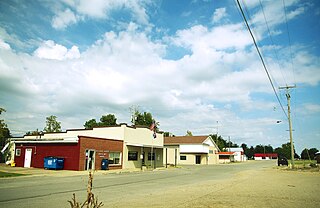
West Reed Street, facing East from the United States post office building.
The city is served by U.S. Route 63 to the east on a bypass. The old route is designated as both Business 63 and Morley Street and goes through town. U.S. Route 24 goes through town as well. Route M (formerly Route 3) also skirts the edge of town. Other routes include Route DD (indirectly goes to Sugar Creek Lake), EE, A, and AA (past the prison). At one time there was a Business 24 that ran from Morley Street via West Coates Street to Johnson Street to Concannon Street turning North on Holman St to current U.S. 24. This route was de-numbered in the late 1960s. State Route 22 was also multiplexed with U.S. 63 to U.S. 24. When U.S. 63 was re-routed in the mid-1960s Highway 22 was truncated to its current end at U.S. 63 near Sturgeon, MO.
Moberly is home to one of Norfolk Southern's many rail yards. Norfolk Southern used to have a line that ran north from Moberly to Albia, Iowa, but it was abandoned in the spring of 1992. The line was reopened from 1993–1995 to help in recovery efforts after the great Flood of 1993. By 1997, the line was dismantled between Moberly and Moulton, Iowa.
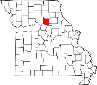
Randolph County is a county in the northern portion of the U.S. state of Missouri. As of the 2020 census, the population was 24,716. Its county seat is Huntsville. The county was organized January 22, 1829, and named for U.S. Representative and U.S. Senator John Randolph of Roanoke, Virginia.
Kirksville is the county seat and most populous city in Adair County, Missouri. Located in Benton Township, its population was 17,530 at the 2020 census. Kirksville is home to three colleges: Truman State University, Moberly Area Community College, and A.T. Still University.
Mexico, formerly known as New Mexico, is a city in and the county seat of Audrain County, Missouri. It is home to the Missouri Military Academy and annually hosts the Miss Missouri Pageant. The city's population was 11,469 at the 2020 census. The micropolitan statistical area consists of Audrain County. It is a part of the Columbia, Missouri metropolitan area.
Marble Hill is a fourth-class city in central Bollinger County in Southeast Missouri, United States. Located at the intersection of State Highways 34 and 51, it is the largest city in Bollinger and serves as the county seat. The population was 1,388 at the 2020 census. The city was officially organized in July 1851 and is named after a marble-like rock.
Pleasant Hill is a city in Cass and Jackson counties, Missouri, United States. The population was 8,777 at the 2020 census. It is part of the Kansas City metropolitan area.
Randolph is a city in Clay County, Missouri, United States. The population was 57 at the 2020 census. It is completely surrounded by Kansas City and is a part of the Kansas City metropolitan area.
Union is a city in and the county seat of Franklin County, Missouri, United States. It is located on the Bourbeuse River, 50 miles (80 km) southwest of St. Louis. The population was 12,348 at the 2020 census.
Republic is a city in Christian and Greene counties in the U.S. state of Missouri. As of the 2020 census, the city's population was 18,750. In 2019, its population was 16,938, making it the second largest city in Greene County in the U.S. state of Missouri. It is also the fourth largest city in the Springfield, Missouri, Metropolitan Statistical Area.
Bucklin is a city in southeast Linn County, Missouri, United States. The population was 413 at the 2020 census.
Risco is a city in New Madrid County, Missouri, United States. The population was 286 at the 2020 census.
Skidmore is a city in western Nodaway County, Missouri, United States. The population was 245 at the 2020 Census. The small farming community is known for the unsolved extrajudicial killing of Ken Rex McElroy. Skidmore also has a yearly "Punkin' Show."
Gainesville is a city in Ozark County, Missouri, United States. The population was 745 at the 2020 census. It is the county seat of Ozark County.
Newburg is a city in Phelps County, Missouri, United States. The population was 470 at the 2010 census.
Higbee is a city in southern Randolph County, Missouri, United States. The population was 568 at the 2010 census. Barrel-making company A&K Cooperage, Barrel 53 Cooperage and Woodsmen Distilling are based in Higbee.
Huntsville is a city in Randolph County, Missouri, United States. The population was 1,376 at the 2020 census. It is the county seat of Randolph County.
Renick is a village in Randolph County, Missouri, United States. The population was 172 at the 2010 census.
Shelbina is a city in southern Shelby County, Missouri, United States. The population was 1,613 at the 2020 census.
Randolph is a city in Cedar County, Nebraska, United States. The population was 881 at the 2020 census. It refers to itself as "The Honey Capital of the Nation" due to the per-capita number of bee keeping families.
Osborn is a city in northern Clinton and southern DeKalb counties in the U.S. state of Missouri. The population was 374 at the 2020 census.
Monroe City is a city in Marion, Monroe, and Ralls counties in the U.S. state of Missouri. The population was 2,652 at the 2020 census.
↑ "Station: Moberly, MO". U.S. Climate Normals 2020: U.S. Monthly Climate Normals (1991-2020). National Oceanic and Atmospheric Administration. Retrieved August 2, 2021.
This page is based on this Wikipedia article Text is available under the CC BY-SA 4.0 license; additional terms may apply. Images, videos and audio are available under their respective licenses.