Jefferson City, Missouri

Last updated

Jefferson City
Jefferson City.jpg
Flag of Jefferson City, Missouri.svg
Seal of Jefferson City Missouri.png
Nickname: 
Jeff City [1]
Motto: 
Jefferson City
Cole County Missouri Incorporated and Unincorporated areas Jefferson City Highlighted.svg
Jefferson-city-map.gif
U.S. Census Map
USA Missouri relief location map.svg
Red pog.svg
Jefferson City
Location within Missouri
Usa edcp relief location map.png
Red pog.svg
Jefferson City
Location within the United States
Coordinates: 38°34′04″N92°10′33″W / 38.56778°N 92.17583°W / 38.56778; -92.17583
Country Flag of United States.svg United States
State Flag of Missouri.svg Missouri
Counties
Founded1821
Incorporated1825
Named for Thomas Jefferson
Government
  Type Mayor–council
   Mayor Ron Fitzwater
  AdministratorBrian Crane
Area
[4]
   State capital 37.65 sq mi (97.51 km2)
  Land36.05 sq mi (93.38 km2)
  Water1.60 sq mi (4.13 km2)
Elevation
[5]
630 ft (192 m)
Population
 (2020)
   State capital 43,228
  Density1,198.98/sq mi (462.93/km2)
   Metro
149,807
Time zone UTC−6 (CST)
  Summer (DST) UTC−5 (CDT)
ZIP codes
65101-65111
Area code 573
FIPS code 29-37000 [6]
GNIS ID 758233 [5]
U.S. Routes US 50.svg US 54.svg US 63.svg
State highways MO-94.svg MO-179.svg
Waterways Missouri River
Public transit JeffTran
Website jeffersoncitymo.gov

Jefferson City, informally Jeff City, [1] is the capital of the U.S. state of Missouri. It had a population of 43,228 at the 2020 census, [7] ranking as the 15th most populous city in the state. [8] It is also the county seat of Cole County and the principal city of the Jefferson City Metropolitan Statistical Area, the second-most-populous metropolitan area in Mid-Missouri and the fifth-largest in the state. Most of the city is in Cole County, with a small northern section extending into Callaway County. Jefferson City is named for Thomas Jefferson, the third President of the United States.

Contents

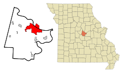
Jefferson City is located on the northern edge of the Ozark Plateau on the southern side of the Missouri River in a region known as Mid-Missouri, that is roughly mid-way between the state's two large urban areas of Kansas City and St. Louis. It is 29 miles (47 km) south of Columbia, Missouri, and sits at the western edge of the Missouri Rhineland, one of the major wine-producing regions of the Midwest. The city is dominated by the domed Capitol, which rises from a bluff overlooking the Missouri River to the north; Lewis and Clark passed the bluff on their historic expedition upriver before Europeans established any settlement there.

Many of Jefferson City's primary employers are in service and manufacturing industries. Jefferson City is also home to Lincoln University, a public historically black land-grant university founded in 1866 by the 62nd Regiment of U.S. Colored Troops with support from the 65th Regiment of U.S. Colored Troops.

History

Sketch of Jefferson City from the 1860s Jefferson City 1860s.PNG
Sketch of Jefferson City from the 1860s
Missouri State Penitentiary Missouri State Penitentiary, Jefferson City.jpg
Missouri State Penitentiary
Parade on "New Capitol Day", October 6, 1924, to celebrate the dedication of the newly constructed Missouri State Capitol Jefferson City, Missouri (1924).jpg
Parade on "New Capitol Day", October 6, 1924, to celebrate the dedication of the newly constructed Missouri State Capitol
Photograph of Jefferson City and its geography from the International Space Station Jefferson City Missouri.jpg
Photograph of Jefferson City and its geography from the International Space Station

In pre-Columbian times, this region was home of an ancient people known only as the "Mound Builders", being replaced by Osage Native Americans. In the late 17th century, frontiersmen started to inhabit the area, including Antoine de la Mothe Cadillac, Louis Jolliet, Jacques Marquette, Robert de LaSalle, and Daniel Boone, with the latter having the greatest influence on the region. Daniel Boone's son, Daniel Morgan Boone, would later lay out Jefferson City in the early 19th century.

When the Missouri Territory was organized in 1812, St. Louis was Missouri's seat of government, and St. Charles would serve as the next capital. However, Jefferson City was chosen as the new capital in 1821. The village first was called "Lohman's Landing", and when the legislature decided to relocate there, they proposed the name "Missouriopolis" before settling on the city of "Jefferson" to honor Thomas Jefferson. [10] [11] Over the years, the city was most often referred to as "Jefferson City" and the name stuck. For years, this village was little more than a trading post located in the wilderness about midway between St. Louis and Kansas City. In 1825, the settlement was incorporated as a city and a year later, the Missouri legislature first met in Jefferson City.

Jefferson City was chosen as the site of a state prison. This prison, named the Missouri State Penitentiary, opened in 1836. This prison was home to multiple infamous Americans, including former heavyweight champion Sonny Liston, assassin James Earl Ray, and bank robber Pretty Boy Floyd.

During the Civil War, Jefferson City was occupied by Union troops and the elected state legislature was driven from Jefferson City by Union General Nathaniel Lyon. Some of the legislators later reconvened in Neosho and passed an ordinance of secession. Missouri was claimed by both the Confederacy and the Union, as was neighboring state Kentucky. Missourians were strongly divided and many people in the state—especially in St. Louis—supported the Union, while other areas (such as Missouri's Little Dixie) were strongly pro-Confederate along the Missouri River between Jefferson City and Kansas City.

German immigrants created vineyards in small towns on either side of the Missouri River, especially on the north from the city east to Marthasville, located outside of St. Louis. Known as the "Missouri Rhineland" for its vineyards and first established by German immigrants in the mid-1800s, this region has become part of Missouri's agricultural and tourist economy.

2019 tornado

Approximately 15 minutes before midnight on May 22, 2019, a tornado emergency was issued for the Jefferson City area. Minutes later, a destructive EF-3 [12] tornado caused extensive damage on the southwest side of the city. [13] [14] At least 20 people were injured, but none was killed due to this tornado. [15]

Geography

According to the United States Census Bureau, the city has a total area of 37.58 square miles (97.33 km2), of which 35.95 square miles (93.11 km2) is land and 1.63 square miles (4.22 km2) is water. [16]

Climate

Jefferson City has a humid continental climate (Dfa) with hot, rainy summers and cold winters. The city borders on having a humid subtropical climate but falls just short due to January having a mean temperature of 30 °F (−1 °C) which is below the 32 °F (0 °C) isotherm. Thunderstorms are common in both the spring and summer. Light snow is common during the winter, although about half of wintertime precipitation falls as rain. [17]

Climate data for Jefferson City WTP, Missouri (1991–2020 normals, extremes 1894–present)
MonthJanFebMarAprMayJunJulAugSepOctNovDecYear
Record high °F (°C)79
(26)
89
(32)
97
(36)
96
(36)
102
(39)
107
(42)
114
(46)
111
(44)
107
(42)
96
(36)
88
(31)
79
(26)
114
(46)
Mean daily maximum °F (°C)39.6
(4.2)
45.1
(7.3)
55.5
(13.1)
66.6
(19.2)
75.2
(24.0)
83.9
(28.8)
88.0
(31.1)
87.2
(30.7)
79.9
(26.6)
68.5
(20.3)
55.1
(12.8)
44.0
(6.7)
65.7
(18.7)
Daily mean °F (°C)30.3
(−0.9)
34.9
(1.6)
44.6
(7.0)
55.2
(12.9)
64.9
(18.3)
74.1
(23.4)
78.3
(25.7)
76.9
(24.9)
69.0
(20.6)
57.2
(14.0)
45.0
(7.2)
34.9
(1.6)
55.4
(13.0)
Mean daily minimum °F (°C)21.0
(−6.1)
24.7
(−4.1)
33.7
(0.9)
43.8
(6.6)
54.6
(12.6)
64.3
(17.9)
68.6
(20.3)
66.6
(19.2)
58.1
(14.5)
45.8
(7.7)
34.8
(1.6)
25.7
(−3.5)
45.1
(7.3)
Record low °F (°C)−23
(−31)
−25
(−32)
−16
(−27)
13
(−11)
24
(−4)
38
(3)
42
(6)
41
(5)
29
(−2)
14
(−10)
1
(−17)
−24
(−31)
−25
(−32)
Average precipitation inches (mm)2.21
(56)
2.30
(58)
3.24
(82)
4.78
(121)
5.17
(131)
4.20
(107)
4.35
(110)
4.13
(105)
4.24
(108)
3.44
(87)
3.24
(82)
2.30
(58)
43.60
(1,107)
Average snowfall inches (cm)2.9
(7.4)
2.9
(7.4)
0.4
(1.0)
0.0
(0.0)
0.0
(0.0)
0.0
(0.0)
0.0
(0.0)
0.0
(0.0)
0.0
(0.0)
0.0
(0.0)
0.2
(0.51)
2.5
(6.4)
8.9
(23)
Average precipitation days (≥ 0.01 in)7.97.511.011.512.29.78.58.17.89.48.58.1110.2
Average snowy days (≥ 0.1 in)1.91.10.40.00.00.00.00.00.00.00.31.45.1
Source: NOAA [18] [19]

Demographics

Historical population
CensusPop.Note
1860 3,082
1870 4,42043.4%
1880 5,27119.3%
1890 6,74227.9%
1900 9,66443.3%
1910 11,85022.6%
1920 14,49022.3%
1930 21,59649.0%
1940 24,26812.4%
1950 25,0993.4%
1960 28,22812.5%
1970 32,40714.8%
1980 33,6193.7%
1990 35,4815.5%
2000 39,63611.7%
2010 43,0798.7%
2020 43,2280.3%
U.S. Decennial Census

2020 census

The 2020 United States census [20] counted 43,228 people, 16,882 households, and 9,327 families in Jefferson City. The population density was 1,199.1 per square mile (462.9/km2). There were 18,942 housing units at an average density of 525.4 per square mile (202.8/km2). The racial makeup was 74.33% (32,130) white, 15.83% (6,841) black or African-American, 0.3% (131) Native American, 1.82% (786) Asian, 0.1% (43) Pacific Islander, 1.31% (566) from other races, and 6.32% (2,731) from two or more races. Hispanic or Latino of any race was 3.6% (1,523) of the population.

Of the 16,882 households, 25.7% had children under the age of 18; 40.2% were married couples living together; 34.4% had a female householder with no husband present. Of all households, 39.6% consisted of individuals and 15.8% had someone living alone who was 65 years of age or older. The average household size was 2.2 and the average family size was 3.0.

20.0% of the population was under the age of 18, 10.0% from 18 to 24, 28.3% from 25 to 44, 25.0% from 45 to 64, and 15.3% who were 65 years of age or older. The median age was 38.0 years. For every 100 females, the population had 106.2 males. For every 100 females ages 18 and older, there were 110.9 males.

The 2016-2020 5-year American Community Survey [21] estimates show that the median household income was $54,003 (with a margin of error of +/- $2,176) and the median family income was $75,490 (+/- $7,940). Males had a median income of $35,561 (+/- $4,299) versus $31,226 (+/- $1,953) for females. The median income for those above 16 years old was $32,642 (+/- $2,031). Approximately, 8.8% of families and 11.9% of the population were below the poverty line, including 17.8% of those under the age of 18 and 6.9% of those ages 65 or over.

2010 census

At the 2010 census, there were 43,079 people in 17,278 households, including 9,969 families, in the city. The population density was 1,198.3 inhabitants per square mile (462.7/km2). There were 18,852 housing units at an average density of 524.4 per square mile (202.5/km2). The racial makeup of the city was 78.0% White, 16.9% African American, 0.3% Native American, 1.8% Asian, 0.1% Pacific Islander, 0.8% from other races, and 2.2% from two or more races. Hispanic or Latino people of any race were 2.6%. [6]

Of the 17,278 households 28.8% had children under the age of 18 living with them, 41.6% were married couples living together, 12.4% had a female householder with no husband present, 3.7% had a male householder with no wife present, and 42.3% were non-families. 36.2% of households were one person and 11.5% were one person aged 65 or older. The average household size was 2.21 and the average family size was 2.89.

The age distribution was 20.9% of residents under the age of 18, 10.3% between the ages of 18 and 24, 28.6% from 25 to 44, 26.8% from 45 to 64, and 13.4% 65 or older. The median age was 37.5 years. The gender makeup of the city was 51.2% male and 48.8% female.

2000 census

At the 2000 census, there were 39,636 people in 15,794 households, including 9,207 families, in the city. The population density was 1,454.4 inhabitants per square mile (561.5/km2). There were 16,987 housing units at an average density of 623.3 per square mile (240.7/km2). The racial makeup of the city was 81.5% White, 14.7% Black or African American, 0.4% Native American, 1.2% Asian, 0.1% Pacific Islander, 0.6% from other races, and 1.5% from two or more races. 1.6% of the population were Hispanic or Latino of any race. [6] Of the 15,794 households 27.9% had children under the age of 18 living with them, 44.4% were married couples living together, 10.8% had a female householder with no husband present, and 41.7% were non-families. 36.1% of households were one person and 11.9% were one person aged 65 or older. The average household size was 2.21 and the average family size was 2.90.

The age distribution was 20.9% under the age of 18, 11.0% from 18 to 24, 32.1% from 25 to 44, 22.0% from 45 to 64, and 14.0% 65 or older. The median age was 36 years. For every 100 females, there were 105.3 males. For every 100 females age 18 and over, there were 106.6 males.

The median household income was $39,628 and the median family income was $52,627. Males had a median income of $35,050 versus $25,521 for females. The per capita income for the city was $21,268. About 7.3% of families and 11.5% of the population were below the poverty line, including 17.1% of those under age 18 and 7.1% of those age 65 or over.

Economy

Jefferson City's top employers (2016) [22]
RankEmployers# of employees
1 State of Missouri 14,223
2 Capital Region Medical Center 1,573
3 Scholastic 1,500
4 Jefferson City Public Schools 1,489
5 SSM Health-St. Mary's Hospital 1,154
6Central Bancompany967
7 ABB Power T&D Company 775
8Jefferson City Medical Group633
9 Wal-Mart Supercenter 622
10 Unilever 510
No change reported in 2017

Jefferson City's economy is driven by its residents, citizens of surrounding communities, and tourists.

Business

Jefferson City's economy relies on government, health care, manufacturing, retail, education, and tourism. In 2016, Jefferson City's gross metropolitan product was $7.366 billion [23] and Missouri's real total gross domestic product was $260.309 billion, [24] making Jefferson City's economy 2.829% of the total gross state product of Missouri.

Central Bancompany, Hawthorn Bancshares, Capital Region Medical Center, and Arris Pizza all have their headquarters in Jefferson City. Jefferson City is also home to Central Dairy, whose products are shipped statewide.

Tourism

Tourists are drawn to the Missouri State Capitol, St. Peter Church (adjacent to the capitol), Missouri State Penitentiary, Missouri Governor's Mansion, and Missouri State Museum. Lincoln University, ranked by U.S. News & World Report in 2007 as a top educational institution for international students, also helps draw students and tourists from other states and countries.

Government

The John G. Christy Municipal Building houses the city hall. John G. Christy Municipal Building - Jefferson City, Missouri.jpg
The John G. Christy Municipal Building houses the city hall.

State government

The Harry S Truman office building houses government workers for various state departments and agencies. Missouri Department of Revenue building in Jefferson City, MO.jpg
The Harry S Truman office building houses government workers for various state departments and agencies.
The Missouri State Capitol in Jefferson City Missouri state capitol.jpg
The Missouri State Capitol in Jefferson City

The State Capitol is located in Jefferson City. In addition, state agencies are headquartered in Jefferson City. The Missouri State Archives is located in Jefferson City.

The Missouri Department of Corrections (MDOC) operates the Jefferson City Correctional Center (JCCC) and the Algoa Correctional Center (ACC) in Jefferson City. [25] [26] JCCC replaced the Missouri State Penitentiary on September 15, 2004, which until its closure was the oldest operating penal facility west of the Mississippi River. It served as the State of Missouri's primary maximum security institution, [27] and it housed male death row prisoners until April 1989, when they were moved to the Potosi Correctional Center. [27]

Federal government

The United States Postal Service operates several postal facilities. The Jefferson City Main Post Office building [28] previously shared occupancy with the U.S. District Court from its dedication in November 1934 until September 27, 2011 when it moved into the Christopher S. Bond Court House.

The 118,000-square-foot courthouse is named for the former Governor and United States Senator from Missouri. The courthouse, which is occupied by the Central Division of the United States District Court for the Western District of Missouri and under the appellate jurisdiction of the United States Court of Appeals for the Eighth Circuit, was designed to achieve the U.S. Green Building Council's LEED Gold rating. Sustainable design features include reducing water use by 44 percent, using 13 percent recycled content, diverting 80 percent of construction waste materials from landfills, and it is 36 percent more efficient than current energy standards. [29]

Education

Schools

Jefferson City Public School District currently operates Jefferson City High School and Capital City High School, two middle schools, Thomas Jefferson Middle School, and Lewis and Clark Middle School, and eleven elementary schools. In addition to public education, there are also five private elementary schools and three private high schools, including Helias High School and Calvary Lutheran High School in the city.

Colleges and universities

Lincoln University is a public historically black university with open enrollment and certificate, associate, bachelor, and graduate programs.

Columbia College, William Woods University, Metro Business College, and Merrell University also have campuses in the city with varying degree levels and options.

The University of Missouri, the state's flagship university, is 30 miles to the north in Columbia.

Public library

Jefferson City has a public library, the Missouri River Regional Library. [30]

Media

Print

The major daily English-language newspaper in the area is the Jefferson City News Tribune . Several monthly magazines cover Jefferson City and/or the surrounding areas: Jefferson City Magazine, Her Magazine, Capital Lifestyles, and Professional Day.

Television

Jefferson City, along with Columbia, is part of the Mid-Missouri television market. KRCG, the region's CBS affiliate, and KFDR, a station owned by the Christian Television Network (CTN), are both licensed to the city.

Radio

The following is a list of radio stations that broadcast from and/or are licensed to Jefferson City, Missouri.

Frequency Callsign NicknameFormatOwnerCity of LicenseWeb site
88.1 KHJR Covenant NetworkCatholicCovenant Network St. Thomas, MO
88.9 KJLU 88.9 KJLUJazz Lincoln University of Missouri Jefferson City, MO
89.9 KMCV Religion Bott Radio High Point, MO
90.3 KNLG Here's Help NetworkReligionNew Life Evangelistic Center New Bloomfield, MO Archived April 14, 2022, at the Wayback Machine
94.3 KATI KAT Country 94.3CountryZimmer Radio Group California, MO
97.1 K246CA Religion Bott Radio Jefferson City, MO
97.5 KJMO 97.5 KJMOClassic Hits Cumulus Media Linn, MO
98.7 KOTC 3ABNReligionJefferson City Seventh-Day Adventist Church Jefferson City, MO
100.1 KBBM 100.1 NASH FMCountry Cumulus Media Jefferson City, MO
103.5 K278CT News Talk 1240News/Talk Cumulus Media Jefferson City, MO
104.5 K283CL NewsRadio KWOSNews/TalkZimmer Radio Group Jefferson City, MO
104.9 K283CL Elevate FMContemporary Worship MusicLake Area Educational Broadcasting Foundation Jefferson City, MO
106.5 K293AX Spirit FMChristian ContemporaryLake Area Educational Broadcasting Foundation Jefferson City, MO
106.9 KTXY Y107Mainstream Top 40Zimmer Radio Group Jefferson City, MO
950 KWOS NewsRadio KWOSNews/TalkZimmer Radio Group Jefferson City, MO
1240 KLIK News Talk 1240News/Talk Cumulus Media Jefferson City, MO

Infrastructure

Transportation

Highways

Federal highways are U.S. Routes 50, 54, and 63. Missouri Routes 179 and 94 also run through the city. Jefferson City is one of the four state capitals that is not served by an Interstate highway (the others are Dover, Delaware; Juneau, Alaska; and Pierre, South Dakota). [31] However, Interstate 70 passes by the city 30 miles (48 km) to the north in Columbia.

Airports

The city is served by Columbia Regional Airport and nearby Jefferson City Memorial Airport. [32] [33]

Public transportation

Local transit

JeffTran, the city operated public transit system, provides year-round bus service during traditional weekday business hours, [34] but is currently considering the extension of service hours to include evenings and weekends. [35]

Intercity transit

The Jefferson City station, located in the former Union Hotel at Jefferson Landing State Historic Site, is one of the Missouri River Runner train stops between Kansas City and St. Louis, provided by Amtrak, the sole intercity passenger railroad service in the United States.

A Greyhound bus stop near the Eastland Drive Convenient Food Mart [36] also provides intercity transit. Jefferson City Memorial Airport, which is located in the Jefferson City limits of Callaway County, Missouri, serves general aviation but has no scheduled commercial airline service.

Healthcare

Jefferson City is home to SSM Health St. Mary's Hospital, which has 154 beds. Capital Region Medical Center, an affiliate of University of Missouri Health Care, is also located in the city.

Notable people

Sister city

Jefferson City is the sister city to the German city of Münchberg. [37] Around 200 years ago, settlers from Münchberg founded a neighborhood south of downtown Jefferson City, which is still known as "Old Munichburg".

See also

Related Research Articles

<span class="mw-page-title-main">Eureka, Missouri</span> A city in St. Louis County and Jefferson County, Missouri

Eureka is a city in St. Louis County and Jefferson County, Missouri, adjacent to Wildwood and Pacific. It is in the extreme southwest of the Greater St. Louis metro area. As of the 2020 census, the city had a population of 11,646. Since 1971, Eureka has been known as the home of the amusement park Six Flags St. Louis.

<span class="mw-page-title-main">Pierre, South Dakota</span> Capital city of South Dakota, United States

Pierre is the capital city of the U.S. state of South Dakota and the seat of Hughes County. The population was 14,091 at the 2020 census, making it the 2nd least populous US state capital after Montpelier, Vermont. It is South Dakota's 9th most populous city. Founded in 1880 on the Missouri River near the center of South Dakota, it was selected as the state capital when the territory was admitted as a state. Pierre is the principal city of the Pierre Micropolitan Statistical Area, which includes all of Hughes and Stanley counties.

<span class="mw-page-title-main">Cole County, Missouri</span> County in Missouri, United States

Cole County is located in the central part of the U.S. state of Missouri. As of the 2020 census, its population was 77,279. Its county seat and largest city is Jefferson City, the state capital. The county was organized November 16, 1820 and named after pioneer William Temple Cole who built Cole's Fort in Boonville.

<span class="mw-page-title-main">Columbia, Illinois</span> City in Illinois, United States

Columbia is a city mainly in Monroe County with a small portion in St. Clair County in the U.S. state of Illinois, about 12 miles (19 km) south of St. Louis, Missouri. The population was 10,999 at the 2020 census.

<span class="mw-page-title-main">Boonville, Missouri</span> City in Missouri, United States

Boonville is a city and the county seat of Cooper County, Missouri, United States. The population was 7,964 at the 2020 census. The city was the site of a skirmish early in the Civil War, on July 17, 1861. Union forces defeated the Missouri State Guard in the first Battle of Boonville. It is part of the Columbia, Missouri metropolitan area.

<span class="mw-page-title-main">Cedar Hill, Missouri</span> Census-designated place in Missouri, United States

Cedar Hill is an unincorporated community and census-designated place (CDP) in northwest Jefferson County, Missouri, United States. The population was 1,721 at the 2010 census.

<span class="mw-page-title-main">High Ridge, Missouri</span> Census-designated place in Missouri, United States

High Ridge is an unincorporated community and census-designated place (CDP) in Jefferson County, Missouri, United States. The population was 4,305 at the 2010 census. At 927 feet (283 m) above sea level, High Ridge is the second-highest point in Jefferson County, second only to Sun Ridge, north of Hillsboro, according to data from the House Springs/Hillsboro 7.5 minute topographic quadrangles. The Beaumont Scout Reservation, a property of the Greater St. Louis Area Council, Boy Scouts of America, is 4 miles (6 km) north of High Ridge.

<span class="mw-page-title-main">Murphy, Missouri</span> Census-designated place in Missouri, United States

Murphy is a census-designated place (CDP) in Jefferson County, Missouri, United States. The population was 8,690 at the 2010 census, down from 9,048 in 2000.

<span class="mw-page-title-main">Eldon, Missouri</span> City in the state of Missouri

Eldon is a city in Miller County, Missouri, United States, located 30 miles (48 km) southwest of Jefferson City. The population was 4,416 as of the 2020 census.

<span class="mw-page-title-main">Farmington, Missouri</span> City in Missouri, United States

Farmington is a city in St. Francois County located about 75 miles (121 km) southwest of St. Louis in the Lead Belt region in Missouri. As of the 2020 census, the population was 18,217. It is the county seat of St. Francois County. Farmington was established in 1822 as Murphy's Settlement, named for William Murphy of Kentucky, who first visited the site in 1798. When St. Francois County was organized, the town was briefly called St. Francois Court House and later renamed to Farmington.

<span class="mw-page-title-main">Florissant, Missouri</span> City in Missouri, United States

Florissant is a city in St. Louis County, Missouri, within Greater St. Louis. It is a middle-class, second-ring northern suburb of St. Louis. Based on the 2020 United States census, the city had a total population of 52,533.

<span class="mw-page-title-main">Dexter, Missouri</span> City in Missouri, United States

Dexter is a city in Stoddard County, Missouri, United States, founded in 1873. The population was 7,864 at the 2010 census.

<span class="mw-page-title-main">Potosi, Missouri</span> City in Missouri, United States

Potosi is a city in Washington County, Missouri, United States. Potosi is seventy-two miles southwest of St. Louis. The population was 2,660 as of the 2010 census. It is the county seat of Washington County.

<span class="mw-page-title-main">Crystal City, Missouri</span> City in Missouri, United States

Crystal City is a city in eastern Jefferson County, Missouri, United States and is a suburb of St. Louis. The population was 4,855 at the 2010 census. It was 4,740 at the 2020 census.

<span class="mw-page-title-main">De Soto, Missouri</span> City in Missouri, United States

De Soto is a city in Jefferson County, Missouri, United States. The population was 6,449 at the 2020 census and the city is part of the St. Louis metropolitan area. The Van Metre family were first to settle in 1803. The town was organized in 1857 and is named for the explorer Hernando De Soto, who claimed the Louisiana Territory for Spain. De Soto was the city closest to the mean center of U.S. population in 1980. The city celebrated its Bicentennial in 2003. The city made national news on and after May 6, 2003, when straight-line winds and a tornado struck.

<span class="mw-page-title-main">Moberly, Missouri</span> City in Missouri, United States

Moberly is a city in Randolph County, Missouri, United States. The population was 13,783 as of the 2020 census. It is part of the Columbia metropolitan area.

<span class="mw-page-title-main">Chesterfield, Missouri</span> City in Missouri, United States

Chesterfield is a city in St. Louis County, Missouri, United States. It is a western suburb of St. Louis. As of the 2020 census, the population was 49,999, making it the state's 14th most populous city. The broader valley of Chesterfield was originally referred to as "Gumbo Flats", derived from its soil, which though very rich and silty, resembled gumbo when wet.

<span class="mw-page-title-main">Vandalia, Missouri</span> City in Missouri, United States

Vandalia is a city in northeastern Audrain and extending into southeastern Ralls Counties in the U.S. state of Missouri. The population was 3,553 at the 2020 census, which includes about 1,000 prisoners incarcerated at the prison located within the city limits.

<span class="mw-page-title-main">Osage Beach, Missouri</span> City in Missouri, United States

Osage Beach is a city in Camden and Miller counties in the U.S. state of Missouri, near the Lake of the Ozarks. Most of the city is in Camden County, while a small eastern sliver is in Miller County. The population was 4,792 at the 2020 census.

<span class="mw-page-title-main">Cameron, Missouri</span> City in Missouri, United States

Cameron is a city in Clinton, DeKalb and Caldwell counties in the U.S. state of Missouri. The population was 8,513 at the 2020 census.

References

  1. 1 2 "Capitol of Missouri – Jefferson City ***". www.spangledwithstars.com. Archived from the original on January 8, 2017. Retrieved June 9, 2017.
  2. "Contact the Mayor". Archived from the original on May 7, 2006. Retrieved September 19, 2010.{{cite web}}: CS1 maint: bot: original URL status unknown (link) City of Jefferson. Retrieved on May 21, 2010.
  3. "Jefferson City — Departments". Archived from the original on September 10, 2014. Retrieved June 9, 2017.
  4. "ArcGIS REST Services Directory". United States Census Bureau. Retrieved August 28, 2022.
  5. 1 2 "Geographic Names Information System". edits.nationalmap.gov. Retrieved May 8, 2023.
  6. 1 2 3 "U.S. Census website". United States Census Bureau . Retrieved July 8, 2012.
  7. "2020 U.S. Census". Census QuickFacts. April 1, 2020. Retrieved November 5, 2021.
  8. "Table 10. Rank by 2010 Population and Housing Units: 2000 and 2010" (PDF). US Census Bureau. Archived (PDF) from the original on October 21, 2016. Retrieved July 10, 2016.
  9. Moorman, Amy (2014). "Picture This" (PDF). The Missouri State Archives...Where History Begins. Missouri State Archives. Archived (PDF) from the original on December 24, 2016. Retrieved September 20, 2016.
  10. McMillen, Margot Ford & Murphy, Dennis. A to Z: The Dictionary of Missouri Place Names. Columbia, MO. Pebble Publishing, 1996. ISBN   0-9646625-4-X.
  11. "Cole County, Missouri Place Names, 1928-1945 | The State Historical Society of Missouri". shsmo.org. Archived from the original on April 4, 2019. Retrieved January 13, 2019.
  12. Louis, NWS St (May 23, 2019). "The updated preliminary damage survey in Jefferson City shows that so far the max rating for last night's tornado damage was EF-3. Numerous other damage points have rated EF-0 to EF-2. The damage survey is ongoing. #mowx #midmowxpic.twitter.com/BNoDmhkgCY". @NWSStLouis. Retrieved May 23, 2019.
  13. "Missouri's capital took a direct hit from a violent tornado that sent debris 13,000 feet into the air". CNN. May 23, 2019. Archived from the original on May 23, 2019.
  14. "Tornado hits Jefferson City, emergency crews responding". News Tribune. May 23, 2019. Archived from the original on May 23, 2019.
  15. Lieb, David. "3 deaths in Missouri as tornado strikes state capital". AP News. Retrieved December 1, 2020.
  16. "US Gazetteer files 2010". United States Census Bureau. Archived from the original on July 2, 2012. Retrieved July 8, 2012.
  17. "Average Weather in Jefferson City, Missouri, United States, Year Round – Weather Spark". weatherspark.com. Archived from the original on December 13, 2013. Retrieved June 9, 2017.
  18. "NowData – NOAA Online Weather Data". National Oceanic and Atmospheric Administration. Retrieved July 22, 2021.
  19. "Station: Jefferson City WTP, MO". U.S. Climate Normals 2020: U.S. Monthly Climate Normals (1991-2020). National Oceanic and Atmospheric Administration. Retrieved July 22, 2021.
  20. "Explore Census Data". data.census.gov. Retrieved December 17, 2023.
  21. "Explore Census Data". data.census.gov. Retrieved December 17, 2023.
  22. "2016 PAFR – Laserfiche WebLink". documents.jeffcitymo.org. Retrieved June 9, 2017.[ permanent dead link ]
  23. "Total Gross Domestic Product for Jefferson City, MO (MSA)". Federal Reserve Economic Data (FRED) St. Louis Fed. September 20, 2017. Archived from the original on June 23, 2018. Retrieved June 23, 2018.
  24. "Real Total Gross Domestic Product for Missouri". Federal Reserve Economic Data (FRED) St. Louis Fed. May 4, 2018. Archived from the original on June 23, 2018. Retrieved June 23, 2018.
  25. "Jefferson City Correctional Center". Archived from the original on May 7, 2006. Retrieved September 19, 2010.{{cite web}}: CS1 maint: bot: original URL status unknown (link) Missouri Department of Corrections. May 7, 2006. Retrieved on September 18, 2010.
  26. "MidMoGIS Mapping Website Archived 2011-07-18 at the Wayback Machine ." City of Jefferson. Retrieved on September 18, 2010.
  27. 1 2 Lombardi, George, Richard D. Sluder, and Donald Wallace. "The Management of Death-Sentenced Inmates: Issues, Realities, and Innovative Strategies Archived 2010-05-27 at the Wayback Machine ." Missouri Department of Corrections. 8. Retrieved on September 18, 2010.
  28. "Post Office Location – JEFFERSON CITY Archived 2010-11-26 at the Wayback Machine ." United States Postal Service. Retrieved on September 18, 2010.
  29. "Christopher S. Bond U.S. Courthouse". www.gsa.gov. Archived from the original on November 5, 2014. Retrieved June 9, 2017.
  30. "Missouri Public Libraries". PublicLibraries.com. Archived from the original on June 10, 2017. Retrieved June 2, 2019.
  31. "The Dwight D. Eisenhower System of Interstate and Defense Highways - Part VII - Miscellaneous Interstate Facts". Federal Highway Administration. Archived from the original on July 16, 2018. Retrieved June 3, 2018.
  32. "Columbia Regional Airport Travel Tips". flycou.com. City of Columbia. Archived from the original on June 2, 2021. Retrieved May 30, 2021.
  33. "Jefferson City Memorial Airport". AirNav.com. Retrieved May 30, 2021.
  34. "Schedules". City of Jefferson. Archived from the original on September 18, 2016. Retrieved June 9, 2017.
  35. "New JeffTran routes on tap Monday". News Tribune. November 30, 2018. Archived from the original on August 17, 2019. Retrieved August 17, 2019.
  36. "Jefferson City Missouri Bus Station – Greyhound". locations.greyhound.com. Archived from the original on January 8, 2017. Retrieved June 9, 2017.
  37. "List of German-U.S. sister cities" (PDF). Consulate General of the Federal Republic of Germany. Retrieved May 31, 2021.

Further reading