Hickory County | |
---|---|
Coordinates: 37°56′N93°19′W / 37.94°N 93.32°W | |
Country | United States |
State | Missouri |
Founded | February 14, 1845 |
Named for | Andrew Jackson, nicknamed "Old Hickory" |
Seat | Hermitage |
Largest city | Hermitage |
Area | |
• Total | 412 sq mi (1,070 km2) |
• Land | 399 sq mi (1,030 km2) |
• Water | 13 sq mi (30 km2) 3.1% |
Population (2020) | |
• Total | 8,279 |
• Estimate (2018) | 9,509 |
• Density | 20/sq mi (7.8/km2) |
Time zone | UTC−6 (Central) |
• Summer (DST) | UTC−5 (CDT) |
Congressional district | 4th |
Website | Hickory County, Missouri |
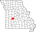
Hickory County is located in the U.S. state of Missouri. As of the 2020 census, the population was 8,279. [1] Its county seat is Hermitage. [2] The county was organized February 14, 1845, and named after President Andrew Jackson, whose nickname was "Old Hickory." [3] [4] The Pomme de Terre Dam, a Corps of Engineers facility, is located three miles south of Hermitage and forms Lake Pomme de Terre by damming the Pomme de Terre River and Lindley Creek. Truman Reservoir, also a Corps of Engineers facility, floods the Pomme de Terre Reservoir from the northern border of the county southward to the city limits of Hermitage.
According to the U.S. Census Bureau, the county has a total area of 412 square miles (1,070 km2), of which 399 square miles (1,030 km2) is land and 13 square miles (34 km2) (3.1%) is water. [5] It is the fifth-smallest county in Missouri by area.
Census | Pop. | Note | %± |
---|---|---|---|
1850 | 2,329 | — | |
1860 | 4,705 | 102.0% | |
1870 | 6,452 | 37.1% | |
1880 | 7,387 | 14.5% | |
1890 | 9,453 | 28.0% | |
1900 | 9,985 | 5.6% | |
1910 | 8,741 | −12.5% | |
1920 | 7,033 | −19.5% | |
1930 | 6,430 | −8.6% | |
1940 | 6,506 | 1.2% | |
1950 | 5,387 | −17.2% | |
1960 | 4,516 | −16.2% | |
1970 | 4,481 | −0.8% | |
1980 | 6,367 | 42.1% | |
1990 | 7,335 | 15.2% | |
2000 | 8,940 | 21.9% | |
2010 | 9,627 | 7.7% | |
2020 | 8,279 | −14.0% | |
U.S. Decennial Census [6] 1790-1960 [7] 1900-1990 [8] 1990-2000 [9] 2010-2015 [10] |
As of the census [11] of 2000, there were 8,940 people, 3,911 households, and 2,737 families residing in the county. The population density was 22 people per square mile (8.5 people/km2). There were 6,184 housing units at an average density of 16 units per square mile (6.2/km2). The racial makeup of the county was 97.51% White, 0.08% Black or African American, 0.66% Native American, 0.11% Asian, 0.20% from other races, and 1.44% from two or more races. Approximately 0.76% of the population were Hispanic or Latino of any race.
There were 3,911 households, out of which 22.00% had children under the age of 18 living with them, 59.90% were married couples living together, 6.70% had a female householder with no husband present, and 30.00% were non-families. 26.50% of all households were made up of individuals, and 15.10% had someone living alone who was 65 years of age or older. The average household size was 2.26 and the average family size was 2.70.
In the county, the population was spread out, with 19.90% under the age of 18, 5.30% from 18 to 24, 19.10% from 25 to 44, 29.70% from 45 to 64, and 26.10% who were 65 years of age or older. The median age was 50 years. For every 100 females there were 96.00 males. For every 100 females age 18 and over, there were 92.70 males.
The median income for a household in the county was $25,346, and the median income for a family was $28,779. Males had a median income of $22,679 versus $17,610 for females. The per capita income for the county was $13,536. About 13.00% of families and 19.70% of the population were below the poverty line, including 32.90% of those under age 18 and 11.00% of those age 65 or over.
Race | Num. | Perc. |
---|---|---|
White (NH) | 7,648 | 93.54% |
Black or African American (NH) | 11 | 0.13% |
Native American (NH) | 42 | 0.51% |
Asian (NH) | 15 | 0.2% |
Pacific Islander (NH) | 0 | 0% |
Other/Mixed (NH) | 431 | 5.21% |
Hispanic or Latino | 132 | 1.6% |
The Republican Party predominantly controls politics at the local level in Hickory County. Republicans hold all but four of the elected positions in the county.
Hickory County, Missouri | |||
---|---|---|---|
Elected countywide officials | |||
Assessor | Clint Baker | Republican | |
Circuit Clerk | Cee Cee Smith | Republican | |
County Clerk | Jeannie Lindsey | Republican | |
Collector | Karen Stokes | Republican | |
Commissioner (Presiding) | Robert Sawyer | Republican | |
Commissioner (District 1) | Chase Crawford | Democratic | |
Commissioner (District 2) | Rick Pearson | Republican | |
Coroner | Connie Boller | Republican | |
Prosecuting Attorney | Michael Brown | Republican | |
Public Administrator | Vanessa Prettyman | Republican | |
Recorder | Pamela Hutton | Republican | |
Sheriff | Greg Burke | Republican | |
Surveyor | T. Philip Nasalroad | Democratic | |
Treasurer | Kenny Ratliff | Republican |
Year | Republican | Democratic | Third Parties |
---|---|---|---|
2016 | 62.30%2,936 | 34.12% 1,608 | 3.58% 169 |
2012 | 46.65% 2,177 | 50.01%2,334 | 3.34% 156 |
2008 | 35.62% 1,820 | 60.96%3,115 | 3.42% 175 |
2004 | 56.54%2,750 | 42.17% 2,051 | 1.30% 63 |
2000 | 47.74% 1,869 | 50.46%2,132 | 1.80% 76 |
1996 | 47.36% 1,869 | 49.90%1,969 | 2.74% 108 |
All of Hickory County is a part of Missouri's 126th District in the Missouri House of Representatives and is represented by Jim Kalberloh (R-Lowry City). [14]
Party | Candidate | Votes | % | ±% | |
---|---|---|---|---|---|
Republican | Warren D. Love | 3,977 | 100.00% |
Party | Candidate | Votes | % | ±% | |
---|---|---|---|---|---|
Republican | Warren D. Love | 2,006 | 100.00% |
Party | Candidate | Votes | % | ±% | |
---|---|---|---|---|---|
Republican | Warren D. Love | 3,931 | 100.00% |
All of Hickory County is a part of Missouri's 28th District in the Missouri Senate. The seat is held by Sandy Crawford, who was elected after the previous incumbent, Mike Parson, was elected lieutenant governor in 2016.
Party | Candidate | Votes | % | ±% | |
---|---|---|---|---|---|
Republican | Mike Parson | 2,075 | 100.00% |
Party | Candidate | Votes | % | ±% | |
---|---|---|---|---|---|
Republican | Roy Blunt | 2,959 | 62.93% | +20.24 | |
Democratic | Jason Kander | 1,490 | 31.69% | -17.67 | |
Libertarian | Jonathan Dine | 135 | 2.87% | -5.08 | |
Green | Johnathan McFarland | 69 | 1.47% | +1.47 | |
Constitution | Fred Ryman | 49 | 1.04% | +1.04 |
Party | Candidate | Votes | % | ±% | |
---|---|---|---|---|---|
Republican | Todd Akin | 1,982 | 42.69% | ||
Democratic | Claire McCaskill | 2,292 | 49.36% | ||
Libertarian | Jonathan Dine | 369 | 7.95% |
All of Hickory County is included in Missouri's 4th Congressional District and is currently represented by Vicky Hartzler (R-Harrisonville) in the U.S. House of Representatives.
Party | Candidate | Votes | % | ±% | |
---|---|---|---|---|---|
Republican | Vicky Hartzler | 3,434 | 74.44% | +1.87 | |
Democratic | Gordon Christensen | 994 | 21.55% | -1.76 | |
Libertarian | Mark Bliss | 185 | 4.01% | -0.11 |
Party | Candidate | Votes | % | ±% | |
---|---|---|---|---|---|
Republican | Vicky Hartzler | 1,778 | 72.57% | +8.57 | |
Democratic | Nate Irvin | 571 | 23.31% | -9.02 | |
Libertarian | Herschel L. Young | 101 | 4.12% | +1.20 |
Party | Candidate | Votes | % | ±% | |
---|---|---|---|---|---|
Republican | Vicky Hartzler | 2,963 | 64.00% | ||
Democratic | Teresa Hensley | 1,497 | 32.33% | ||
Libertarian | Thomas Hollbrook | 135 | 2.92% | ||
Constitution | Greg Cowan | 35 | 0.75% |
Year | Republican | Democratic | Third party | |||
---|---|---|---|---|---|---|
No. | % | No. | % | No. | % | |
2020 | 3,966 | 78.07% | 1,056 | 20.79% | 58 | 1.14% |
2016 | 3,542 | 74.40% | 1,016 | 21.34% | 203 | 4.26% |
2012 | 2,835 | 60.58% | 1,733 | 37.03% | 112 | 2.39% |
2008 | 2,850 | 55.72% | 2,171 | 42.44% | 94 | 1.84% |
2004 | 2,791 | 57.36% | 2,043 | 41.99% | 32 | 0.66% |
2000 | 2,172 | 51.25% | 1,961 | 46.27% | 105 | 2.48% |
1996 | 1,491 | 38.11% | 1,858 | 47.49% | 563 | 14.39% |
1992 | 1,259 | 31.03% | 1,929 | 47.54% | 870 | 21.44% |
1988 | 2,043 | 54.82% | 1,677 | 45.00% | 7 | 0.19% |
1984 | 2,190 | 64.37% | 1,212 | 35.63% | 0 | 0.00% |
1980 | 1,893 | 58.92% | 1,248 | 38.84% | 72 | 2.24% |
1976 | 1,403 | 49.72% | 1,398 | 49.54% | 21 | 0.74% |
1972 | 1,851 | 74.85% | 622 | 25.15% | 0 | 0.00% |
1968 | 1,484 | 66.55% | 537 | 24.08% | 209 | 9.37% |
1964 | 1,157 | 57.53% | 854 | 42.47% | 0 | 0.00% |
1960 | 1,885 | 75.40% | 615 | 24.60% | 0 | 0.00% |
1956 | 1,661 | 70.50% | 695 | 29.50% | 0 | 0.00% |
1952 | 2,054 | 76.47% | 622 | 23.16% | 10 | 0.37% |
1948 | 1,728 | 70.19% | 733 | 29.77% | 1 | 0.04% |
1944 | 2,171 | 79.41% | 560 | 20.48% | 3 | 0.11% |
1940 | 2,496 | 75.84% | 787 | 23.91% | 8 | 0.24% |
1936 | 2,329 | 71.73% | 910 | 28.03% | 8 | 0.25% |
1932 | 1,586 | 63.98% | 878 | 35.42% | 15 | 0.61% |
1928 | 2,233 | 84.68% | 399 | 15.13% | 5 | 0.19% |
1924 | 1,895 | 70.71% | 722 | 26.94% | 63 | 2.35% |
1920 | 2,131 | 78.55% | 532 | 19.61% | 50 | 1.84% |
1916 | 1,144 | 64.74% | 552 | 31.24% | 71 | 4.02% |
1912 | 735 | 45.82% | 421 | 26.25% | 448 | 27.93% |
1908 | 1,182 | 65.52% | 561 | 31.10% | 61 | 3.38% |
1904 | 1,245 | 66.65% | 531 | 28.43% | 92 | 4.93% |
1900 | 1,270 | 60.05% | 777 | 36.74% | 68 | 3.22% |
1896 | 1,194 | 53.14% | 1,045 | 46.51% | 8 | 0.36% |
1892 | 927 | 49.84% | 423 | 22.74% | 510 | 27.42% |
1888 | 1,076 | 57.60% | 628 | 33.62% | 164 | 8.78% |
Former U.S. Senator Hillary Clinton (D-New York) received more votes, a total of 1,056, than any candidate from either party in Hickory County during the 2008 presidential primary.
Webster County is a county located in the U.S. state of Missouri. As of the 2010 census, the population was 36,202. Its county seat is Marshfield. The county was organized in 1855 and named for U.S. Senator and U.S. Secretary of State Daniel Webster.
St. Francois County is a county located in the Lead Belt region in the U.S. state of Missouri. As of the 2020 census, the population was 66,922. The largest city and county seat is Farmington. The county was officially organized on December 19, 1821. It was named after the St. Francis River. The origin of the river's name is unclear. It might refer to St. Francis of Assisi. Another possibility is that Jacques Marquette, a Jesuit who explored the region in 1673, named the river for the Jesuit missionary Francis Xavier. Marquette had spent some time at the mission of St. François Xavier before his voyage and, as a Jesuit, was unlikely to have given the river a name honoring the Franciscans.
St. Clair County is a county located in the western portion of the U.S. state of Missouri. As of the 2020 census, the population was 9,284. Its county seat is Osceola. The largest city is Appleton City. The county was organized in 1841 and named after General Arthur St. Clair, Governor of the Northwest Territory. St. Clair was also the 9th president of the United States in Congress Assembled. Under his presidency, the Northwest Ordinance and United States Constitution were passed.
Ray County is a county located in the northwestern portion of the U.S. state of Missouri and is part of the Kansas City metropolitan area. As of the 2020 census, the population was 23,158. Its county seat is Richmond. The county was organized November 16, 1820 and named for John Ray, a Missouri state legislator and member of the first state Constitutional Convention.
Pettis County is a county located in west central U.S. state of Missouri. As of the 2010 census, the population was 42,201. Its county seat is Sedalia. The county was organized on January 24, 1833, and named after former U.S. Representative Spencer Darwin Pettis.
Osage County is a county in the central part of the U.S. state of Missouri. As of the 2020 census, the population was 13,274. Its county seat is Linn. The county was organized January 29, 1841, and named from the Osage River.
Newton County is a county located in the southwest portion of the U.S. state of Missouri. As of the 2010 census, the population was 58,114. Its county seat is Neosho. The county was organized in 1838 and is named in honor of John Newton, a hero who fought in the Revolutionary War.
Moniteau County is a county located in the U.S. state of Missouri. As of the 2020 United States census, the population was 15,473. Its county seat is California. The county was organized February 14, 1845 and named for the Moniteau Creek. 'Moniteau' is a French spelling of Manitou, Algonquian for the Great Spirit.
Macon County is a county located in the northern portion of the U.S. state of Missouri. As of the 2020 census, the population was 15,209. Its county seat is Macon. The county was organized January 6, 1837, and named for Nathaniel Macon, a Revolutionary War hero and North Carolina politician.
Linn County is a county located in the northern portion of the U.S. state of Missouri. As of the 2020 census, the population was 11,874. Its county seat is Linneus. The county was organized January 1, 1837 and named after U.S. Senator Lewis F. Linn of Missouri.
Lincoln County is located in the eastern part of the U.S. state of Missouri. As of the 2020 census, the population was 59,574. Its county seat is Troy. The county was founded December 14, 1818, and named for Major General Benjamin Lincoln of the American Revolutionary War.
Lawrence County is located in the southwest portion of the U.S. state of Missouri, in the area of the Ozarks. As of the 2010 census, the population was 38,634. Its county seat is Mount Vernon. The county was organized in 1845 and named for James Lawrence, a naval officer from the War of 1812 known for his battle cry, "Don't give up the ship!"
Laclede County is a county located in the U.S. state of Missouri. As of the 2010 census, the population was 35,571. Its county seat is Lebanon. The county was organized February 24, 1849, and was named after Pierre Laclède, founder of St. Louis.
Greene County is located in the U.S. state of Missouri. As of the 2020 census, its population was 298,915. making it the fourth most-populous county in Missouri. Its county seat and most-populous city is Springfield. The county was organized in 1833 and is named after American Revolutionary War General Nathanael Greene.
Dallas County is a county located in the U.S. state of Missouri. As of the 2010 census, the population was 16,777. Its county seat is Buffalo. The county was organized in 1842 as Niangua County and then renamed in 1844 for George M. Dallas, who served as Vice President under James K. Polk.
Cole County is located in the central part of the U.S. state of Missouri. As of the 2020 census, its population was 77,279. Its county seat and largest city is Jefferson City, the state capital. The county was organized November 16, 1820 and named after pioneer William Temple Cole who built Cole's Fort in Boonville.
Camden County is a county located in the U.S. state of Missouri. As of the 2020 Census, the population was 42,745. Its county seat is Camdenton. The county was organized on January 29, 1841, as Kinderhook County and renamed Camden County in 1843 after Charles Pratt, 1st Earl Camden, Lord Chancellor of the United Kingdom and leader of the British Whig Party. Camden County is also the primary setting of the Netflix show Ozark.
Benton County is a county located in the west central part of the U.S. state of Missouri. The population was 19,394 as of the 2020 Census. Its county seat is Warsaw. The county was organized January 3, 1835, and named for U.S. Senator Thomas Hart Benton of Missouri.
Hermitage is a city in Hickory County, Missouri, United States, on the Pomme de Terre River. The population was 621 at the 2020 census. It is the county seat of Hickory County. The John Siddles Williams House on Museum Street in Hermitage, on the National Register of Historic Places since 1980, houses the Hickory County Historical Society Museum and Research Room.
Montgomery Township is an inactive township in Hickory County, in the U.S. state of Missouri. It was named after Judge Joseph C. Montgomery.