References
- ↑ U.S. Geological Survey Geographic Names Information System: Elkton, Missouri
- ↑ "Post Offices". Jim Forte Postal History. Retrieved October 6, 2016.
- ↑ https://butterfieldoverlandstage.com/2012/08/01/maps-of-the-route/
- ↑ "Hickory County Place Names, 1928–1945 (archived)". The State Historical Society of Missouri. Archived from the original on June 24, 2016. Retrieved October 6, 2016.
{{cite web}}: CS1 maint: bot: original URL status unknown (link) - ↑ Shteir, Rachel (November 1, 2004). Striptease: The Untold History of the Girlie Show . Oxford University Press, USA. p. 148. ISBN 978-0-19-512750-8.
"Born Harriet Helen Beck in Elkton, Missouri, in 1904...
Municipalities and communities of Hickory County, Missouri, United States | ||
|---|---|---|
| Cities | 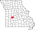 | |
| Village | ||
| Townships | ||
| Unincorporated communities | ||
| Footnotes | ‡This populated place also has portions in an adjacent county or counties | |
37°51′09″N93°25′34″W / 37.85250°N 93.42611°W
| | This Hickory County, Missouri state location article is a stub. You can help Wikipedia by expanding it. |