
Tunas is an unincorporated community in northern Dallas County, Missouri, United States. It lies fourteen miles north of Buffalo on Route 73 and approximately seven miles east of Urbana on Route D. The town is located on Route 73, just southwest of the Little Niangua River. Tunas is part of the Springfield, Missouri Metropolitan Statistical Area.
Dora is an unincorporated community in Ozark County, in the U.S. state of Missouri. The ZIP Code for Dora is 65637.
Ridgedale is an unincorporated community in southern Taney County, Missouri, United States. It lies approximately ten miles south of Branson on U.S. Route 65, about one-half mile north of the Arkansas state line. The community is part of the Branson, Missouri Micropolitan Statistical Area.

Walnut Shade is an unincorporated community in Taney County, Missouri, United States. It is located approximately six miles northwest of Forsyth on U.S. Route 160. The town sits at the confluence of Bull and Bear Creeks. Walnut Shade is part of the Branson, Missouri Micropolitan Statistical Area. The ZIP Code for Walnut Shade is 65771.
Cape Fair is an unincorporated community in Stone County, Missouri, United States. It is located on Route 76 and the southern terminus of Route 173. Cape Fair is on the west side of the James River arm of Table Rock Lake. The community is part of the Branson, Missouri Micropolitan Statistical Area. The ZIP Code for Cape Fair is 65624.
Lampe is an unincorporated community in southern Stone County, Missouri, United States. It is located on Route 13, south of Table Rock Lake.
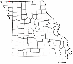
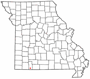
Brighton is an unincorporated community in southern Polk County, Missouri, United States. It is located at the intersection of Missouri Routes 13 and 215. Bolivar is eleven miles to the north and Springfield is approximately fifteen miles south.
Bucyrus is an unincorporated community in central Texas County, Missouri, United States. It is located on Route 17, approximately three miles northwest of Houston. The ZIP Code for Bucyrus is 65444.
Eldridge is an unincorporated community in northern Laclede County, Missouri, United States. It is situated approximately twelve miles northwest of Lebanon on Missouri Route E, west of Missouri Route 5. The ZIP Code for Eldridge is 65463.
Falcon is an unincorporated community in eastern Laclede County, Missouri, United States. It is approximately sixteen miles east of Lebanon on Route 32. The Gasconade River lies just east of the community, which is within the Mark Twain National Forest. The community consists of a post office and two houses.

Valles Mines is an unincorporated community in southern Jefferson County, Missouri, United States. It is located approximately seven miles south of De Soto. It is located on Missouri Route V less than one mile west of U.S. Route 67. Joachim Creek flows past the north side of the community. The ZIP Code for Valles Mines is 63087.

French Village is an unincorporated community in eastern St. Francois County, Missouri, United States. It is located approximately ten miles east of Bonne Terre and has a population of 1,226. The ZIP Code for French Village is 63036.

Knob Lick is an unincorporated community in southern Saint Francois County, Missouri, United States. It is located on Missouri Route DD, just east of U.S. Route 67, approximately eight miles south of Farmington.
Echo Lake is a small unincorporated community in El Dorado County, California, United States, along U.S. Route 50 in the mountains of the Sierra Nevada. It is 1.5 miles (2.4 km) north-northwest of Echo Summit. Echo Lake's nearest neighboring town is Little Norway. The ZIP code is 95721. The community is inside area code 530. The elevation of Echo Lake is 7539 feet. The average snowpack per year is 10.5 feet, with over 15 feet of snow depositing in certain areas. Precipitation and accumulation at Echo Lake can be found in California Data Exchange Center stations located at Echo Peak (EP5) and Echo Summit (ECS).

Solon Township is a civil township of Leelanau County in the U.S. state of Michigan. The population was 1,542 at the 2000 census.
Halfway, Illinois was an unincorporated community in northeastern Williamson County, Illinois located about halfway between the county seat of Marion and Corinth. A post office operated from 1895 to 1911 in a country store. The ZIP Code was 62974.
Mohawk Corner is an unincorporated community in northeast Polk County, in the U.S. state of Missouri. The community is at the intersection of Missouri Routes 64 and D. Pittsburg and the Pomme de Terre Lake area is five miles to the north on Route 64 in Hickory County. Polk is two miles to the south on Route D.
Possum Creek is a small stream in northern Polk County, Missouri, United States. Its source coordinates are 37°48′00″N93°18′02″W, and its confluence coordinates are 37°48′01″N93°21′58″W.
Sentinel is an unincorporated community in northern Polk County, in the U.S. state of Missouri.
Sharon is an unincorporated community in Saline County, in the U.S. state of Missouri.

