Howard County, Missouri

Last updated

Howard County
Howard County MO Courthouse 20140920-pano2.jpg
The Howard County Courthouse in Fayette
Nickname: 
Mother of Counties
Map of Missouri highlighting Howard County.svg
Location within the U.S. state of Missouri
Missouri in United States.svg
Missouri's location within the U.S.
Coordinates: 39°08′N92°42′W / 39.14°N 92.7°W / 39.14; -92.7
CountryFlag of the United States.svg United States
StateFlag of Missouri.svg  Missouri
FoundedJanuary 23, 1816
Named for Benjamin Howard
Seat Fayette
Largest cityFayette
Area
  Total472 sq mi (1,220 km2)
  Land464 sq mi (1,200 km2)
  Water7.7 sq mi (20 km2)  1.6%
Population
 (2020)
  Total10,151
  Estimate 
(2018)
10,137
  Density22/sq mi (8.3/km2)
Time zone UTC−6 (Central)
  Summer (DST) UTC−5 (CDT)
Congressional district 4th

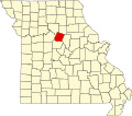
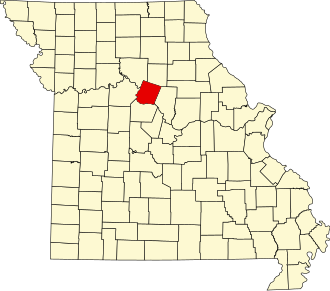
Howard County is located in the U.S. state of Missouri, with its southern border formed by the Missouri River. As of the 2020 census, the population was 10,151. [1] Its county seat is Fayette. [2] The county was organized January 23, 1816, and named for Benjamin Howard, the first Governor of the Missouri Territory. [3] Settled originally by migrants from the Upper South, it is part of the region historically known as Little Dixie. It is part of the Columbia, Missouri, metropolitan area.

Contents

History

Located on the north bank of the Missouri River, Howard County was settled primarily from the Upper Southern states of Kentucky, Tennessee and Virginia. The migrants brought slaves and slaveholding traditions with them, and cultivated hemp and tobacco, crops of Middle Tennessee. Howard was one of several counties settled mainly by Southerners along the Missouri River in the center of the state. Because of this, this area became known as Little Dixie, and Howard County was at its heart. [4] Following the 1848 revolutions in the German nations, many German immigrants also came to this region, developing farms.

Due to the reliance on slave labor, by 1860 African-American slaves composed at least 25 percent of the county's population. [5] Given their backgrounds and cultural affiliations, many Howard County residents supported the Confederacy during the Civil War. Ethnic German immigrants and descendants tended to support the Union.

After the end of Reconstruction, whites enforced Jim Crow laws and racial segregation in the county to maintain white supremacy. In the most violent period, at the turn of the 20th century, five African Americans were lynched in Howard County from 1891 to 1914: Olli Truxton, Frank Embree, Thomas Hayden, Arthur McNeal, and Dallas Shields. [6] Howard County tied with Pike County for the highest rate of lynchings in the state. [7]

The county continued to be developed for agriculture and is still largely rural. However, Howard County has lost population since its peak in 1880. The mechanization of farming reduced the demand for labor, and many workers left for jobs in the cities and less oppressive societies. By 2000 African Americans in the county had declined to less than seven percent of the total. In the early 21st century, nearly one-third of the residents identify as being of German ancestry, reflecting the wave of mid-19th century immigration.

Geography

According to the U.S. Census Bureau, the county has a total area of 472 square miles (1,220 km2), of which 464 square miles (1,200 km2) is land and 7.7 square miles (20 km2) (1.6%) is water. [8]

Adjacent counties

Major highways

National protected area

Demographics

Historical population
CensusPop.Note
1820 13,426
1830 10,854−19.2%
1840 13,10820.8%
1850 13,9696.6%
1860 15,94614.2%
1870 17,2338.1%
1880 18,4286.9%
1890 17,371−5.7%
1900 18,3375.6%
1910 15,653−14.6%
1920 13,997−10.6%
1930 13,490−3.6%
1940 13,026−3.4%
1950 11,857−9.0%
1960 10,859−8.4%
1970 10,561−2.7%
1980 10,008−5.2%
1990 9,631−3.8%
2000 10,2126.0%
2010 10,144−0.7%
2020 10,1510.1%
U.S. Decennial Census [9]
1790-1960 [10] 1900-1990 [11]
1990-2000 [12] 2010-2015 [13]

As of the census [14] of 2000, there were 10,212 people, 3,836 households, and 2,631 families residing in the county. The population density was 22 people per square mile (8.5 people/km2). There were 4,346 housing units at an average density of 9 units per square mile (3.5/km2). The racial makeup of the county was 91.13% White, 6.84% Black or African American, 0.33% Native American, 0.12% Asian, 0.08% Pacific Islander, 0.40% from other races, and 1.10% from two or more races. Approximately 0.86% of the population were Hispanic or Latino of any race. 32.4% were of German, 16.1% American, 8.9% English and 8.3% Irish ancestry.

There were 3,836 households, out of which 31.50% had children under the age of 18 living with them, 55.30% were married couples living together, 9.50% had a female householder with no husband present, and 31.40% were non-families. 27.30% of all households were made up of individuals, and 13.30% had someone living alone who was 65 years of age or older. The average household size was 2.46 and the average family size was 2.98.

In the county, the population was spread out, with 24.00% under the age of 18, 13.30% from 18 to 24, 25.20% from 25 to 44, 21.30% from 45 to 64, and 16.10% who were 65 years of age or older. The median age was 37 years. For every 100 females, there were 94.00 males. For every 100 females age 18 and over, there were 94.40 males.

The median income for a household in the county was $31,614, and the median income for a family was $40,167. Males had a median income of $26,369 versus $19,950 for females. The per capita income for the county was $15,198. About 7.50% of families and 11.60% of the population were below the poverty line, including 14.70% of those under age 18 and 14.40% of those age 65 or over.

2020 Census

Howard County Racial Composition [15]
RaceNum.Perc.
White (NH)8,82687%
Black or African American (NH)5425.34%
Native American (NH)340.33%
Asian (NH)270.26%
Pacific Islander (NH)30.03%
Other/Mixed (NH)5115%
Hispanic or Latino 2082.05%

Education

Public schools

Private schools

Post-secondary

Public libraries

Communities

Cities and Towns

Unincorporated Communities

Notable people

Politics

Local

The Democratic Party predominantly controls politics at the local level in Howard County. Democrats hold all but four of the elected positions in the county.

Howard County, Missouri
Elected countywide officials
Assessor John (Woody) McCutcheon Democratic
Circuit Clerk Charles J. Flaspohler Democratic
County Clerk Shelly Howell Republican
Collector Jinger Felten Republican
Commissioner
(Presiding)
Jeremiah Johnmeyer Republican
Commissioner
(District 1)
Richard Conrow Democratic
Commissioner
(District 2)
Howard McMillan Democratic
Coroner Frank Flaspohler Democratic
Prosecuting Attorney Deborah Riekhof Republican
Public Administrator Lisa Asbury Democratic
Recorder Charles J. Flaspohler Democratic
Sheriff Jeff Oswald
Surveyor Gene Bowen Democratic
Treasurer Susan Keyton Democratic

State

Past Gubernatorial Elections Results
Year Republican Democratic Third Parties
2020 69.58%3,52527.38% 1,3873.04% 154
2016 56.47%2,72740.26% 1,9443.27% 158
2012 47.89% 2,30248.89%2,3503.22% 155
2008 48.69% 2,35849.08%2,3772.33% 108
2004 52.46%2,57846.34% 2,2771.20% 59
2000 44.96% 2,02952.12%2,3522.92% 132
1996 33.90% 1,43663.53%2,6912.57% 109

Howard County is split between two districts of the Missouri House of Representatives, both of which are represented by Republicans.

Missouri House of Representatives — District 47 — Howard County (2016)
PartyCandidateVotes%±%
Republican Chuck Basye62572.17%+8.83
Democratic Susan McClintic24127.83%-8.83
Missouri House of Representatives — District 47 — Howard County (2014)
PartyCandidateVotes%±%
Republican Chuck Basye33063.34%+5.61
Democratic John Wright19136.66%-5.61
Missouri House of Representatives — District 47 — Howard County (2012)
PartyCandidateVotes%±%
Republican Mitch Richards47457.73%
Democratic John Wright34742.27%
Missouri House of Representatives — District 48 — Howard County (2016)
PartyCandidateVotes%±%
Republican Dave Muntzel2,89378.15%-21.85
Independent Debra Dilks80921.85%+21.85
Missouri House of Representatives — District 48 — Howard County (2014)
PartyCandidateVotes%±%
Republican Dave Muntzel1,962100.00%+50.61
Missouri House of Representatives — District 48 — Howard County (2012)
PartyCandidateVotes%±%
Republican Dave Muntzel1,91049.39%
Democratic Ron Monnig1,95750.61%

All of Howard County is a part of Missouri's 21st District in the Missouri Senate and is currently represented by Denny Hoskins (R-Warrensburg).

Missouri Senate — District 21 — Howard County (2016)
PartyCandidateVotes%±%
Republican Denny Hoskins2,97065.36%+3.81
Democratic ElGene Ver Dught1,25427.60%-4.68
Libertarian Bill Wayne3207.04%+0.87
Missouri Senate — District 21 — Howard County (2012)
PartyCandidateVotes%±%
Republican David Pearce2,83561.55%
Democratic ElGene Ver Dught1,48732.28%
Libertarian Steven Hedrick2846.17%

Federal

U.S. Senate — Missouri — Howard County (2016)
PartyCandidateVotes%±%
Republican Roy Blunt2,67155.27%+11.59
Democratic Jason Kander1,92839.89%-7.89
Libertarian Jonathan Dine1342.77%-5.77
Green Johnathan McFarland480.99%+0.99
Constitution Fred Ryman521.08%+1.08
U.S. Senate — Missouri — Howard County (2012)
PartyCandidateVotes%±%
Republican Todd Akin2,10143.68%
Democratic Claire McCaskill2,29847.78%
Libertarian Jonathan Dine4118.54%

All of Howard County is included in Missouri's 4th Congressional District and is currently represented by Vicky Hartzler (R-Harrisonville) in the U.S. House of Representatives.

U.S. House of Representatives — Missouri's 4th Congressional District — Howard County (2016)
PartyCandidateVotes%±%
Republican Vicky Hartzler3,13166.82%+2.48
Democratic Gordon Christensen1,30027.74%-1.25
Libertarian Mark Bliss2555.44%-1.23
U.S. House of Representatives — Missouri's 4th Congressional District — Howard County (2014)
PartyCandidateVotes%±%
Republican Vicky Hartzler1,83364.34%+8.04
Democratic Nate Irvin82628.99%-9.25
Libertarian Herschel Young1906.67%+2.45
U.S. House of Representatives — Missouri’s 4th Congressional District — Howard County (2012)
PartyCandidateVotes%±%
Republican Vicky Hartzler2,64056.30%
Democratic Teresa Hensley1,79338.24%
Libertarian Thomas Holbrook1984.22%
Constitution Greg Cowan581.24%
United States presidential election results for Howard County, Missouri [18]
Year Republican Democratic Third party
No.%No.%No.%
2020 3,55369.78%1,41327.75%1262.47%
2016 3,27767.32%1,28326.36%3086.33%
2012 3,01761.99%1,72335.40%1272.61%
2008 2,70855.78%2,03641.94%1112.29%
2004 2,91559.24%1,97240.07%340.69%
2000 2,41453.50%1,94443.09%1543.41%
1996 1,54536.76%2,01447.92%64415.32%
1992 1,25328.20%2,08546.93%1,10524.87%
1988 1,86543.15%2,44656.59%110.25%
1984 2,36053.96%2,01446.04%00.00%
1980 2,17947.85%2,24349.25%1322.90%
1976 1,69037.61%2,76961.62%350.78%
1972 2,61356.15%2,04143.85%00.00%
1968 1,82539.12%2,33350.01%50710.87%
1964 1,33927.63%3,50772.37%00.00%
1960 2,07538.59%3,30261.41%00.00%
1956 2,17738.07%3,54261.93%00.00%
1952 2,34039.12%3,63560.77%70.12%
1948 1,53827.02%4,14372.77%120.21%
1944 1,95132.97%3,95866.88%90.15%
1940 2,33332.75%4,77066.97%200.28%
1936 1,74524.61%5,32675.10%210.30%
1932 1,33719.85%5,35479.47%460.68%
1928 2,25433.54%4,45266.25%140.21%
1924 1,87327.30%4,75969.37%2283.32%
1920 2,12530.85%4,73568.74%280.41%
1916 1,12127.86%2,86671.24%360.89%
1912 89623.63%2,67270.48%2235.88%
1908 1,14128.15%2,88471.16%280.69%
1904 1,19930.52%2,67468.06%561.43%
1900 1,29528.75%3,13469.57%761.69%
1896 1,35328.80%3,31770.60%280.60%
1892 1,05228.05%2,57068.52%1293.44%
1888 1,27832.48%2,57765.49%802.03%

Missouri presidential preference primary (2008)

Former U.S. Senator Hillary Clinton (D-New York) received more votes, a total of 685, than any candidate from either party in Howard County during the 2008 presidential primary.

See also

Related Research Articles

<span class="mw-page-title-main">Clinton County, Missouri</span> County in Missouri, United States

Clinton County is a county located in the U.S. state of Missouri and is part of the Kansas City metropolitan area. As of the 2010 U.S. Census, the county had a population of 20,743. Its county seat is Plattsburg. The county was organized January 2, 1833 and named for Governor DeWitt Clinton of New York. The county seat of Plattsburg derives its name from a town of a similar name that is the county seat of Clinton County, New York, which was also named for the Governor.

<span class="mw-page-title-main">Montgomery County, Missouri</span> County in Missouri, United States

Montgomery County is a county in the east central part of the U.S. state of Missouri. As of the 2020 census, the population was 11,322. Its county seat is Montgomery City. The county was named in honor of Richard Montgomery, an American Revolutionary War general killed in 1775 while attempting to capture Quebec City, Canada.

<span class="mw-page-title-main">Saline County, Missouri</span> County in Missouri, United States

Saline County is located along the Missouri River in the U.S. state of Missouri. As of the 2010 census, the population was 23,370. Its county seat is Marshall. The county was established November 25, 1820, and named for the region's salt springs.

<span class="mw-page-title-main">Randolph County, Missouri</span> County in Missouri, United States

Randolph County is a county in the northern portion of the U.S. state of Missouri. As of the 2010 census, the population was 25,414. Its county seat is Huntsville. The county was organized January 22, 1829 and named for U.S. Representative and U.S. Senator John Randolph of Roanoke, Virginia.

<span class="mw-page-title-main">Ralls County, Missouri</span> County in Missouri, United States

Ralls County is a county located in the northeastern portion of the U.S. state of Missouri. As of the 2020 census, the population was 10,355. Its county seat is New London. The county was organized November 16, 1820 and named for Daniel Ralls, Missouri state legislator.

<span class="mw-page-title-main">Pike County, Missouri</span> County in Missouri, United States

Pike County is a county on the eastern border of the U.S. state of Missouri, bounded by the Mississippi River. As of the 2010 census, the population was 18,516. Its county seat is Bowling Green. Its namesake was a city in middle Kentucky, a region from where many early migrants came. The county was organized December 14, 1818, and named for explorer Zebulon Pike. The folksong "Sweet Betsy from Pike" is generally thought to be associated with Pike County, Missouri.

<span class="mw-page-title-main">Monroe County, Missouri</span> County in Missouri, United States

Monroe County is a county in northeast Missouri. As of the 2020 census, the population was 8,666. Its county seat is Paris. It is the birthplace of Mark Twain.

<span class="mw-page-title-main">Mississippi County, Missouri</span> County in Missouri, United States

Mississippi County is a county located in the Bootheel of the U.S. state of Missouri, with its eastern border formed by the Mississippi River. As of the 2020 census, the population was 12,577. The largest city and county seat is Charleston. The county was officially organized on February 14, 1845, and was named after the Mississippi River.

<span class="mw-page-title-main">Miller County, Missouri</span> County in Missouri, United States

Miller County is a county located in the U.S. state of Missouri. As of the 2020 United States census, the population was 24,722. Its county seat is Tuscumbia. The county was organized February 6, 1837 and named for John Miller, former U.S. Representative and Governor of Missouri.

<span class="mw-page-title-main">Macon County, Missouri</span> County in Missouri, United States

Macon County is a county located in the northern portion of the U.S. state of Missouri. As of the 2020 census, the population was 15,209. Its county seat is Macon. The county was organized January 6, 1837, and named for Nathaniel Macon, a Revolutionary War hero and North Carolina politician.

<span class="mw-page-title-main">Linn County, Missouri</span> County in Missouri, United States

Linn County is a county located in the northern portion of the U.S. state of Missouri. As of the 2020 census, the population was 11,874. Its county seat is Linneus. The county was organized January 1, 1837 and named after U.S. Senator Lewis F. Linn of Missouri.

<span class="mw-page-title-main">Lawrence County, Missouri</span> County in Missouri, United States

Lawrence County is located in the southwest portion of the U.S. state of Missouri, in the area of the Ozarks. As of the 2010 census, the population was 38,634. Its county seat is Mount Vernon. The county was organized in 1845 and named for James Lawrence, a naval officer from the War of 1812 known for his battle cry, "Don't give up the ship!"

<span class="mw-page-title-main">Lafayette County, Missouri</span> County in Missouri, United States

Lafayette County is a county in the western portion of Missouri, part of the Kansas City metropolitan area. As of the 2010 census, the population was 33,381. Its county seat is Lexington. The county was organized November 16, 1820 from Cooper County and originally named Lillard County for James Lillard of Tennessee, who served in the first state constitutional convention and first state legislature. It was renamed Lafayette County on February 16, 1825, in honor of Revolutionary War hero the Marquis de La Fayette, who was then visiting the United States.

<span class="mw-page-title-main">Laclede County, Missouri</span> County in Missouri, United States

Laclede County is a county located in the U.S. state of Missouri. As of the 2010 census, the population was 35,571. Its county seat is Lebanon. The county was organized February 24, 1849, and was named after Pierre Laclède, founder of St. Louis.

<span class="mw-page-title-main">Crawford County, Missouri</span> County in Missouri, United States

Crawford County is a county located in the east-central portion of the U.S. state of Missouri. At the 2010 Census, the population was 24,696. Its county seat is Steelville. The county was organized in 1829 and is named after U.S. Senator William H. Crawford of Georgia.

<span class="mw-page-title-main">Cooper County, Missouri</span> County in Missouri, United States

Cooper County is located in the central portion of the U.S. state of Missouri. As of the 2020 United States census, the population was 17,103. Its county seat is Boonville. The county was organized December 17, 1818 and named for Sarshell Cooper, a frontier settler who was killed by Native Americans near Arrow Rock in 1814. It is a part of the Columbia, Missouri metropolitan area.

<span class="mw-page-title-main">Chariton County, Missouri</span> County in Missouri, United States

Chariton County is a county located in the north-central portion of the U.S. state of Missouri. As of the 2020 census, the population was 7,408. Its county seat is Keytesville. The county was organized November 16, 1820, from part of Howard County and is named for the Chariton River.

<span class="mw-page-title-main">Fayette, Missouri</span> City in Missouri, United States

Fayette is a city in and the county seat of Howard County, Missouri, United States. It is part of the Columbia, Missouri Metropolitan Statistical Area. The city's population was 2,803 at the 2020 census.

<span class="mw-page-title-main">Moberly, Missouri</span> City in Missouri, United States

Moberly is a city in Randolph County, Missouri, United States. The population was 13,974 at the 2010 census. It is part of the Columbia, Missouri metropolitan area.

<span class="mw-page-title-main">Glasgow, Missouri</span> City in Missouri, United States

Glasgow is a city on the Missouri River mostly in northwest Howard County and extending into the southeast corner of Chariton County in the U.S. state of Missouri. The population was 1,087 at the 2020 census.

References

  1. "Explore Census Data". data.census.gov. Retrieved January 5, 2022.
  2. "Find a County". National Association of Counties. Archived from the original on May 31, 2011. Retrieved June 7, 2011.
  3. Eaton, David Wolfe (1916). How Missouri Counties, Towns and Streams Were Named. The State Historical Society of Missouri. pp.  174.
  4. The Story of Little Dixie, Missouri, Missouri Division, Sons of Confederate Veterans Archived July 17, 2012, at the Wayback Machine , accessed June 3, 2008
  5. T. J. Stiles, Jesse James: The Last Rebel of the Civil War, New York: Vintage Books, 2003, pp.10-11
  6. NAACP (1919). Thirty Years of Lynching in the United States, 1889—1918. NAACP. pp. 80–81.
  7. Lynching in America/ Supplement: Lynchings by County, 3rd edition Archived October 23, 2017, at the Wayback Machine , Montgomery, Alabama: Equal Justice Initiative, 2015, p. 7
  8. "2010 Census Gazetteer Files". United States Census Bureau. August 22, 2012. Archived from the original on October 21, 2013. Retrieved November 16, 2014.
  9. "U.S. Decennial Census". United States Census Bureau. Retrieved November 16, 2014.
  10. "Historical Census Browser". University of Virginia Library. Retrieved November 16, 2014.
  11. "Population of Counties by Decennial Census: 1900 to 1990". United States Census Bureau. Retrieved November 16, 2014.
  12. "Census 2000 PHC-T-4. Ranking Tables for Counties: 1990 and 2000" (PDF). United States Census Bureau. Archived (PDF) from the original on March 27, 2010. Retrieved November 16, 2014.
  13. "State & County QuickFacts". United States Census Bureau. Archived from the original on June 7, 2011. Retrieved September 9, 2013.
  14. "U.S. Census website". United States Census Bureau . Retrieved January 31, 2008.
  15. "P2 HISPANIC OR LATINO, AND NOT HISPANIC OR LATINO BY RACE – 2020: DEC Redistricting Data (PL 94-171) – Howard County, Missouri".
  16. Breeding, Marshall. "Howard County Library". Libraries.org. Retrieved May 8, 2017.
  17. Breeding, Marshall. "Lewis Library of Glasgow". Libraries.org. Retrieved May 8, 2017.
  18. Leip, David. "Dave Leip's Atlas of U.S. Presidential Elections". uselectionatlas.org. Retrieved March 25, 2018.

Further reading

39°08′N92°42′W / 39.14°N 92.70°W / 39.14; -92.70