References
- ↑ U.S. Geological Survey Geographic Names Information System: Boonesboro, Missouri
- ↑ Missouri Atlas & Gazetteer, 1998, Delorme p.30 ISBN 0-89933-224-2
- ↑ Eaton, David Wolfe (1916). How Missouri Counties, Towns and Streams Were Named. The State Historical Society of Missouri. pp. 175.
- ↑ Ramsay, Robert L. (1952). Our Storehouse of Missouri Place Names. University of Missouri Press. p. 22. ISBN 9780826205865.
{{cite book}}: ISBN / Date incompatibility (help) - ↑ Earngey, Bill (1995). Missouri Roadsides: The Traveler's Companion. University of Missouri Press. p. 21. ISBN 9780826210210.
39°04′37″N92°50′30″W / 39.0769716°N 92.8415770°W
Municipalities and communities of Howard County, Missouri, United States | ||
|---|---|---|
| Cities | 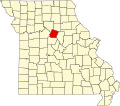 | |
| Townships | ||
| Unincorporated communities | ||
| Ghost town | ||
| Footnotes | ‡This populated place also has portions in an adjacent county or counties | |
| International | |
|---|---|
| National | |
| | This Howard County, Missouri state location article is a stub. You can help Wikipedia by expanding it. |