National Register of Historic Places listings in Howard County, Missouri

Last updated
Location of Howard County in Missouri Map of Missouri highlighting Howard County.svg
Location of Howard County in Missouri

This is a list of the National Register of Historic Places listings in Howard County, Missouri.

Contents

This is intended to be a complete list of the properties and districts on the National Register of Historic Places in Howard County, Missouri, United States. Latitude and longitude coordinates are provided for many National Register properties and districts; these locations may be seen together in a map. [1]

There are 25 properties and districts listed on the National Register in the county.

This National Park Service list is complete through NPS recent listings posted January 29, 2021. [2]
Map all coordinates using: OpenStreetMap  
Download coordinates as: KML  ·  GPX

Current listings

[3] Name on the RegisterImageDate listed [4] Location City or townDescription
1 Edwin and Nora Payne Bedford House
Edwin and Nora Payne Bedford House Edwin and Nora Payne Bedford House.jpg
Edwin and Nora Payne Bedford House
January 23, 1998
(#97001666)
308 S. Main St.
39°08′39″N92°40′51″W / 39.144167°N 92.680791°W / 39.144167; -92.680791 (Edwin and Nora Payne Bedford House)
Fayette
2 Boonslick State Park
Boonslick State Park BOONSLICK STATE PARK.jpg
Boonslick State Park
December 30, 1969
(#69000104)
1 mile (1.6 km) north of Boonesboro on MO 87, 2 miles (3.2 km) southwest on MO 187
39°05′01″N92°52′44″W / 39.083611°N 92.878889°W / 39.083611; -92.878889 (Boonslick State Park)
Boonesboro
3 Campbell Chapel African Methodist Episcopal Church
Campbell Chapel African Methodist Episcopal Church Campbell Chapel African Methodist Episcopal Church.jpg
Campbell Chapel African Methodist Episcopal Church
November 13, 1997
(#97001427)
602 Commerce St.
39°13′36″N92°50′29″W / 39.226667°N 92.841389°W / 39.226667; -92.841389 (Campbell Chapel African Methodist Episcopal Church)
Glasgow
4 Cedar Grove
Cedar Grove 1825 Amick-Kingsbury House, Howard County, Missouri 02.jpg
Cedar Grove
July 19, 1982
(#82003140)
West of Franklin
39°00′35″N92°47′57″W / 39.009722°N 92.799167°W / 39.009722; -92.799167 (Cedar Grove)
Franklin
5 Central Methodist College Campus Historic District
Central Methodist College Campus Historic District T. Berry Smith Hall - Central Methodist University - panoramio.jpg
Central Methodist College Campus Historic District
September 15, 1980
(#80002357)
Roughly bounded by Mulberry, Elm, Church and MO 5
39°09′01″N92°41′07″W / 39.150380°N 92.685380°W / 39.150380; -92.685380 (Central Methodist College Campus Historic District)
Fayette
6 Coleman Hall
Coleman Hall Coleman Hall.jpg
Coleman Hall
June 11, 1986
(#86001326)
502 N. Linn
39°08′55″N92°41′10″W / 39.148611°N 92.686111°W / 39.148611; -92.686111 (Coleman Hall)
Fayette
7 Fayette City Park Swimming Pool
Fayette City Park Swimming Pool Fayette City Park Swimming Pool.jpg
Fayette City Park Swimming Pool
April 15, 1999
(#99000457)
Memorial Park
39°09′07″N92°41′42″W / 39.151944°N 92.695°W / 39.151944; -92.695 (Fayette City Park Swimming Pool)
Fayette
8 Fayette Courthouse Square Historic District
Fayette Courthouse Square Historic District CarnegiePublicLibraryFayetteMissouri.jpg
Fayette Courthouse Square Historic District
February 5, 1998
(#98000069)
Roughly along S. Main and N. Main, W. Morrison, E. Morrison, N. Church, and W. Davis Sts.
39°08′45″N92°40′57″W / 39.145833°N 92.6825°W / 39.145833; -92.6825 (Fayette Courthouse Square Historic District)
Fayette
9 Fayette Residential Historic District September 3, 2009
(#09000681)
Roughly bounded by Church Street, West Morrison Street and Cleveland Avenue
39°08′35″N92°41′08″W / 39.143056°N 92.685556°W / 39.143056; -92.685556 (Fayette Residential Historic District)
Fayette
10 Finks-Harvey Plantation December 11, 1978
(#78001649)
West of Roanoke
39°19′20″N92°45′11″W / 39.322222°N 92.753056°W / 39.322222; -92.753056 (Finks-Harvey Plantation)
Roanoke
11 Glasgow Commercial Historic District
Glasgow Commercial Historic District Glasgow, Missouri.jpg
Glasgow Commercial Historic District
January 16, 1992
(#91001915)
501-623 First St., 100-195 Market St., 603 Second St.
39°13′35″N92°50′48″W / 39.226389°N 92.846667°W / 39.226389; -92.846667 (Glasgow Commercial Historic District)
Glasgow
12 Glasgow Presbyterian Church
Glasgow Presbyterian Church Glasgow Presbyterian Church.jpeg
Glasgow Presbyterian Church
September 9, 1982
(#82003141)
Commerce and 4th Sts.
39°13′36″N92°50′36″W / 39.226667°N 92.843333°W / 39.226667; -92.843333 (Glasgow Presbyterian Church)
Glasgow
13 Glasgow Public Library
Glasgow Public Library Glasgow Public Library.jpeg
Glasgow Public Library
May 21, 1969
(#69000106)
NW corner Market and 4th Sts.
39°13′34″N92°50′36″W / 39.226111°N 92.843333°W / 39.226111; -92.843333 (Glasgow Public Library)
Glasgow
14 Greenwood
Greenwood Greenwood (Fayette, Missouri).jpg
Greenwood
March 29, 1983
(#83000994)
MO 5
39°03′49″N92°45′04″W / 39.063611°N 92.751111°W / 39.063611; -92.751111 (Greenwood)
Fayette
15 Harris-Chilton-Ruble House
Harris-Chilton-Ruble House Harris-Chilton-Ruble House (under renovation).jpg
Harris-Chilton-Ruble House
September 4, 1980
(#80002359)
108 N. Missouri Ave.
39°01′12″N92°44′28″W / 39.02°N 92.741111°W / 39.02; -92.741111 (Harris-Chilton-Ruble House)
New Franklin
16 Thomas Hickman House July 19, 2006
(#06000627)
10 Research Center Rd.
39°01′22″N92°45′37″W / 39.022778°N 92.760278°W / 39.022778; -92.760278 (Thomas Hickman House)
New Franklin
17 Inglewood June 21, 1990
(#90000981)
701 Randolph St.
39°13′48″N92°50′18″W / 39.23°N 92.838333°W / 39.23; -92.838333 (Inglewood)
Glasgow
18 Prior Jackson Homeplace March 10, 1980
(#80002358)
South of Fayette on MO DD
39°08′03″N92°41′20″W / 39.134167°N 92.688889°W / 39.134167; -92.688889 (Prior Jackson Homeplace)
Fayette
19 Alfred W. Morrison House April 16, 1969
(#69000105)
1 mile (1.6 km) southwest of Fayette on MO 5
39°08′03″N92°41′36″W / 39.134167°N 92.693333°W / 39.134167; -92.693333 (Alfred W. Morrison House)
Fayette
20 New Franklin Commercial Historic District
New Franklin Commercial Historic District Alsop's General Store (107 E. Broadway).jpg
New Franklin Commercial Historic District
January 23, 2013
(#12001207)
106-136 & 101-113 E. Broadway
39°01′02″N92°44′12″W / 39.0173°N 92.736651°W / 39.0173; -92.736651 (New Franklin Commercial Historic District)
New Franklin
21 Oakwood
Oakwood Oakwood (Fayette, Missouri).jpg
Oakwood
September 23, 1982
(#82003138)
1 Leonard Ave.
39°08′51″N92°40′34″W / 39.1475°N 92.676111°W / 39.1475; -92.676111 (Oakwood)
Fayette
22 Rivercene February 16, 1973
(#73001039)
R.F.D. 1
38°59′08″N92°44′30″W / 38.985556°N 92.741667°W / 38.985556; -92.741667 (Rivercene)
New Franklin
23 St. Mary's Episcopal Church
St. Mary's Episcopal Church Original St. Mary's Episcopal Church (Fayette, Missouri).jpg
St. Mary's Episcopal Church
September 9, 1982
(#82003139)
104 W. Davis St.
39°08′46″N92°41′06″W / 39.146111°N 92.685°W / 39.146111; -92.685 (St. Mary's Episcopal Church)
Fayette
24 South Main Street Historic District
South Main Street Historic District Julius and Margaret Ferguson House.jpg
South Main Street Historic District
February 5, 1999
(#99000083)
200, 202, 204, and 208-312 South Main St.
39°08′37″N92°40′50″W / 39.143611°N 92.680556°W / 39.143611; -92.680556 (South Main Street Historic District)
Fayette
25 Dr. Uriel S. Wright Office
Dr. Uriel S. Wright Office Dr. Uriel S. Wright Office.jpg
Dr. Uriel S. Wright Office
December 22, 1987
(#87001727)
120 Church St.
39°08′49″N92°41′01″W / 39.146944°N 92.683611°W / 39.146944; -92.683611 (Dr. Uriel S. Wright Office)
Fayette

See also

Related Research Articles

National Register of Historic Places listings in Jackson County, Missouri

This is a list of the National Register of Historic Places listings in Jackson County, Missouri.

National Register of Historic Places listings in Lafayette County, Missouri

This is a list of the National Register of Historic Places listings in Lafayette County, Missouri.

National Register of Historic Places listings in Crawford County, Missouri

This is a list of the National Register of Historic Places listings in Crawford County, Missouri.

National Register of Historic Places listings in Franklin County, Missouri

This is a list of the National Register of Historic Places listings in Franklin County, Missouri.

National Register of Historic Places listings in Pike County, Missouri

This is a list of the National Register of Historic Places listings in Pike County, Missouri.

National Register of Historic Places listings in Macon County, Missouri

This is a list of the National Register of Historic Places listings in Macon County, Missouri.

National Register of Historic Places listings in Gasconade County, Missouri

This is a list of the National Register of Historic Places listings in Gasconade County, Missouri.

National Register of Historic Places listings in Marion County, Missouri

The following properties are listed on the National Register of Historic Places in Marion County, Missouri.

National Register of Historic Places listings in Johnson County, Missouri

This is a list of the National Register of Historic Places listings in Johnson County, Missouri.

National Register of Historic Places listings in Carroll County, Missouri

This is a list of the National Register of Historic Places listings in Carroll County, Missouri.

National Register of Historic Places listings in Wright County, Missouri

This is a list of the National Register of Historic Places listings in Wright County, Missouri.

National Register of Historic Places listings in Phelps County, Missouri

This is a list of the National Register of Historic Places listings in Phelps County, Missouri.

National Register of Historic Places listings in Madison County, Missouri

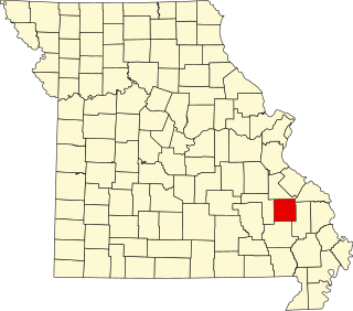
This is a list of the National Register of Historic Places listings in Madison County, Missouri.

National Register of Historic Places listings in Butler County, Missouri

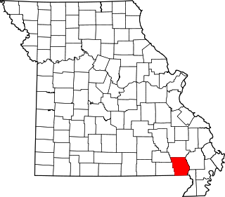
This is a list of the National Register of Historic Places listings in Butler County, Missouri.

National Register of Historic Places listings in Montgomery County, Missouri

This is a list of the National Register of Historic Places listings in Montgomery County, Missouri.

National Register of Historic Places listings in Camden County, Missouri

This is a list of the National Register of Historic Places listings in Camden County, Missouri.

National Register of Historic Places listings in Osage County, Missouri

This is a list of the National Register of Historic Places listings in Osage County, Missouri.

National Register of Historic Places listings in Henry County, Missouri

This is a list of the National Register of Historic Places listings in Henry County, Missouri.

National Register of Historic Places listings in Grundy County, Missouri

This is a list of the National Register of Historic Places listings in Grundy County, Missouri.

National Register of Historic Places listings in Texas County, Missouri

This is a list of the National Register of Historic Places listings in Texas County, Missouri.

References

  1. The latitude and longitude information provided in this table was derived originally from the National Register Information System, which has been found to be fairly accurate for about 99% of listings. Some locations in this table may have been corrected to current GPS standards.
  2. "National Register of Historic Places: Weekly List Actions". National Park Service, United States Department of the Interior. Retrieved on January 29, 2021.
  3. Numbers represent an alphabetical ordering by significant words. Various colorings, defined here, differentiate National Historic Landmarks and historic districts from other NRHP buildings, structures, sites or objects.
  4. The eight-digit number below each date is the number assigned to each location in the National Register Information System database, which can be viewed by clicking the number.