Current listings
| [1] | Name on the Register | Image | Date listed [2] | Location | Description |
|---|---|---|---|---|---|
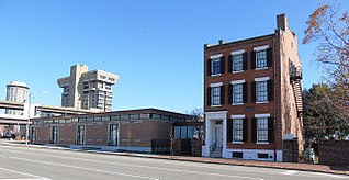
| 1 | 1907 Dorris Motor Car Company Building |  | February 10, 2000 (#00000084) | 4063–4065 Forest Park Ave. 38°38′10″N90°14′48″W / 38.636244°N 90.246731°W | |
| 2 | 5882 Cabanne Courtyard Apartment Building |  | June 27, 2014 (#14000380) | 5882 Cabanne Ave. 38°39′33″N90°17′21″W / 38.6591°N 90.2893°W | |
| 3 | A & P Food Stores Building | 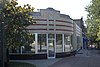 | October 15, 2000 (#00001171) | 6016, 6014, and 6018 Delmar 38°39′16″N90°17′41″W / 38.654444°N 90.294722°W | |
| 4 | ABC Auto Sales and Investment Company Building |  | November 14, 2012 (#12000925) | 3509–3527 Page Boulevard 38°38′45″N90°13′35″W / 38.645819°N 90.226389°W | |
| 5 | American Brake Company Building | 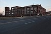 | March 21, 2007 (#07000172) | 1920 N. Broadway 38°38′53″N90°11′13″W / 38.648056°N 90.186944°W | |
| 6 | Antioch Baptist Church | 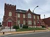 | September 17, 1999 (#99001166) | 4213 N. Market St. 38°39′35″N90°14′17″W / 38.659722°N 90.238056°W | |
| 7 | Apartments at 5561–71 Chamberlain |  | August 24, 2011 (#11000587) | 5561–5571 Chamberlain 38°39′42″N90°16′47″W / 38.661667°N 90.279722°W | |
| 8 | Arlington School | 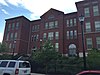 | April 16, 2008 (#08000311) | 1617 Burd Ave. 38°40′15″N90°16′26″W / 38.670872°N 90.273944°W | |
| 9 | Aubert Place |  | September 30, 1982 (#82004730) | Fountain Ave. between Walton Ave. and the Kings Highway 38°39′19″N90°15′34″W / 38.655278°N 90.259444°W | |
| 10 | Autocar Sales and Service Building | 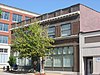 | June 26, 2006 (#06000530) | 2745 Locust 38°38′07″N90°13′04″W / 38.635278°N 90.217778°W | |
| 11 | Baden School | 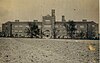 | September 26, 2022 (#100008201) | 8724 Halls Ferry Rd. 38°43′03″N90°14′12″W / 38.7175°N 90.2366°W | |
| 12 | Banneker School |  | October 23, 2017 (#100001761) | 2840 Samuel Shepard Dr. 38°38′13″N90°13′07″W / 38.637069°N 90.218585°W | |
| 13 | Beaumont Medical Building |  | January 19, 1984 (#84002615) | 3714–3726 Washington Ave. 38°38′24″N90°14′04″W / 38.64°N 90.234444°W | Imploded, April 26, 1997. |
| 14 | Beaumont Telephone Exchange Building | 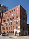 | February 16, 2006 (#06000038) | 2654 Locust St. 38°38′04″N90°12′58″W / 38.634444°N 90.216111°W | |
| 15 | Beckley-Ralston Company |  | December 2, 2016 (#15000197) | 3306–3314 Washington Blvd. 38°38′16″N90°13′36″W / 38.637797°N 90.226698°W | |
| 16 | Bel Air Motel |  | May 1, 2009 (#09000253) | 4630 Lindell 38°38′33″N90°15′39″W / 38.642611°N 90.260967°W | |
| 17 | Bellefontaine Cemetery |  | July 3, 2014 (#14000378) | 4947 W. Florissant Ave. 38°41′51″N90°14′01″W / 38.6974°N 90.2336°W | |
| 18 | Chuck Berry House |  | December 12, 2008 (#08001179) | 3137 Whittier St. 38°39′52″N90°13′53″W / 38.664311°N 90.231431°W | |
| 19 | Biddle Street Market |  | June 1, 2015 (#15000304) | 1211–19 N. Tucker Blvd. 38°38′15″N90°11′42″W / 38.6375°N 90.195°W | |
| 20 | Bissell Street Water Tower | 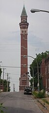 | June 5, 1970 (#70000906) | Junction of Bissell St. and Blair Ave. 38°40′13″N90°12′21″W / 38.670278°N 90.205833°W | |
| 21 | Frank P. Blair School |  | February 10, 1983 (#83001041) | 2707 Rauschenbach Ave. 38°39′03″N90°12′18″W / 38.650833°N 90.205°W | |
| 22 | Blind Girls' Home |  | August 23, 1984 (#84002617) | 5235 Page Boulevard 38°39′38″N90°16′09″W / 38.660556°N 90.269167°W | |
| 23 | Block Unit No. 1 Historic District |  | July 14, 2000 (#00000794) | 4100–4191 Enright Ave. 38°38′55″N90°14′36″W / 38.648611°N 90.243333°W | |
| 24 | Dr. George Ashe Bronson House |  | June 2, 2015 (#15000305) | 3201 Washington St. 38°38′15″N90°13′30″W / 38.6376°N 90.2251°W | |
| 25 | Building at 3910–12 Laclede Ave. |  | May 30, 2003 (#03000478) | 3910–3912 Laclede Ave. 38°38′16″N90°14′33″W / 38.637778°N 90.2425°W | |
| 26 | Buster Brown Blue Ribbon Shoe Factory |  | January 26, 2005 (#04001560) | 1526 N. Jefferson Ave. 38°38′51″N90°12′45″W / 38.6475°N 90.2125°W | |
| 27 | Butler House |  | September 2, 1982 (#82004733) | 4484 W. Pine Boulevard 38°38′26″N90°15′28″W / 38.640616°N 90.257735°W | |
| 28 | Cadillac Automobile Company Building |  | August 4, 2005 (#05000812) | 3224 Locust St. 38°38′12″N90°13′35″W / 38.636667°N 90.226389°W | |
| 29 | Carr School |  | December 13, 2000 (#00001512) | 1419 Carr St. 38°38′20″N90°11′54″W / 38.638889°N 90.198333°W | |
| 30 | Cass Bank and Trust Company |  | February 14, 2011 (#11000012) | 1450 N. 13th St. 38°38′27″N90°11′38″W / 38.640833°N 90.193889°W | |
| 31 | Castle Ballroom |  | February 18, 2011 (#11000024) | 2839–2845 Olive St. 38°38′03″N90°13′10″W / 38.634167°N 90.219444°W | |
| 32 | Central High School |  | October 17, 2012 (#12000873) | 3616 Garrison 38°39′35″N90°12′55″W / 38.659648°N 90.215241°W | Used from 1927 to 2004 by what is now the Central VPA High School |
| 33 | Central Institute for the Deaf Building |  | September 1, 2015 (#15000554) | 800 S. Euclid Ave. 38°37′58″N90°15′48″W / 38.6329°N 90.2633°W | |
| 34 | Central States Life Insurance Company Building | 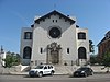 | July 25, 2012 (#12000436) | 3207 Washington Boulevard 38°38′16″N90°13′31″W / 38.637778°N 90.225278°W | |
| 35 | Century Electric Foundry Complex |  | November 2, 2016 (#16000750) | 3711–3739, 3815R Market St., 3700–3800 Forest Park Ave. 38°38′00″N90°14′24″W / 38.633343°N 90.239863°W | |
| 36 | Chain of Rocks Bridge |  | December 1, 2006 (#06001091) | West Chain of Rocks Rd. 38°45′41″N90°10′26″W / 38.761389°N 90.173889°W | |
| 37 | Kate Chopin House | 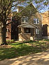 | February 14, 1986 (#86000209) | 4232 McPherson Ave. 38°38′35″N90°14′56″W / 38.643056°N 90.248889°W | |
| 38 | Chouteau Apartments/Parkway Dwellings | 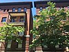 | February 10, 1983 (#83001043) | 4937–4943 Laclede Ave. 38°38′26″N90°15′49″W / 38.64058°N 90.263546°W | |
| 39 | Church of the Messiah | 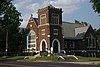 | February 13, 2013 (#13000005) | 5261 Enright Ave. 38°39′14″N90°16′22″W / 38.654014°N 90.272799°W | |
| 40 | Winston Churchill Apartments |  | April 4, 1985 (#85000697) | 5475 Cabanne 38°39′32″N90°16′35″W / 38.658889°N 90.276389°W | |
| 41 | Clemens House-Columbia Brewery District |  | July 19, 1984 (#84002622) | Roughly bounded by Maiden Lane, Cass Ave., 21st, Helen, and Howard Sts.; also roughly bounded by St. Louis Ave., N. Florissant Ave., Maiden Ln., and N. 21st and N. 20th Sts 38°38′41″N90°12′33″W / 38.644722°N 90.209167°W | Second set of boundaries represents a boundary increase of July 22, 1986 |
| 42 | Colchester Apartments |  | July 12, 2006 (#06000603) | 4–10-14-20 N. Kingshighway Boulevard 38°38′27″N90°15′53″W / 38.640833°N 90.264722°W | |
| 43 | Cook Avenue Methodist Episcopal Church, South |  | August 27, 2008 (#08000806) | 3680 Cook Ave. 38°38′45″N90°13′50″W / 38.645961°N 90.230644°W | |
| 44 | Cook School |  | January 14, 2022 (#100007360) | 5935 Horton Pl. 38°39′45″N90°17′24″W / 38.6624°N 90.2899°W | |
| 45 | Cote Brilliante Avenue in The Ville Historic District |  | January 17, 2012 (#11001021) | 4200 W. block of Cote Brilliante Ave. and the 1700 block of Annie Malone Dr. 38°39′21″N90°14′23″W / 38.655803°N 90.239711°W | |
| 46 | Cotton Belt Freight Depot |  | April 21, 2004 (#04000344) | 1400 N. 1st St. 38°38′27″N90°10′57″W / 38.640833°N 90.1825°W | |
| 47 | Council Plaza |  | March 2, 2007 (#06000217) | 212, 300, and 310 S. Grand Boulevard 38°37′57″N90°14′04″W / 38.632414°N 90.23445°W | |
| 48 | Crunden Branch Library |  | April 20, 2018 (#100002334) | 2008 Cass Ave. 38°38′37″N90°12′21″W / 38.6436°N 90.2058°W | |
| 49 | Samuel Cupples House |  | October 21, 1976 (#76002260) | 3673 W. Pine Boulevard 38°38′12″N90°14′08″W / 38.636667°N 90.235556°W | |
| 50 | S.S. Cyril and Methodius Historic District |  | June 28, 1982 (#82004740) | Interstate 70 38°38′44″N90°11′29″W / 38.645556°N 90.191389°W | |
| 51 | De Hodiamont Car House Historic District |  | February 10, 2005 (#05000012) | Bounded by N. Skinker Parkway, Horton Place, and the Wabash railroad tracks 38°39′45″N90°17′45″W / 38.6625°N 90.295833°W | |
| 52 | Emmanuel DeHodiamont House |  | January 15, 2003 (#02001708) | 951 Maple Place 38°39′40″N90°17′32″W / 38.661111°N 90.292222°W | |
| 53 | Delmar Loop-Parkview Gardens Historic District |  | February 16, 1984 (#84002624) | Roughly bounded by Kingsland Ave., North Dr., Delmar Boulevard, and Eastgate 38°39′21″N90°18′15″W / 38.655833°N 90.304167°W | |
| 54 | DePaul Hospital |  | March 29, 1983 (#83001045) | 2415 N. Kingshighway Boulevard 38°40′05″N90°15′32″W / 38.668056°N 90.258889°W | |
| 55 | Dorris Motor Car Company Building |  | May 1, 1986 (#86000883) | 4100 Laclede 38°38′12″N90°14′49″W / 38.636667°N 90.246944°W | |
| 56 | Dr. Herman S. Dreer House |  | February 20, 2009 (#09000035) | 4335 Cote Brilliante Ave. 38°39′29″N90°14′36″W / 38.658064°N 90.243247°W | |
| 57 | Eliot School |  | September 2, 1992 (#92001092) | 4242 Grove 38°39′59″N90°12′31″W / 38.666389°N 90.208611°W | |
| 58 | Ralph Waldo Emerson School |  | September 2, 1992 (#92001145) | 5415 Page Boulevard 38°39′51″N90°16′39″W / 38.664167°N 90.2775°W | |
| 59 | Joseph Erlanger House |  | December 8, 1976 (#76002234) | 5127 Waterman Boulevard 38°38′55″N90°16′04″W / 38.648611°N 90.267778°W | |
| 60 | Fairgrounds Hotel |  | July 19, 2002 (#02000796) | 3644 Natural Bridge Ave. 38°39′42″N90°13′06″W / 38.661576°N 90.218426°W | |
| 61 | Falstaff Brewing Corporation Plant Number 1 |  | July 12, 2007 (#07000008) | 3644–3690 Forest Park Boulevard 38°38′08″N90°14′15″W / 38.635556°N 90.2375°W | |
| 62 | Father Dunne's News Boys' Home and Protectorate |  | August 12, 2010 (#10000550) | 3010 Washington Ave. 38°38′13″N90°13′22″W / 38.636944°N 90.222778°W | |
| 63 | Federal Cold Storage Company Building |  | January 12, 2010 (#09001226) | 1800–1828 N. Broadway 38°38′41″N90°11′09″W / 38.6447°N 90.1859°W | |
| 64 | Eugene Field School |  | September 2, 1992 (#92001093) | 4466 Olive St. 38°38′53″N90°15′15″W / 38.6481°N 90.2542°W | |
| 65 | Forest Park Headquarters Building |  | June 11, 1986 (#86001300) | 115 Union, Forest Park 38°38′40″N90°16′31″W / 38.6444°N 90.2753°W | |
| 66 | Forest Park Hotel |  | March 22, 1984 (#84002632) | 4910 W. Pine Boulevard 38°38′29″N90°15′44″W / 38.6414°N 90.2622°W | |
| 67 | Forty-Eleven Delmar |  | February 28, 2008 (#08000092) | 4005–4017 Delmar Boulevard 38°38′45″N90°14′19″W / 38.6458°N 90.2386°W | |
| 68 | Fox Theater |  | October 8, 1976 (#76002261) | 527 N. Grand Boulevard 38°38′19″N90°13′55″W / 38.6386°N 90.2319°W | |
| 69 | Fullerton's Westminster Place |  | April 10, 1980 (#80004506) | Fullerton Place (4300 and 4400 blocks on Westminster Place) 38°38′43″N90°15′07″W / 38.6453°N 90.2519°W | |
| 70 | Gerhart Block |  | May 30, 2003 (#03000477) | 3900–3908 Laclede Ave., 1–17 Vandeventer 38°38′16″N90°14′31″W / 38.6378°N 90.2419°W | |
| 71 | Goodfellow-Julian Concrete Block District |  | August 13, 1987 (#87001389) | Roughly bounded by Julian Ave., Blackstone, and Goodfellow Boulevard 38°39′52″N90°17′01″W / 38.6644°N 90.2836°W | |
| 72 | Goodwill Building |  | February 25, 2021 (#100006165) | 4140 Forest Park Ave. 38°38′10″N90°14′57″W / 38.6361°N 90.2491°W | |
| 73 | Grand Avenue Water Tower |  | June 15, 1970 (#70000908) | Junction of E. Grand Ave. and 20th St. 38°40′13″N90°12′31″W / 38.6703°N 90.2086°W | |
| 74 | Philip and Louisa Green House |  | November 2, 2015 (#15000761) | 4171 W. Belle Place 38°38′54″N90°14′35″W / 38.6484°N 90.2431°W | |
| 75 | Edwin F. Guth Company Complex |  | July 28, 2004 (#04000748) | 2615 Washington Ave. 38°38′07″N90°12′50″W / 38.6353°N 90.2139°W | |
| 76 | Hamilton Hotel |  | April 29, 2011 (#11000248) | 956 Hamilton Ave. 38°39′40″N90°17′21″W / 38.6611°N 90.2892°W | |
| 77 | Hamilton Place Historic District |  | October 15, 2005 (#05001164) | 5900–6000 blocks of Enright, Cates, and Clemens 38°39′26″N90°17′33″W / 38.6572°N 90.2925°W | |
| 78 | Harrison School |  | July 18, 2007 (#07000703) | 4224 Fair Ave. 38°40′28″N90°13′26″W / 38.6744°N 90.2239°W | |
| 79 | Hempstead School |  | July 3, 2007 (#07000653) | 5872 Minerva Ave. 38°40′09″N90°17′04″W / 38.6692°N 90.2844°W | |
| 80 | Hi-Pointe-De Mun Historic District |  | May 7, 2005 (#05000370) | Roughly bounded by S. Skinker Boulevard, Clayton Rd., Seminary Place, De Mun Ave., and Northwood Ave.; also roughly bounded by Clayton Rd., De Mun Ave., San Bonita Ave., and Big Bend Boulevard 38°38′14″N90°18′31″W / 38.6372°N 90.3086°W | Second set of boundaries represents a boundary increase of March 22, 2007 |
| 81 | Holly Place Historic District |  | July 18, 2007 (#07000704) | 4500 block of Holly Place 38°40′39″N90°13′35″W / 38.6776°N 90.2263°W | |
| 82 | Holy Corners Historic District |  | December 29, 1975 (#75002138) | Both sides of Kings Highway between and including Westminster Pl. and Washington Ave. 38°38′59″N90°15′49″W / 38.6497°N 90.2636°W | |
| 83 | Holy Cross Parish District |  | March 27, 1980 (#80004507) | 8115 Church Rd. 38°42′36″N90°13′58″W / 38.71°N 90.2329°W | |
| 84 | Jack Rabbit Candy Company Building |  | February 9, 2007 (#07000024) | 1928–1930 Martin Luther King 38°38′17″N90°12′24″W / 38.638056°N 90.206667°W | |
| 85 | Jackson School |  | September 2, 1992 (#92001094) | 1632 Hogan St. 38°38′41″N90°12′03″W / 38.644722°N 90.200833°W | |
| 86 | Jefferson-Cass Health Center |  | August 24, 2018 (#100002792) | 1421 N Jefferson Ave. 38°38′41″N90°12′46″W / 38.6448°N 90.2128°W | |
| 87 | Jewel Box | 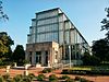 | March 14, 2000 (#00000147) | Junction of Wells Dr. and McKinley Dr., Forest Park 38°38′07″N90°16′46″W / 38.635278°N 90.279444°W | |
| 88 | William Cuthbert Jones House |  | February 7, 2007 (#07000017) | 3724 Olive St. 38°38′29″N90°14′12″W / 38.641389°N 90.236667°W | |
| 89 | Scott Joplin House |  | December 8, 1976 (#76002235) | 2658 Delmar Boulevard 38°38′14″N90°12′53″W / 38.637222°N 90.214722°W | |
| 90 | Frederick Newton Judson House |  | April 30, 2008 (#08000360) | 3733 Washington Ave. 38°38′27″N90°14′03″W / 38.640856°N 90.234208°W | |
| 91 | Kellerman Motor Car Company |  | May 5, 2015 (#15000198) | 3318–3322 Washington Blvd. 38°38′16″N90°13′37″W / 38.6379°N 90.2270°W | |
| 92 | Otto Kulage House |  | May 10, 2002 (#02000467) | 1904 E. College Ave. 38°40′40″N90°12′46″W / 38.677778°N 90.212778°W | |
| 93 | William A. Lange Subdivision |  | July 14, 2011 (#11000444) | 4101–4235 Florissant Ave., 4128–4150 Glasgow Ave., 2141–2325 Angelica St., and 4111–4220 N. 22nd St. 38°39′58″N90°12′32″W / 38.666111°N 90.208889°W | |
| 94 | Leonardo | 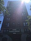 | August 11, 1983 (#83001048) | 4166 Lindell Boulevard 38°38′24″N90°14′53″W / 38.64°N 90.248056°W | |
| 95 | Lewis Place Historic District |  | September 15, 1980 (#80004509) | Lewis Pl. 38°39′16″N90°15′14″W / 38.654444°N 90.253889°W | |
| 96 | Lindell Park Subdivision Historic District |  | February 5, 2013 (#12001256) | Bounded by N. Grand Boulevard and Natural Bridge, Glasgow, and St. Louis Aves. 38°39′26″N90°13′02″W / 38.657097°N 90.217202°W | |
| 97 | Lister Building |  | February 10, 1983 (#83004298) | 4500 Olive St. 38°39′24″N90°15′18″W / 38.656667°N 90.255°W | |
| 98 | Locust Street Automotive District |  | September 15, 2005 (#05001024) | 2914–3124 Locust and 3043 Olive Boundary increase 1: 3133–3207 and 3150–3202 Locust St. Boundary increase 2: 2722–2900 Locust St., 2727–2801 Locust St. 38°38′15″N90°13′21″W / 38.637500°N 90.222500°W | |
| 99 | Louise Apartments |  | August 23, 1984 (#84002651) | 3900 Lindell Boulevard and Vandeventer Ave. 38°38′18″N90°14′29″W / 38.638333°N 90.241389°W | |
| 100 | Lowell School |  | May 24, 2007 (#07000464) | 1409 E. Linton 38°40′38″N90°12′32″W / 38.677222°N 90.208889°W | |
| 101 | Luyties Homeopathic Pharmacy Company Building |  | March 27, 2003 (#02001442) | 4200 Laclede Ave. 38°38′21″N90°14′58″W / 38.639167°N 90.249444°W | |
| 102 | Marshall School |  | September 17, 1999 (#99001162) | 4342 Aldine Ave. 38°39′31″N90°14′38″W / 38.658611°N 90.243889°W | |
| 103 | Marshall School Neighborhood in The Ville Historic District |  | January 17, 2012 (#11001022) | Parts of the 4300 blocks of Aldine and Cote Brilliante Aves. and the 1500 and 1700 blocks of Billups Ave. 38°39′27″N90°14′36″W / 38.657625°N 90.243469°W | |
| 104 | William Cullen McBride Catholic High School |  | January 29, 2008 (#07001493) | 1909–1915 N. Kingshighway Boulevard 38°39′57″N90°15′35″W / 38.6658°N 90.2597°W | |
| 105 | Measuregraph Company Building |  | October 14, 2005 (#05001163) | 4245 Forest Park Boulevard 38°38′16″N90°15′01″W / 38.6378°N 90.2503°W | |
| 106 | Medart's |  | April 22, 2011 (#09000410) | 7036 Clayton Ave. 38°37′59″N90°18′22″W / 38.6331°N 90.3061°W | Site was originally listed in June 2009, but was removed from the Register August 16, 2010. Site was returned to the Register in April 2011. |
| 107 | Melrose Apartments |  | April 18, 2007 (#07000324) | 4065 W. Pine Boulevard 38°38′26″N90°15′00″W / 38.6406°N 90.25°W | |
| 108 | Metropolitan Police Garage |  | October 9, 2020 (#100005664) | 3919 Laclede Ave. 38°38′11″N90°14′34″W / 38.6364°N 90.2428°W | |
| 109 | Midtown Historic District |  | July 7, 1978 (#78003392) | Lindell and Grand Boulevards 38°38′19″N90°14′09″W / 38.6386°N 90.2358°W | |
| 110 | More Automobile Company Building |  | December 3, 2008 (#08001130) | 2801 Locust St. 38°38′07″N90°13′05″W / 38.6353°N 90.2181°W | |
| 111 | Mount Cabanne-Raymond Place Historic District |  | September 13, 2002 (#02000984) | Roughly bounded by Kingshighway, Page, Union, and Delmar Boulevards 38°39′23″N90°16′03″W / 38.6564°N 90.2675°W | |
| 112 | Mullanphy Historic District |  | February 14, 1983 (#83001051) | N. 14th St. between Mullanphy and Howard and N. 13th between Howard and Tyler 38°38′36″N90°11′40″W / 38.6433°N 90.1944°W | |
| 113 | Murphy-Blair District |  | January 26, 1984 (#84002658) | Roughly bounded by Interstate 70, Florissant Ave., and Chambers and Branch Sts. 38°39′01″N90°11′49″W / 38.6503°N 90.1969°W | |
| 114 | Negro Masonic Hall |  | April 15, 1993 (#93000262) | 3615–3619 Dr. Martin Luther King Boulevard 38°38′49″N90°13′37″W / 38.6469°N 90.2269°W | Demolished after a 1995 fire. [3] |
| 115 | Neighborhood Gardens Apartments |  | January 31, 1986 (#86000143) | 1205 N. 7th St. 38°38′12″N90°11′20″W / 38.6367°N 90.1889°W | |
| 116 | North Broadway Glass and Plow Warehouse District |  | November 14, 2012 (#12000928) | 2500–2522, 2600–2614 N. Broadway 38°39′06″N90°11′24″W / 38.6517°N 90.1900°W | |
| 117 | North Broadway Wholesale and Warehouse District |  | June 18, 2010 (#10000352) | 1400–1600 and 1609–1629 North Broadway 38°38′25″N90°11′09″W / 38.6402°N 90.1859°W | |
| 118 | North Riverfront Industrial Historic District |  | May 1, 2003 (#03000320) | Roughly bounded by Dickson, Lewis, O'Fallon, 2nd, Ashley, Biddle, and the Mississippi River 38°38′18″N90°10′55″W / 38.6383°N 90.1819°W | |
| 119 | Oakherst Place Concrete Block District |  | May 5, 1987 (#87000642) | Roughly bounded by Julian, Oakley, Plymouth, and Oakherst 38°40′01″N90°17′19″W / 38.6669°N 90.2886°W | |
| 120 | Our Lady of Perpetual Help Parish Hall, School, Convent, and Rectory |  | November 5, 2009 (#09000890) | 5217 N. 21st St. (parish hall), 2017 Linton Ave. (school and convent), and 2011 Linton Ave. (rectory) 38°40′27″N90°12′49″W / 38.6743°N 90.2137°W | |
| 121 | Armando Pacini Restaurant |  | July 26, 2005 (#04001162) | 8 S. Sarah St. 38°38′12″N90°14′48″W / 38.6368°N 90.2466°W | |
| 122 | Page Boulevard Police Station |  | September 11, 1980 (#80004504) | Page and Union Boulevards 38°39′40″N90°16′17″W / 38.6611°N 90.2714°W | Demolished in 1995 |
| 123 | Parkview Historic District |  | March 14, 1986 (#86000788) | Roughly bounded by Delmar Ave., Skinker and Millbrook Boulevards, and Mellville Ave. 38°39′08″N90°18′11″W / 38.6522°N 90.3031°W | |
| 124 | D. L. Parrish Laundry Company Building |  | January 28, 2004 (#03001506) | 3100–3128 Olive St. 38°38′14″N90°13′31″W / 38.6372°N 90.2253°W | |
| 125 | Pendennis Club Apartment Building |  | July 16, 2008 (#08000665) | 3737 Washington Ave. 38°38′26″N90°14′02″W / 38.640453°N 90.233944°W | |
| 126 | Homer G. Phillips Hospital |  | September 23, 1982 (#82004738) | 2601 Whittier St. 38°39′31″N90°14′07″W / 38.658528°N 90.23535°W | |
| 127 | Homer G. Phillips House |  | February 20, 2009 (#09000036) | 4524 Cottage Ave. 38°39′46″N90°14′44″W / 38.662661°N 90.245617°W | |
| 128 | Plaza Hotel Complex |  | May 7, 1985 (#85001007) | 307 N. Leonard, 3301-3321 Olive, 3300-3322 and 3339 Lindell, 3322-3334 Locust, and 308-310 Channing 38°38′13″N90°13′40″W / 38.636944°N 90.227778°W | |
| 129 | Portland and Westmoreland Places |  | February 12, 1974 (#74002276) | Northeastern corner of Forest Park 38°38′48″N90°16′10″W / 38.646667°N 90.269444°W | |
| 130 | Principia Page-Park YMCA Gymnasium |  | September 2, 1982 (#82004739) | 5569 Minerva Ave. 38°39′46″N90°16′23″W / 38.662778°N 90.273056°W | |
| 131 | Pruitt School |  | January 29, 2018 (#100002038) | 1212 N 22nd St. 38°38′26″N90°12′31″W / 38.640591°N 90.208636°W | |
| 132 | Ramsey Accessories Manufacturing Corporation |  | April 16, 2008 (#07000813) | 3693 Forest Park Boulevard 38°38′03″N90°14′15″W / 38.634228°N 90.237369°W | |
| 133 | Remington Rand Building |  | May 5, 2015 (#15000199) | 4100 Lindell Blvd. 38°38′23″N90°14′46″W / 38.6398°N 90.2460°W | |
| 134 | Roberts Chevrolet |  | June 22, 2007 (#07000617) | 5875–91 Delmar Boulevard 38°39′17″N90°17′22″W / 38.654722°N 90.289444°W | |
| 135 | Royal Tire Service Inc. Building |  | June 22, 2007 (#07000616) | 3229 Washington Ave. 38°38′17″N90°13′33″W / 38.638056°N 90.225833°W | |
| 136 | S. Pfeiffer Manufacturing Company Headquarters | 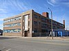 | August 30, 2010 (#10000598) | 3965 Laclede Ave. 38°38′13″N90°14′39″W / 38.636944°N 90.244167°W | |
| 137 | St. Augustine's Roman Catholic Church |  | October 2, 1986 (#86002819) | 3114 Lismore 38°39′24″N90°12′41″W / 38.656667°N 90.211389°W | |
| 138 | St. Joseph's Roman Catholic Church |  | May 19, 1978 (#78003396) | 1220 N. 11th St. 38°38′14″N90°11′33″W / 38.637222°N 90.1925°W | |
| 139 | St. Liborius Church and Buildings | 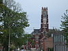 | October 11, 1979 (#79003637) | 1835 N. 18th St. 38°38′48″N90°11′59″W / 38.646667°N 90.199722°W | |
| 140 | St. Louis Colored Orphans Home | 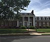 | September 17, 1999 (#99001164) | 2612 Annie Malone Dr. 38°39′40″N90°14′11″W / 38.661111°N 90.236389°W | |
| 141 | St. Louis Stamping Company Buildings |  | November 10, 2009 (#09000902) | 101 Cass Ave. 38°38′24″N90°11′03″W / 38.640056°N 90.18405°W | |
| 142 | St. Louis Theatre |  | May 25, 2001 (#01000545) | 718 N. Grand Boulevard 38°38′32″N90°13′49″W / 38.642222°N 90.230278°W | |
| 143 | St. Ferdinand Avenue in The Ville Historic District |  | January 17, 2012 (#11001023) | 4200 W. block of St. Ferdinand Ave. 38°39′33″N90°14′21″W / 38.659167°N 90.239181°W | |
| 144 | St. Louis Place Historic District |  | August 31, 2011 (#11000617) | Roughly bounded by 21st, 22nd, 23rd, 25th, Benton, Montgomery, and N. Market Sts., and Rauschenbach and St. Louis Aves. 38°39′01″N90°12′12″W / 38.650278°N 90.203333°W | |
| 145 | St. Louis Post-Dispatch Rotogravure Printing Plant | 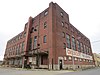 | February 23, 2016 (#16000032) | 4340–50 Duncan Ave. 38°38′09″N90°15′14″W / 38.635709°N 90.253844°W | |
| 146 | St. Luke's Hospital Historic District |  | April 20, 2018 (#100002335) | 5535 Delmar Blvd. 38°39′13″N90°16′49″W / 38.6536°N 90.2804°W | |
| 147 | St. Luke's Plaza Apartments |  | November 1, 2007 (#07001120) | 5602–5629 Enright Ave. 38°39′18″N90°16′58″W / 38.655°N 90.282778°W | |
| 148 | St. Mark the Evangelist Catholic Church, Convent and Academy |  | October 11, 2007 (#07001075) | 1313 Academy Ave. and 5100 Minerva Ave. 38°39′46″N90°15′59″W / 38.662778°N 90.266389°W | |
| 149 | Saint Matthew's Parish Complex |  | August 6, 1986 (#86002236) | Sarah and Kennerly 38°39′32″N90°13′57″W / 38.658889°N 90.2325°W | |
| 150 | St. Stanislaus Kostka Church |  | July 10, 1979 (#79003635) | 1413 N. 20th St. 38°38′31″N90°12′20″W / 38.641944°N 90.205556°W | |
| 151 | Sanitol Building |  | October 21, 1985 (#85003362) | 4252–4264 Laclede Ave. 38°38′16″N90°15′04″W / 38.637778°N 90.251111°W | |
| 152 | Savings Trust Company of St. Louis |  | January 4, 2024 (#100009691) | 4915 Delmar Blvd 38°39′05″N90°15′40″W / 38.6515°N 90.2612°W | |
| 153 | Scudder Motor Truck Company Building |  | April 24, 2012 (#12000233) | 3942–3962 Laclede Ave. 38°38′11″N90°14′38″W / 38.636316°N 90.243913°W | |
| 154 | Second Presbyterian Church |  | September 11, 1975 (#75002140) | 4501 Westminster Pl. 38°38′51″N90°15′20″W / 38.6475°N 90.255556°W | |
| 155 | Ben J. Selkirk and Sons Building |  | November 15, 2005 (#05001280) | 4160–4166 Olive St. 38°38′45″N90°14′47″W / 38.645833°N 90.246389°W | |
| 156 | Shelley House |  | April 18, 1988 (#88000437) | 4600 Labadie Ave. 38°40′00″N90°14′38″W / 38.666667°N 90.243889°W | |
| 157 | Shriners' Hospital for Crippled Children |  | June 1, 2015 (#15000306) | 700–728 S. Euclid & 4565 Clayton Ave. 38°38′01″N90°15′46″W / 38.6335°N 90.2629°W | |
| 158 | Simmons Colored School |  | September 17, 1999 (#99001163) | 4306–4318 St. Louis Ave. 38°39′54″N90°14′15″W / 38.665°N 90.2375°W | |
| 159 | Sligo Iron Store Co. Buildings |  | April 21, 2010 (#10000205) | 1301 N. 6th St. 38°38′15″N90°11′14″W / 38.637506°N 90.187278°W | |
| 160 | Smith Academy and Manual Training School |  | April 28, 2003 (#03000296) | 5351 Enright Ave. 38°39′20″N90°16′31″W / 38.655556°N 90.275278°W | |
| 161 | Standard Adding Machine Building | 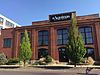 | November 25, 2005 (#05001328) | 3701 Forest Park Boulevard 38°38′09″N90°14′17″W / 38.635833°N 90.238056°W | |
| 162 | Standard Stamping Company Factory |  | January 20, 2020 (#100004877) | 2000 North Broadway 38°38′50″N90°11′16″W / 38.6473°N 90.1878°W | |
| 163 | Star Bucket Pump Company Building |  | September 19, 2012 (#12000794) | 1218–1224 N. 15th St. 38°38′19″N90°11′55″W / 38.638528°N 90.19855°W | |
| 164 | Stix, Baer and Fuller Dry Goods Company's "Grand Leader" Relay Station |  | July 17, 2002 (#02000805) | 3712–3748 Laclede Ave. and 3717 Forest Park Boulevard 38°38′11″N90°14′19″W / 38.636389°N 90.238611°W | |
| 165 | Robert Henry Stockton House | 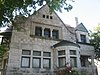 | August 10, 1988 (#88001177) | 3508 Samuel Shepard Dr. 38°38′21″N90°13′46″W / 38.639167°N 90.229444°W | |
| 166 | Stowe Teachers College |  | September 17, 1999 (#99001161) | 2615 Billups 38°39′45″N90°14′24″W / 38.6625°N 90.24°W | |
| 167 | Charles Sumner High School |  | April 19, 1988 (#88000469) | 4248 W. Cottage Ave. 38°39′34″N90°14′21″W / 38.659444°N 90.239167°W | |
| 168 | Tandy Community Center |  | September 17, 1999 (#99001160) | 4206 W. Kennerly Ave. 38°39′42″N90°14′13″W / 38.661667°N 90.236944°W | |
| 169 | Taylor-Olive Building |  | December 12, 2002 (#02001494) | 4505 Olive St. 38°38′53″N90°15′17″W / 38.648056°N 90.254722°W | |
| 170 | Charles Turner Open Air School |  | September 17, 1999 (#99001165) | 4235 W. Kennerly Ave. 38°39′47″N90°14′19″W / 38.663056°N 90.238611°W | |
| 171 | Mark Twain Elementary School |  | July 14, 2011 (#11000445) | 5316 Ruskin Ave. 38°41′26″N90°14′33″W / 38.690556°N 90.2425°W | |
| 172 | United Railways Spring Avenue Substation-Trouble Station |  | January 21, 2020 (#100004876) | 2423 North Spring Ave. 38°39′10″N90°13′31″W / 38.6527°N 90.2252°W | |
| 173 | Vashon Community Center |  | August 11, 2005 (#05000882) | 3145 Market St. 38°37′59″N90°13′36″W / 38.633056°N 90.226667°W | |
| 174 | Vesper-Buick Auto Company Building |  | October 2, 1986 (#86002814) | 3900–3912 W. Pine 38°38′13″N90°14′30″W / 38.636944°N 90.241667°W | demolished in 1995 |
| 175 | Wagoner Place Historic District | 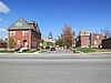 | December 19, 2007 (#07001292) | Bounded by Dick Gregory, Marcus, Dr. M.L. King, and N. Market Sts. 38°39′42″N90°15′07″W / 38.6616°N 90.251928°W | |
| 176 | Wainwright Tomb |  | June 15, 1970 (#70000907) | Bellefontaine Cemetery, 4947 W. Florissant Ave. 38°41′20″N90°13′28″W / 38.688889°N 90.224444°W | |
| 177 | Walnut Park School | 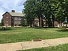 | April 23, 2013 (#13000194) | 5314 Riverview Boulevard and 5814 Thekla Ave. 38°42′09″N90°15′12″W / 38.702416°N 90.253224°W | |
| 178 | Washington Metropolitan African Methodist Episcopal Zion Church |  | December 29, 2005 (#05001095) | 613 N. Garrison Ave. 38°38′21″N90°13′17″W / 38.639167°N 90.221389°W | |
| 179 | Washington University Dental Department Building |  | March 13, 2017 (#100000751) | 2647 Locust St. 38°38′04″N90°12′55″W / 38.634458°N 90.215381°W | |
| 180 | Washington University Hilltop Campus Historic District |  | January 12, 1979 (#79003636) | Roughly bounded by Big Bend, Forsyth, Skinker, and Millbrook Boulevards 38°38′54″N90°18′35″W / 38.648333°N 90.309722°W | |
| 181 | Waterman Place-Kingsbury Place-Washington Terrace Historic District |  | June 12, 2007 (#07000549) | Bounded by Union Boulevard, the alley south of Waterman Place, Belt Ave., the alley south of Kingsbury Place, Clara Ave., and the former alley line between Washington Terrace and Delmar 38°38′56″N90°16′34″W / 38.648992°N 90.276144°W | |
| 182 | Welfare Finance Company Building |  | March 22, 2016 (#16000103) | 1027–29 N. Grand Blvd. 38°38′35″N90°13′44″W / 38.643181°N 90.229021°W | |
| 183 | Wellston J.C. Penney Building |  | February 5, 2009 (#08001410) | 5930 Dr. Martin Luther King Dr. 38°40′27″N90°17′00″W / 38.6742°N 90.283425°W | |
| 184 | Wellston Loop Commercial Historic District |  | September 9, 2010 (#09001266) | Bounded by the city limits, the alleys south and north of Martin Luther King Dr. and Clara Ave. 38°40′21″N90°16′49″W / 38.6725°N 90.280278°W | |
| 185 | Wellston Station |  | May 2, 2007 (#07000377) | 6111 Dr. Martin Luther King Dr. 38°40′31″N90°17′00″W / 38.675278°N 90.283333°W | |
| 186 | West Cabanne Place Historic District |  | November 21, 1980 (#80004393) | West Cabanne Place 38°39′31″N90°17′34″W / 38.658611°N 90.292778°W | |
| 187 | West Locust and Olive Street Commercial and Industrial District |  | September 6, 2006 (#06000787) | Roughly bounded by Theresa, Olive, Locust, and Leonard 38°38′20″N90°13′44″W / 38.638889°N 90.228889°W | |
| 188 | West Pine-Laclede Historic District | 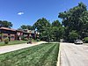 | May 9, 2002 (#02000466) | Roughly bounded by Euclid, Lindell, Sarah, and Forest Park Parkway 38°38′23″N90°15′11″W / 38.639722°N 90.253056°W | |
| 189 | Western Electric-Southwestern Bell Telephone Distribution House | 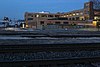 | July 14, 2011 (#11000446) | 4250 Duncan St. 38°38′06″N90°15′06″W / 38.635°N 90.251667°W | |
| 190 | Zebediah F. Mary H. Wetzell House |  | August 1, 2008 (#08000739) | 3741 Washington Ave. 38°38′26″N90°14′02″W / 38.640486°N 90.234019°W | |
| 191 | Wiltshire and Versailles Historic Buildings | 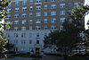 | September 29, 1982 (#82004744) | 724 and 709 Skinker Boulevard 38°38′13″N90°18′15″W / 38.636944°N 90.304167°W | |
| 192 | Henry L. Wolfner Memorial Library for the Blind | 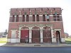 | June 30, 2005 (#05000631) | 3842–3844 Olive St. 38°38′33″N90°14′19″W / 38.6425°N 90.238611°W | |
| 193 | Wydown-Forsyth District |  | May 23, 1988 (#88000628) | Roughly bounded by Forsyth, Skinker Boulevard, Fauquier, Wydown Terrace Dr., and University Ln. 38°38′38″N90°18′25″W / 38.643889°N 90.306944°W | |
| 194 | Yeatman Square Historic District |  | May 8, 2012 (#12000255) | Parts of Glasgow, Leffingwell, Madison, Magazine, and N. Market Sts. 38°38′56″N90°12′59″W / 38.649003°N 90.216511°W | |
| 195 | YWCA, Phillis Wheatley Branch |  | July 24, 1984 (#84002694) | 2709 Locust St. 38°38′06″N90°12′59″W / 38.635000°N 90.216389°W |