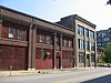
[1] Name on the Register Image Date listed [2] Location Description 1 Advertising Building Advertising Building January 18, 1985 (# 85000106 1627–1629 Locust St. 38°37′56″N 90°12′14″W / 38.632222°N 90.203889°W / 38.632222; -90.203889 (Advertising Building ) 2 Ambassador Theater Building Ambassador Theater Building March 29, 1983 (# 83001039 411 N. 7th St. 38°37′46″N 90°11′28″W / 38.629444°N 90.191111°W / 38.629444; -90.191111 (Ambassador Theater Building ) Demolished in 1996. [3] 3 American Theater American Theater March 18, 1985 (# 85000617 416 N. 9th St. 38°37′48″N 90°11′34″W / 38.630000°N 90.192778°W / 38.630000; -90.192778 (American Theater ) 4 American Zinc, Lead and Smelting Company Building American Zinc, Lead and Smelting Company Building May 4, 1998 (# 98000363 20 S. 4th St. 38°37′28″N 90°11′19″W / 38.624383°N 90.188712°W / 38.624383; -90.188712 (American Zinc, Lead and Smelting Company Building ) 5 Arcade Building Arcade Building March 23, 2003 (# 03000126 810 Olive St. 38°37′42″N 90°11′34″W / 38.628333°N 90.192778°W / 38.628333; -90.192778 (Arcade Building ) 6 Balmer & Weber Music House Co. Building Balmer & Weber Music House Co. Building August 31, 2000 (# 00001008 1004 Olive St. 38°37′44″N 90°11′42″W / 38.628889°N 90.195000°W / 38.628889; -90.195000 (Balmer & Weber Music House Co. Building ) 7 Beethoven Conservatory Beethoven Conservatory March 2, 1989 (# 89000075 2301 Locust St. 38°38′03″N 90°12′44″W / 38.634167°N 90.212222°W / 38.634167; -90.212222 (Beethoven Conservatory ) 8 Bell Telephone Building Bell Telephone Building August 5, 1999 (# 99000936 920 Olive St. 38°37′44″N 90°11′40″W / 38.628889°N 90.194444°W / 38.628889; -90.194444 (Bell Telephone Building ) 9 Berry Motor Car Service Building Berry Motor Car Service Building July 19, 2010 (# 10000480 2220 Washington Ave. 38°38′04″N 90°12′41″W / 38.634444°N 90.211389°W / 38.634444; -90.211389 (Berry Motor Car Service Building ) 10 Blackwell-Wielandy Building Blackwell-Wielandy Building July 21, 1983 (# 83001040 1601–1609 Locust St. 38°37′56″N 90°12′11″W / 38.632222°N 90.203056°W / 38.632222; -90.203056 (Blackwell-Wielandy Building ) 11 Board of Education Building Board of Education Building January 12, 2005 (# 04001475 901–911 Locust St. and 401–409 N. Ninth St. 38°37′48″N 90°11′36″W / 38.630000°N 90.193333°W / 38.630000; -90.193333 (Board of Education Building ) 12 Boatman's Bank Building Boatman's Bank Building October 22, 1998 (# 98001265 300 North Broadway 38°37′40″N 90°11′19″W / 38.627778°N 90.188611°W / 38.627778; -90.188611 (Boatman's Bank Building ) 13 A. D. Brown Building A. D. Brown Building March 28, 1980 (# 80004502 1136 Washington Ave. 38°37′53″N 90°11′47″W / 38.631389°N 90.196389°W / 38.631389; -90.196389 (A. D. Brown Building ) 14 Paul Brown Building Paul Brown Building December 12, 2002 (# 02001496 818 Olive St. 38°37′42″N 90°11′36″W / 38.628333°N 90.193333°W / 38.628333; -90.193333 (Paul Brown Building ) 15 Building at 1009 Olive St. Building at 1009 Olive St. May 9, 2002 (# 02000468 1009 Olive St. 38°37′46″N 90°11′42″W / 38.629444°N 90.195000°W / 38.629444; -90.195000 (Building at 1009 Olive St. ) 16 Building at 1121–23 Locust St. Building at 1121–23 Locust St. August 4, 2004 (# 04000785 1121–23 Locust St. 38°37′50″N 90°11′46″W / 38.630556°N 90.196111°W / 38.630556; -90.196111 (Building at 1121–23 Locust St. ) 17 Building at 1300 Washington Avenue Building at 1300 Washington Avenue September 2, 1982 (# 82004732 1300–1310 Washington Ave. 38°37′55″N 90°11′55″W / 38.631944°N 90.198611°W / 38.631944; -90.198611 (Building at 1300 Washington Avenue ) 18 Robert G. Campbell House Robert G. Campbell House April 21, 1977 (# 77001560 1508 Locust St. 38°37′53″N 90°12′06″W / 38.631389°N 90.201750°W / 38.631389; -90.201750 (Robert G. Campbell House ) 19 Centenary Methodist Episcopal Church, South Centenary Methodist Episcopal Church, South January 16, 1997 (# 96001596 55 Plaza Sq. 38°37′50″N 90°12′13″W / 38.630556°N 90.203611°W / 38.630556; -90.203611 (Centenary Methodist Episcopal Church, South ) 20 Centennial Malt House Centennial Malt House November 15, 2005 (# 05001281 2017–19 Chouteau Ave. 38°37′17″N 90°12′47″W / 38.621389°N 90.213056°W / 38.621389; -90.213056 (Centennial Malt House ) 21 Century Building and Syndicate Trust Building Century Building and Syndicate Trust Building October 16, 2002 (# 02001054 Bounded by Locust, 9th, 10th, and Olive Sts. 38°37′46″N 90°11′39″W / 38.629444°N 90.194167°W / 38.629444; -90.194167 (Century Building and Syndicate Trust Building ) The Century Building was demolished and replaced by a parking garage in February 2005. [4] 22 Chemical Building Chemical Building March 19, 1982 (# 82004734 721 Olive St. 38°37′43″N 90°11′31″W / 38.628611°N 90.191944°W / 38.628611; -90.191944 (Chemical Building ) 23 Chouteau's Landing Historic District Upload image April 12, 2024 (# 100010146 Cedar St., South 1st St., Chouteau Ave., South 3rd St. 38°37′02″N 90°11′24″W / 38.6171°N 90.1899°W / 38.6171; -90.1899 (Chouteau's Landing Historic District ) 24 Christ Church Cathedral Christ Church Cathedral March 7, 1990 (# 90000345 1210 Locust St. 38°37′50″N 90°11′54″W / 38.630556°N 90.198333°W / 38.630556; -90.198333 (Christ Church Cathedral ) 25 City Club Building City Club Building June 6, 2002 (# 02000610 1012–1024 Locust St. 38°37′48″N 90°11′43″W / 38.630000°N 90.195278°W / 38.630000; -90.195278 (City Club Building ) 26 Crunden-Martin Manufacturing Company Crunden-Martin Manufacturing Company February 9, 2005 (# 05000013 104 Cedar, 760 S. 2nd St., and 757 S. 2nd St. 38°37′04″N 90°11′21″W / 38.617778°N 90.189167°W / 38.617778; -90.189167 (Crunden-Martin Manufacturing Company ) 27 Cupples Warehouse District Cupples Warehouse District June 26, 1998 (# 85003615 Roughly Spruce and Clark Sts. between 7th and 11th Sts. 38°37′26″N 90°11′51″W / 38.623889°N 90.197500°W / 38.623889; -90.197500 (Cupples Warehouse District ) 28 Delany Building Delany Building March 1, 2002 (# 02000102 1000–06 Locust St. 38°37′47″N 90°11′41″W / 38.629722°N 90.194722°W / 38.629722; -90.194722 (Delany Building ) 29 Downtown YMCA Building Downtown YMCA Building June 27, 2014 (# 14000379 1528 Locust St. 38°37′54″N 90°12′10″W / 38.6317°N 90.2027°W / 38.6317; -90.2027 (Downtown YMCA Building ) 30 Eads Bridge Eads Bridge October 15, 1966 (# 66000946 Spanning the Mississippi River at Washington St. 38°37′45″N 90°10′52″W / 38.629167°N 90.181111°W / 38.629167; -90.181111 (Eads Bridge ) 31 Emerson Electric Company Building Emerson Electric Company Building November 6, 1986 (# 86003138 2012–2018 Washington Ave. 38°38′02″N 90°12′31″W / 38.633889°N 90.208611°W / 38.633889; -90.208611 (Emerson Electric Company Building ) 32 Employment Security Building Employment Security Building May 21, 2018 (# 100002429 505 Washington Ave. 38°37′48″N 90°11′19″W / 38.630020°N 90.1885°W / 38.630020; -90.1885 (Employment Security Building ) 33 Endicott-Johnson Shoe Distribution Plant Endicott-Johnson Shoe Distribution Plant October 11, 2007 (# 07001074 1132 Spruce St. 38°37′26″N 90°11′58″W / 38.623889°N 90.199444°W / 38.623889; -90.199444 (Endicott-Johnson Shoe Distribution Plant ) 34 Engine House No. 32 Engine House No. 32 November 24, 2015 (# 15000816 2000 Washington Ave. & 503 N. 20th St. 38°38′03″N 90°12′28″W / 38.63406°N 90.2079°W / 38.63406; -90.2079 (Engine House No. 32 ) 35 Executive Office Building Executive Office Building November 14, 2012 (# 12000926 515–517 Olive St. 38°37′41″N 90°11′23″W / 38.628056°N 90.189722°W / 38.628056; -90.189722 (Executive Office Building ) 36 Farm and Home Savings and Loan Association Farm and Home Savings and Loan Association October 29, 2008 (# 08001025 1001 Locust St. 38°37′48″N 90°11′40″W / 38.630000°N 90.194444°W / 38.630000; -90.194444 (Farm and Home Savings and Loan Association ) 37 Fashion Square Building Fashion Square Building October 9, 1985 (# 85003105 1307 Washington Ave. 38°37′57″N 90°11′55″W / 38.632500°N 90.198611°W / 38.632500; -90.198611 (Fashion Square Building ) 38 Eugene Field House Eugene Field House August 19, 1975 (# 75002137 634 S. Broadway 38°37′12″N 90°11′31″W / 38.620000°N 90.191944°W / 38.620000; -90.191944 (Eugene Field House ) Home of civil rights lawyer Roswell Field 39 Ford Apartments Ford Apartments January 26, 2005 (# 04001562 1405 Pine St. 38°37′47″N 90°12′03″W / 38.629722°N 90.200833°W / 38.629722; -90.200833 (Ford Apartments ) 40 Franklin School Franklin School March 9, 2005 (# 05000121 814 N. 19th St. 38°38′08″N 90°12′19″W / 38.635556°N 90.205278°W / 38.635556; -90.205278 (Franklin School ) 41 Frisco Building Frisco Building March 29, 1983 (# 83001046 906 Olive St. 38°37′44″N 90°11′38″W / 38.628889°N 90.193889°W / 38.628889; -90.193889 (Frisco Building ) 42 Fulton Bag Company Building Fulton Bag Company Building September 5, 1991 (# 91001372 612–618 S. 7th St. 38°37′16″N 90°11′38″W / 38.621111°N 90.193889°W / 38.621111; -90.193889 (Fulton Bag Company Building ) 43 Gateway Arch Gateway Arch May 28, 1987 (# 87001423 Memorial Dr. between the Poplar St. and Eads bridges 38°37′28″N 90°11′06″W / 38.624444°N 90.185000°W / 38.624444; -90.185000 (Gateway Arch ) 44 General American Life Insurance Co. Buildings General American Life Insurance Co. Buildings October 22, 2002 (# 02001206 1501–1511 Locust St. 38°37′55″N 90°12′06″W / 38.631944°N 90.201667°W / 38.631944; -90.201667 (General American Life Insurance Co. Buildings ) 45 General American Life Insurance Co. Buildings General American Life Insurance Co. Buildings March 27, 2008 (# 07000461 700 Market St. 38°37′32″N 90°11′35″W / 38.625556°N 90.193056°W / 38.625556; -90.193056 (General American Life Insurance Co. Buildings ) Now known as 700 Market. 46 William A. Gill Building William A. Gill Building May 8, 2009 (# 09000282 622 Olive St. 38°37′41″N 90°11′28″W / 38.628056°N 90.191250°W / 38.628056; -90.191250 (William A. Gill Building ) 47 Grand-Leader (Stix, Baer & Fuller Dry Goods Co.) Building Grand-Leader (Stix, Baer & Fuller Dry Goods Co.) Building July 17, 2003 (# 03000650 601 Washington Ave. 38°37′50″N 90°11′22″W / 38.630556°N 90.189444°W / 38.630556; -90.189444 (Grand-Leader (Stix, Baer & Fuller Dry Goods Co.) Building ) 48 Haas Building Haas Building July 28, 2004 (# 04000747 410 N. Jefferson Ave. and 2327 Locust St. 38°38′03″N 90°12′48″W / 38.634167°N 90.213333°W / 38.634167; -90.213333 (Haas Building ) 49 Elias Haas Building Elias Haas Building April 12, 2006 (# 06000248 2223 Locust St. 38°38′02″N 90°12′43″W / 38.633889°N 90.211944°W / 38.633889; -90.211944 (Elias Haas Building ) 50 Hadley-Dean Glass Company Hadley-Dean Glass Company August 1, 1979 (# 79003634 701–705 N. 11th St. 38°37′56″N 90°11′42″W / 38.632222°N 90.195000°W / 38.632222; -90.195000 (Hadley-Dean Glass Company ) 51 Halsey-Packard Building Halsey-Packard Building December 14, 2005 (# 05001036 2201–2211 Locust St. 38°38′02″N 90°12′40″W / 38.633889°N 90.211111°W / 38.633889; -90.211111 (Halsey-Packard Building ) 52 Hamilton-Brown Shoe Factory Hamilton-Brown Shoe Factory May 5, 2000 (# 00000437 2031 Olive St. 38°37′57″N 90°12′34″W / 38.632500°N 90.209444°W / 38.632500; -90.209444 (Hamilton-Brown Shoe Factory ) 53 Hargadine-McKittrick Dry Goods Building Hargadine-McKittrick Dry Goods Building March 19, 1982 (# 82004728 911 Washington Ave. 38°37′53″N 90°11′36″W / 38.631389°N 90.193333°W / 38.631389; -90.193333 (Hargadine-McKittrick Dry Goods Building ) 54 Hotel Jefferson Hotel Jefferson October 24, 2003 (# 03001066 415 N. Tucker Boulevard 38°37′51″N 90°11′51″W / 38.630833°N 90.197500°W / 38.630833; -90.197500 (Hotel Jefferson ) 55 Hotel Statler Hotel Statler March 19, 1982 (# 82004729 822 Washington Ave. 38°37′50″N 90°11′33″W / 38.630556°N 90.192500°W / 38.630556; -90.192500 (Hotel Statler ) 56 International Fur Exchange Building International Fur Exchange Building April 13, 1998 (# 98000313 2–14 S. 4th St. 38°37′30″N 90°11′19″W / 38.625000°N 90.188611°W / 38.625000; -90.188611 (International Fur Exchange Building ) 57 J.C. Penney Co. Warehouse Building J.C. Penney Co. Warehouse Building December 31, 1998 (# 98001563 400 S. 14th St. 38°37′28″N 90°12′07″W / 38.624444°N 90.201944°W / 38.624444; -90.201944 (J.C. Penney Co. Warehouse Building ) 58 Gateway Arch National Park Gateway Arch National Park October 15, 1966 (# 66000941 Mississippi River between Washington and Poplar Sts. 38°37′30″N 90°11′12″W / 38.625000°N 90.186667°W / 38.625000; -90.186667 (Gateway Arch National Park ) 59 J. Kennard and Sons Carpet Company Building J. Kennard and Sons Carpet Company Building May 5, 2000 (# 00000438 400 Washington Ave. 38°37′46″N 90°11′14″W / 38.629444°N 90.187222°W / 38.629444; -90.187222 (J. Kennard and Sons Carpet Company Building ) 60 Kiel Opera House Kiel Opera House February 11, 2000 (# 00000016 1400 Market St. 38°37′40″N 90°12′07″W / 38.627778°N 90.201944°W / 38.627778; -90.201944 (Kiel Opera House ) 61 Kieselhorst Piano Company Building Kieselhorst Piano Company Building April 10, 2008 (# 08000268 1007 Olive St. 38°37′46″N 90°11′41″W / 38.629444°N 90.194861°W / 38.629444; -90.194861 (Kieselhorst Piano Company Building ) 62 Laclede Building Laclede Building August 6, 1998 (# 98000994 408 Olive St. 38°37′38″N 90°11′18″W / 38.627222°N 90.188333°W / 38.627222; -90.188333 (Laclede Building ) 63 Laclede's Landing Laclede's Landing August 25, 1976 (# 76002262 Roughly bounded by Washington, N. 3rd, Dr. Martin Luther King Dr., and the Mississippi River 38°37′48″N 90°11′02″W / 38.630000°N 90.183889°W / 38.630000; -90.183889 (Laclede's Landing ) 64 Lambert Building Lambert Building February 24, 1983 (# 83001047 2101–2107 Locust St. 38°38′01″N 90°12′34″W / 38.633611°N 90.209444°W / 38.633611; -90.209444 (Lambert Building ) 65 Lambert-Deacon-Hull Printing Company Building Lambert-Deacon-Hull Printing Company Building October 20, 1980 (# 80004508 2100 Locust St. 38°37′59″N 90°12′35″W / 38.633056°N 90.209722°W / 38.633056; -90.209722 (Lambert-Deacon-Hull Printing Company Building ) 66 LaSalle Building LaSalle Building November 15, 2005 (# 05001282 501 Olive St. 38°37′41″N 90°11′21″W / 38.628056°N 90.189167°W / 38.628056; -90.189167 (LaSalle Building ) 67 Leacock Sporting Goods Company Building Leacock Sporting Goods Company Building April 24, 2017 (# 100000912 921 Locust St. 38°37′47″N 90°11′39″W / 38.629831°N 90.194041°W / 38.629831; -90.194041 (Leacock Sporting Goods Company Building ) 68 Robert E. Lee Hotel Robert E. Lee Hotel February 7, 2007 (# 07000021 205 N. 18th St. 38°37′51″N 90°12′22″W / 38.630833°N 90.206111°W / 38.630833; -90.206111 (Robert E. Lee Hotel ) 69 Lennox Hotel Lennox Hotel September 6, 1984 (# 84002647 823–827 Washington Ave. 38°37′52″N 90°11′33″W / 38.631111°N 90.192500°W / 38.631111; -90.192500 (Lennox Hotel ) 70 Lesan-Gould Building Lesan-Gould Building November 6, 1986 (# 86003137 1320–1324 Washington Ave. 38°37′55″N 90°11′58″W / 38.631944°N 90.199306°W / 38.631944; -90.199306 (Lesan-Gould Building ) 71 Liggett & Myers Tobacco Co. Building Liggett & Myers Tobacco Co. Building February 10, 1983 (# 83001049 1900–1912 Pine St. 38°37′51″N 90°12′28″W / 38.630833°N 90.207778°W / 38.630833; -90.207778 (Liggett & Myers Tobacco Co. Building ) 72 Liggett and Myers (Rice-Stix) Building Liggett and Myers (Rice-Stix) Building February 16, 1984 (# 84002648 1000 Washington Ave. 38°37′51″N 90°11′40″W / 38.630833°N 90.194444°W / 38.630833; -90.194444 (Liggett and Myers (Rice-Stix) Building ) 73 Lindell Real Estate Company Building Lindell Real Estate Company Building March 19, 1982 (# 82004737 1015 Washington Ave. 38°37′54″N 90°11′40″W / 38.631528°N 90.194444°W / 38.631528; -90.194444 (Lindell Real Estate Company Building ) 74 Louderman Building Louderman Building November 22, 2000 (# 00001399 317 N. 11th St. 38°37′48″N 90°11′44″W / 38.630000°N 90.195556°W / 38.630000; -90.195556 (Louderman Building ) 75 Lucas Avenue Industrial Historic District Lucas Avenue Industrial Historic District August 31, 2000 (# 00001009 Bounded by Washington, Delmar, 20th, and 21st Sts.; also roughly bounded by Locust St., Delmar , and 19th and 20th Sts. 38°38′06″N 90°12′29″W / 38.635000°N 90.208056°W / 38.635000; -90.208056 (Lucas Avenue Industrial Historic District ) Second set of boundaries represents a boundary increase of April 24, 2007 76 Majestic Hotel Majestic Hotel January 26, 1984 (# 84002653 1017–23 Pine St. and 200–10 N. 11th St. 38°37′44″N 90°11′44″W / 38.628889°N 90.195556°W / 38.628889; -90.195556 (Majestic Hotel ) 77 Majestic Manufacturing Company Buildings Majestic Manufacturing Company Buildings December 31, 1998 (# 98001562 2014 Delmar Boulevard and 2011–2017 Lucas Ave. 38°38′08″N 90°12′29″W / 38.635556°N 90.208056°W / 38.635556; -90.208056 (Majestic Manufacturing Company Buildings ) 78 Mansion House Center Historic District Mansion House Center Historic District August 23, 2016 (# 16000547 200–444 N. 4th St. 38°37′41″N 90°11′15″W / 38.628092°N 90.187552°W / 38.628092; -90.187552 (Mansion House Center Historic District ) 79 Marquette Hotel Marquette Hotel September 26, 1985 (# 85002557 1734 Washington Ave. 38°38′00″N 90°12′17″W / 38.633333°N 90.204722°W / 38.633333; -90.204722 (Marquette Hotel ) Demolished in 1988. [5] 80 Maryland Hotel Maryland Hotel February 16, 1996 (# 96000044 205 N. 9th St. 38°37′42″N 90°11′38″W / 38.628333°N 90.193889°W / 38.628333; -90.193889 (Maryland Hotel ) 81 May Company Department Store Building May Company Department Store Building June 23, 1983 (# 83001050 509–23 Washington Ave. 38°37′50″N 90°11′20″W / 38.630556°N 90.188889°W / 38.630556; -90.188889 (May Company Department Store Building ) 82 Mayfair Hotel Mayfair Hotel September 17, 1979 (# 79003638 806 St. Charles Ave. 38°37′48″N 90°11′32″W / 38.630000°N 90.192222°W / 38.630000; -90.192222 (Mayfair Hotel ) 83 Midwest Terminal Building Midwest Terminal Building January 23, 2017 (# 16000548 700–720 N. Tucker Blvd. 38°37′57″N 90°11′47″W / 38.632500°N 90.196429°W / 38.632500; -90.196429 (Midwest Terminal Building ) 84 Mississippi Valley Trust Company Building Mississippi Valley Trust Company Building May 25, 2001 (# 01000544 401 Pine St. 38°37′37″N 90°11′18″W / 38.626944°N 90.188333°W / 38.626944; -90.188333 (Mississippi Valley Trust Company Building ) 85 Missouri Athletic Club Building Missouri Athletic Club Building April 16, 2007 (# 07000325 405–409 Washington Ave. 38°37′48″N 90°11′14″W / 38.630000°N 90.187222°W / 38.630000; -90.187222 (Missouri Athletic Club Building ) 13-story Renaissance Revival design by William B. Ittner ; adjacent to an entrance to the Eads Bridge 86 Missouri Electric Light and Power Co. Missouri Electric Light and Power Co. September 6, 2005 (# 05000996 1906–1932 Locust St. 38°37′58″N 90°12′28″W / 38.632778°N 90.207778°W / 38.632778; -90.207778 (Missouri Electric Light and Power Co. ) 87 Missouri Pacific Building Missouri Pacific Building November 27, 2002 (# 02001441 210 N. 13th St. 38°37′46″N 90°11′56″W / 38.629444°N 90.198889°W / 38.629444; -90.198889 (Missouri Pacific Building ) Office building for the Missouri Pacific Railroad , designed by Mauran. Russell & Crowell and railroad Chief Engineer E. M. Tucker , built in 1928. [6] 88 Moon Brothers Carriage Company Building Moon Brothers Carriage Company Building September 28, 2005 (# 05001094 1706 Delmar Boulevard 38°38′04″N 90°12′11″W / 38.634444°N 90.203056°W / 38.634444; -90.203056 (Moon Brothers Carriage Company Building ) 89 Municipal Courts Building Municipal Courts Building November 14, 2012 (# 12000927 1320 Market St. 38°37′38″N 90°12′03″W / 38.627222°N 90.200833°W / 38.627222; -90.200833 (Municipal Courts Building ) 90 Municipal Service Building Municipal Service Building January 12, 2005 (# 04001474 Bounded by Clark, Spruce, 11th, and Tucker 38°37′28″N 90°11′56″W / 38.624444°N 90.198889°W / 38.624444; -90.198889 (Municipal Service Building ) 91 National Cash Register Company Sales and Repair Building National Cash Register Company Sales and Repair Building October 16, 2013 (# 13000840 1011 Olive St. 38°37′46″N 90°11′42″W / 38.629477°N 90.195093°W / 38.629477; -90.195093 (National Cash Register Company Sales and Repair Building ) 92 Old Laclede Gas and Light Company Building Old Laclede Gas and Light Company Building November 26, 1980 (# 80004392 1017 Olive St. 38°37′46″N 90°11′43″W / 38.629444°N 90.195278°W / 38.629444; -90.195278 (Old Laclede Gas and Light Company Building ) 93 Old Weber Implement and Automobile Company Old Weber Implement and Automobile Company February 28, 2008 (# 08000093 1900 Locust St. 38°37′57″N 90°12′25″W / 38.632500°N 90.206944°W / 38.632500; -90.206944 (Old Weber Implement and Automobile Company ) 94 Olive and Locust Historic Business District Olive and Locust Historic Business District November 7, 2007 (# 07001158 Roughly bounded by N. Jefferson, Olive, 21st, and St. Charles Sts. 38°38′01″N 90°12′44″W / 38.633611°N 90.212222°W / 38.633611; -90.212222 (Olive and Locust Historic Business District ) 95 One Bell Center One Bell Center September 26, 2022 (# 100008205 909 Chestnut St. 38°37′40″N 90°11′41″W / 38.6277°N 90.1946°W / 38.6277; -90.1946 (One Bell Center ) 96 Peabody Coal Company National Headquarters Peabody Coal Company National Headquarters December 3, 2008 (# 08001131 301 N. Memorial Dr. 38°37′39″N 90°11′12″W / 38.627500°N 90.186667°W / 38.627500; -90.186667 (Peabody Coal Company National Headquarters ) 97 Pet Plaza Pet Plaza October 19, 2004 (# 04000749 400 S. 4th St. 38°37′17″N 90°11′24″W / 38.621389°N 90.190000°W / 38.621389; -90.190000 (Pet Plaza ) 98 Peters Shoe Company Building Peters Shoe Company Building January 26, 1984 (# 84002663 1232–36 Washington Ave. 38°37′54″N 90°11′53″W / 38.631667°N 90.198056°W / 38.631667; -90.198056 (Peters Shoe Company Building ) 99 Phipps-Wallace Store Building Phipps-Wallace Store Building November 22, 2000 (# 00001398 312–316 N. 8th St. 38°37′45″N 90°11′31″W / 38.629028°N 90.191944°W / 38.629028; -90.191944 (Phipps-Wallace Store Building ) 100 Plaza Square Apartments Historic District Plaza Square Apartments Historic District July 12, 2007 (# 07000705 Bounded by 15th, Olive, 17th, and Chestnut Sts. 38°37′49″N 90°12′16″W / 38.630278°N 90.204444°W / 38.630278; -90.204444 (Plaza Square Apartments Historic District ) 101 Polar Wave Ice and Fuel Company, Plant No. 6 Polar Wave Ice and Fuel Company, Plant No. 6 July 19, 2006 (# 06000629 502 LaSalle St. 38°36′59″N 90°11′39″W / 38.616389°N 90.194167°W / 38.616389; -90.194167 (Polar Wave Ice and Fuel Company, Plant No. 6 ) 102 The Publicity Building The Publicity Building October 2, 2017 (# 100001691 1133 Pine St. 38°37′44″N 90°11′49″W / 38.628794°N 90.196993°W / 38.628794; -90.196993 (The Publicity Building ) 103 Railway Exchange Building Railway Exchange Building June 11, 2009 (# 09000411 600 Locust St. 38°37′43″N 90°11′26″W / 38.628611°N 90.190556°W / 38.628611; -90.190556 (Railway Exchange Building ) 104 St. Louis Globe-Democrat Building St. Louis Globe-Democrat Building June 17, 2019 (# 100004066 900 N. Tucker Blvd. 38°38′06″N 90°11′44″W / 38.6349°N 90.1955°W / 38.6349; -90.1955 (St. Louis Globe-Democrat Building ) 105 Robert A. Young Federal Building Robert A. Young Federal Building September 16, 2010 (# 16000477 1222 Spruce St. 38°37′28″N 90°12′01″W / 38.624494°N 90.200385°W / 38.624494; -90.200385 (Robert A. Young Federal Building ) formerly the St. Louis Mart and Terminal Warehouse 106 St. Louis News Company St. Louis News Company September 16, 2010 (# 10000755 1008–1010 Locust St. 38°37′47″N 90°11′41″W / 38.629722°N 90.194861°W / 38.629722; -90.194861 (St. Louis News Company ) 107 St. Louis Post-Dispatch Building St. Louis Post-Dispatch Building February 11, 2000 (# 00000015 1139 Olive St. 38°37′48″N 90°11′49″W / 38.630000°N 90.196944°W / 38.630000; -90.196944 (St. Louis Post-Dispatch Building ) 108 St. Louis Post-Dispatch Printing Building St. Louis Post-Dispatch Printing Building August 29, 1984 (# 84002672 1111 Olive St. 38°37′47″N 90°11′47″W / 38.629722°N 90.196389°W / 38.629722; -90.196389 (St. Louis Post-Dispatch Printing Building ) 109 Saint Louis Provident Association Building Saint Louis Provident Association Building June 20, 2001 (# 01000652 2221 Locust St. 38°38′02″N 90°12′42″W / 38.633889°N 90.211667°W / 38.633889; -90.211667 (Saint Louis Provident Association Building ) 110 St. Louis Union Station St. Louis Union Station June 15, 1970 (# 70000888 18th and Market Sts. 38°37′45″N 90°12′27″W / 38.629167°N 90.207500°W / 38.629167; -90.207500 (St. Louis Union Station ) 111 St. Mary's Infirmary St. Mary's Infirmary April 18, 2007 (# 07000322 1536–1548 Papin St. 38°37′14″N 90°12′25″W / 38.620556°N 90.206944°W / 38.620556; -90.206944 (St. Mary's Infirmary ) 112 St. Mary of Victories Church St. Mary of Victories Church August 28, 1980 (# 80004510 744 S. 3rd St. 38°37′05″N 90°11′26″W / 38.618056°N 90.190556°W / 38.618056; -90.190556 (St. Mary of Victories Church ) 113 Scruggs-Vandervoort-Barney Warehouse Scruggs-Vandervoort-Barney Warehouse February 21, 1985 (# 85000320 917 Locust St. 38°37′48″N 90°11′38″W / 38.630000°N 90.193889°W / 38.630000; -90.193889 (Scruggs-Vandervoort-Barney Warehouse ) 114 Security Building Security Building February 10, 2000 (# 00000083 319 N. 4th St. 38°37′41″N 90°11′16″W / 38.628056°N 90.187778°W / 38.628056; -90.187778 (Security Building ) 115 Seven-Up Company Headquarters Seven-Up Company Headquarters February 24, 2004 (# 04000089 1300–1316 Convention Plaza 38°38′00″N 90°11′51″W / 38.633333°N 90.197500°W / 38.633333; -90.197500 (Seven-Up Company Headquarters ) Now known as the Uncola Lofts 116 Martin Shaughnessy Building Martin Shaughnessy Building September 15, 2005 (# 05001035 2201–2215 Washington 38°38′06″N 90°12′40″W / 38.635000°N 90.211111°W / 38.635000; -90.211111 (Martin Shaughnessy Building ) 117 Shell Building Shell Building June 9, 2015 (# 15000319 1221 Locust St. 38°37′51″N 90°11′52″W / 38.6308°N 90.1978°W / 38.6308; -90.1978 (Shell Building ) 118 Silk Exchange Building Silk Exchange Building September 2, 1982 (# 82004742 501–511 N. Tucker Boulevard 38°37′53″N 90°11′50″W / 38.631389°N 90.197222°W / 38.631389; -90.197222 (Silk Exchange Building ) Destroyed in a 1995 fire. [7] 119 South Fourth Street Commercial District South Fourth Street Commercial District April 12, 2006 (# 06000245 740–908 S. 4th St., 319 Gratiot, and 317–321 Lombard 38°37′07″N 90°11′30″W / 38.618611°N 90.191667°W / 38.618611; -90.191667 (South Fourth Street Commercial District ) 120 Spool Cotton Co. Building Spool Cotton Co. Building August 4, 2004 (# 04000786 1113–15 Locust St. 38°37′50″N 90°11′45″W / 38.630556°N 90.195833°W / 38.630556; -90.195833 (Spool Cotton Co. Building ) 121 William A. Stickney Cigar Company Building William A. Stickney Cigar Company Building August 20, 2009 (# 09000627 209 N. 4th St. 38°37′37″N 90°11′17″W / 38.627083°N 90.188167°W / 38.627083; -90.188167 (William A. Stickney Cigar Company Building ) 122 Thiebe-Stierlin Music Company Building Thiebe-Stierlin Music Company Building January 28, 2004 (# 03001507 1006 Olive St. 38°37′44″N 90°11′43″W / 38.628889°N 90.195139°W / 38.628889; -90.195139 (Thiebe-Stierlin Music Company Building ) 123 U.S. Customhouse and Post Office U.S. Customhouse and Post Office November 22, 1968 (# 68000053 8th and Olive Sts. 38°37′44″N 90°11′34″W / 38.628889°N 90.192778°W / 38.628889; -90.192778 (U.S. Customhouse and Post Office ) 124 Union Market Union Market January 16, 1984 (# 84002692 Broadway and Lucas Ave. 38°37′52″N 90°11′18″W / 38.631111°N 90.188333°W / 38.631111; -90.188333 (Union Market ) 125 Union Station Post Office Annex Union Station Post Office Annex September 26, 1985 (# 85002488 329 S. 18th St. 38°37′35″N 90°12′27″W / 38.626389°N 90.207500°W / 38.626389; -90.207500 (Union Station Post Office Annex ) 126 Union Trust Company Building Union Trust Company Building June 17, 1982 (# 82004743 705 Olive St. 38°37′43″N 90°11′29″W / 38.628611°N 90.191389°W / 38.628611; -90.191389 (Union Trust Company Building ) 127 United Shoe Machinery Building United Shoe Machinery Building June 27, 2007 (# 07000619 2200–2208 Washington Ave. 38°38′04″N 90°12′39″W / 38.634444°N 90.210833°W / 38.634444; -90.210833 (United Shoe Machinery Building ) 128 Wainwright Building Wainwright Building May 23, 1968 (# 68000054 709 Chestnut St. 38°37′37″N 90°11′32″W / 38.626944°N 90.192222°W / 38.626944; -90.192222 (Wainwright Building ) One of the first skyscrapers, designed by Louis Sullivan and others 129 Washington Avenue Historic District Washington Avenue Historic District February 12, 1987 (# 86003733 Roughly bounded by Delmar, Tucker, St. Charles, N. 15th, Olive, N. 18th, Washington Ave., and Lucas St. 38°37′57″N 90°12′00″W / 38.632500°N 90.200000°W / 38.632500; -90.200000 (Washington Avenue Historic District ) 130 Washington Avenue: East of Tucker District Washington Avenue: East of Tucker District March 24, 1987 (# 87000458 Roughly bounded by Lucas, N. 9th, St. Charles, Locust, and Tucker Boulevard 38°37′53″N 90°11′42″W / 38.631389°N 90.195000°W / 38.631389; -90.195000 (Washington Avenue: East of Tucker District ) 131 Weber Implement and Automobile Company Building Weber Implement and Automobile Company Building April 21, 2004 (# 04000343 1815 Locust St. 38°37′58″N 90°12′22″W / 38.632778°N 90.206111°W / 38.632778; -90.206111 (Weber Implement and Automobile Company Building ) 132 John Weisert Tobacco Company John Weisert Tobacco Company June 16, 2004 (# 04000602 1120 S. 6th St. 38°36′57″N 90°11′41″W / 38.615833°N 90.194722°W / 38.615833; -90.194722 (John Weisert Tobacco Company ) 133 Willys-Overland Building Willys-Overland Building December 30, 1999 (# 99001617 2300 Locust St. 38°38′01″N 90°12′45″W / 38.633611°N 90.212500°W / 38.633611; -90.212500 (Willys-Overland Building ) 134 Winkelmeyer Building Winkelmeyer Building July 11, 1985 (# 85001500 11th and Walnut Sts. 38°37′34″N 90°11′51″W / 38.626111°N 90.197500°W / 38.626111; -90.197500 (Winkelmeyer Building ) 135 Wrought Iron Range Company Building Wrought Iron Range Company Building July 28, 2004 (# 04000746 1901–1937 Washington Ave. 38°38′03″N 90°12′25″W / 38.634167°N 90.206944°W / 38.634167; -90.206944 (Wrought Iron Range Company Building )