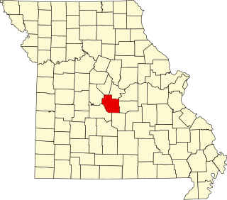
[3] Name on the Register Image Date listed [4] Location City or town Description 1 Henry and Elizabeth Bockrath House Henry and Elizabeth Bockrath House April 23, 2013 (# 13000190 309 W. Dunklin St. 38°34′30″N 92°10′50″W / 38.5750°N 92.1806°W / 38.5750; -92.1806 (Henry and Elizabeth Bockrath House ) Jefferson City 2 Lewis and Elizabeth Bolton House Lewis and Elizabeth Bolton House August 20, 1999 (# 99001017 9514 MO W 38°26′43″N 92°09′58″W / 38.4453°N 92.1661°W / 38.4453; -92.1661 (Lewis and Elizabeth Bolton House ) Jefferson City 3 Broadway-Dunklin Historic District Broadway-Dunklin Historic District November 14, 2002 (# 02001300 Most of 600 block of Broadway, and the 200 and 300 blocks of West Dunklin St. 38°34′30″N 92°10′44″W / 38.575°N 92.1789°W / 38.575; -92.1789 (Broadway-Dunklin Historic District ) Jefferson City 4 J.B. Bruns Shoe Co. Building Upload image February 26, 2021 (# 100006167 627 West McCarty St. 38°34′51″N 92°10′54″W / 38.5807°N 92.1818°W / 38.5807; -92.1818 (J.B. Bruns Shoe Co. Building ) Jefferson City 5 Nelson C. and Gertrude A. Burch House Nelson C. and Gertrude A. Burch House January 8, 2003 (# 02001302 115 W. Atchison St. 38°34′15″N 92°10′49″W / 38.5708°N 92.1803°W / 38.5708; -92.1803 (Nelson C. and Gertrude A. Burch House ) Jefferson City 6 Oscar G. and Mary H. Burch House Oscar G. and Mary H. Burch House November 15, 2002 (# 02001301 924 Jefferson St. 38°34′14″N 92°10′49″W / 38.5706°N 92.1803°W / 38.5706; -92.1803 (Oscar G. and Mary H. Burch House ) Jefferson City 7 Capitol Avenue Historic District Capitol Avenue Historic District December 28, 2005 (# 05001473 Roughly Capitol Ave., from Adams to Cherry Sts. 38°34′23″N 92°09′51″W / 38.5731°N 92.1642°W / 38.5731; -92.1642 (Capitol Avenue Historic District ) Jefferson City 8 Cole County Courthouse and Jail-Sheriff's House Cole County Courthouse and Jail-Sheriff's House April 3, 1973 (# 73001038 Monroe and E. High Sts. 38°34′30″N 92°10′09″W / 38.575°N 92.1692°W / 38.575; -92.1692 (Cole County Courthouse and Jail-Sheriff's House ) Jefferson City 9 Cole County Historical Society Building Cole County Historical Society Building May 21, 1969 (# 69000093 109 Madison St. 38°34′38″N 92°10′09″W / 38.5772°N 92.1692°W / 38.5772; -92.1692 (Cole County Historical Society Building ) Jefferson City 10 Dulle Farmstead Historic District Dulle Farmstead Historic District December 30, 1993 (# 93001468 1101 Hwy. 54 W. 38°31′25″N 92°13′34″W / 38.5236°N 92.2262°W / 38.5236; -92.2262 (Dulle Farmstead Historic District ) Jefferson City 11 East End Drugs East End Drugs August 21, 2003 (# 03000794 630 E. High St. 38°34′18″N 92°09′52″W / 38.5717°N 92.1644°W / 38.5717; -92.1644 (East End Drugs ) Jefferson City 12 Garnett Farm Historic District Upload image May 31, 2016 (# 16000305 7119 MO 179 38°42′32″N 92°22′57″W / 38.7090°N 92.3826°W / 38.7090; -92.3826 (Garnett Farm Historic District ) Centertown 13 Gay Archeological Site Upload image January 25, 1971 (# 71000466 Address Restricted Osage City 14 H.E. Gensky Grocery Store Building H.E. Gensky Grocery Store Building June 6, 2001 (# 01000628 423 Cherry St. 38°34′07″N 92°09′54″W / 38.5686°N 92.165°W / 38.5686; -92.165 (H.E. Gensky Grocery Store Building ) Jefferson City 15 Claud D. Grove and Berenice Sinclair Grove House Claud D. Grove and Berenice Sinclair Grove House November 15, 2002 (# 02001310 505 E. State St. 38°34′31″N 92°09′51″W / 38.5753°N 92.1642°W / 38.5753; -92.1642 (Claud D. Grove and Berenice Sinclair Grove House ) Jefferson City 16 Herman Haar House Herman Haar House May 2, 1997 (# 97000398 110 Bolivar St. 38°35′02″N 92°10′43″W / 38.58389°N 92.1786°W / 38.58389; -92.1786 (Herman Haar House ) Jefferson City 17 Philip Hess House Philip Hess House November 15, 2002 (# 02001304 714 Washington St. 38°34′23″N 92°10′45″W / 38.5731°N 92.1792°W / 38.5731; -92.1792 (Philip Hess House ) Jefferson City 18 Hobo Hill Historic District Hobo Hill Historic District January 2, 2013 (# 12001124 500 blocks of E. Miller & Jackson Sts. 38°34′16″N 92°10′11″W / 38.5710°N 92.1697°W / 38.5710; -92.1697 (Hobo Hill Historic District ) Jefferson City 19 International Shoe East End-Main Street Factory Upload image February 1, 2021 (# 100006079 1101 East Capitol Ave. 38°34′09″N 92°09′31″W / 38.5693°N 92.1585°W / 38.5693; -92.1585 (International Shoe East End-Main Street Factory ) Jefferson City 20 Ivy Terrace Ivy Terrace March 16, 1990 (# 90000426 500 E. Capitol Ave. 38°34′26″N 92°09′57″W / 38.5739°N 92.1658°W / 38.5739; -92.1658 (Ivy Terrace ) Jefferson City 21 Jefferson City Community Center Jefferson City Community Center May 14, 1992 (# 92000503 608 E. Dunklin St. 38°34′04″N 92°10′12″W / 38.5678°N 92.17°W / 38.5678; -92.17 (Jefferson City Community Center ) Jefferson City 22 Jefferson City National Cemetery Jefferson City National Cemetery October 1, 1998 (# 98001221 1024 E. McCarty St. 38°34′06″N 92°09′42″W / 38.5683°N 92.1617°W / 38.5683; -92.1617 (Jefferson City National Cemetery ) Jefferson City 23 Jefferson Female Seminary Jefferson Female Seminary February 24, 2000 (# 00000087 416 and 420 E. State St. 38°34′32″N 92°09′56″W / 38.575556°N 92.165556°W / 38.575556; -92.165556 (Jefferson Female Seminary ) Jefferson City 24 Kaullen Mercantile Company Kaullen Mercantile Company November 21, 2002 (# 02001402 900 and 902 E. High St. 38°34′09″N 92°09′43″W / 38.569167°N 92.161944°W / 38.569167; -92.161944 (Kaullen Mercantile Company ) Jefferson City 25 Lansdown-Higgins House Upload image November 12, 1999 (# 99001311 5240 Tanner Bridge Rd. 38°30′23″N 92°12′19″W / 38.506389°N 92.205278°W / 38.506389; -92.205278 (Lansdown-Higgins House ) Jefferson City 26 Lincoln Univ. Hilltop Campus Historic District Lincoln Univ. Hilltop Campus Historic District April 28, 1983 (# 83000978 820 Chestnut St.; also another part of 820 Chestnut St. 38°33′51″N 92°10′09″W / 38.564167°N 92.169167°W / 38.564167; -92.169167 (Lincoln Univ. Hilltop Campus Historic District ) Jefferson City "Another part" represents a boundary increase of August 21, 2002 27 Lohman's Landing Building Lohman's Landing Building February 25, 1969 (# 69000094 W corner of Jefferson and Water Sts. 38°34′39″N 92°10′14″W / 38.5775°N 92.170556°W / 38.5775; -92.170556 (Lohman's Landing Building ) Jefferson City Part of the Jefferson Landing State Historic Site 28 Frank Miller Green Berry Road Historic District Upload image March 21, 2022 (# 100007507 1427, 1431 and 1503 Green Berry Rd. 38°32′54″N 92°10′09″W / 38.5484°N 92.1692°W / 38.5484; -92.1692 (Frank Miller Green Berry Road Historic District ) Jefferson City 29 Missouri Governor's Mansion Missouri Governor's Mansion May 21, 1969 (# 69000095 100 Madison St. 38°34′41″N 92°10′12″W / 38.578056°N 92.17°W / 38.578056; -92.17 (Missouri Governor's Mansion ) Jefferson City 30 Missouri State Capitol Building and Grounds Missouri State Capitol Building and Grounds June 23, 1969 (# 69000096 High St. between Broadway and Jefferson Sts. 38°34′44″N 92°10′23″W / 38.578889°N 92.173056°W / 38.578889; -92.173056 (Missouri State Capitol Building and Grounds ) Jefferson City 31 Missouri State Capitol Historic District Missouri State Capitol Historic District June 18, 1976 (# 76001109 Bounded roughly by Adams, McCarthy, Mulberry Sts. and the Missouri River; also the 200 block of W. McCarty St. and 406-408 Washington St. 38°34′39″N 92°10′16″W / 38.5775°N 92.171111°W / 38.5775; -92.171111 (Missouri State Capitol Historic District ) Jefferson City Second set of addresses represents a boundary increase of July 17, 2002 32 Missouri State Penitentiary Warden's House Missouri State Penitentiary Warden's House October 24, 1991 (# 91001518 700 E. Capitol Ave. 38°34′20″N 92°09′47″W / 38.572222°N 92.163056°W / 38.572222; -92.163056 (Missouri State Penitentiary Warden's House ) Jefferson City 33 Moreau Drive Historic District Moreau Drive Historic District December 11, 2013 (# 13000907 Moreau & Elmerine Drs., Fairmount Blvd., Oakwood Ave., Fairmount Ct., Lee St., Moreland Ave. 38°33′31″N 92°10′08″W / 38.55867°N 92.168838°W / 38.55867; -92.168838 (Moreau Drive Historic District ) Jefferson City 34 Moreau Park Historic District Moreau Park Historic District September 30, 2009 (# 09000786 3714 Wardsville Rd. 38°31′46″N 92°09′52″W / 38.529389°N 92.164334°W / 38.529389; -92.164334 (Moreau Park Historic District ) Jefferson City 35 Munichburg Commercial Historic District Munichburg Commercial Historic District July 1, 2009 (# 09000477 114-130 (even only) E. Dunklin St., 610, 620 Madison St., 704 Madison St. 38°34′19″N 92°10′33″W / 38.571992°N 92.175919°W / 38.571992; -92.175919 (Munichburg Commercial Historic District ) Jefferson City Southside Munichburg, Missouri MPS 36 Orchard Acres Upload image October 7, 2021 (# 100007040 2113 West Main St. 38°35′30″N 92°12′28″W / 38.5917°N 92.2079°W / 38.5917; -92.2079 (Orchard Acres ) Jefferson City 37 Lester S. and Missouri "Zue" Gordon Parker House Lester S. and Missouri "Zue" Gordon Parker House June 15, 2000 (# 00000690 624 E. Capitol Ave. 38°34′21″N 92°09′49″W / 38.5725°N 92.163611°W / 38.5725; -92.163611 (Lester S. and Missouri "Zue" Gordon Parker House ) Jefferson City 38 Dr. Joseph P. and Effie Porth House Dr. Joseph P. and Effie Porth House January 26, 2001 (# 01000009 631 W. Main St. 38°35′00″N 92°10′43″W / 38.583333°N 92.178611°W / 38.583333; -92.178611 (Dr. Joseph P. and Effie Porth House ) Jefferson City 39 John B. and Elizabeth Ruthven House John B. and Elizabeth Ruthven House May 26, 2000 (# 00000537 406 Cherry St. 38°34′09″N 92°09′55″W / 38.569167°N 92.165278°W / 38.569167; -92.165278 (John B. and Elizabeth Ruthven House ) Jefferson City 40 St. Francis Xavier Catholic Church and Rectory St. Francis Xavier Catholic Church and Rectory March 22, 2016 (# 16000100 7319 Missouri Route M 38°30′28″N 92°04′08″W / 38.507656°N 92.068789°W / 38.507656; -92.068789 (St. Francis Xavier Catholic Church and Rectory ) Taos 41 Simonsen School Upload image October 7, 2021 (# 100007041 501 East Miller St. 38°34′15″N 92°10′08″W / 38.5709°N 92.1690°W / 38.5709; -92.1690 (Simonsen School ) Jefferson City 42 Charles J. and Clara B. Schmidt House Charles J. and Clara B. Schmidt House January 7, 2003 (# 02001303 215 W. Atchison St. 38°34′19″N 92°10′53″W / 38.571944°N 92.181389°W / 38.571944; -92.181389 (Charles J. and Clara B. Schmidt House ) Jefferson City 43 John M. and Lillian Sommerer House John M. and Lillian Sommerer House June 12, 2007 (# 07000548 2023 W. Main St. 38°35′27″N 92°12′13″W / 38.590783°N 92.203522°W / 38.590783; -92.203522 (John M. and Lillian Sommerer House ) Jefferson City 44 Hugh and Bessie Stephens House Hugh and Bessie Stephens House May 12, 2009 (# 09000301 601 Jackson St. 38°34′13″N 92°10′14″W / 38.570378°N 92.170636°W / 38.570378; -92.170636 (Hugh and Bessie Stephens House ) Jefferson City 45 Tergin Apartment Building Tergin Apartment Building April 22, 1999 (# 99000475 201 W. McCarty St. 38°34′37″N 92°10′31″W / 38.576944°N 92.175278°W / 38.576944; -92.175278 (Tergin Apartment Building ) Jefferson City 46 Albert and Wilhelmina Thomas House Albert and Wilhelmina Thomas House November 14, 2002 (# 02001305 224 W. Elm St. 38°34′33″N 92°10′40″W / 38.575833°N 92.177778°W / 38.575833; -92.177778 (Albert and Wilhelmina Thomas House ) Jefferson City 47 Trinity Lutheran Church Historic District Upload image February 28, 2020 (# 100005004 13007-13013 Route C 38°30′33″N 92°26′16″W / 38.5091°N 92.4378°W / 38.5091; -92.4378 (Trinity Lutheran Church Historic District ) Russellville 48 Villa Panorama Villa Panorama January 3, 1985 (# 85000031 1310 Swifts Hwy. 38°34′09″N 92°11′32″W / 38.569167°N 92.192222°W / 38.569167; -92.192222 (Villa Panorama ) Jefferson City 49 Joseph and Elizabeth Wallendorf House Joseph and Elizabeth Wallendorf House April 4, 2008 (# 08000253 701 S. Country Club Dr. 38°34′41″N 92°15′51″W / 38.578078°N 92.264044°W / 38.578078; -92.264044 (Joseph and Elizabeth Wallendorf House ) Jefferson City 50 West End Saloon West End Saloon June 27, 2014 (# 14000374 700-702 W. Main St. 38°35′01″N 92°10′45″W / 38.5837°N 92.1791°W / 38.5837; -92.1791 (West End Saloon ) Jefferson City 51 Woodland-Old City Cemetery Upload image July 23, 2018 (# 100002688 1022 & 1000 E McCarty St. 38°34′06″N 92°09′47″W / 38.5684°N 92.1630°W / 38.5684; -92.1630 (Woodland-Old City Cemetery ) Jefferson City 52 Zion Lutheran Church Zion Lutheran Church November 15, 2000 (# 00001374 2346 Zion Rd. 38°32′10″N 92°15′11″W / 38.536111°N 92.253056°W / 38.536111; -92.253056 (Zion Lutheran Church ) Jefferson City 53 William E. and Frederica M. Zuendt House William E. and Frederica M. Zuendt House November 15, 2002 (# 02001306 920 Jefferson St. 38°34′15″N 92°10′48″W / 38.570833°N 92.18°W / 38.570833; -92.18 (William E. and Frederica M. Zuendt House ) Jefferson City