National Register of Historic Places listings in Newton County, Missouri

Last updated
Location of Newton County in Missouri Map of Missouri highlighting Newton County.svg
Location of Newton County in Missouri

This is a list of the National Register of Historic Places listings in Newton County, Missouri.

Contents

This is intended to be a complete list of the properties and districts on the National Register of Historic Places in Newton County, Missouri, United States. Latitude and longitude coordinates are provided for many National Register properties and districts; these locations may be seen together in a map. [1]

There are 12 properties and districts listed on the National Register in the county.

This National Park Service list is complete through NPS recent listings posted October 1, 2021. [2]
Map all coordinates using: OpenStreetMap  
Download coordinates as: KML

Current listings

[3] Name on the RegisterImageDate listed [4] Location City or townDescription
1 First Battle of Newtonia Historic District December 23, 2004
(#04000697)
Junction of Routes 86 and O
36°53′05″N94°11′02″W / 36.884722°N 94.183889°W / 36.884722; -94.183889 (First Battle of Newtonia Historic District)
Newtonia
2 Bonnie & Clyde Garage Apartment
Bonnie & Clyde Garage Apartment Bonnie and Clyde Garage Apartment.jpg
Bonnie & Clyde Garage Apartment
May 15, 2009
(#09000302)
3 miles (4.8 km) south of Monument
37°03′06″N94°31′00″W / 37.05167°N 94.516697°W / 37.05167; -94.516697 (Bonnie & Clyde Garage Apartment)
Joplin
3 George Washington Carver National Monument
George Washington Carver National Monument George-washington-carver-nmon-2.jpg
George Washington Carver National Monument
October 15, 1966
(#66000114)
3 miles (4.8 km) south of Monument
36°59′07″N94°21′18″W / 36.985278°N 94.355°W / 36.985278; -94.355 (George Washington Carver National Monument)
Diamond
4 Jolly Mill
Jolly Mill Jolly Mill.jpg
Jolly Mill
October 13, 1983
(#83004021)
Southwest of Pierce City
36°53′50″N94°04′18″W / 36.897222°N 94.071667°W / 36.897222; -94.071667 (Jolly Mill)
Pierce City
5 Lentz-Carter Merchandise Store
Lentz-Carter Merchandise Store Lentz-Carter Store.jpg
Lentz-Carter Merchandise Store
August 19, 2008
(#08000799)
744 Ozark St.
36°45′38″N94°11′32″W / 36.760608°N 94.192252°W / 36.760608; -94.192252 (Lentz-Carter Merchandise Store)
Stella
6 Neosho Colored School
Neosho Colored School Side-by-Side.png
Neosho Colored School
April 17, 2017
(#100000887)
639 Young St.
36°52′34″N94°22′27″W / 36.876101°N 94.374227°W / 36.876101; -94.374227 (Neosho Colored School)
Neosho
7 Neosho Commercial Historic District
Neosho Commercial Historic District NEOSHO COMMERCIAL HISTORIC DISTRICT, NEWTON COUNTY, MO.jpg
Neosho Commercial Historic District
August 12, 1993
(#93000722)
Along sections of Main, Spring, Washington and Wood Sts.; also 114, 116, 118-120, 120, and 124-126 S. Wood St.
36°52′11″N94°22′03″W / 36.869722°N 94.3675°W / 36.869722; -94.3675 (Neosho Commercial Historic District)
Neosho Second set of boundaries represents a boundary increase of April 18, 2007
8 Neosho High School
Neosho High School KHS 5329m.jpg
Neosho High School
August 30, 2002
(#02000906)
W. McCord and N. Wood Sts.
36°52′17″N94°22′08″W / 36.871389°N 94.368889°W / 36.871389; -94.368889 (Neosho High School)
Neosho
9 Neosho Wholesale Grocery Company
Neosho Wholesale Grocery Company NEOSHO WHOLESALE GROCERY COMPANY.jpg
Neosho Wholesale Grocery Company
April 16, 2013
(#13000171)
224 N. Washington St.
36°52′17″N94°22′02″W / 36.871405°N 94.367291°W / 36.871405; -94.367291 (Neosho Wholesale Grocery Company)
Neosho
10 Mathew H. Ritchey House
Mathew H. Ritchey House Mathew H. Ritchey House.jpg
Mathew H. Ritchey House
December 5, 1978
(#78003399)
Mill St.
36°52′39″N94°10′58″W / 36.8775°N 94.182778°W / 36.8775; -94.182778 (Mathew H. Ritchey House)
Newtonia
11 Second Baptist Church
Second Baptist Church SECOND BAPTIST CHURCH, NEOSHO, NEWTON COUNTY, MO.jpg
Second Baptist Church
January 4, 1996
(#95001495)
430 W. Grant St.
36°52′31″N94°22′29″W / 36.875278°N 94.374722°W / 36.875278; -94.374722 (Second Baptist Church)
Neosho
12 Second Battle of Newtonia Site December 23, 2004
(#04000698)
Roughly an area northwest, southwest and southeast of the junction of Routes 86 and O at Newtonia
36°52′19″N94°11′36″W / 36.871944°N 94.193333°W / 36.871944; -94.193333 (Second Battle of Newtonia Site)
Newtonia

See also

Related Research Articles

National Register of Historic Places listings in Newton County, Indiana

This is a list of the National Register of Historic Places listings in Newton County, Indiana.

National Register of Historic Places listings in Howard County, Missouri

This is a list of the National Register of Historic Places listings in Howard County, Missouri.

National Register of Historic Places listings in Crawford County, Missouri

This is a list of the National Register of Historic Places listings in Crawford County, Missouri.

National Register of Historic Places listings in Franklin County, Missouri

This is a list of the National Register of Historic Places listings in Franklin County, Missouri.

National Register of Historic Places listings in Pike County, Missouri

This is a list of the National Register of Historic Places listings in Pike County, Missouri.

National Register of Historic Places listings in Macon County, Missouri

This is a list of the National Register of Historic Places listings in Macon County, Missouri.

National Register of Historic Places listings in Gasconade County, Missouri

This is a list of the National Register of Historic Places listings in Gasconade County, Missouri.

National Register of Historic Places listings in Marion County, Missouri

The following properties are listed on the National Register of Historic Places in Marion County, Missouri.

National Register of Historic Places listings in Johnson County, Missouri

This is a list of the National Register of Historic Places listings in Johnson County, Missouri.

National Register of Historic Places listings in Cole County, Missouri

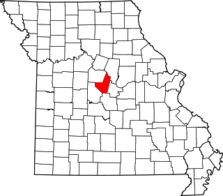
This is a list of the National Register of Historic Places listings in Cole County, Missouri.

National Register of Historic Places listings in Wright County, Missouri

This is a list of the National Register of Historic Places listings in Wright County, Missouri.

National Register of Historic Places listings in Phelps County, Missouri

This is a list of the National Register of Historic Places listings in Phelps County, Missouri.

National Register of Historic Places listings in Madison County, Missouri

This is a list of the National Register of Historic Places listings in Madison County, Missouri.

National Register of Historic Places listings in Montgomery County, Missouri

This is a list of the National Register of Historic Places listings in Montgomery County, Missouri.

National Register of Historic Places listings in Moniteau County, Missouri

This is a list of the National Register of Historic Places listings in Moniteau County, Missouri.

National Register of Historic Places listings in Osage County, Missouri

This is a list of the National Register of Historic Places listings in Osage County, Missouri.

National Register of Historic Places listings in Dent County, Missouri

This is a list of the National Register of Historic Places listings in Dent County, Missouri.

National Register of Historic Places listings in Nodaway County, Missouri

This is a list of the National Register of Historic Places listings in Nodaway County, Missouri.

National Register of Historic Places listings in Pulaski County, Missouri

This is a list of the National Register of Historic Places listings in Pulaski County, Missouri.

National Register of Historic Places listings in Lincoln County, Missouri

This is a list of the National Register of Historic Places listings in Lincoln County, Missouri.

References

  1. The latitude and longitude information provided in this table was derived originally from the National Register Information System, which has been found to be fairly accurate for about 99% of listings. Some locations in this table may have been corrected to current GPS standards.
  2. National Park Service, United States Department of the Interior, "National Register of Historic Places: Weekly List Actions", retrieved October 1, 2021.
  3. Numbers represent an alphabetical ordering by significant words. Various colorings, defined here, differentiate National Historic Landmarks and historic districts from other NRHP buildings, structures, sites or objects.
  4. The eight-digit number below each date is the number assigned to each location in the National Register Information System database, which can be viewed by clicking the number.