Pierce City, Missouri | |
---|---|
Coordinates: 36°56′48″N94°0′1″W / 36.94667°N 94.00028°W [1] | |
Country | United States |
State | Missouri |
County | Lawrence, Barry |
Area | |
• Total | 1.29 sq mi (3.35 km2) |
• Land | 1.29 sq mi (3.34 km2) |
• Water | 0.01 sq mi (0.01 km2) |
Elevation | 1,211 ft (369 m) |
Population (2020) | |
• Total | 1,251 |
• Density | 969.77/sq mi (374.46/km2) |
Time zone | UTC-6 (Central (CST)) |
• Summer (DST) | UTC-5 (CDT) |
ZIP code | 65723 |
Area code | 417 |
FIPS code | 29-57494 [3] |
GNIS feature ID | 2396200 [1] |
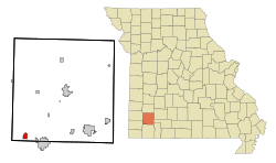
Pierce City, formerly Peirce City, is a city in southwest Lawrence and northwest Barry counties, in southwest Missouri, United States. The population was 1,292 at the 2010 census. In 2010, the town annexed property along Route 97 into Barry County to a point just north of U.S. Route 60. It was estimated to be 1,309 by the City of Pierce City as of July 1, 2019. [4]
There was once a small village called St. Martha about two and a half miles west of Pierce City. It was surveyed for William Robert Wild on Section 30, Pierce Township, May 9, 1870. Wild committed suicide there on June 8, 1870. [5] Nothing remains of the village. [6]
Pierce City was laid out in 1870 [7] as a stop on the Atlantic and Pacific Railroad. It was originally spelled Peirce City, named for Andrew Peirce, Jr. of Boston, president of the St. Louis–San Francisco Railway. [8] [nb 1] The Pierce spelling was used erroneously by the United States Postal Service and adopted officially in the 1930s. [8] [10] A 1982 attempt to revert to Peirce was rejected by the United States Census Bureau. [10]
On August 19, 1901 a large white mob took three African-American men from jail in Pierce City and lynched them. French and William Godley, and Peter Hampton [11] were suspects in the murder of a young white woman. Two of the men were quite aged and were unlikely suspects; none had a chance at a trial. These are the only recorded lynchings in Lawrence County. [12]
Unrest continued, and the white mob burned five black homes, and drove "30 families into the woods", affecting the roughly 300 black residents in the town. (It had about 1,000 white residents.) Most of the African Americans lost all their land and property; whites simply took over the empty properties.
This was part of a pattern of violence in southwest Missouri in the early 20th century; there were also large public lynchings in Joplin and Springfield, resulting in many African Americans abandoning the region for less hostile territory. "Monett, Peirce City, Rogers, Ark., and several other towns around here have driven the negros out." [13] By 1910 only 91 African Americans remained in Lawrence County and their numbers continued to decline. [14] The incident has been considered an act of ethnic cleansing. [15]
In reaction, Mark Twain wrote the essay The United States of Lyncherdom , which was published posthumously. [16]
In the 21st century, some descendants of the people who had been driven out of Pierce City threatened to file a lawsuit for the city's failure to protect their families and to recover the value of their families' properties, but none has been filed. There have been other grassroots efforts to acknowledge these crimes and injustices.
The Lawrence County Bank Building and Pierce City Fire Station, Courthouse and Jail are listed on the National Register of Historic Places. [17]
One of the most notable tornadoes of the May 2003 tornado outbreak sequence was the one that hit in Pierce City. According to reports, nearly all of the buildings in the town were damaged, destroyed, or liable to collapse. Damage was most severe in the historic downtown business district, where approximately 90 percent of the businesses and homes nearby were severely damaged, and they later had to be torn down. A nearby National Guard Armory, regularly used as the town's storm shelter, sustained heavy damage. J. Dale Taunton was killed; he was one of the several dozen people who had fled to the shelter. [18]
But, outside the main path of the tornado, many Pierce City structures, including homes and the Harold Bell Wright Museum, sustained little or no damage. The Pierce City tornado was rated F3 on the Fujita scale.
Pierce City is located in the southwestern corner of Lawrence County at the intersection of Missouri routes 37 and 97. Monett lies four miles to the east. Clear Creek flows through the city. [19]
According to the United States Census Bureau, the city has a total area of 1.28 square miles (3.32 km2), of which 1.27 square miles (3.29 km2) is land and 0.01 square miles (0.03 km2) is water. [20]
Census | Pop. | Note | %± |
---|---|---|---|
1870 | 432 | — | |
1880 | 1,350 | 212.5% | |
1890 | 2,511 | 86.0% | |
1900 | 2,151 | −14.3% | |
1910 | 2,043 | −5.0% | |
1920 | 1,476 | −27.8% | |
1930 | 1,135 | −23.1% | |
1940 | 1,208 | 6.4% | |
1950 | 1,156 | −4.3% | |
1960 | 1,006 | −13.0% | |
1970 | 1,097 | 9.0% | |
1980 | 1,391 | 26.8% | |
1990 | 1,382 | −0.6% | |
2000 | 1,385 | 0.2% | |
2010 | 1,292 | −6.7% | |
2020 | 1,251 | −3.2% | |
U.S. Decennial Census |
As of the census [21] of 2010, there were 1,292 people, 538 households, and 343 families residing in the city. The population density was 1,017.3 inhabitants per square mile (392.8/km2). There were 602 housing units at an average density of 474.0 per square mile (183.0/km2). The racial makeup of the city was 95.9% White, 0.8% Native American, 0.2% Asian, 1.8% from other races, and 1.3% from two or more races. Hispanic or Latino of any race were 4.6% of the population.
There were 538 households, of which 33.3% had children under the age of 18 living with them, 45.0% were married couples living together, 13.8% had a female householder with no husband present, 5.0% had a male householder with no wife present, and 36.2% were non-families. 31.8% of all households were made up of individuals, and 13.9% had someone living alone who was 65 years of age or older. The average household size was 2.39 and the average family size was 2.97.
The median age in the city was 37.4 years. 26% of residents were under the age of 18; 8.4% were between the ages of 18 and 24; 24% were from 25 to 44; 25.6% were from 45 to 64; and 16.2% were 65 years of age or older. The gender makeup of the city was 48.5% male and 51.5% female.
As of the census [3] of 2000, there were 1,385 people, 574 households, and 378 families residing in the city. The population density was 1,133.3 inhabitants per square mile (437.6/km2). There were 646 housing units at an average density of 528.6 per square mile (204.1/km2). The racial makeup of the city was 96.46% White, 0.22% African American, 1.08% Native American, 0.22% from other races, and 2.02% from two or more races. Hispanic or Latino of any race were 1.01% of the population.
There were 574 households, out of which 33.3% had children under the age of 18 living with them, 48.4% were married couples living together, 12.5% had a female householder with no husband present, and 34.0% were non-families. 28.6% of all households were made up of individuals, and 12.9% had someone living alone who was 65 years of age or older. The average household size was 2.41 and the average family size was 2.96.
In the city the population was spread out, with 25.8% under the age of 18, 10.8% from 18 to 24, 28.2% from 25 to 44, 22.1% from 45 to 64, and 13.1% who were 65 years of age or older. The median age was 35 years. For every 100 females, there were 94.0 males. For every 100 females age 18 and over, there were 84.7 males.
The median income for a household in the city was $24,186, and the median income for a family was $34,219. Males had a median income of $23,429 versus $17,857 for females. The per capita income for the city was $12,310. About 18.3% of families and 20.6% of the population were below the poverty line, including 20.8% of those under age 18 and 29.5% of those age 65 or over.
Pierce City R-VI School District operates one elementary school, one middle school, and Pierce City High School. [22]
Pierce City has a public library, a branch of the Barry-Lawrence Regional Library. [23]
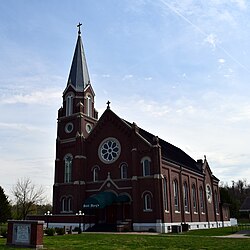
St. Mary’s Church was established in 1871 in Pierce City, Missouri. Today, the campus includes the church, school, gymnasium and cafeteria, and pavilion. St. Mary’s School was built in 1968 in Pierce City, Missouri. Today, the school includes preschool thru 8th grade. (https://stmaryspcmo.com/)
Ozark County is a county in the southern portion of the U.S. state of Missouri. As of the 2020 census, the population was 8,553. The largest city and county seat is Gainesville. The county was organized as Ozark County, named after the Ozark Mountains, on January 29, 1841. It was renamed Decatur County, after Commodore Stephen Decatur, from 1843 to 1845, after which the name Ozark County was restored.
Lawrence County is located in the southwest portion of the U.S. state of Missouri, in the area of the Ozarks. As of the 2020 census, the population was 38,001. Its county seat is Mount Vernon. The county was organized in 1845 and named for James Lawrence, a naval officer from the War of 1812 known for his battle cry, "Don't give up the ship!"
Sharp County is a county located in the U.S. state of Arkansas. As of the 2020 census, the population was 17,271. The county seat is Ash Flat. The county was formed on July 18, 1868, and named for Ephraim Sharp, a state legislator from the area.
Cassville is a city in Flat Creek Township, Barry County, Missouri, United States. According to the 2020 census, the population of Cassville was 3,190. Cassville is one of the primary markets and job centers for an estimated 14,000 people living in the surrounding area. It is the county seat of Barry County.
Warsaw is a city located in Benton County, Missouri, United States. The population was 2,127 at the 2010 census. Warsaw is the county seat of Benton County.
Camdenton is a city in and the county seat of Camden County, Missouri, United States. Its population was 3,718 at the 2010 census. The city is enveloped by the Lower Niangua arm of the Lake of the Ozarks, and serves as a popular trade point for visitors to the area.
Ozark is a city in and the county seat of Christian County, Missouri. Its population was 21,284 as of the 2020 census. Ozark is also the third largest city in the Springfield, Missouri Metropolitan Area, and is centered along a business loop of U.S. Route 65, where it intersects with Missouri Route 14.
Buffalo is a city in and the county seat of Dallas County, Missouri, United States. The population was 3,290 at the 2020 census.
Ava is the only incorporated city in Douglas County, Missouri, United States. The population was 2,894 at the 2020 census. Ava is the county seat of Douglas County. The city was founded in 1871. It was renamed Ava in 1881, the town's original name having been "Militia Springs."
Annapolis is a city located in southern Iron County, Missouri, United States. The population was 250 at the 2020 census.
Ironton is a city in Iron County, Missouri, United States. The population was 1,475 at the 2020 census. It is the county seat of Iron County, and is located 12 miles south of Belgrade.
Viburnum is a city in Iron County, Missouri, United States. The population was 667 at the 2020 census. The city is located in the New Lead Belt. The Mayor of Viburnum is the honorable Johnny Setzer
Wentworth is a village in northeastern Newton County, Missouri, United States. The population was 151 at the 2010 census. It is part of the Joplin, Missouri Metropolitan Statistical Area.
Houston is a city in Texas County, Missouri, United States. The population was 2,079 at the 2020 census. It is the county seat of Texas County.
Piedmont is a city in northwestern Wayne County in Southeast Missouri, United States. Its population was 1,897 at the 2020 census. Part of the Ozark Foothills Region, it is at the convergence of State Highways 34 and 49. Piedmont, transliterated as "foot of the mountain," is named for its position at the foot of Clark Mountain, a 1424-foot summit approximately two miles north of the town.
Mount Vernon is a city in and the county seat of Lawrence County, Missouri, United States. The population was 4,575 as of the 2010 census. It was estimated to be 4,960 by the City of Mount Vernon on July 1, 2020.
Monett is the most-populous city in the Barry and Lawrence counties in the U.S. state of Missouri. The city is located in the Ozarks, just south of Interstate 44 between Joplin and Springfield. According to the 2020 census, the population of the town was estimated to be 9,576 individuals.
Lake Ozark is a city in Camden and Miller counties in the U.S. state of Missouri, near its namesake, the Lake of the Ozarks. The population was 2,077 at the 2020 census.
Osage Beach is a city in Camden and Miller counties in the U.S. state of Missouri, near the Lake of the Ozarks. Most of the city is in Camden County, while a small eastern sliver is in Miller County. The population was 4,351 at the 2010 census.
Glasgow is a city on the Missouri River mostly in northwest Howard County and extending into the southeast corner of Chariton County in the U.S. state of Missouri. The population was 1,087 at the 2020 census.
{{cite web}}
: CS1 maint: bot: original URL status unknown (link)