
Lawrence County is located in the southwest portion of the U.S. state of Missouri, in the area of the Ozarks. As of the 2010 census, the population was 38,634. Its county seat is Mount Vernon. The county was organized in 1845 and named for James Lawrence, a naval officer from the War of 1812 known for his battle cry, "Don't give up the ship!"

Cole County is located in the central part of the U.S. state of Missouri. As of the 2020 census, its population was 77,279. Its county seat and largest city is Jefferson City, the state capital. The county was organized November 16, 1820 and named after pioneer William Temple Cole who built Cole's Fort in Boonville.

Barry County is a county located in the southwest portion of the U.S. state of Missouri. As of the 2020 Census, the population was 34,534. Its county seat is Cassville. The county was organized in 1835 and named after William Taylor Barry, a U.S. Postmaster General from Kentucky. The town of Barry, also named after the postmaster-general, was located just north of Kansas City, not in Barry County.

Randolph County is located between the Ozark Mountains and Arkansas Delta in the U.S. state of Arkansas. The county is named for John Randolph, a U.S. senator from Virginia influential in obtaining congressional approval of the Louisiana Purchase, which includes today's Randolph County. Created as Arkansas's 32nd county on October 29, 1835, Randolph County has two incorporated cities, including Pocahontas, the county seat and most populous city. The county is also the site of numerous unincorporated communities and ghost towns.
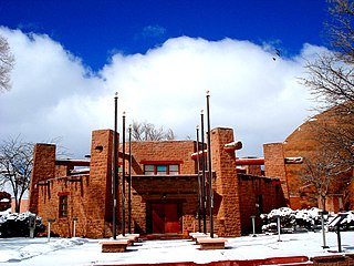
Window Rock is a census-designated place that serves as the seat of government and capital of the Navajo Nation, the largest territory in North America of a sovereign Native American nation. The capital lies within the boundaries of the St. Michaels Chapter, adjacent to the Arizona and New Mexico state line. Window Rock is the site of the Navajo Nation governmental campus, which contains the Navajo Nation Council, Navajo Nation Supreme Court, the offices of the Navajo Nation President and Vice President, and many Navajo government buildings.
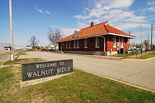
Walnut Ridge is a city in Lawrence County, Arkansas, United States. The population was 5098 at the United States Census's 2019 estimate. The city is the county seat of Lawrence County. Walnut Ridge lies immediately north of Hoxie. The two towns form a contiguous urban area with approximately 8,000 residents. Williams Baptist University is in College City, a formerly separate community that merged into Walnut Ridge in 2017.

Cassville is a city in Flat Creek Township, Barry County, Missouri, United States. According to the 2020 census, the population of Cassville was 3,190. Cassville is one of the primary markets and job centers for an estimated 14,000 people living in the surrounding area. It is the county seat of Barry County.
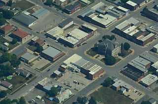
Carrollton is a city in Carroll County, Missouri, United States. Carrollton won the 2005 All-America City Award, given out annually by the National Civic League. The population was 3,514 at the 2020 census. Carrollton is the county seat of Carroll County.

High Ridge is an unincorporated community and census-designated place (CDP) in Jefferson County, Missouri, United States. The population was 4,305 at the 2010 census. At 927 feet (283 m) above sea level, High Ridge is the second-highest point in Jefferson County, second only to Sun Ridge, north of Hillsboro, according to data from the House Springs/Hillsboro 7.5 minute topographic quadrangles. The Beaumont Scout Reservation, a property of the Greater St. Louis Area Council, Boy Scouts of America, is 4 miles (6 km) north of High Ridge.

Warrensburg is a city in and the county seat of Johnson County, Missouri, United States. The population was 20,313 at the 2020 census. The Warrensburg Micropolitan Statistical Area consists of Johnson County. The city is a college town as it is home to the University of Central Missouri.

Marionville is a city in Lawrence County, Missouri, United States. The population was 2,225 at the 2010 census.

Miller is a town in Lawrence County, Missouri, United States. As of the 2010 census, the city population was 699.

Mount Vernon is a city in and the county seat of Lawrence County, Missouri, United States. The population was 4,575 as of the 2010 census. It was estimated to be 4,960 by the City of Mount Vernon on July 1, 2020.

Monett is the most-populous city in the Barry and Lawrence counties in the U.S. state of Missouri. The city is located in the Ozarks, just south of Interstate 44 between Joplin and Springfield. According to the 2020 census, the population of the town was estimated to be 9,576 individuals.

Shell Knob is a census-designated place (CDP) located within White River Township, Barry County, Missouri. The population was 1,254 at the 2020 census.
Belle is a city in northeast Maries County and extending north into southeast Osage County in the U.S. state of Missouri. The population was 1,381 at the 2020 census.
Golden is an unincorporated community and census-designated place in southeastern Barry County, Missouri, United States. It is approximately 20 miles (32 km) southeast of Cassville. It is located south of Table Rock Lake and one mile north of Missouri Route 86 on Highway J. At the 2020 census, Golden had a population of 275.
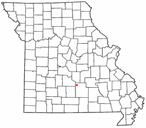
Plato is an incorporated village in northwestern Texas County, Missouri, United States. It is located approximately 20 miles northwest of Houston and 10 miles south of Fort Leonard Wood on Route 32. The population was 82 at the 2020 census.
Phelps City is a census-designated place and unincorporated community in Atchison County, Missouri, United States. As of the 2020 census, its population was zero. The community is 5 miles (8.0 km) west of Rock Port. It is the closest Missouri community to Brownville Bridge, a Missouri River crossing that is listed on the National Register of Historic Places.

Lawrence County is a county located in the U.S. state of Pennsylvania. As of the 2010 census, the population was 91,108. The county seat is New Castle.


