Newton County is a county located in the southwest portion of the U.S. state of Missouri. As of the 2010 census, the population was 58,114. Its county seat is Neosho. The county was organized in 1838 and is named in honor of John Newton, a hero who fought in the Revolutionary War.

Jasper County is a county located in the southwest portion of the U.S. state of Missouri. As of the 2010 census, the population was 117,404. Its county seat is Carthage, and its largest city is Joplin. The county was organized in 1841 and named for William Jasper, a hero of the American Revolutionary War.

Stark City is a village in Newton County, Missouri, United States. The population was 139 at the 2010 census, at which time it was a town. It is part of the Joplin, Missouri Metropolitan Statistical Area. It is adjacent to the battlefield of the Second Battle of Newtonia.

Redings Mill is a village in Newton County, Missouri, United States. The population was 151 at the 2010 census. It is part of the Joplin, Missouri Metropolitan Statistical Area.

Ritchey is a village in Newton County, Missouri, United States. The population was 82 at the 2010 census. It is part of the Joplin, Missouri Metropolitan Statistical Area.

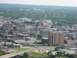
Joplin, officially known as the City of Joplin, is a city in southern Jasper County and northern Newton County in the southwestern corner of the U.S. state of Missouri. Joplin is the largest city in Jasper County - even though it is not the county seat, and it is the 12th most-populous city in the state. As of the 2010 census, the city's population was 50,150. The city covers an area of 35.69 square miles (92.41 km2) on the outer edge of the Ozark Mountains. Joplin is the main hub of the three-county Joplin-Miami, Missouri-Oklahoma Metro area, which is home to 209,192 people making it the 5th largest metropolitan area in Missouri.

Tipton Ford is a small unincorporated community in Newton County, Missouri, United States, and located at the intersection of Interstate 49 and Route 175. The community is part of the Joplin, Missouri Metropolitan Statistical Area.

Racine is an unincorporated community in Newton County, Missouri, United States. It is part of the Joplin, Missouri Metropolitan Statistical Area.

Wanda is an unincorporated community in Newton County, Missouri, United States. It lies along Missouri State Route O, between the towns of Stark City and Stella.

Spring City is a Village in Newton County, Missouri, United States. It is located five miles south of Joplin on Route 86. The community is part of the Joplin, Missouri Metropolitan Statistical Area.

The Joplin Globe is a seven-day daily newspaper published in Joplin, Missouri, United States, covering parts of 14 counties in southwestern Missouri. Ottaway Community Newspapers owned the Globe from 1975 to 2002. Since 2002, it has been owned by Community Newspaper Holdings Inc.
Parshley is an unincorporated community in southern Jasper County, in the U.S. state of Missouri.
Turkey Creek is a stream in Jasper and Newton counties of southwest Missouri and Cherokee county of southeastern Kansas in the United States. It is a tributary of the Spring River.
Aroma is an unincorporated community in southern Newton County, in the U.S. state of Missouri. The community is on the north bank of Hickory Creek 1.5 miles east of Monark Springs. It is on Missouri Route H 2.5 miles north of Sweetwater and 4.5 miles east of Neosho.
Boulder City is an unincorporated community in Newton County, in the U.S. state of Missouri. The community is on Missouri Route O, one mile west of Indian Creek and approximately nine miles southeast of Neosho.
June is an unincorporated community in Newton County, in the U.S. state of Missouri.
McElhany is an unincorporated community in Newton County, in the U.S. state of Missouri.
Spurgeon is an unincorporated community in Newton County, in the U.S. state of Missouri.
Sweetwater is an unincorporated community in Newton County, in the U.S. state of Missouri.
Talmage City is an unincorporated community in Newton County, in the U.S. state of Missouri.


