
Newton County is a county located in the southwest portion of the U.S. state of Missouri. As of the 2010 census, the population was 58,114. Its county seat is Neosho. The county was organized in 1838 and is named in honor of John Newton, a hero who fought in the Revolutionary War.

Jasper County is a county located in the southwest portion of the U.S. state of Missouri. As of the 2010 census, the population was 117,404. Its county seat is Carthage, and its largest city is Joplin. The county was organized in 1841 and named for William Jasper, a hero of the American Revolutionary War.
Fairview is a city in southeastern Newton County, Missouri, United States. The population was 383 at the 2010 census. It is part of the Joplin, Missouri Metropolitan Statistical Area.

Neosho is the most populous city in Newton County, Missouri, United States, which it serves as the county seat. With a population of 11,835 as of the 2010 census, the city is a part of the Joplin, Missouri Metropolitan Statistical Area, a region with an estimated 176,849 (2011) residents. Neosho lies on the western edge of the Ozarks.

Newtonia is a village in Newton County, Missouri, United States. The population was 199 at the 2010 census. It is part of the Joplin, Missouri Metropolitan Statistical Area. Newtonia was the site of the Battles of Newtonia. Newtonia has some Antebellum houses, such as the Ritchey Mansion, as well as a cemetery for Civil War dead. It is a farming community and is immediately adjacent to Stark City, Missouri. In 2008, a tornado struck the village damaging many homes including the Mathew H. Ritchey House.

Seneca is a city in western Newton County, Missouri, United States. The population was 2,336 at the 2010 census. Located on the southwest border of the state, the city is part of the Joplin, Missouri Metropolitan Statistical Area.

Stark City is a village in Newton County, Missouri, United States. The population was 139 at the 2010 census, at which time it was a town. It is part of the Joplin, Missouri Metropolitan Statistical Area. It is adjacent to the battlefield of the Second Battle of Newtonia.

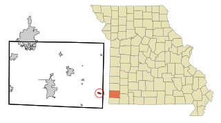
Stella is a village in southern Newton County, Missouri, United States. The population was 158 at the 2010 census. It is part of the Joplin, Missouri Metropolitan Statistical Area. The village of Stella is located 17 miles southeast of Neosho.

Diamond is a city in Newton County, Missouri, United States, located southeast of Joplin. The population was 902 at the 2010 census. It is part of the Joplin, Missouri, Metropolitan Statistical Area. Diamond is primarily renowned as the birthplace of George Washington Carver.

Tipton Ford is a small unincorporated community in Newton County, Missouri, United States, and located at the intersection of Interstate 49 and Route 175. The community is part of the Joplin, Missouri Metropolitan Statistical Area.
Wanda is an unincorporated community in Newton County, Missouri, United States. It lies along Missouri State Route O, between the towns of Stark City and Stella.
Hornet is an unincorporated community in western Newton County, Missouri, United States. It is located approximately six miles southwest of Joplin, less than one mile west of Route 43. The community is part of the Joplin, Missouri Metropolitan Statistical Area. West of Hornet is the famous Hornet Spooklight, which is a few miles west at the Oklahoma state line.
Spring City is a Village in Newton County, Missouri, United States. It is located five miles south of Joplin on Route 86. The community is part of the Joplin, Missouri Metropolitan Statistical Area.
Monark Springs is a ghost town in Newton County, Missouri, United States. It is located approximately five miles east of Neosho. The site is on the north bank of Hickory Creek about 1.5 miles east of U.S. Route 60. The spring associated with the town is located within the Hickory Creek floodplain approximately 500 feet to the southeast.

The Joplin, Missouri, Metropolitan Statistical Area (MSA), as defined by the United States Census Bureau, is an area consisting of Jasper and Newton counties in southwest Missouri, anchored by the city of Joplin.
Dayton is an unincorporated community in southeast Cass County, in the U.S. state of Missouri. Garden City is five miles north along Missouri Route F and Creighton lies 6.5 miles east along Missouri Route B. The Settles Ford Conservation Area along the South Grand River lies to the southeast. The community lies atop a ridge between Sugar Creek to the west and Lick Branch to the east. It is part of the Kansas City metropolitan area.
Aroma is an unincorporated community in southern Newton County, in the U.S. state of Missouri. The community is on the north bank of Hickory Creek 1.5 miles east of Monark Springs. It is on Missouri Route H 2.5 miles north of Sweetwater and 4.5 miles east of Neosho.
McElhany is an unincorporated community in southern Newton County, in the U.S. state of Missouri. The community is on U.S. Route 71 approximately five miles south of Neosho.
Sweetwater is an unincorporated community in Newton County, in the U.S. state of Missouri. The community is located at the intersection of Missouri routes H and HH approximately five miles southeast of Neosho. Aroma is 2.5 miles north and Boulder City lies two miles southeast on Route H.
Lost Creek is a stream in Newton County, Missouri and Ottawa County, Oklahoma. It is a tributary to the Spring River.

