
Newton County is a county located in the southwest portion of the U.S. state of Missouri. As of the 2020 census, the population was 58,648. Its county seat is Neosho. The county was organized in 1838 and is named in honor of John Newton, a hero who fought in the Revolutionary War.

Airport Drive is a village in Jasper County, Missouri, United States. The population was 766 at the 2020 census. It is part of the Joplin, Missouri Metropolitan Statistical Area. The community is still commonly referred to as "Stone's Corner," as the intersection of Route 43 and Route 171 is known.
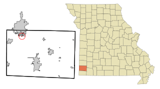
Brooklyn Heights is a village in Jasper County, Missouri, United States. The population was 101 at the 2020 census. It is part of the Joplin, Missouri Metropolitan Statistical Area.

Carl Junction is a city in Jasper County, Missouri, United States. The population was 8,143 at the 2020 census.

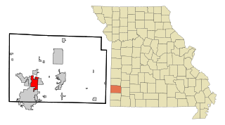
Duquesne is a Fourth-Class City in Jasper County, Missouri, United States. The population was 2,159 at the 2020 census. It is part of the Joplin, Missouri Metropolitan Statistical Area.

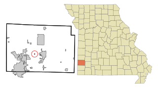
Fidelity is a village in Jasper County, Missouri, United States. The population was 227 at the 2020 census. It is part of the Joplin, Missouri Metropolitan Statistical Area.
Webb City is a city in Jasper County, Missouri, United States. The population was 13,031 at the 2020 census. It is part of the Joplin, Missouri Metropolitan Statistical Area. Webb City also has a police department, a fire department, and animal control services.
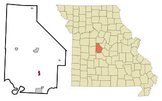
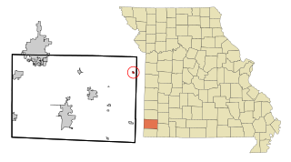
Gravois Mills is a town in Morgan County, Missouri, United States. The population was 129 at the 2020 census.

Cliff Village is a village in Newton County, Missouri, United States. The population was 40 at the 2010 census. It is part of the Joplin, Missouri Metropolitan Statistical Area.

Grand Falls Plaza is a village in Newton County, Missouri, United States. The population was 114 at the 2010 census, at which time it was a town. It is part of the Joplin, Missouri Metropolitan Statistical Area.

Leawood is a village in Newton County, Missouri, United States. The population was 682 at the 2010 census. It is part of the Joplin, Missouri Metropolitan Statistical Area.

Loma Linda is a town in Newton County, Missouri, United States. The population was 725 at the 2010 census. It is part of the Joplin, Missouri Metropolitan Statistical Area.

Shoal Creek Drive is a village in Newton County, Missouri, United States. The population was 337 at the 2010 census. It is part of the Joplin, Missouri Metropolitan Statistical Area.
Shoal Creek Estates is a village in Newton County, Missouri, United States. The population was 76 at the 2010 census. It is part of the Joplin, Missouri Metropolitan Statistical Area.

Stark City is a town in Newton County, Missouri, United States. The population was 139 at the 2010 census, at which time it was a town. It is part of the Joplin, Missouri Metropolitan Statistical Area. It is adjacent to the battlefield of the Second Battle of Newtonia.
Wentworth is a village in northeastern Newton County, Missouri, United States. The population was 151 at the 2010 census. It is part of the Joplin, Missouri Metropolitan Statistical Area.

Bull Creek is a village in northwest Taney County, Missouri, United States. The population was 426 at the 2020 census. It is part of the Branson, Missouri Micropolitan Statistical Area.

Dennis Acres is a village in Newton County, Missouri, United States. The population was 76 at the 2010 census.

Redings Mill is a village in Newton County, Missouri, United States. The population was 151 at the 2010 census. It is part of the Joplin, Missouri Metropolitan Statistical Area.

Saginaw is a village in Newton County, Missouri, United States. The population was 297 at the 2010 census. It is part of the Joplin, Missouri Metropolitan Statistical Area.

