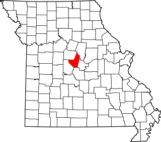
[3] Name on the Register Image Date listed [4] Location City or town Description 1 B'Nai Israel Synagogue B'Nai Israel Synagogue May 5, 2004 (# 04000385 121 S. Main St. 37°18′04″N 89°31′09″W / 37.301111°N 89.519167°W / 37.301111; -89.519167 (B'Nai Israel Synagogue ) Cape Girardeau 2 Bainbridge Ferry Upload image June 21, 2007 (# 07000573 County Road 630 37°24′43″N 89°26′16″W / 37.411944°N 89.437778°W / 37.411944; -89.437778 (Bainbridge Ferry ) Cape Girardeau 3 Bainbridge Ferry Rd. Upload image June 21, 2007 (# 07000577 County Road 623 37°26′11″N 89°28′07″W / 37.436517°N 89.468747°W / 37.436517; -89.468747 (Bainbridge Ferry Rd. ) Cape Girardeau 4 Bennett-Tobler-Pace-Oliver House Bennett-Tobler-Pace-Oliver House April 18, 1985 (# 85000853 224 E. Adams 37°22′54″N 89°39′56″W / 37.381667°N 89.665556°W / 37.381667; -89.665556 (Bennett-Tobler-Pace-Oliver House ) Jackson 5 Big Hill Farmstead Historic District Upload image December 22, 1999 (# 99001598 2246 Route PP 37°21′49″N 89°41′26″W / 37.363611°N 89.690556°W / 37.363611; -89.690556 (Big Hill Farmstead Historic District ) Jackson 6 Broadway Commercial Historic District Broadway Commercial Historic District September 6, 2016 (# 15001017 600, 700 & 800 blocks of Broadway & 210 N. Ellis St. 37°18′24″N 89°31′39″W / 37.306789°N 89.527404°W / 37.306789; -89.527404 (Broadway Commercial Historic District ) Cape Girardeau 7 Broadway Theatre Broadway Theatre June 15, 2015 (# 15000354 805 Broadway St. 37°18′24″N 89°31′42″W / 37.306667°N 89.528472°W / 37.306667; -89.528472 (Broadway Theatre ) Cape Girardeau 8 Broadway and North Fountain Street Historic District Broadway and North Fountain Street Historic District July 15, 2003 (# 03000654 320-400 Broadway St. and 221 N. Fountain St. 37°18′23″N 89°31′20″W / 37.306389°N 89.522222°W / 37.306389; -89.522222 (Broadway and North Fountain Street Historic District ) Cape Girardeau 9 Broadway-Middle Commercial Historic District Broadway-Middle Commercial Historic District July 24, 2007 (# 07000753 500 block of Broadway St. and 100 block of N. Middle St.; also south side 400 block of Broadway 37°18′24″N 89°31′27″W / 37.306667°N 89.524167°W / 37.306667; -89.524167 (Broadway-Middle Commercial Historic District ) Cape Girardeau Second set of boundaries represents a boundary increase of September 4, 2013 10 Burfordville Covered Bridge Burfordville Covered Bridge May 19, 1970 (# 70000325 Eastern edge of Burfordville on County Road HH 37°22′02″N 89°48′09″W / 37.367222°N 89.8025°W / 37.367222; -89.8025 (Burfordville Covered Bridge ) Burfordville 11 Burfordville Mill Burfordville Mill May 27, 1971 (# 71000463 Off Route 34 37°22′05″N 89°48′06″W / 37.368056°N 89.801667°W / 37.368056; -89.801667 (Burfordville Mill ) Burfordville 12 Abraham Byrd House Abraham Byrd House June 21, 2007 (# 07000572 2832 County Road 442 37°27′05″N 89°41′58″W / 37.451389°N 89.699444°W / 37.451389; -89.699444 (Abraham Byrd House ) Jackson 13 Cape Girardeau Commercial Historic District Cape Girardeau Commercial Historic District July 20, 2000 (# 00000820 100 block of N. Main and the 100 block of Broadway Sts.; also 101 N. Main St.; also 127 N. Water St. 37°18′20″N 89°31′06″W / 37.305556°N 89.518333°W / 37.305556; -89.518333 (Cape Girardeau Commercial Historic District ) Cape Girardeau 101 N. Main and 127 N. Water represent boundary increases of July 11, 2007 and August 29, 2008 respectively 14 Cape Girardeau Court of Common Pleas Cape Girardeau Court of Common Pleas October 25, 2010 (# 10000856 44 N. Lorimier St. 37°18′18″N 89°31′12″W / 37.305°N 89.52°W / 37.305; -89.52 (Cape Girardeau Court of Common Pleas ) Cape Girardeau 15 Central High School Central High School July 18, 2008 (# 08000663 101 S. Pacific St. 37°18′12″N 89°31′50″W / 37.303333°N 89.530556°W / 37.303333; -89.530556 (Central High School ) Cape Girardeau 16 Dr. Jean Chapman House Dr. Jean Chapman House March 15, 2016 (# 16000084 1150 N. Henderson Ave. 37°19′12″N 89°31′57″W / 37.320063°N 89.532561°W / 37.320063; -89.532561 (Dr. Jean Chapman House ) Cape Girardeau 17 George Boardman Clark House George Boardman Clark House July 22, 1994 (# 94000738 6 S. Fountain St. 37°18′12″N 89°31′20″W / 37.303333°N 89.522222°W / 37.303333; -89.522222 (George Boardman Clark House ) Cape Girardeau 18 Courthouse-Seminary Neighborhood Historic District Courthouse-Seminary Neighborhood Historic District September 9, 2010 (# 10000723 Roughly bounded by Middle St., Themis St., Main St., Aquamsi St., and Morgan Oaks St. 37°18′05″N 89°31′17″W / 37.301389°N 89.521389°W / 37.301389; -89.521389 (Courthouse-Seminary Neighborhood Historic District ) Cape Girardeau 19 Erlbacher Buildings Erlbacher Buildings July 8, 2009 (# 09000502 1105 and 1107 Broadway St. 37°18′30″N 89°31′56″W / 37.308333°N 89.532222°W / 37.308333; -89.532222 (Erlbacher Buildings ) Cape Girardeau 20 Esquire Theater Esquire Theater September 15, 2005 (# 05001025 824 Broadway St. 37°18′26″N 89°31′45″W / 37.307222°N 89.529028°W / 37.307222; -89.529028 (Esquire Theater ) Cape Girardeau 21 Fort D Fort D August 1, 2019 (# 100004219 920 Fort St. 37°17′27″N 89°31′35″W / 37.2909°N 89.5263°W / 37.2909; -89.5263 (Fort D ) Cape Girardeau 22 Frizel-Welling House Frizel-Welling House June 25, 1999 (# 99000742 209 W. Main St. 37°22′57″N 89°40′10″W / 37.3825°N 89.669444°W / 37.3825; -89.669444 (Frizel-Welling House ) Jackson 23 Glenn House Glenn House October 11, 1979 (# 79001354 325 S. Spanish St. 37°17′53″N 89°31′14″W / 37.298056°N 89.520556°W / 37.298056; -89.520556 (Glenn House ) Cape Girardeau 24 Green's Ferry Upload image June 21, 2007 (# 07000571 On the Mississippi River at the end of Green's Ferry Rd. [5] 37°27′04″N 89°27′27″W / 37.451111°N 89.457500°W / 37.451111; -89.457500 (Green's Ferry ) Cape Girardeau 25 Haarig Commercial Historic District Haarig Commercial Historic District July 20, 2000 (# 00000819 Along sections of the 600 block of Good Hope St. and 300 block of S. Sprigg St. 37°17′58″N 89°31′38″W / 37.299444°N 89.527222°W / 37.299444; -89.527222 (Haarig Commercial Historic District ) Cape Girardeau 26 Hanover Lutheran Church Hanover Lutheran Church September 14, 1987 (# 87001575 2949 Perryville Rd. 37°21′10″N 89°33′37″W / 37.352778°N 89.560278°W / 37.352778; -89.560278 (Hanover Lutheran Church ) Cape Girardeau 27 William Henry and Lilla Luce Harrison House William Henry and Lilla Luce Harrison House December 6, 2005 (# 05001375 313 Themis St. 37°18′17″N 89°31′17″W / 37.304722°N 89.521500°W / 37.304722; -89.521500 (William Henry and Lilla Luce Harrison House ) Cape Girardeau 28 Himmelberger and Harrison Building Himmelberger and Harrison Building July 17, 2003 (# 03000653 400 Broadway St. 37°18′24″N 89°31′21″W / 37.306667°N 89.522500°W / 37.306667; -89.522500 (Himmelberger and Harrison Building ) Cape Girardeau 29 House at 323 Themis Street House at 323 Themis Street June 27, 1997 (# 97000629 323 Themis St. 37°18′18″N 89°31′19″W / 37.305000°N 89.521806°W / 37.305000; -89.521806 (House at 323 Themis Street ) Cape Girardeau 30 Huhn-Harrison House Huhn-Harrison House June 27, 2002 (# 02000699 340 S. Lorimier St. 37°17′52″N 89°31′18″W / 37.297778°N 89.521667°W / 37.297778; -89.521667 (Huhn-Harrison House ) Cape Girardeau 31 Jackson Uptown Commercial Historic District Jackson Uptown Commercial Historic District February 1, 2006 (# 05001562 Roughly bounded by Court, Main, Missouri, and High Sts. 37°22′57″N 89°40′06″W / 37.3825°N 89.668436°W / 37.3825; -89.668436 (Jackson Uptown Commercial Historic District ) Jackson 32 Jefferson School Jefferson School May 12, 2009 (# 09000300 731 Jefferson Ave. 37°17′49″N 89°31′45″W / 37.296944°N 89.529167°W / 37.296944; -89.529167 (Jefferson School ) Cape Girardeau 33 Kage School Kage School September 29, 2005 (# 05001090 3110 Kage Rd. 37°19′57″N 89°34′45″W / 37.3325°N 89.579167°W / 37.3325; -89.579167 (Kage School ) Cape Girardeau 34 Klostermann Block Klostermann Block July 22, 1994 (# 94000739 7, 9, 11, 13, and 15 S. Spanish St. 37°18′11″N 89°31′11″W / 37.303056°N 89.519722°W / 37.303056; -89.519722 (Klostermann Block ) Cape Girardeau 35 Edward S. and Mary Annatoile Albert Lilly House Edward S. and Mary Annatoile Albert Lilly House June 20, 2008 (# 08000535 129 S. Lorimier St. 37°18′05″N 89°31′18″W / 37.301389°N 89.521667°W / 37.301389; -89.521667 (Edward S. and Mary Annatoile Albert Lilly House ) Cape Girardeau 36 Main-Spanish Commercial Historic District Main-Spanish Commercial Historic District December 30, 2008 (# 08001259 Roughly the 100 blocks of Main and Spanish Sts. and adjacent portions of Themis and Independence Sts. 37°18′16″N 89°31′08″W / 37.304444°N 89.518889°W / 37.304444; -89.518889 (Main-Spanish Commercial Historic District ) Cape Girardeau 37 Marquette Hotel Marquette Hotel April 11, 2002 (# 02000356 338 Broadway St. 37°18′24″N 89°31′19″W / 37.306667°N 89.521944°W / 37.306667; -89.521944 (Marquette Hotel ) Cape Girardeau 38 McKendree Chapel McKendree Chapel April 13, 1987 (# 06000042 Off Interstate 55 ; also the southern side of Bainbridge Rd., 0.5 miles west of Interstate 55 37°22′41″N 89°37′07″W / 37.378056°N 89.618611°W / 37.378056; -89.618611 (McKendree Chapel ) Jackson Specific address represents a boundary increase of February 14, 2006 39 Miller-Seabaugh House and Dr. Seabaugh Office Building Upload image January 4, 1996 (# 95001494 341 Market St. 37°25′58″N 89°47′52″W / 37.432778°N 89.797778°W / 37.432778; -89.797778 (Miller-Seabaugh House and Dr. Seabaugh Office Building ) Millersville 40 Old Appleton Bridge Old Appleton Bridge August 25, 2009 (# 09000648 Main St. over Apple Creek 37°35′52″N 89°42′50″W / 37.597639°N 89.71375°W / 37.597639; -89.71375 (Old Appleton Bridge ) Old Appleton 41 Old Lorimier Cemetery Old Lorimier Cemetery September 28, 2005 (# 05001091 500 N. Fountain St. 37°18′40″N 89°31′12″W / 37.311111°N 89.520000°W / 37.311111; -89.520000 (Old Lorimier Cemetery ) Cape Girardeau 42 Oliver-Leming House Oliver-Leming House September 12, 1980 (# 80002323 740 North St. 37°18′35″N 89°31′40″W / 37.309722°N 89.527778°W / 37.309722; -89.527778 (Oliver-Leming House ) Cape Girardeau 43 Abraham Russell Ponder House Abraham Russell Ponder House March 27, 2008 (# 08000226 141 S. Louisiana Ave. 37°18′09″N 89°32′19″W / 37.302500°N 89.538611°W / 37.302500; -89.538611 (Abraham Russell Ponder House ) Cape Girardeau 44 Frederick W. and Mary Karau Pott House Frederick W. and Mary Karau Pott House June 25, 1999 (# 99000745 826 Themis St. 37°18′22″N 89°31′46″W / 37.306111°N 89.529444°W / 37.306111; -89.529444 (Frederick W. and Mary Karau Pott House ) Cape Girardeau 45 James Reynolds House James Reynolds House October 13, 1983 (# 83003942 623 N. Main St. 37°18′41″N 89°31′05″W / 37.311389°N 89.518056°W / 37.311389; -89.518056 (James Reynolds House ) Cape Girardeau 46 Shady Grove Cemetery Upload image June 27, 2022 (# 100007826 502 Cty. Rd. 211 37°15′53″N 89°37′34″W / 37.2647°N 89.6260°W / 37.2647; -89.6260 (Shady Grove Cemetery ) Gordonville vicinity 47 August and Amalia Shivelbine House August and Amalia Shivelbine House June 25, 1999 (# 99000743 303 S. Spanish St. 37°17′55″N 89°31′14″W / 37.298750°N 89.520556°W / 37.298750; -89.520556 (August and Amalia Shivelbine House ) Cape Girardeau 48 South Middle Street Historic District South Middle Street Historic District October 14, 2009 (# 09000829 513 William St. and 202-230 and 203-229 S. Middle St. 37°18′00″N 89°31′29″W / 37.300000°N 89.524720°W / 37.300000; -89.524720 (South Middle Street Historic District ) Cape Girardeau 49 Southeast Missourian Building Southeast Missourian Building June 1, 2005 (# 05000509 301 Broadway St. 37°18′22″N 89°31′16″W / 37.306111°N 89.521111°W / 37.306111; -89.521111 (Southeast Missourian Building Cape Girardeau 50 St. James A.M.E. Church St. James A.M.E. Church January 15, 2014 (# 13001085 516 North St. 37°18′34″N 89°31′26″W / 37.309543°N 89.523856°W / 37.309543; -89.523856 (St. James A.M.E. Church ) Cape Girardeau 51 St. Vincent De Paul Catholic Church St. Vincent De Paul Catholic Church April 12, 1982 (# 82003131 131 S. Main St. 37°18′03″N 89°31′10″W / 37.300833°N 89.519444°W / 37.300833; -89.519444 (St. Vincent De Paul Catholic Church ) Cape Girardeau 52 St. Vincent's College Building St. Vincent's College Building September 30, 2005 (# 05001092 201 Morgan Oak St. 37°17′47″N 89°31′16″W / 37.296389°N 89.521111°W / 37.296389; -89.521111 (St. Vincent's College Building ) Cape Girardeau 53 Col George C. Thilenius House Col George C. Thilenius House April 14, 1983 (# 83000974 100 Longview Pl. 37°18′24″N 89°32′30″W / 37.306667°N 89.541667°W / 37.306667; -89.541667 (Col George C. Thilenius House ) Cape Girardeau 54 Trail of Tears State Park Archeological Site Trail of Tears State Park Archeological Site December 2, 1970 (# 70000326 Address Restricted Oriole An archeological site in Trail of Tears State Park 55 Julius Vasterling Building Julius Vasterling Building June 17, 2009 (# 09000439 633-637 Broadway St. 37°18′23″N 89°31′35″W / 37.306527°N 89.526527°W / 37.306527; -89.526527 (Julius Vasterling Building ) Cape Girardeau 56 Warehouse Row Historic District Warehouse Row Historic District December 4, 2004 (# 04001285 19 N. Water St. 37°18′20″N 89°31′04″W / 37.305556°N 89.517778°W / 37.305556; -89.517778 (Warehouse Row Historic District ) Cape Girardeau 57 Robert Felix and Elma Taylor Wichterich House Robert Felix and Elma Taylor Wichterich House August 12, 1999 (# 99000987 300 Good Hope St. 37°17′57″N 89°31′19″W / 37.299305°N 89.522083°W / 37.299305; -89.522083 (Robert Felix and Elma Taylor Wichterich House ) Cape Girardeau 58 J. Maple and Grace Senne Wilson House J. Maple and Grace Senne Wilson House July 7, 2015 (# 15000365 344 N. Ellis St. 37°18′34″N 89°31′39″W / 37.309444°N 89.527500°W / 37.309444; -89.527500 (J. Maple and Grace Senne Wilson House ) Cape Girardeau 59 Wood Building Wood Building December 10, 2003 (# 03001269 1-3 S. Frederick and 605-607 Independence Sts. 37°18′14″N 89°31′33″W / 37.303889°N 89.525833°W / 37.303889; -89.525833 (Wood Building ) Cape Girardeau