Hickory Ridge, Missouri

Last updated

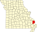
Hickory Ridge is an unincorporated community in Cape Girardeau County, in the U.S. state of Missouri. [1]

History

A post office called Hickory Ridge was established in 1856, and remained in operation until 1875. [2] The community was named after a nearby ridge where hickory timber was abundant. [3]

Related Research Articles

<span class="mw-page-title-main">Cape Girardeau County, Missouri</span> County in Missouri, United States

Cape Girardeau County is located in the southeastern part of the U.S. state of Missouri; its eastern border is formed by the Mississippi River. At the 2020 census, the population was 81,710. The county seat is Jackson, the first city in the US to be named in honor of President Andrew Jackson. Officially organized on October 1, 1812, the county is named after Ensign Sieur Jean Baptiste de Girardot, an official of the French colonial years. The "cape" in the county's name is named after a former promontory rock overlooking the Mississippi River; this feature was demolished during railroad construction. Cape Girardeau County is the hub of the Cape Girardeau–Jackson metropolitan area. Its largest city is Cape Girardeau.

<span class="mw-page-title-main">Fruitland, Missouri</span> Unincorporated community in the American state of Missouri

Fruitland is an unincorporated community in Cape Girardeau County, Missouri, United States. It is located on U.S. Route 61, 5 mi (8.0 km) north of Jackson and just over one mile north of the intersection of U.S. 61 and Interstate 55.

Daisy is an unincorporated community in northwestern Cape Girardeau County, Missouri, United States. It is located sixteen miles northwest of Cape Girardeau and is part of the Cape Girardeau–Jackson, MO-IL Metropolitan Statistical Area.

<span class="mw-page-title-main">Millersville, Missouri</span> Census-Designated Place in Missouri, United States

Millersville is an unincorporated community in western Cape Girardeau County, Missouri, United States. It is located six miles (10 km) west of Jackson on Route 72.

Bainbridge is an unincorporated community in Cape Girardeau County, in the U.S. state of Missouri.

Blomeyer is an unincorporated community in Cape Girardeau County, in the U.S. state of Missouri.

Dissen is an unincorporated community in Cape Girardeau County, in the U.S. state of Missouri.

Gravel Hill is an unincorporated community in Cape Girardeau County, in the U.S. state of Missouri.

Hilderbrand is an unincorporated community in Cape Girardeau County, in the U.S. state of Missouri.

Houck is an unincorporated community in Cape Girardeau County, in the U.S. state of Missouri.

Kurreville is an unincorporated community in Cape Girardeau County, in the U.S. state of Missouri.

Leemon is an unincorporated community in Cape Girardeau County, in the U.S. state of Missouri.

Lovejoy is an extinct town in Cape Girardeau County, in the U.S. state of Missouri. The GNIS classifies it as a populated place.

Moccasin Springs is an unincorporated community in Cape Girardeau County, in the U.S. state of Missouri.

Oriole is an unincorporated community in eastern Cape Girardeau County, in the U.S. state of Missouri.

Randles is an unincorporated community in Cape Girardeau County, in the U.S. state of Missouri.

Stroderville is an extinct town in Cape Girardeau County, in the U.S. state of Missouri. The GNIS classifies it as a populated place.

Tilsit is an unincorporated community in Cape Girardeau County, in the U.S. state of Missouri.

Toga is an unincorporated community located on Crowleys Ridge in northern Stoddard County, in the U.S. state of Missouri. The community lies two miles northeast of Advance on Missouri Route 25. The Stoddard-Bollinger-Cape Girardeau county line junction is approximately one mile northeast of the location.

Crump is an unincorporated community in western Cape Girardeau County, in the U.S. state of Missouri.

References

  1. U.S. Geological Survey Geographic Names Information System: Hickory Ridge, Missouri
  2. "Post Offices". Jim Forte Postal History. Retrieved September 10, 2016.
  3. "Cape Girardeau County Place Names, 1928–1945 (archived)". The State Historical Society of Missouri. Archived from the original on June 24, 2016. Retrieved September 10, 2016.{{cite web}}: CS1 maint: bot: original URL status unknown (link)

37°10′24″N89°48′18″W / 37.17333°N 89.80500°W / 37.17333; -89.80500