
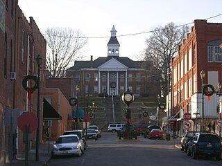
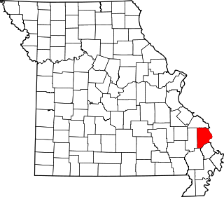
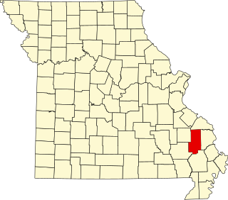
Cape Girardeau County is located in the southeastern part of the U.S. state of Missouri; its eastern border is formed by the Mississippi River. At the 2020 census, the population was 81,710. The county seat is Jackson, the first city in the US to be named in honor of President Andrew Jackson. Officially organized on October 1, 1812, the county is named after Ensign Sieur Jean Baptiste de Girardot, an official of the French colonial years. The "cape" in the county's name is named after a former promontory rock overlooking the Mississippi River; this feature was demolished during railroad construction. Cape Girardeau County is the hub of the Cape Girardeau–Jackson metropolitan area. Its largest city is Cape Girardeau.
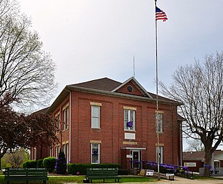
Bollinger County is a county located in the southeastern part of the U.S. state of Missouri. As of the 2020 census, the county's population was 10,567. The county seat, largest and only city, is Marble Hill. The largely rural county is supported by agriculture and construction. The county was officially organized in March, 1851 from portions of Wayne, Cape Girardeau and Stoddard Counties, and named in honor of George Frederick Bollinger, an early settler.

Zalma, once known as "Bollinger's Mill", is an unincorporated community and census-designated place (CDP) on the banks of the winding Castor River at a point where the river makes a horseshoe bend in southern Bollinger County in southeast Missouri, United States. When the railroad moved to town, the name Bollinger's Mill was changed to Zalma, after railroad worker Zalma Block. Zalma is also said to come from a Native American word meaning "the end." As of the 2020 U.S. Census, Zalma had a population of 73.

Whitewater is a village in Hubble Township in southwestern Cape Girardeau County, Missouri, United States. The population was 88 at the 2020 census. It is part of the Cape Girardeau–Jackson, MO-IL Metropolitan Statistical Area.
Cape Girardeau is a city in Cape Girardeau and Scott Counties in the U.S. state of Missouri. At the 2020 census, the population was 39,540. The city is one of two principal cities of the Cape Girardeau-Jackson, MO-IL Metropolitan Statistical Area, which encompasses Alexander County, Illinois, Bollinger County, Missouri and Cape Girardeau County, Missouri and has a population of 97,517. The sliver of the city located in Scott County is part of the Sikeston Micropolitan Statistical Area, and the entire city forms the core of the Cape Girardeau-Sikeston Combined Statistical Area.
Patton is an unincorporated community in the southeastern part of Union Township in northern Bollinger County in Southeast Missouri, United States. It is located on State Highway 51, approximately one mile south of the intersection with Route 72 along Little Whitewater Creek and 15 miles north of Marble Hill. The ZIP Code for Patton is 63662.

Coffman is an unincorporated community in Saline Township in southern Sainte Genevieve County, Missouri, United States. It is located approximately fifteen miles southwest of Ste. Genevieve.

Grassy is an unincorporated community in Filmore Township in western Bollinger County, Missouri, United States.

The Bollinger Mill State Historic Site is a state-owned property preserving a mill and covered bridge that pre-date the American Civil War in Burfordville, Cape Girardeau County, Missouri. The park was established in 1967 and offers mill tours and picnicking. It is managed by the Missouri Department of Natural Resources. It includes the Burfordville Covered Bridge, which is listed on the National Register of Historic Places.
The Cape Girardeau–Jackson Metropolitan Statistical Area, as defined by the United States Census Bureau, is an area consisting of two counties in southeastern Missouri and one in southern Illinois, anchored by the cities of Cape Girardeau and Jackson. It was upgraded from a Micropolitan Statistical Area (μSA) to a Metropolitan Statistical Area (MSA) by the Office of Management and Budget on November 20, 2008.

Highland is an unincorporated community in Cinque Hommes Township in Perry County, Missouri, United States.

Ozora is an unincorporated community and census-designated place located in Beauvais Township in Sainte Genevieve County, Missouri, United States. Ozora is located approximately eight miles south of Sainte Genevieve.
Shawneetown is an unincorporated community in Shawnee Township in northern Cape Girardeau County, Missouri, United States. It is located twenty miles north of Cape Girardeau and is part of the Cape Girardeau–Jackson, MO-IL Metropolitan Statistical Area.
Egypt Mills is an unincorporated community in Randol Township in eastern Cape Girardeau County, Missouri, United States. It is located approximately 12 miles east of Jackson.
Lawrenceton is an unincorporated community located in the southern part of Jackson Township in Sainte Genevieve County, Missouri, United States. The town lies 14 miles to the west of Ste. Genevieve.
Brickey's or Brickeys is an unincorporated community located in Jackson Township in Sainte Genevieve County, Missouri, United States. The town lies 11 miles to the northwest of Ste. Genevieve on the Mississippi River.
Mayfield is an unincorporated community in the central part of Scopus Township in Bollinger County, Missouri, United States, approximately 4.5 miles west of the Cape Girardeau County line.
Neely's Landing or Neelys Landing is an unincorporated community in Shawnee Township in northern Cape Girardeau County, Missouri, United States. It is located seventeen miles north of Cape Girardeau and is part of the Cape Girardeau–Jackson, MO-IL Metropolitan Statistical Area.
Byrd Creek is a stream in Cape Girardeau County, Missouri. The stream is a tributary of the Whitewater River.
Crooked Creek is a stream in Bollinger and Cape Girardeau counties of southeast Missouri. It is a tributary to the Headwater Diversion Channel.


