Stroderville, Missouri

Last updated • a couple of secsFrom Wikipedia, The Free Encyclopedia

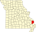
Stroderville is an extinct town in Cape Girardeau County, in the U.S. state of Missouri. The GNIS classifies it as a populated place. [1]

A post office called Stroderville was established in 1870, and remained in operation until 1889. [2] The community was named after William Stroder, an early settler. [3]

Related Research Articles

References

  1. U.S. Geological Survey Geographic Names Information System: Stroderville (historical)
  2. "Post Offices". Jim Forte Postal History. Retrieved 10 September 2016.
  3. "Cape Girardeau County Place Names, 1928–1945 (archived)". The State Historical Society of Missouri. Archived from the original on 24 June 2016. Retrieved 8 September 2016.CS1 maint: BOT: original-url status unknown (link)

Coordinates: 37°14′48″N89°48′47″W / 37.246720°N 89.813151°W / 37.246720; -89.813151
Geographic coordinate system Coordinate system

A geographic coordinate system is a coordinate system that enables every location on Earth to be specified by a set of numbers, letters or symbols. The coordinates are often chosen such that one of the numbers represents a vertical position and two or three of the numbers represent a horizontal position; alternatively, a geographic position may be expressed in a combined three-dimensional Cartesian vector. A common choice of coordinates is latitude, longitude and elevation. To specify a location on a plane requires a map projection.