References
- ↑ State Historical Society of Missouri: Cape Girardeau Place Names http://shs.umsystem.edu/manuscripts/ramsay/ramsay_cape_girardeau.html Archived 2016-03-31 at the Wayback Machine
- ↑ Cape Girardeau churches areaconnect http://capegirardeau.areaconnect.com/churches.htm
- ↑ Robert Sidney Douglass (1912). "History of Southeast Missouri: A Narrative Account of Its Historical Progress, Its People and Its Principal Interests, Volume 1".
{{cite journal}}: Cite journal requires|journal=(help) - ↑ A Directory of Towns, Villages, and Hamlets Past and Present of Cape Girardeau County, Missouri, by Arthur Paul Moser http://thelibrary.org/lochist/moser/girardpl.html Archived September 16, 2013, at the Wayback Machine
Municipalities and communities of Cape Girardeau County, Missouri, United States | ||
|---|---|---|
| Cities | 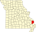 | |
| Villages | ||
| Townships | ||
| CDPs | ||
| Other communities | ||
| Ghost towns | ||
| Footnotes | ‡This populated place also has portions in an adjacent county or counties | |
37°24′18″N89°27′49″W / 37.40500°N 89.46361°W
| | This Cape Girardeau County, Missouri state location article is a stub. You can help Wikipedia by expanding it. |