Friedheim, Missouri | |
|---|---|
 Interactive map of Friedheim, Missouri | |
| Coordinates: 37°34′12″N89°49′12″W / 37.57000°N 89.82000°W [1] | |
| Country | United States |
| State | Missouri |
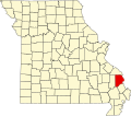
| County | Cape Girardeau |
| Township | Apple Creek Township |
| Elevation | 545 ft (166 m) |
Friedheim is an unincorporated community in Apple Creek Township in northwestern Cape Girardeau County, Missouri, United States. [1]