References
- ↑ U.S. Geological Survey Geographic Names Information System: Arbor, Missouri
- ↑ "Post Offices". Jim Forte Postal History. Archived from the original on March 6, 2016. Retrieved September 8, 2016.
- ↑ "Cape Girardeau County Place Names, 1928–1945 (archived)". The State Historical Society of Missouri. Archived from the original on June 24, 2016. Retrieved September 8, 2016.
{{cite web}}: CS1 maint: bot: original URL status unknown (link) - ↑ Rand McNally and Company (1925). Premier Atlas of the World: Containing Maps of All Countries of the World, with the Most Recent Boundary Decisions, and Maps of All the States, Territories, and Possessions of the United States with Population Figures from the Latest Official Census Reports, Also Data of Interest Concerning International and Domestic Political Questions. Rand McNally & Company. p. 259. Retrieved February 19, 2023.
Municipalities and communities of Cape Girardeau County, Missouri, United States | ||
|---|---|---|
| Cities | 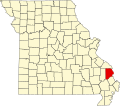 | |
| Villages | ||
| Townships | ||
| CDPs | ||
| Other communities | ||
| Ghost towns | ||
| Footnotes | ‡This populated place also has portions in an adjacent county or counties | |
37°09′33″N89°48′08″W / 37.15917°N 89.80222°W
| | This Cape Girardeau County, Missouri state location article is a stub. You can help Wikipedia by expanding it. |